Tuesday, August 7, 2018

Sunday, August 5, 2018 - Stung


23.26 miles - Total to date - 385.6 miles
Ascent - 3890’ , Descent - 6876’ - Moosehead Creek Headwaters (1445.2) to Ash Camp Campground

Derek and I agree, too many miles. Bailey and Logan like 28 mile days. Derek and I are rebelling. 20-22 is just fine with us, give or take a mile or two to land on a good campsite or where there is water. With this in mind, we set our aim at Ash Camp Campground, a primitive car campground 23.26 miles away. Bailey and Logan expressed a desire to add 3 miles onto that distance. We said go for it, we are stopping at the campground. 
Up at 5:00 am. On the road at 5:45 am. The trail climbed for the first mile or two. As it rounded a rocky promontory out of the trees I checked for cell service. Bingo! We stopped on the point and texted, emailed and posted blogs. Me met Hoover here, a hiker from San Diego. 
For the next thirteen miles the trail stayed on the ridge top. We leap frogged Water Rope and Little Abe as we each stopped for second breakfast or water. I got in the zone and just started walking. I am listening to a book by Stephan Ambrose called “Nothing Like It In The World” about building the transcontinental railroad between 1862 and 1870. It is fascinating, especially about building the railroad over the Sierra at Donner Pass which I hiked through two weeks ago. Did you know 10,000 people worked on the line running east from Sacramento and 8000 of them were Chinese immigrants? And 10,000 worked on the line from Omaha, Nebraska going west and 8000 of them were Irish Immigrants? This crew laid a pair of rails every 30 seconds 8 hours a day with no machinery, just muscle power. Astounding!!

Anyway, once the thirteen miles of ridge running were out of the way, it was 10 miles of downhill to the campground. I found a shady place to wait for the others and eat food. I found a sunny place to deploy my solar panel to charge my battery and phone. I ate and waited. It took about thirty minutes for everyone to catch up. They headed down the hill toward Deer Creek for water and lunch. I packed up and was soon following. It was nice to be going steadily downhill after the up and down that comes with following a ridge line. 

The trail crosses Deer Creek in two places, one at 2.3 miles and the next at 3.3 miles. Derek stopped at the first and took the short 100’ side trail down to the actual spring that is the start of Deer Creek. It was fun to see the water swelling up out of the ground, crystal clear and cold. Since I had eaten up on top of the ridge I just stopped to talk while Derek ate. A deer came into the clearing where we were eating, coyly browsing on bushes while eyeing us. We figured it wanted to get the salt off our pack straps and such. We didn't give it the chance. 

After about 15 minutes we were back on the trail and soon joined Bailey and Logan at the second instance of Deer Creek. From this point it was about 7 more miles downhill to the Ash Camp Campground, winding in and out of drainages as we descended. Finally, about 5:15 we hit the bottom of the ridge and the parking lot above the campground. I had read there was an outhouse at the Campground, but as Derek would say, ”the children want to come out to play.”  I found a secluded place and did my business. 

It was only a little ways down to the campground. As I approached I saw Derek, Hoover, Bailey, Logan and Double D sitting in a semi-circle with COOLERS in the center!  Trail magic! MT’s parents from Puyallup were there to meet him, but he was behind us a day and had told his parents to play trail angel. They did so with gusto. The dad works at Costco. He had coolers full of pop, Gatorade, fruit drinks and more. The other coolers and boxes had 50-60 bags of chips, Honey Buns, Oreos, cookies, Twix candy bars, Reese's products and more. I drank three bottles and ate a bag of chips, a package of Oreos, a Honey Bun, a bag of Gummy Bears and candy bar. We left them 45 minutes later and found a campsite near the river. Double D, Derek and I all soaked our feet in the ice cold MacCloud River before retiring to our separate tents to sleep. As always, yellow jackets are everywhere. As I was putting my pack in my tent I inadvertently pinched a bee between my forearm and the mosquito netting of the entrance of my tent. I didn't realize this had happened until I felt the bee sting me. I had gotten stung a week ago and little became of it. I hoped the same would happen with this sting, although this was a yellow jacket and I always react, even though it often takes a day before the swelling begins. We will see what tomorrow brings.


Saturday, August 4, 2018 - Big Miles Be Damned


28.63 miles - Total to date - 362.3 miles
Ascent - 5624’ , Descent - 3148’ - Burney Falls State Park (1419.0) to Moosehead Creek Headwaters (1445.2)

Derek and I decided to get an earlier start than normal as we were faced with a big climb for the day. We set our alarms for 4:30 am with the ambition to be on the trail at 5:00 am. All went as planned and we were hiking by headlamp at 5:00 am. The trail took us alongside Britton Lake and then down across the dam that forms the lake before beginning its 3000’ ascent. We stopped for breakfast after three miles at Rock Creek. Derek had a bowl of cereal, I munched a nut bar. Another mile and we passed Phil sleeping in a half erected tent, just inches off the trail.  As the morning progressed we walked through magnificent stands of Doug fir, many soaring 80 feet before their first limb, each tree surrounded at the base by verdant shrubbery. It was a magnificent forest. The trail also took us under high tension power lines. Eventually, we made it to Clark Spring  where we took a break. We had covered 17.5 miles.  I arrived about ten minutes after the “kids” (Derek, Double D, Logan and Bailey). The spring was down a side trail about 0.2 miles away. I headed down with my bottles to fill. I also took my food bag and a towel. Derek told me there was a good pool for soaking feet. He was right. First I filled my bottles from the trickle of water coming out of a culvert. Bailey and Logan showed up. As I was already straddling the puddle below the culvert I had them hand me their bottles to fill. When finished, I removed my shoes and socks and submerged my feet into the cold water, splashing water up into my shins and calf to remove the solid sheet of dirt that coats my legs after an hour or two pounding down this dusty trail. I try to do this soaking and washing ritual whenever possible, but the opportunity does not come too often. Most water sources are little trickles without a pool to soak in or the yellow jackets are so thick near the water I fear I will get stung on my bare feet, a disaster of epic proportions. I swell considerably when stung, particularly by yellow jackets. A sting on the foot would render me unable to get my shoe on. And, the swelling lasts for two or three days. 

I had told myself I was not going to do big miles anymore. Just 3.5 miles from this water source was a campsite, giving me 21 for the day. I left our lunch break before the rest and hiked the distance, feeling surprisingly well for miles 17.5 to 21 for the day. The spot I was headed for was another side trail to another spring. When I got there, I sat on a log, removed my shoes and rested, waiting for the others. They arrived shortly, asked if I was going to stay here and moved on. I answered no, I was moving on with them. I reasoned the last 3.5 didn't feel too bad. If I just split these last seven miles into two - 3.5 mile romps, how bad could it be?  Bad. The last 3.5 mile “romp” was tough. To add misery to the misery, we needed to add another 0.4 mile on to the end to get to an open campsite. 28.63 miles for the day. I was beat. So was Derek. Fitting our four tents into the available spots on this sloping piece of ground proved to be a tight fit. A Japanese man was there when we arrived. He spoke no English so communication was impossible. He quickly went into his tent to sleep. I cooked Quinoe for dinner. I was sitting on the hill, bent over eating and talking with the group (we have been together enough we are becoming what is known as a “trail family”) when I felt it. A sense of dread overtook me. I straightened up and twisted my torso back and forth, but to no avail. I had food stuck in my esophagus right where it enters my stomach. It is uncomfortable, but more importantly, I cannot swallow food nor drink as long as the blockage is there. I walked away from the group and back down the trail a bit, out of sight and tried my only known technique that works to dislodge the stuck food-jump up and land with knees locked, jolting the food into a new position and hopefully into my stomach. I tried this a dozen times. No change. I twisted and torqued.  No change. It persisted for about ten minutes, enough to make me worry it would never free itself. After another ten minutes and more jumping, I felt the obstruction drop into my stomach. Phew!  Of course, this delayed me getting to bed by nearly half an hour and I still had to finish dinner. I was the last to bed. I wanted to write my blog, but I was too tired. 

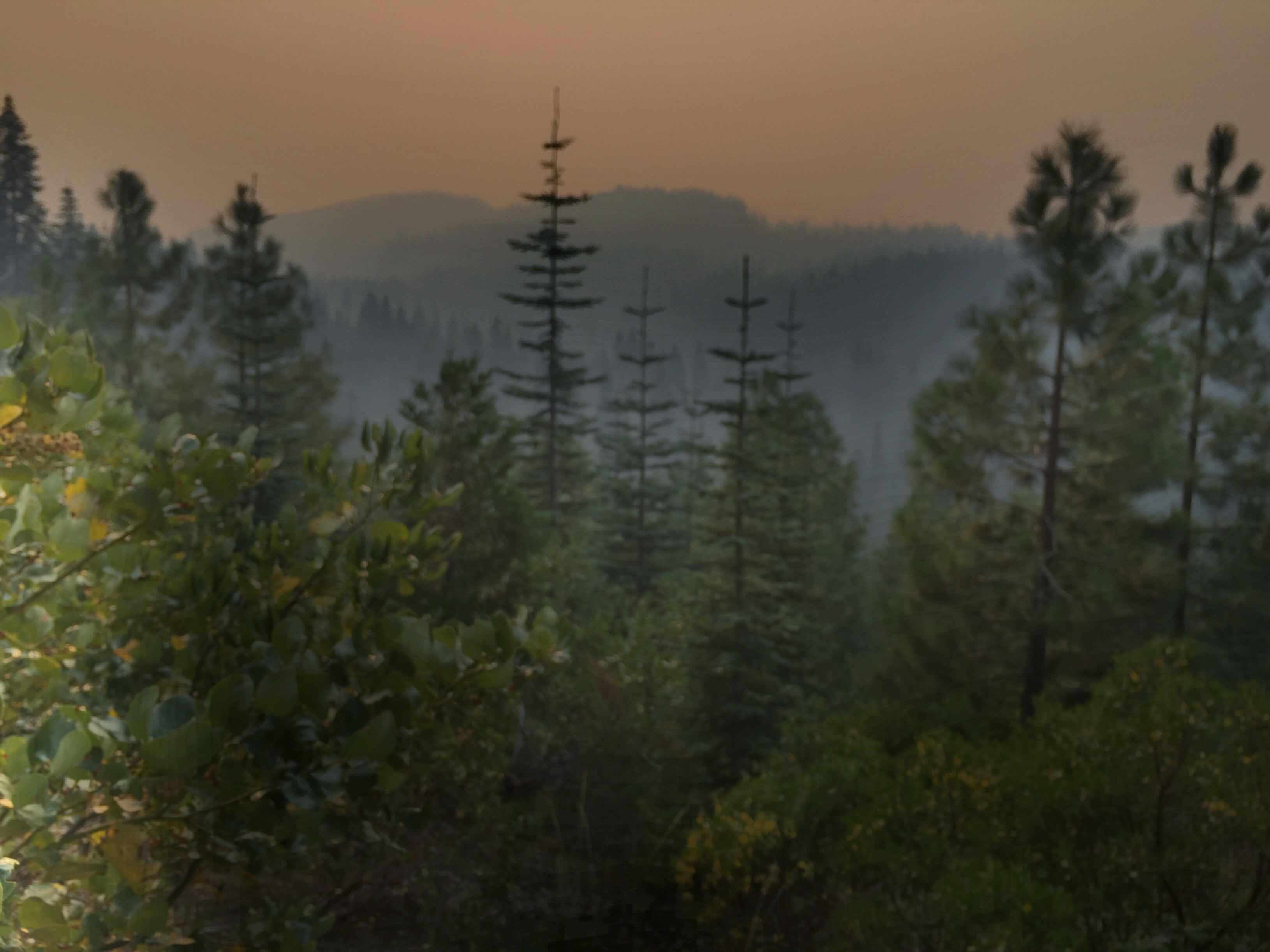
The air was cool, a very welcome condition, but the smoke was still ever present, blocking the scenery and easily smelled with every breath. At times it could be tasted in my mouth as I breathed. It is so thick that all scenery is obscured by it. The sun rises and sets as a glowing red ball and during the middle of the day I feel like I am in Washington. The sky is slate grey with no direct sunlight. It is like a cloud cover, except it is smoke from the Carr fire near Redding. It has helped to make the hiking in the afternoons cooler as we are not beneath the direct sun, but it also makes it impossible to see anything beyond about a mile radius. I don't expect this to change for the rest of the hike. Too many fires.


Dam at Lake Britton by early morning light. 

Beautiful section of trail through open old growth forest.


Our water source-Clark Spring. Better than it looks. Cold and delicious.


Smoke blocks out all the scenery


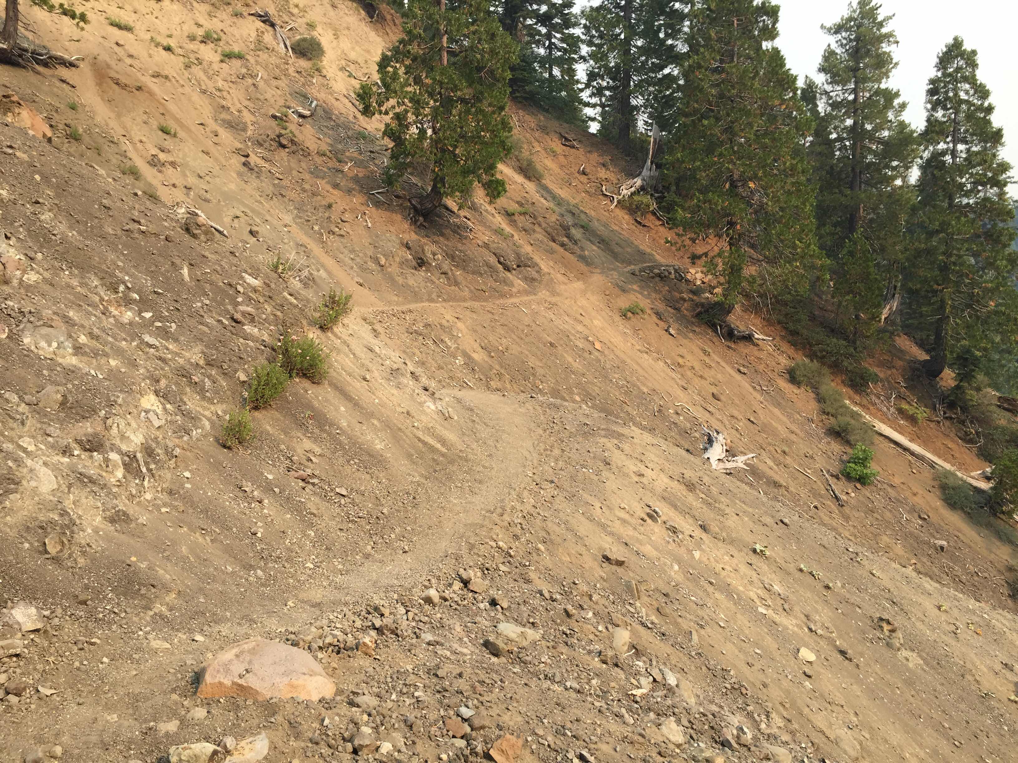
Sometimes the trail feels like it is slipping off the hillside.


More smoky scenery. 

Monday, August 6, 2018

Friday, August 3, 2018 - A Nero Day?


12.5 miles - Total to date - 333.7  miles
Ascent - 1614’ , Descent - 3003’ - small creek (1404)
to Burney Falls State Park (1419.0)

I don’t have mileage to do today. Just 12.5 to Burney Falls State Park. There I hope to just sit most of the afternoon and let my body recover from 2 - 30+ days. Even though the mileage requirement was low, I still got up at 5:30 am to avoid the heat and to get a full day. Riley had texted me yesterday while I was on the Rim that she had woke up sick and taken a taxi to the Burney Mountain Guest Ranch and taken a room. This morning I hike within 0.3 miles and will stop in to see how she is doing. 
The first part of the hike took me past a power plant.  No one was around at 5:45 am. I felt like an intruder as I walked past the power plant and used their porta potty. 

The trail then wound around the shores of Baum Lake. In the early morning light it was stunning, although I believe it would be stunning anytime of the day. Pelicans, swans, geese, ducks, song birds and glades and marches on the margins of the lake all lit by the first rising of the sun. Breathtaking. 

In less than three miles I was at the trail junction to Burney Mountain Trail Ranch. 0.3 miles later I walked up to the lodge. I was preparing to enter the lodge when Space Jam told me the woman proprietor wanted everyone to wash their hands before entering. He pointed out the “Goat Shed” where he said there was a sink for washing hands, soap and a shower. hmmmm . . .

I carried my pack over to the goat shed and looked inside. It was a small utility building about 8 x 16’. It had a laundry tub, washer and dryer and two showers. I jumped into one of the shower rooms, stripped, and quickly washed up, head to foot with a minuscule piece of soap. Wonderful!!  I put my grubby clothes back on and entered the lodge feeling clean. The PCT hikers there asked if I was going to have breakfast. I said no, just wanted a pop and to check in on Riley. They pointed me to the “store” in another out building. I entered and found all manner of foods and equipment that would be useful to a PCT hiker. I grabbed a Coke and some water filter bags and returned to the lodge to pay. 

The owner was in the kitchen cooking breakfast for a group of 6 PCT hikers. When she emerged to deliver the food I asked if I could pay for my items. She said sure, and got an iPad to swipe my credit card. I asked about Riley. She said she was really sick and was worried about her, thinking maybe the emergency room was the next step. She gave me pad and paper and I wrote Riley a note. The woman running the lodge was super friendly and very kind. She reminded me a lot of Donna at Donna’s Place in Toledo. 
I returned to the trail via the entrance road. I noticed I had good signal so I called Sally. She answered and had Robby. I switched to FaceTime and spent 15-20 minutes with Sally and Robby. 
I walked the 9+ miles to Burney Falls State Park, arriving about noon. I went straight to the store, bought a Diet Pepsi and retrieved my resupply box. The store charged me $7.00 cash for holding it for me. I flirted with the ladies running the store, three of them. There were no customers even though it was Friday. The nearby fire in Redding had scared everyone away. 
On a picnic table I sorted my resupply box, threw away excess food and repacked. Then I headed for the bathrooms to wash my clothes and myself. Luckily the bathrooms were each a private room. I locked myself in one and washed all my clothes in the sink. All my clothes? Two pair socks, one extra underwear, the T-shirt and shorts I am wearing. That’s it. That’s all the clothes I have that I have been wearing. 
Clothes clean, I put my wet T-shirt and wet shorts back on and walked around to the other side of the building to the showers. None of the four were in use so I grabbed the far right one. Now for a proper shower. With wash cloth and soap I scrubbed my filthy body and washed my hair. 
With everything clean, I headed back to the store for another DP.  As I approached the picnic bench I had been sorting and bagging my food on I recognized a couple faces. It was Oak and Hippsy Gypsy. I had met them on the PCT a day out of Casa de Luna and leap frogged them the four days I was on the trail in early May. We chatted a few minutes. 
I headed for the Visitors Center to hook into their WiFi and use the plug-ins with my phone. I was hoping to get caught up on my blog .  . .  But with so many PCT hikers sitting around I got little done except talking to them. 
After about four hours of chatting with Space Jam, Grubb, Assless Chaps, Stephen, Squirrel and Shark and giving my body some down time, Double D walked up. Derek was hot on his heels as was the Pocket Family. We stayed and chatted and made runs to the grocery store until 7:30 pm when we decided to stealth camp in the park on the other side of the river next to the PCT. We found a broad flat area in the trees and out of the beaten path, pitched our tents and crawled in. I was tired, and asleep in 10 minutes. 


Sunday, August 5, 2018

Thursday, August 2, 2018 - A Long Way Without Water


30.5 miles - Total to date - 321.2  miles
Ascent - 1614’ , Descent - 3003’ - JJ’s Cafe (1374.9)
to small creek (1404)

After a night where I got little sleep due to head downhill and flat air mat, I was loath to get up at my usual 5:00 am. But, I knew I would regret it if I did not catch the cool early morning hours. I got up and started moving. This is a particularly heinous section of trail-29 miles with no water through a treeless area that burned nine years ago. Many people skip this section. I was excited to see it because we have driven by this area many times and I wanted to see it from the hikers point of view instead of the motorist’s point of view. 

I had two donuts for breakfast, quietly packed up so as not to disturb Riley, Top Notch and Joe Dirt and stopped at the sanican before I got underway. 

It was actually cold!  I put my fleece on as I headed down the highway. I took a right toward Susanville and began scanning for the PCT crossing the road. I found it, and set a brisk pace across the valley floor. I knew I had a 300-400 foot climb to get on top of the Hat Creek Rim and I stopped to take off my fleece before I started the climb. Once on top the trail passes through a scenic overlook and its parking lot. Here I met Assless Chaps and Spirit for the first time. They had spent the night there. We talked about the dry trail ahead. A trail angel had left 8 gallon jugs of water under one of the picnic tables. With 26 miles to go to the next water I filled my last two bottles, bringing my water total to 6 liters, about 13.2 pounds. 

The trail stays right on the edge of the cliff that defines the Hat Creek Rim. The trail is nearly perfectly level for about 15 miles along this portion. I had cell service, so although it was still early I called a lot of friends and family. 

At ten miles (9:09 am) I took a break, kicked off my shoes and had a big snack. I had way too much food and was trying to get rid of a bit of it. Rested and full, I picked up my pack and started off again. I filled in my info at a PCTA trail register, then passed through a gate. At mile 12 for the day I looked ahead and saw a big, white cooler under a tree. My heart lept for joy. Trail Magic. I stopped to take a picture. As I approached I saw FOUR coolers. I dropped my pack and opened the first cooler. Full of Cola sodas!  I looked around for the heavenly angel that had left this bonanza. Not seeing anyone I yelled “THANK YOU!!” in all directions, then checked out the other coolers. One was full of pastries and mini powdered donuts and propel packages. The third had water bottles still half frozen. The last one had another flavor of soda and frozen water bottles. Hanging from the tree were two bunches of bananas and multiple bags of oranges. Wow!!
I popped the top on a cola and sat in one of the two chairs left for us and nearly inhaled the soda. I went for a second. I was disappointed I had eaten just a mile or two back. I just wasn’t hungry. Donuts, pastries, bananas and I wasn’t hungry. 
Spirit showed up about then. She found a fruit juice to enjoy. We both wrote in the journal that the trail angel had put there. I soon left. Spirit stayed behind a while. 
Back on the trail it was getting hotter. The trail stayed on top of the rim for the next 9 or so miles and cell service was good. I talked to friends as my feet pounded out the miles. I also met Apollo, Stuff Sack and Assless Chaps again. They were lounging in the shade of a tree near a 500 gallon water cache-it was empty. Stuff Sack had been given 5 quart ziplock bags full of cookies and was anxious to give them away rather than carry them. I helped her out and ate a dozen or so chocolate chip cookies. That’s just the kind of guy I am. Always willing to help. 

About 2 pm the trail dropped off the plateau. I took a break and checked the temperature on my little pack thermometer. Somewhere between 90° and 95°. Ouch. The wind was blowing about 20 mph so I wasn’t getting wet from sweat, but it was sucking the moisture out of me. My 6 liters were down to 2. 
Now the trail headed off across grasslands dotted with occasional trees. Still hot, still arid. 

About 4:30 pm I was dogging it. I was tired, hot and mildly dehydrated even though I was continually drinking water. Problem was, my water was the same temperature as the weather, about 95°. Not cooling or satisfying to drink. I was listening to a John Grisham novel “Gray’s Mountain” when a rattlesnake 5 feet ahead of me on the trail startled me back to awareness with his rattle and hissing. He  slithered off the trail keeping a wary eye on me. I passed without incident. 

I came to the first paved road crossing of the day. Next to the road was a note held in place with a rock, “Turn Left. 100’ in the van. Cold water & soda.” Trail Magic twice in one day? I looked left and sure enough, there was a white van parked on the side of the road. I walked down and found Danielle from New Zealand offering a Dr. Pepper and ice cold water, plus a couple camp chairs. I pounded a Dr. Pepper then filled one of my bottles with ice cold water and soon finished it. Assless Chaps soon arrived followed in a few minutes by Joe Dirt. We all groaned with pleasure at the cold water. Even had a cotton candy flavored Twinkie. As hungry as I was, it still did not taste good. 

Ten minutes and I was back on the road. I had about 3.5 miles to water and a campsite for the night. About 1.5 miles up the trail Joe Dirt came jogging past. Danielle would pick her up at the road ahead if she could be there by 8:30 pm. She was hustling. 

Finally, I reached the creek and a campsite. I erected my tent, went to the creek to soak my feet, wash my legs, socks and underwear and get water for dinner. I finished up dinner just after dark and slept. 


Friday, August 3, 2018

Wednesday, August 1, 2018 - A Run For The Store


31.06 miles - Total to date - 290.8  miles
Ascent - 2497’ , Descent - 3040’ - Border Springs (1343.8) to JJ’s Cafe (1374.9)

Up at 4:55 am. Granola with milk for breakfast, munching and packing, trying to be silent so as not to disturb the kids sleeping in their tents nearby. I was up and out by 5:25 am. 

Within 200 yards I was in Lassen National Park. The only indication was the classy trail signs at every junction and maybe the forest floor was cleared of limbs and wood debris, presenting a deterrent to fires. 

Climbing out of Warner Valley Campground I saw two hikers that appeared to be cutting a switchback up hill. It took a minute to realize there was a bear on the trail and they were trying to avoid it. I am not as fearful of bears as I perhaps should be, so I walked up the trail banging my poles together trying to scare it off the trail. I got within 15-20 feet of it before it reluctantly moved about 20 feet off the trail, a big enough margin to let all three of us pass. The other two were quite nervous with the encounter. I was not. 

I felt good. My nap of yesterday was beneficial. At 11 miles I was at Lower Twin Lake. I had been checking for cell signal all morning and my battery was lower than normal. Why all the cell service checking? I mailed a resupply box to the post office in Old Station, 27 miles from today’s start point. The post office is only open 11 am to 3 pm. There was no way I was going to get there before 3:00 pm. If I could get service, I could call Renee, the post master, and ask her to carry my package next door to the store that doesn’t close until 6:00 pm. I can get to the store by 6:00 pm. 

At the lake I stripped and plunged into the lake from the pebbly beach. The water temperature was heavenly. While my phone charged on my solar panel, I soaked and swam. Last night Riley had suggested I use her InReach satellite personal locator to contact Renee if I didn’t get signal. I have the same device, so while the wind dried me off I used mine to text the phone number Renee posted on Guthook. Someone had posted a correction to her number, so I texted it too. The problems is, it is probably a landline, so the text won’t get to her. 

Riley passed by on the trail as I was texting, checked to see if I needed her device, then traveled on. Another five minutes and I was following her. The trail now entered a huge burned area. Dead standing white bleached trees, dry grasses and a nearly level trail for 10 miles. It was hot and under direct sun the whole way.  Thankfully, the wind was blowing. We passed out of Lassen NP about 2:00 pm. 19.5 miles done.  Now another 8 miles to the post office and store. I still had not had signal all day. The post office closed in one hour. If I couldn’t get a hold of Renee it meant I couldn’t get my food resupply until 11:00 am the following morning. Riley, Joe Dirt and Top Notch we’re setting a good pace up in front with me trailing by about 1/4 to 1/2 mile behind. Clover was behind me and his phone carrier was Verizon. Maybe he had signal. I sat by the trail for 10 minutes. He came into view. I asked if he had signal. A quick check showed no signal. I resigned myself to having to wait until tomorrow, although I did not slow my pace. I wanted to stay with the group. 

The trail started to descend slowly once it left the park. At on point it broke over a slight ridge giving clear line of site to the north. I checked for signal. Bingo!!  3 bars. I quickly called Renee. She picked up and cheerfully agreed to run my package next door. Yahoo! 

We finally got to water about 3.5 miles from the store and post office. The last water had been Lower Twin Lake , 11 miles back. As I pulled in to soak my feet and get some water to drink Riley headed down the trail. Joe Dirt was napping on her sleeping pad. I soaked my feet, then quickly packed up and took off, just as Top Notch arrived. With 3+ miles to go, I wanted to get to the store and my box with a little time to spare. 

I left the trail and wandered through the campground behind the store picking my way until I came out on the main highway and the store. Seated outside the store eating ice creams were Riley and Joe Dirt. I bought an ice cream cone, two sodas and picked up my box, then joined the girls out front. Top Notch and Clover soon arrived, bought some goodies and joined us. As a group, we decided that dinner at the diner 3.8 miles further down the trail was desirable. They closed at 8:00 pm. It was now 6:10 pm. We loaded up and headed back to the PCT running just beyond the bounds of the campground. I used Guthook to guide us to the trail and we were soon hiking quickly north to get a meal. Since this was miles 28-32 for the day, I asked if everyone would want to solve a mystery story while we walked. All agreed, so I presented the same story/scenarios I used to use at Camp Sheppard 45 years ago and with my own kids 25 years ago. We worked through three stories and we were at JJ’s by 7:35 pm. We took a table and enjoyed a dinner together. I had breakfast: fried eggs, hash browns, bacon and toast. Everyone else had hamburgers. We charged our devices while we ate and enjoyed the free WiFi. We got out the door at 8:30 pm and sat on the porch still using the WiFi to catch up. Then we headed to the area behind the gas station/store to pitch our tents and hit the sack. Once my tent was up I walked around to the front of the store and bought a box of donuts, a gatoraide and filled my water bottles-4 liters. 
Once in the tent I realized in the dark I had set up my tent with my head downhill. I figured I could endure. Then my air mat went flat. Still I could endure. It was not a restful night. I felt sorry for the kids nearby as I am rustled about. After a 32 miles day, I was hoping for a better nights sleep. But, it is what it is. 


Joe Dirt, Clover, Riley and Top Notch

Wednesday, August 1, 2018

Tuesday, July 31, 2018 - The Morning After


18.27 miles - Total to date - 259.7  miles
Ascent - 2692’’ , Descent - 2258’ - Soldier Creek (1325.52) to Border Springs (1343.8)

Considering the distance I traveled yesterday and the shortened distance I had to go today, I let myself sleep in a bit, all the way to 5:15 am. I took a few minutes to wash my socks with soap in my pot before I hung them on my pack and hit the trail. No one camped with me last night. I assume everyone goes the extra three miles and hitches into Chester 8 miles down the road. 

I was bothered that I was getting no data on my phone, only voice. As I hiked along I explored my system settings and noticed that cellular data had been shut off. Not sure when that happened, but when I turned it back on, a flood of emails came pouring in. With a data connection again, I uploaded the past five day's blog postings, did some banking chores and generally got caught up. I did this while hiking down the trail. 

At this point I did not feel any ill effects from my expanded distance of yesterday. Maybe a little more tired than usual in the morning, but not significantly so. 

Once I got to highway 36, I stopped to call the Caldwell’s and check in with them. The temperature was really cool, felt like in the mid 50’s. It felt great after my continual daily sweat-a-thons. 

I did not make my daily 10 by 10 due to phone calls, banking chores and other internet activities. This meant the walking started getting hot as the day was progressing. 

12 miles in the trail crosses the North Fork of the Feather River. There is a nice bridge over it and a nice beach under the bridge for soaking feet and bathing. Three people were there bathing and I soon joined them. Now my exertions of yesterday were beginning to be felt. I was seriously lacking energy. After a good half hour break under the bridge I shouldered my pack and headed out again. I had a 1000’ climb ahead of me and 5.8 miles to go to the boundary springs. It was a struggle. It was hot. The sun was beating down. I was fatigued. 

I pulled into the spring about 3:00 pm, about when I expected to. My feelings of lethargy had not translated into much of a decrease in my speed. 

I put up my tent, soaked my feet and put my solar charger on a huge log out in the sun to recharge my iPhone battery. My spare battery had been charging all morning, riding in the pocket of my solar panel that was strapped to the outside of my pack and was full up. The panel bumped my iPhone from 13% to 82% charged while I set up camp and lay down for a rest. While lying on my back, I noticed a massive dead snag standing next to my tent. I decided to move to a new location. I was sure it would not fall tonight, but with lots of places to choose from, why chance it. Just 75 feet away was enough to get me out of the drop zone and into a nice area. At this point fatigue overcame me. I climbed in my tent, blew up my sleeping pad and was out like a light, for at least half an hour, maybe longer. I was still the only person camping here. Again, like last night, I think most people hike an additional four miles to camp in an established car camping campground, Warner Springs, in Lassen NP and go eat at the nearby restaurant at Drakesbad Guest Ranch. There are bear boxes at the campground to get around the need for a bear canister. 

I cooked spaghetti for dinner and lounged in my tent for the rest of the evening, until about 6:30 pm when hikers started arriving. I heard familiar voices. Riley, Top Notch and Hercules had arrived. Along with them came Generic, Road Kill and Clover. Everyone gathered in a circle and cooked their dinner with an entertaining and lively discussion. It was a hoot. A great ending to a tiring day!!  We broke up at 8:45 pm as it was nearly dark. 

I am hoping to recover a bit before tomorrow’s hike. We will see what tomorrow morning brings. 


Signs along the trail


The trail

The trail crosses a road. More trail traffic than road traffic. 

One of the water sources


Dinner in my tent to avoid the bugs (mosquitoes, flys and hornets)


Part of our dinner circle. Generic and Joe Dirt. 

Monday, July 30, 2018 - Going The Distance


33.5 miles - Total to date - 241.4  miles
Ascent - 5191’’ , Descent - 5898’ - Camp at Chips Creek Crossing (1293.43)  to Soldier Creek (1325.52)

I am camped almost exactly 50 miles from the Mt. Lassen National Park border. Normally, this line on a map would have little meaning, just an administrative  boundary to cross. The trees, flora and fauna continue on and from a hiker’s perspective nothing has changed. But, national forests and national parks have different mandates and guidelines by which they operate. Forests are generally multi-use whereas national parks are preserve. Consequently, Lassen National Park requires all hikers spending a night within their boundary to carry a bear can containing all food to protect their bears. The national forest has no such requirement. I do not have a bear can with me. What to do?  Hike the PCT portion that lies within Lassen NP all in one day. At 19.3 miles, this is not a tall order, but it does require a little planning, such as being on the southern border of the park in the morning so the 19.3 miles can be traversed in a day without undue strain. 

To get to the southern border in two days requires two consecutive 25 mile days or some variation there of. Water and camping looks appropriately spaced to allow two 25 mile days, although I would have to dry camp, so when I left camp at 5:17 am this morning, I had in mind doing just that. But as the day progressed I noticed that if I hiked 32.5 miles today I could camp at Soldier Creek and have running water available for washing, drinking and cooking. I resolved to see how I felt as the day progressed and determine my course of action later in the day. 

First thing out of the gate was a 3000’ climb up out of Chips Creek. It was cool in the morning. This made the climb bearable. 
Once on top the trail ran along the ridge top for the most part, rising and falling along with the ridge. Sometimes it would side hill around a high point, sometimes go right over the top. 

The first water stop was a spring called Cold Spring. The water came out of the ground in a water pipe that filled a water trough. It was cold and wonderful. I had a bite to eat, soaked my feet  and drank my fill.  This was at the ten mile mark for the day. I thought for certain I would be joined by other hikers as I lounged by the spring, but no one came. 

About midday, Obe Wan caught up with me. I am not sure how he got behind me as he had left the day before. I was talking to Sally on the phone at the time and only just greeted him, thinking I would get a chance to talk to him later, but with phone service I called and talked to Jeff and John Sanford, slowing my pace a bit because I stopped when signal was good to avoid getting cut off.  I did not see him again for the rest of the day. 

I stopped at twenty miles from my starting point at Little Cub spring. With the trail up right on the ridge top, the water was earned by hiking down off the ridge 0.3 miles to the spring. I repeated my actions, soaking feet, eating and drinking my fill. Then I had to climb back up to the PCT on the ridge. 

Once I had gained the ridge and the PCT the trail climbed over the next five miles, bringing us to Butt Mountain. From this high vantage point it was nearly all downhill to Soldier Creek, 7.5 miles away. I sat down, had a bite to eat and evaluated how I felt. After a few minutes evaluation I felt good. All systems Go!  

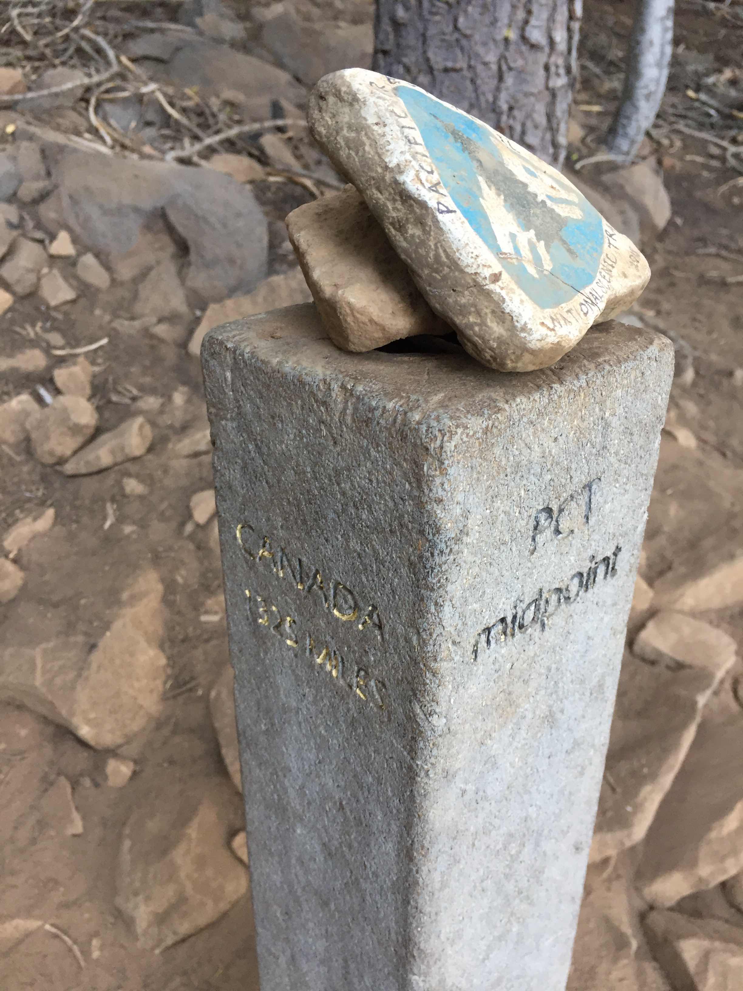
About two miles down the hill I passed the halfway marker, a concrete post in the ground that marks half the distance from Mexico to Canada. The trail has been altered in recent years. The marker is no longer exactly at the halfway point, but it still is a psychological milestone to hit this point. For some it is uplifting, others look at it and think “I am only halfway?”
I had had cell service off and on all day. For this descent it was on. I called Andy, Ed and Sally as I walked along, still talking to Sally as I walked into the campsites near the creek. I was surprised to find no one here. It was now 7:30 pm and I suspected someone would be camping here, but that was not the case. I soaked my feet, pitched the tent, crawled in and cooked a quart of rice, chicken, pineapple, walnuts, dried cranberries and spinach and ate the entire pot while laying on my sleeping pad. I was tired, but did not have any points of pain, just overwhelming fatigue. 32.5 miles from where I camped last night to where I was now laying. That does not include the 0.6 round trip to Little Cub Spring, nor the distance off trail to Cold Spring. I was pleased with my accomplishment.  I hoped I would not pay for it in the coming days. With 32.5 miles today, tomorrow was a relatively short day, just 18 miles to the Mt. Lassen NP border. 
Cold Spring, a couple tenths off the PCT