Wednesday, July 6, 2022

Day 71 - Monday, July 4, 2022 - 19.9 miles - 50,672 steps - MP 1398.3 (Quick camp to avoid thunderstorm) to MP 1418.3 (Random flat spot off side of road)" - Vert Up - 3931’ - Vert Dwn - 4259’ - Total Miles to Date - 1105.3.

I was doubtful of making camp last night with only one liter of water, but it worked out fine. I had chugged an entire liter at the last water supply, so I suppose I really had two liters, one in my Smart Water bottle and one in my belly. I ate a package of Pop Tarts for breakfast while packing. A nutrition filled meal. Not!  But, 400 calories. They are a pretty calorie dense food. Like eating a slab of lard for breakfast. 


In all my years of hiking and climbing it never occurred to me to dedicate a pocket on the outside of the pack for a tent. My new pack (well, really, 6 weeks of continuous use old now) has a long pocket on one side for your shelter. Smart!  The first thing you want when entering camp is your tent. The last thing you pack in the morning is your tent. This is wonderful. I can completely pack my pack inside my tent, avoiding the mosquitoes, then pop out, strike the tent, stuff it in its pocket and zoom off on my way. Brilliant. 


Yesterday, I had hoped and planned to camp 2.0 miles further up the trail than I did, but a thunderstorm was flailing on that part of the trail so I stopped short and sheltered from the storm. This morning as I passed my planned spot I saw it was indeed a very nice, flat spot with lots of room for tents. It was also right on top of the ridge, not a good place to weather an electrical storm. 


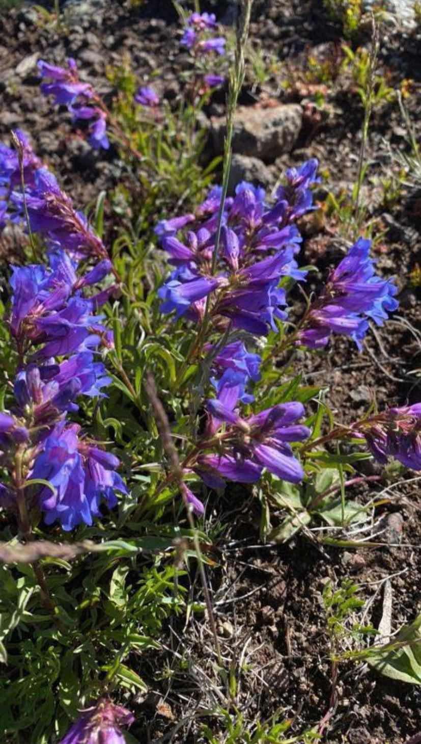
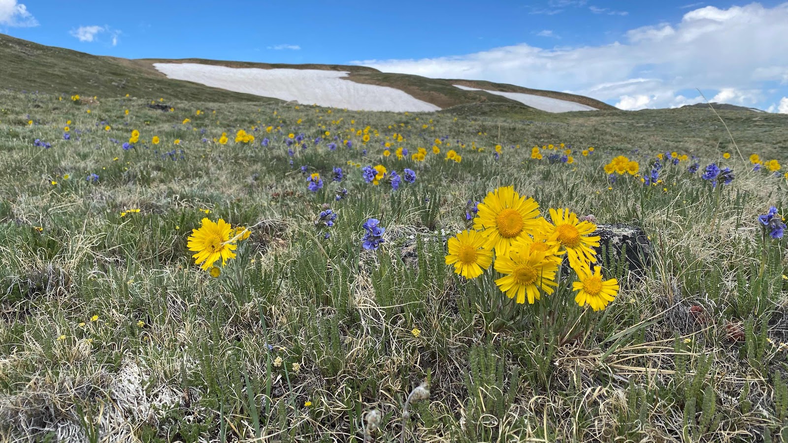
My foot took its usual couple miles to settle in to its day of beatings. The trail undulated up and down as it wove in and out between bumps on the ridge. Not much elevation change and the flowers were stunning. I took photos and used the “Picture This” app to identify them, if I had service at that moment (see some below). At one of these brief pauses I saw new text messages and found Sally had rented an AirB&B for me in Steamboat Springs. What?!?  How wonderful is that? I was planning to visit an Urgent Care facility and have my foot x-rayed to make sure it is just aggravated tendons and not a stress fracture. This made it easy. 


About this time I heard someone coming up behind me. G-String?  Yep. How did I get ahead of him?  On questioning, I found out he  and Woodpecker camped on the ridge and weathered the storm directly over them last night. He was a little slow getting out of camp this morning. Woodpecker was up ahead. I let him pass, but then kept up with him for a couple of miles, my foot being pain free right at the moment. We got a chance to talk a little. Soon we caught up with Woodpecker. She was pulled to the side of the trail in the sun, drying all her gear from last night’s soaking. I left them alone so they could talk in private if need be, and started down the trail, missed a turn and had to backtrack. G-String didn’t miss it and ended in front of me. 


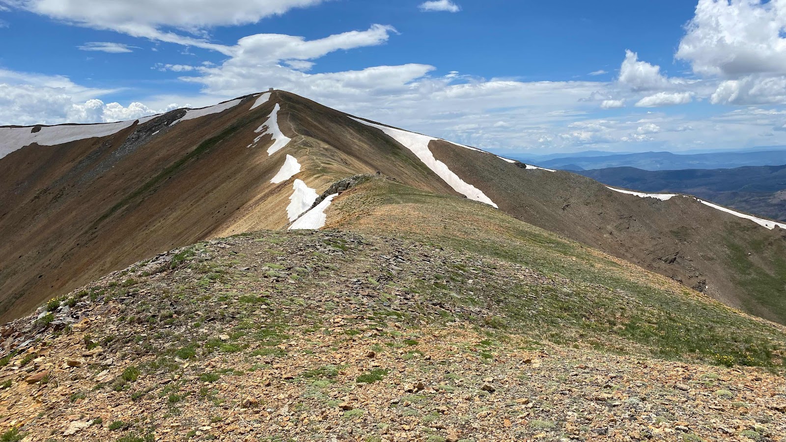
The trail descended for a while, then began a 1000’ climb. On the climb, I got off trail again, noticed my mistake, but saw in essence I was cutting a very long road switchback and using FarOut, guided myself back to the road/trail higher up on the climb. As it turns out, from here to where we leave the trail to go to Steamboat Springs is all road walk, about 30 miles. 


Unless you zoom way in on FarOut, and I mean way in, the thick red line that marks the route covers the underlying map symbols and you don’t notice whether you are on trail or road. This section of road walk escaped me as I didn’t expect it to be road so I never zoomed in to look for it (I sent FarOut’s support team a suggestion that they use different symbology to make it easier for us to distinguish dirt road [- - - - ] from paved road [-••-••-••] from trail [ _______ ]. They sent a response back within an hour. Amazing.)


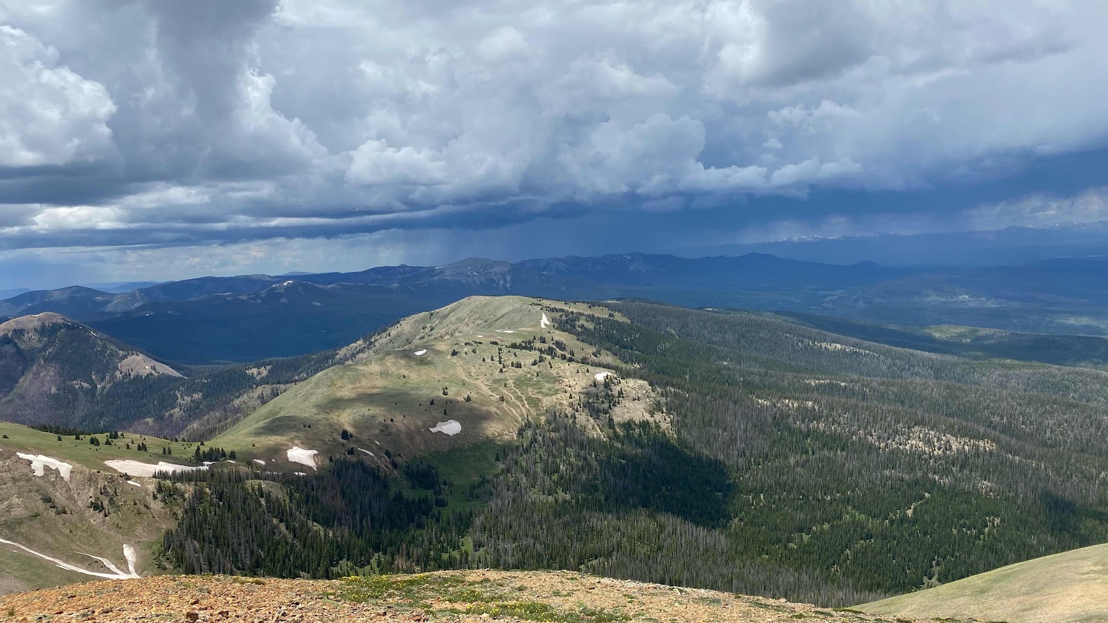
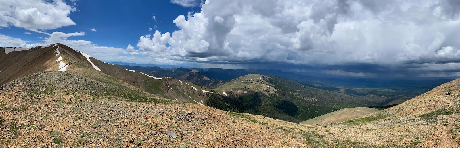
The rest of today was dirt road, very eroded at times, but good enough some OHVs made it up. G-String and Woodpecker were way ahead of me, or so I thought. Another thunderstorm was brewing and passing directly overhead. I had my umbrella out and was walking down the road when I heard voices in the trees to the side. They had taken shelter in the trees, waiting for the lightning to pass over. I joined them for about ten minutes, enjoying my umbrella’s protective wonderfulness when hail the size of marbles started pelting us. 


With the storm passed, we headed down the road again. They soon outdistanced me. I continued until I had 20 miles in (or so I thought. 0.1 miles short), set up my tent on the side of the road in the now shining sun and rested, wrote, ate dinner and watched the final episode of Stranger Things. It was only 4:15pm when I stopped. I could have gone farther, but I was tired of fighting the pain in my left foot with each step. I’ll wait until tomorrow. I’ll have about 18 miles to hike before I start hitchhiking into Steamboat Springs. 


Road walking does have its advantages. You can hike much faster because you don’t need to be concerned about foot placement and the grade is much gentler than a trail. Still, 18 miles is a lot of road to cover. I’ll get up earlier than normal so I can get to town at a descent hour. 


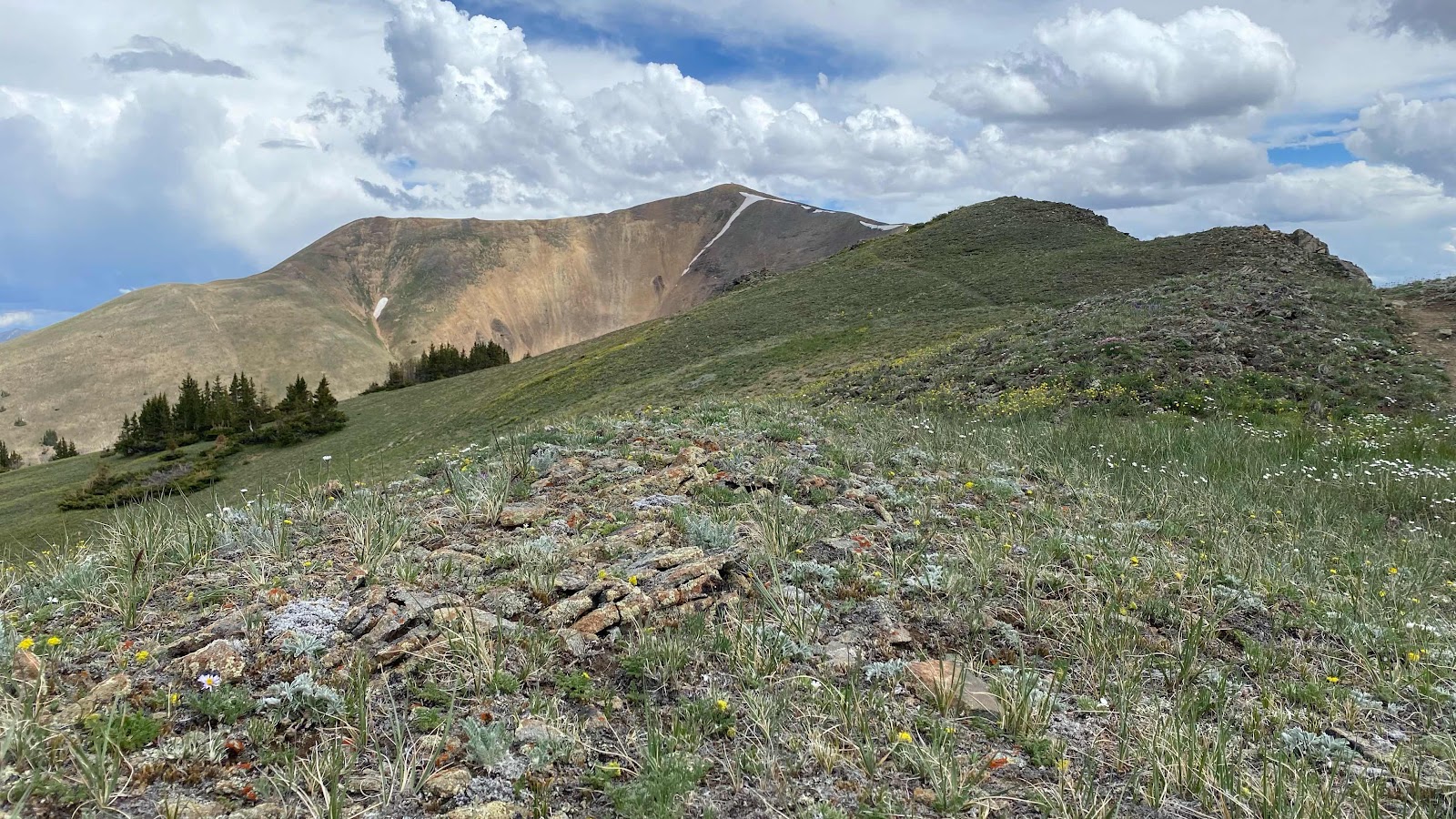
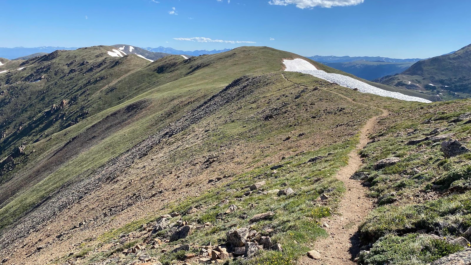
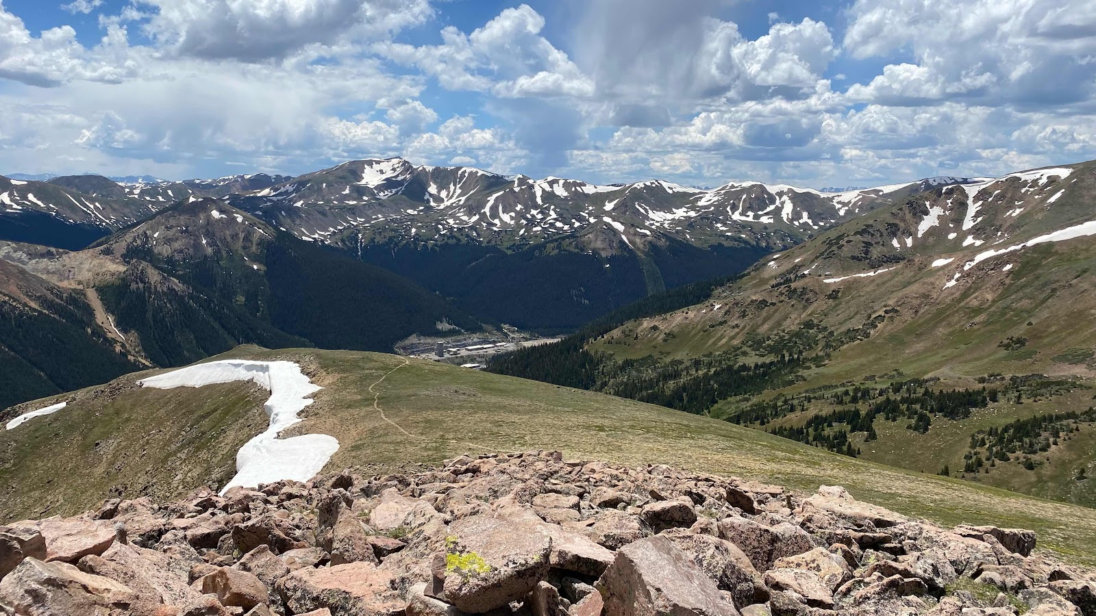
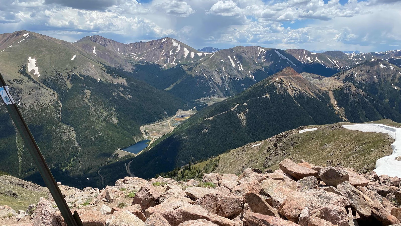
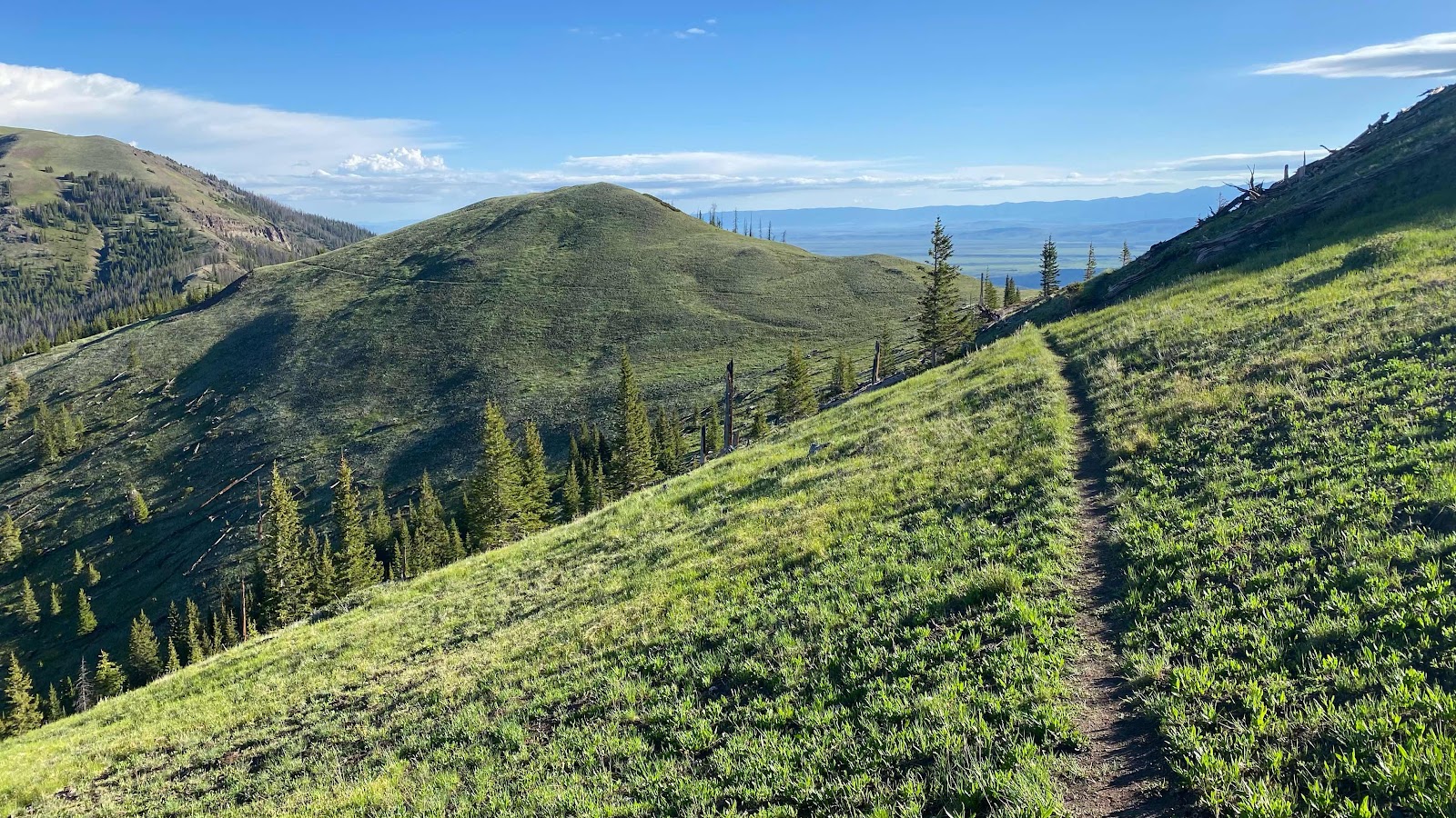
You can see the trail cutting across the hill in the near distance. Beautiful scenery for the whole day. 


The yellow flowers are Spearleaf Stonecrop


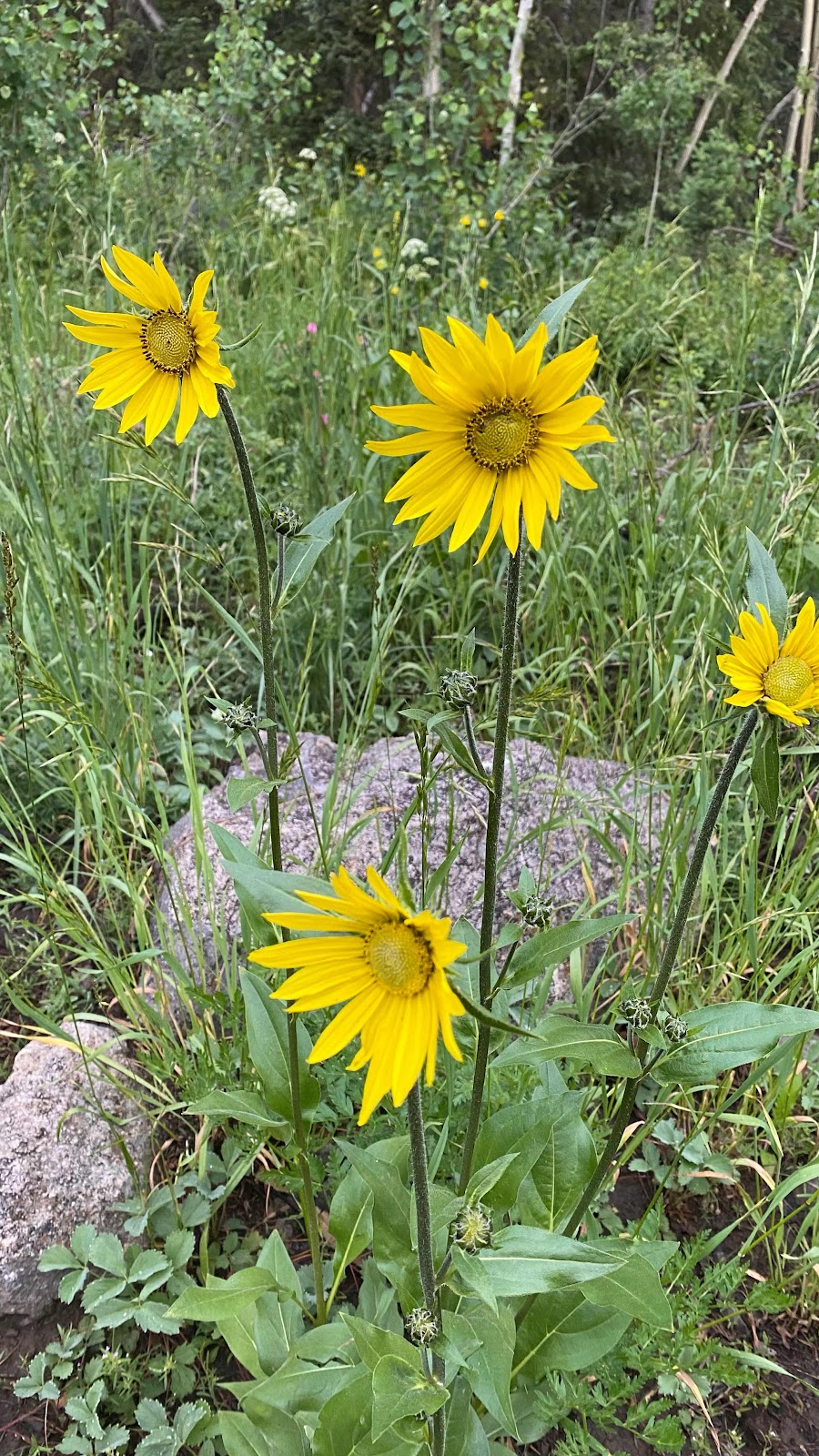
How about some Roughstem Rosinweed?  I love names that describe the plant. Easier to remember. 


Some Sky Pilot. Always found high up, as the name suggests


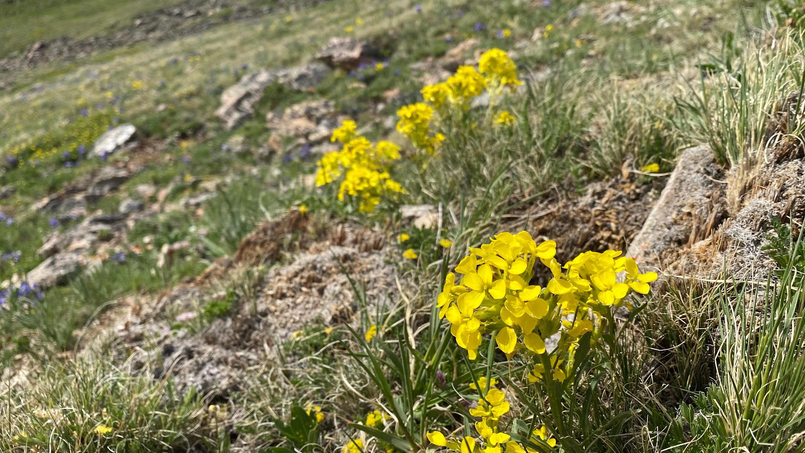
Sanddune Wallflower

Royal Penstemon


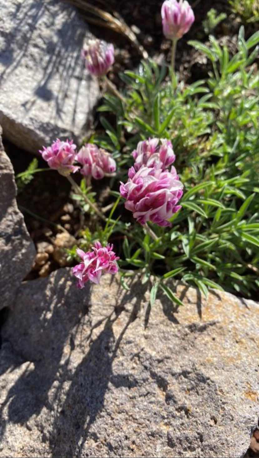
Tomcat Clover


Silky Phacelia


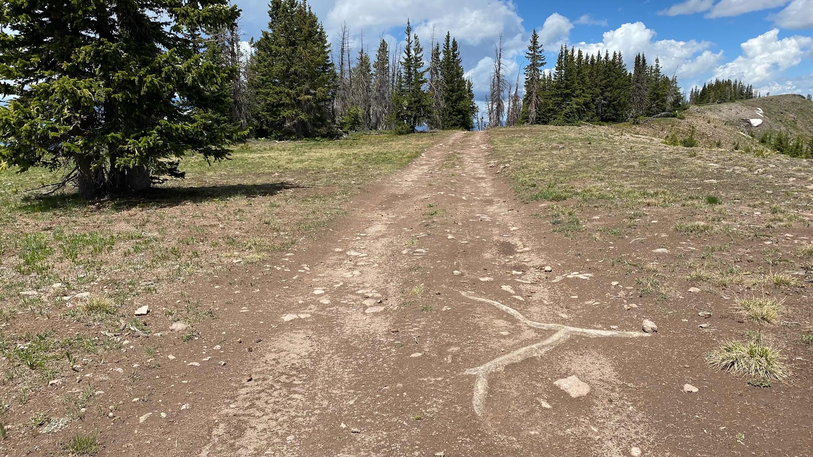
The Road


The hail that pelted us


Tuesday, July 5, 2022

Day 70 - Sunday, July 3, 2022 - 17.6 miles - 48,375 steps - MP 1380.7 (Trail Junction) to MP 1398.3 (Quick camp to avoid thunderstorm) - Vert Up - 4759’ - Vert Dwn - 4788’ - Total Miles to Date - 1085.4

Dewy night last night. Luckily I was in the trees and I somewhat escaped the brunt of it. It was a little damp inside, but not bad. My foot was an exceptional pain this morning. It took it over an hour to calm down and quit stabbing me with each step. Once it warmed up and the Ibu kicked in it was nearly pain free.


The trail started out going downhill for the first couple miles. It wasn’t really a trail, more like a  five foot wide two foot deep ditch with muddy walls. Tracks of four wheelers were visible in the goo. The steepness abated and now a babbling brook on my left ran through the totally burned forest. About a mile later the trail turned uphill. The beginning of a long climb. 


This is the last 12,000+ peak of the trail. Parkland Peak stands 12,296’. It’s name is appropriate as all the ridges leading to and away from it are beautiful parks of meadows. It was 3800’ of ascent over 8.5 miles. I thought I had gotten up and moving early enough to clear this peak before the thunderstorms that appear every afternoon arrived, but I was late, or rather the storm came early. I don’t think I could have gone appreciably faster had I known the sky was moving it’s time table up. 


Tree line here in Colorado’s northern Rockies is about 11,000’. I cleared tree line and was climbing up through the meadows when I heard the first peal of thunder. I still had 2 miles to go and another 1300’ to climb. I knew three hikers ahead of me. I had been leap frogging them all morning, Sketch, Savage and (can’t remember).  I could see them high on the ridge above me, maybe a 45 minute lead. Once above tree line the wind picked up. I couldn’t see the source of the thunder. The sound was coming from the north and I was climbing up a south facing slope. Once I crested the ridge I saw a massive storm to the north. Bolts of lightning streaking to the ground and peals of thunder. At most it was three or four miles away, but the wind appeared to be coming right toward me from its location. 


I really needed to get over this mountain today. I still had about 8 miles to cover on the other side if I was to get to Steamboat Springs on Tuesday, July 5th. I decided to press on with all possible haste while keeping an eye on the angry storm. If it advanced too quickly, I’d turn around and scamper down to tree line and wait for it to pass. 


I met two parties descending from the top. Seeing them above me gave me a frame of reference as to how far below the summit ridge I was. I was pretty sure I could make it up and over. Once I crested the summit ridge I still had half a mile, at 12,000’, to traverse to the real summit, plus an additional 300’ to climb. I hustled my buns, still watching and listening to the storm flash and boom. It was approaching slowly. I had picked a few landmarks in the sun to watch. They were now in the shade of the storm. 


When I was just a few feet from the top I looked up to see Sketch and Savage hanging out on top. There was a building up there, about 8’x10’ with a hefty lighting rod attached. They were looking in it. I considered hunkering down in it to ride out the storm if it passed overhead, but dismissed the idea and quoted in my head the line from The Mountains Don’t Care, “We gotta get off this ridge”. I hunted for

a minute to find the trail. It went straight down the fall line, fairly steeply. I jogged down it for the first ten minutes trying to lose altitude quickly and get to tree line. I think Sketch and Savage thought I was crazy or a chicken, but they were not too far behind me. Once off the main summit block and on the ridge I sat in the meadow to let my legs recover and to get a drink of water. The storm was veering to the east, missing the peak, but it’s flashes and thunder continued. That was fun!


I still had a mile or two of ridge to walk, so I kept an eye on the weather as I did. It looked settled so I got a bite to eat and called Andy about finding a room in Steamboat Springs through his friend Ross who works for a huge hotel chain. Word came back it wasn’t going to work. 


I covered the next six miles or so. I was out of water now and quite thirsty. The nearest water on the trail was just under four miles away. I drank a liter while at the creek, then loaded a liter in my pack. My intention was to camp 0.1 miles short of the next water source, about 2 miles away. When about 0.3 miles away the sky started booming again, like once every 15 seconds. I found a perfect little place to set up my tent, did so and crawled inside just as the rain started. I only had a liter of water for the night, that includes making dinner. I told myself I would walk the two tenths of a mile when the rain stopped . . . but I didn’t. I made do with one liter. Knowing the next water was only 0.2 miles away in the morning was a comfort. 


I watched episode 8 of Stranger Things while eating dinner. I wrote a little, but couldn’t concentrate so I rolled over and went to sleep. Exciting and difficult day. 


The thunderstorm to the north taken from my position on the trail leading up to the summit ridge. I tried to time my photo to catch a flash of lightning, but no luck. I wanted to keep moving. 


On the “false summit” looking at the ridge run to the true summit a half a mile away. 


A 90° panorama shot showing the ridge run to the summit and the storm off to my right. 


Down in the meadows nearer to tree line looking back up at the summit (center of photo) and the summit ridge to its left. 


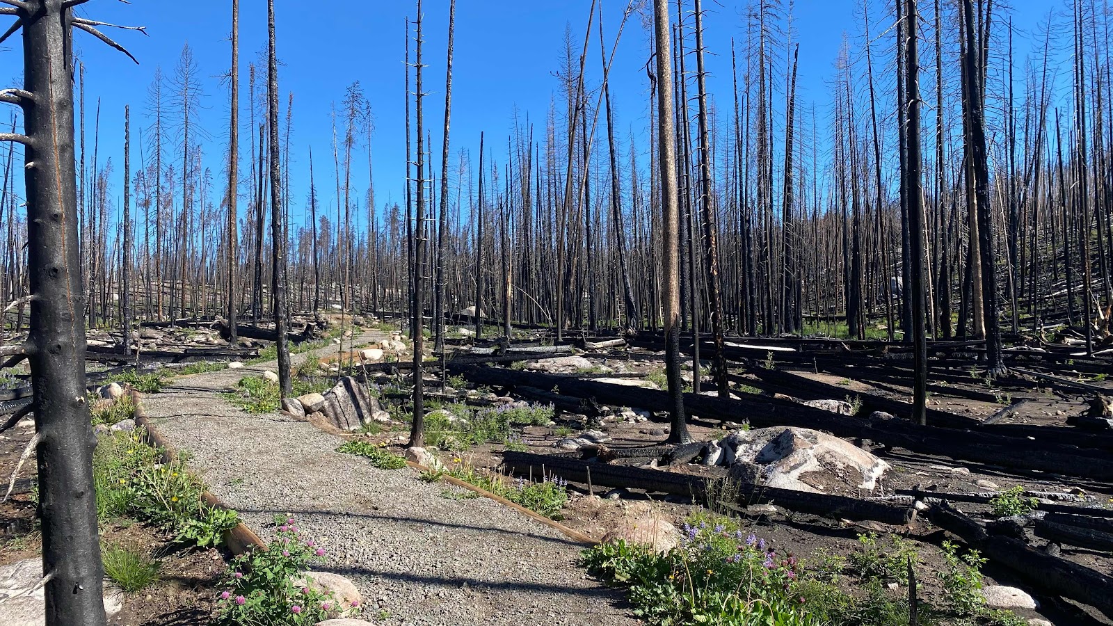
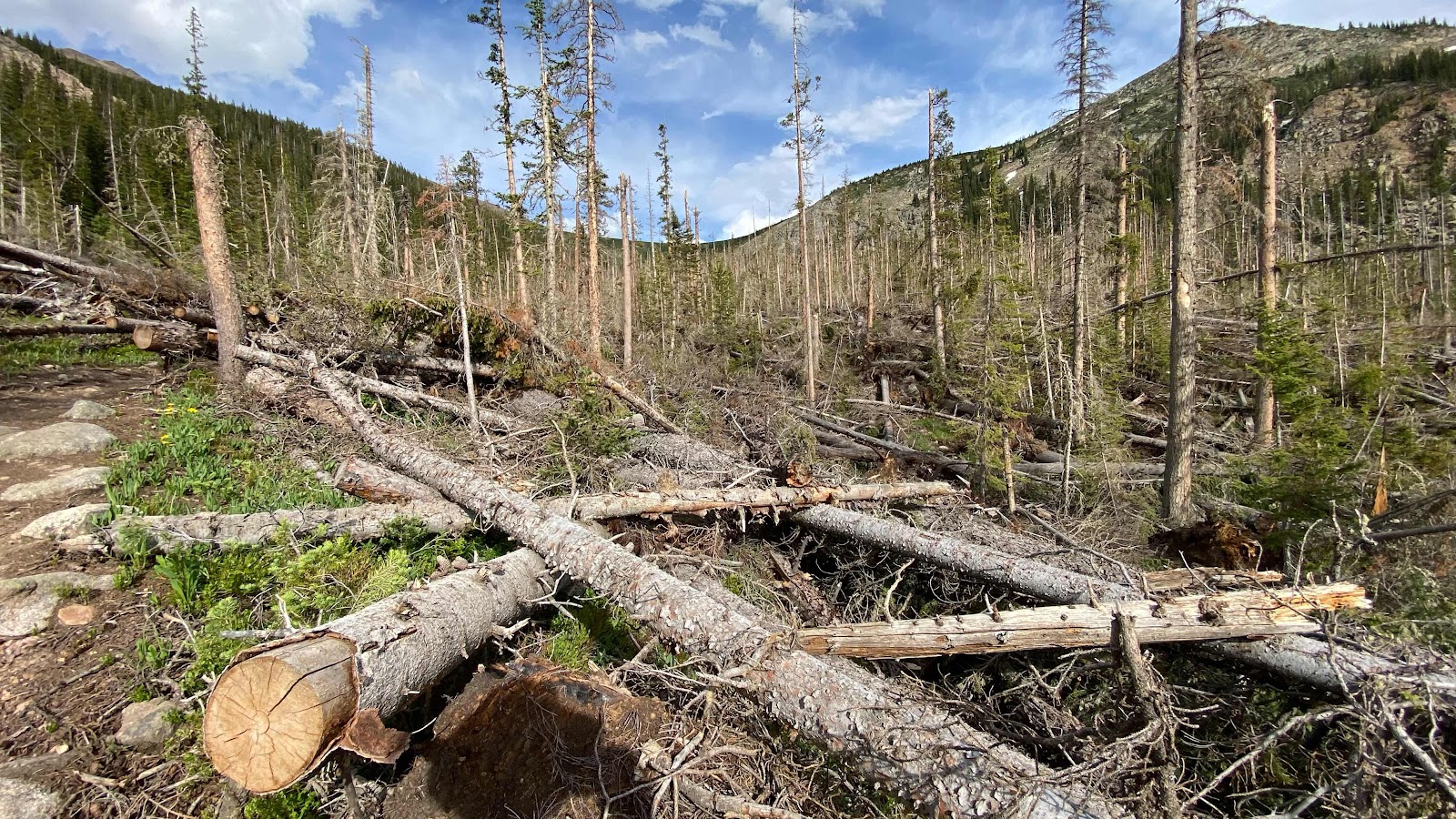
I thought I had made it out of the RMNP fire of 2020 but I was back in it traversing to my much needed water source. Such devastation. 

Day 69 - Saturday, July 2, 2022 - 20.0 miles - 48,359 steps - MP 1343.7 (Shadow Cliff Hostel) to MP 1380.7 (Trail Junction) - Vert Up - 4715’ - Vert Dwn - 2953’ - Total Miles to Date - 1067.8

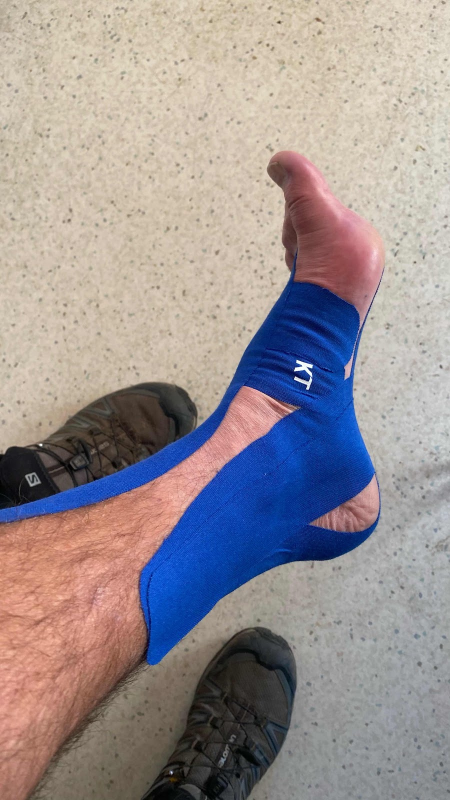
This is the first bed I have slept in since Pagosa Springs back on May 30th. I have forgotten how luxurious a simple bed is. Normally, I would be up at 5:20am and on the trail, hiking by 6:00am. But . . . wow!! I decided last night I wasn’t going to abandon this cushy life so quickly and stayed in bed until 7:00am!  I wasn’t asleep all that time. The internet in the hostel was super fast and a joy to use. I thought I would use it to find how to tape my foot with KT tape for top of the foot pain and Plantars Fasciitis. I quickly found the videos on YouTube and watched them with the sound turned off so I wouldn’t disturb my roommates. I grabbed my supply of KT tape and moved to the men’s restroom. There I taped for Plantars Fasciitis on the bottom of my foot and for “Top of the Foot Pain” on the same foot. My foot didn’t look Iike a mummy, but it did have a lot of tape on it. 


Down in the dining and living area of the commons there were about a dozen of us. We had a fun conversation that ranged over many topics. Everyone was making and eating their breakfasts and getting in their cups of coffee. Most people weren’t planning to leave until between 10 and noon. I like to get an early start. Today that would be defined as a 8:10am start. 


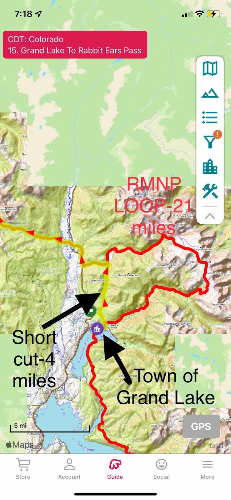
The Shadow Cliff Hostel and Lodge sits less than 100 yards from the Rocky Mountain National Park border. The CDT goes right by the hostel then loops up into the park for about 22 miles. There is an alternate that is only 4.7 miles that skips RMNP. A fire roared through the park in 2020 and decimated this whole side of the park. It came within 100 yards of the Hostel and is starkly visible out the windows of the hostel that face away from the lake. 


Many CDT hikers were planning to leave their packs at the hostel and “slack pack” the loop in the park, then spend another night or grab their packs and move up the trail a bit and camp. However, we found out the park service had closed the second half of the loop due

to falling burned trees and a landslide. Raider and Pitch tried to hike it yesterday and got caught by the park and were escorted back the way they came. This discouraged everyone. Those planning to hike it changed their plans. There was a real concern regarding giving CDT hikers a bad name for trying to circumvent the rules. Everyone just resigned themselves to hiking the alternate and continuing northbound without seeing the park. 


It has been taking about a mile or two for my foot to stop hurting in the morning when I start hiking. Today was the worst so far. After three miles the top of my foot was still frustratingly painful. Then it donned on me that tape job on top was causing rather than relieving pain. I stopped on the shoulder of the highway and removed the KT Tape. Ahhhhhhh. Instant improvement. 


Once off the highway bypass route and on the trail I was hiking with Quiet, a retired geneticist who worked breeding and altering Cyanobacteria for different purposes. I was in the middle of reading the audiobook “Project Hail Mary” by Andy Weir (The Martian) about a bacteria in outer space that causes humanity trouble. He has read it a couple of times and loves its accuracy about science issues and techniques. This got us into discussing books, politics, science and a wide range of other topics. It made the miles slip underfoot. 


I covered 20.0 miles for the day and camped in the woods by a trail intersection. The mosquitoes were beyond belief. Once my tent is up it really doesn’t matter because once I am inside for the night the netting keeps them out and I go about my business. 


About a dozen hikers passed me after I was inside my tent. I am in the bubble. 


Taped for Plantars Fasciitis and “Top of Foot Pain” I am hoping for a miracle here. Didn’t get one. The tape on top made my foot hurt worse. Not sure the Plantars taping helped. At least it didn’t hurt. 


The shortcut was the only route open, and even it was partially closed and forced us out on the highway to get to where the trail headed ENE


Just a couple hundred yards behind the hostel is RMNP and the devastation from its fire in 2020. 


Scorched earth fire. Burned the soil too. 


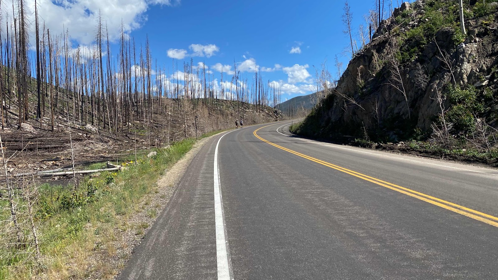
Due to closures had about four miles of highway to walk


This is the Colorado River way up in the Rockies


With nothing to hold the rain water, it pours off the hillsides. This ditch used to be the CDT. Too deep to walk in now after just two years. 


Day 68 - Friday, July 1, 2022 - 8.0 miles - 23,713 steps - MP 1335.7 (Camp by Lake) to MP 1343.7 (Shadow Cliff Hostel) - Vert Up - 668’ - Vert Dwn - 492’ - Total Miles to Date - 1047.8

Petr and Kafka are very kind souls. They waited for me yesterday when I got behind and included me in their camping plans. Last night they said they wanted to leave at 6:00am this morning to get to town early. Perfect. 


I was up and taking my tent down at five to six. Petr and Kafka were just a few minutes behind me. Kafka took the lead. She sets a pace I can maintain. The trail stayed right on the shore of the lake. Suddenly I noticed the lake was a river. We were at the inlet to the lake, a broad river flowing in, the Colorado River. 


We were only 7 miles from the town of Grand Lake. On the walk in I called the shadow Cliff Hostel about a room for the three of us. They didn’t answer the phone until 9:00 so I left a message. About 3 hours were required to get to town. At the outskirts of town Kafka and Petr wanted to hang their tent and other stuff in the sun so it would dry out after a dewy night. I thought mine was okay and headed to the Post Office. I had a resupply to retrieve plus my hiking umbrella that Andy had mailed. I also planned to mail some stuff back home to lighten my load, 3/4 of my zPad, my ice axe, extra iPhone, some socks I had found, my malfunctioning trekking pole, an extra 10,000mamphr battery and some other stuff. Just trying to lighten my load. It took a few minutes to construct a box to hold the ice ax with its long shaft. Kyle showed up and we cheerfully sorted out gear and food in the Post Office, spread out on the floor and counters. People of the town would stop to talk to us as if dirty, scruffy looking people Living out of their packs was a totally acceptable thing. In this town it is, because everyday hikers come through, stop at the Post Office to get their resupply, walk to the downtown district and buy food at the grocery and eat at the restaurants, which is exactly what we did.  First stop grocery for a soda and some chips, then to the Sagebrush restaurant for food outside on the sidewalk. Burgers and burritos were the hit. Kyle, 70 Pound Hammer, Petr, Kafka and I enjoyed the meal together. 


Now it was decision time! There was no

Laundry at the hostel, so do laundry in town first and then to the hostel, of to the hostel, then back to town to do laundry?  The hostel is about 200’ above the town on a rock outcropping, about 1/4 mile from downtown. I voted for hostel first as I was planning to wash my clothes in a sink and the sooner I got to lay down on a real bed the better. They agreed and up the hill we went. 


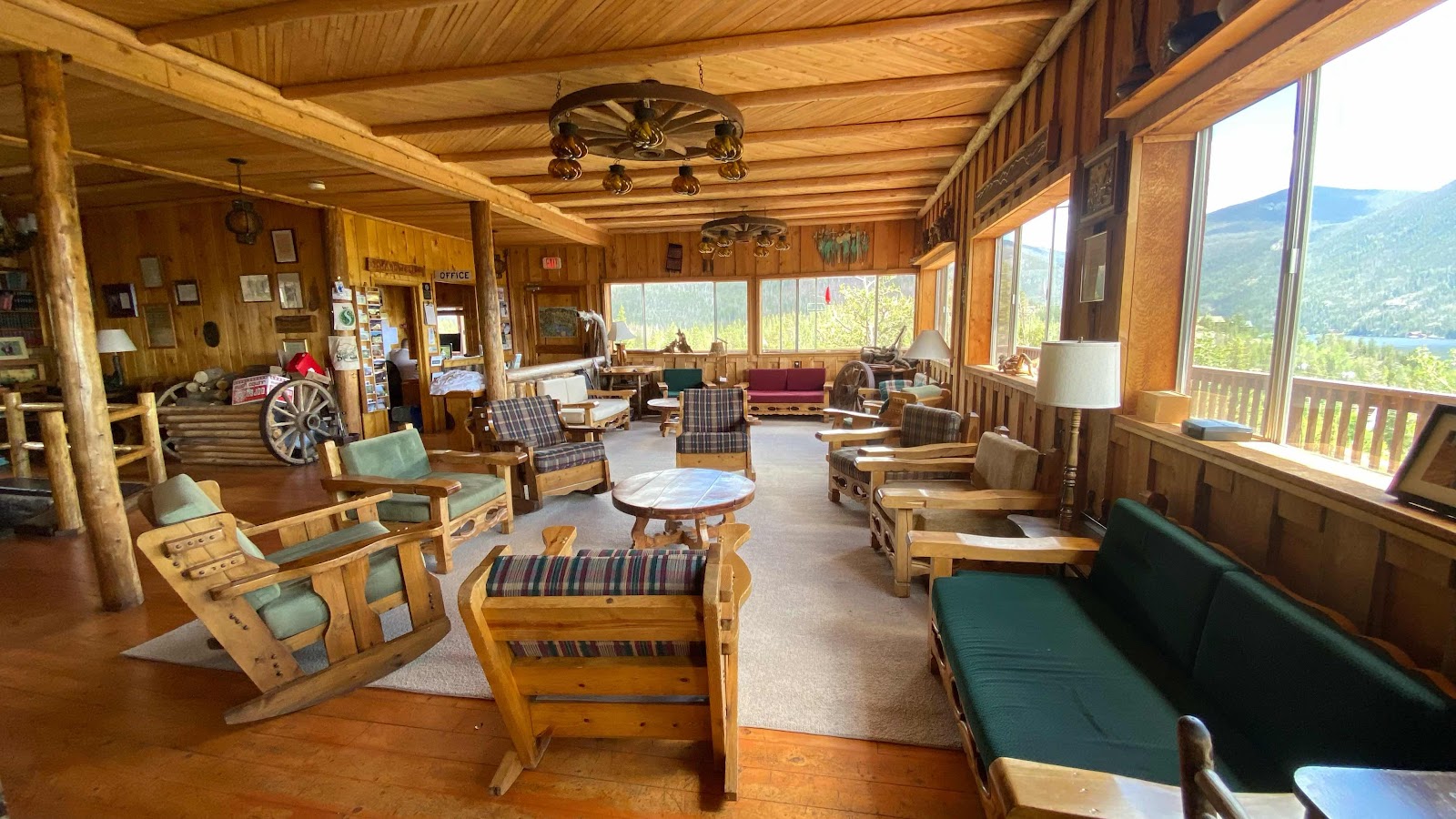
What an incredible hostel!  The common room was so inviting and cozy and huge!! It overlooked the lake. The cooking facilities were great, it had an industrial sized kitchen for events, a large donning area and rooms on the two floors above. Bruce checked is in and showed us our room. It had a double bed and a  bunk bed with the Colorado River right out our window, except it was about 150’ below us, roaring and tumbling down into Grand Lake. 


I flopped onto the lower bunk and was surprised at how exhausted I felt. Petr and Kafka were headed to town to do laundry. They agreed to thrown my few articles in with theirs. It was only about 1:00pm so I had the rest of the day off. I just layed on my bunk in my raingear and dozed and rested. Why my rain gear? I only have one set of clothes, a yellow button down shirt, a red fleece, a pair of underwear, a pair of zippy pants and two pair of socks. They were all headed down town to be washed so the only thing for me to wear was my Frog Togg rain gear. 


I owed all afternoon, icing first the top, then bottom of my foot, hoping it would calm down. I downloaded episodes 8 & 9 of Stranger Things. Excited to watch those. Sally called twice, once to talk and once to FaceTime. It was really nice to spend over an hour with her. I wish she were here. Of course, I spent time on the blog and spent an hour or so in the common room talking with Petr and Kafka and Hammer. This day was as close to a zero for me as a nero can get. What a great day. Now if I can just get this foot nursed back to health!


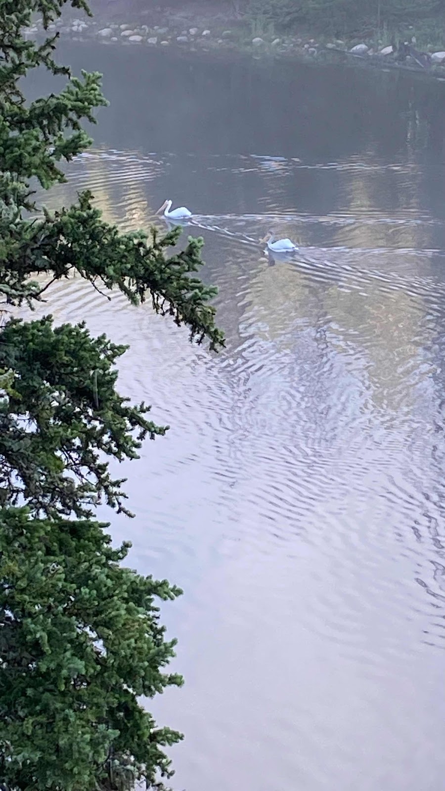
Pelicans on the Lake/Colorado River


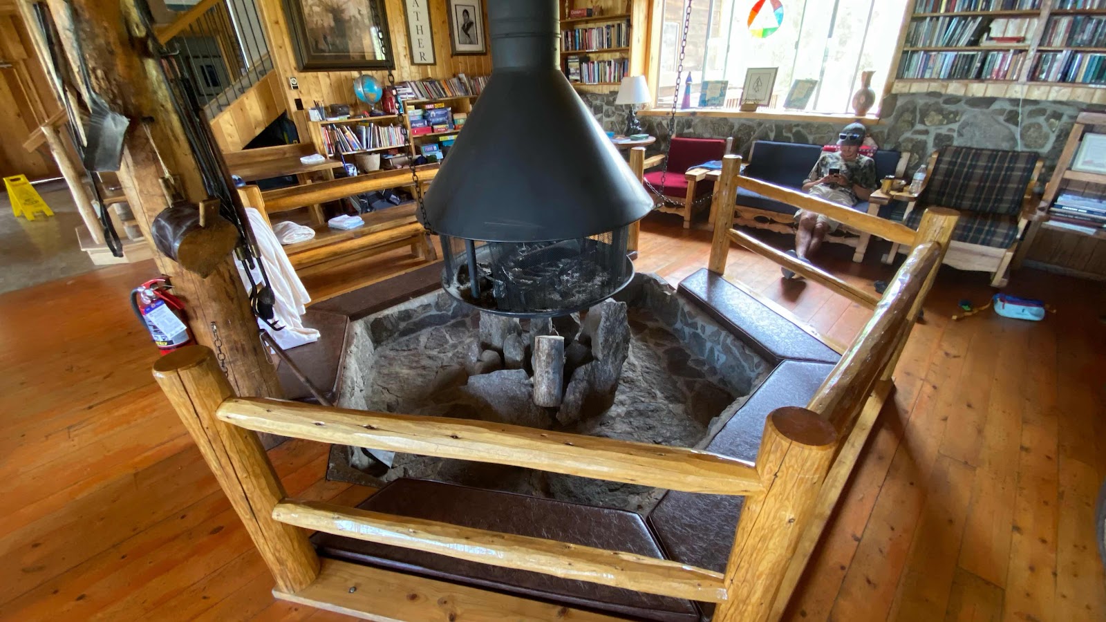
The common room at the hostel


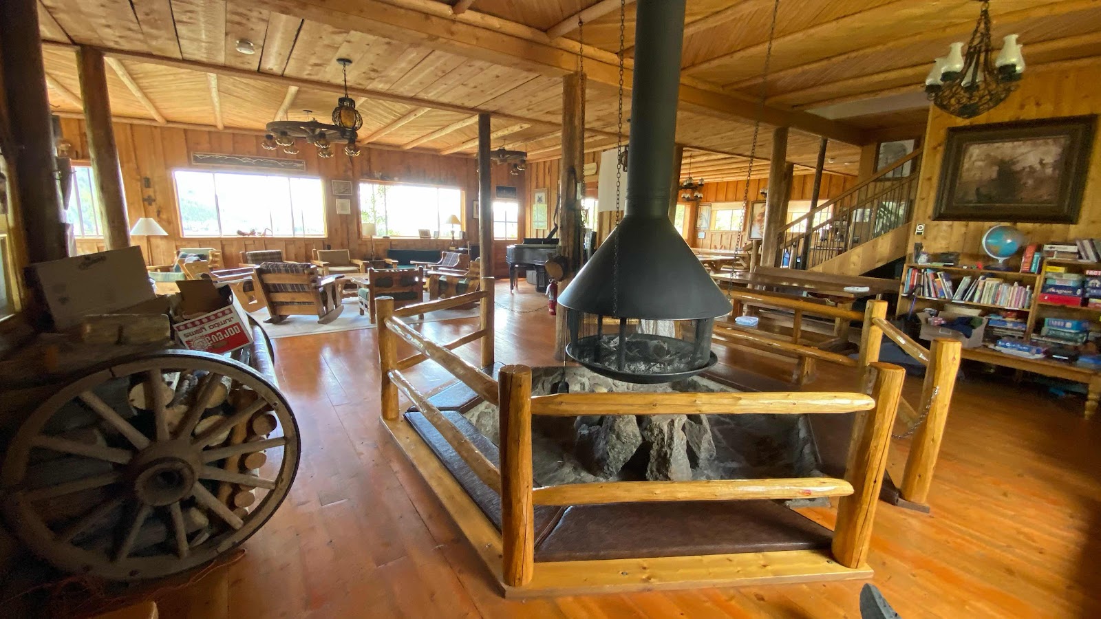
The fireplace


Seating down in the pit and close to the fire. 


The view out our room


The town and lake below the hostel


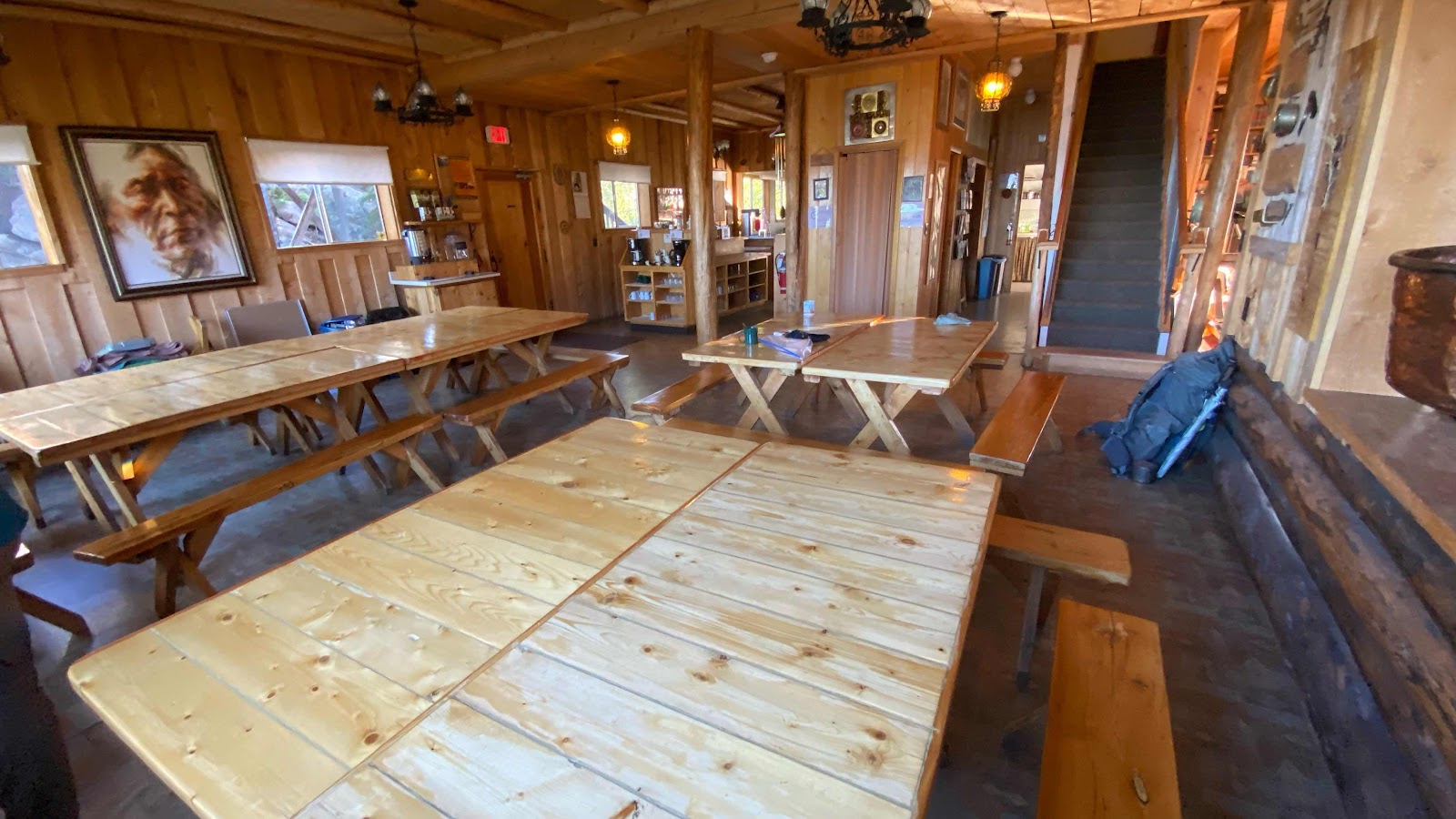
Dining area


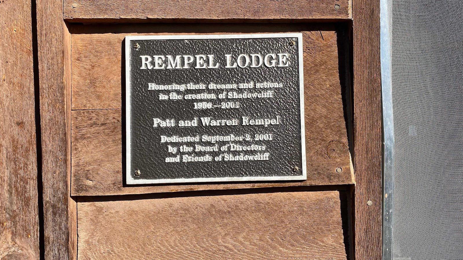
The Rempel family was the driving force behind this non profit facility 


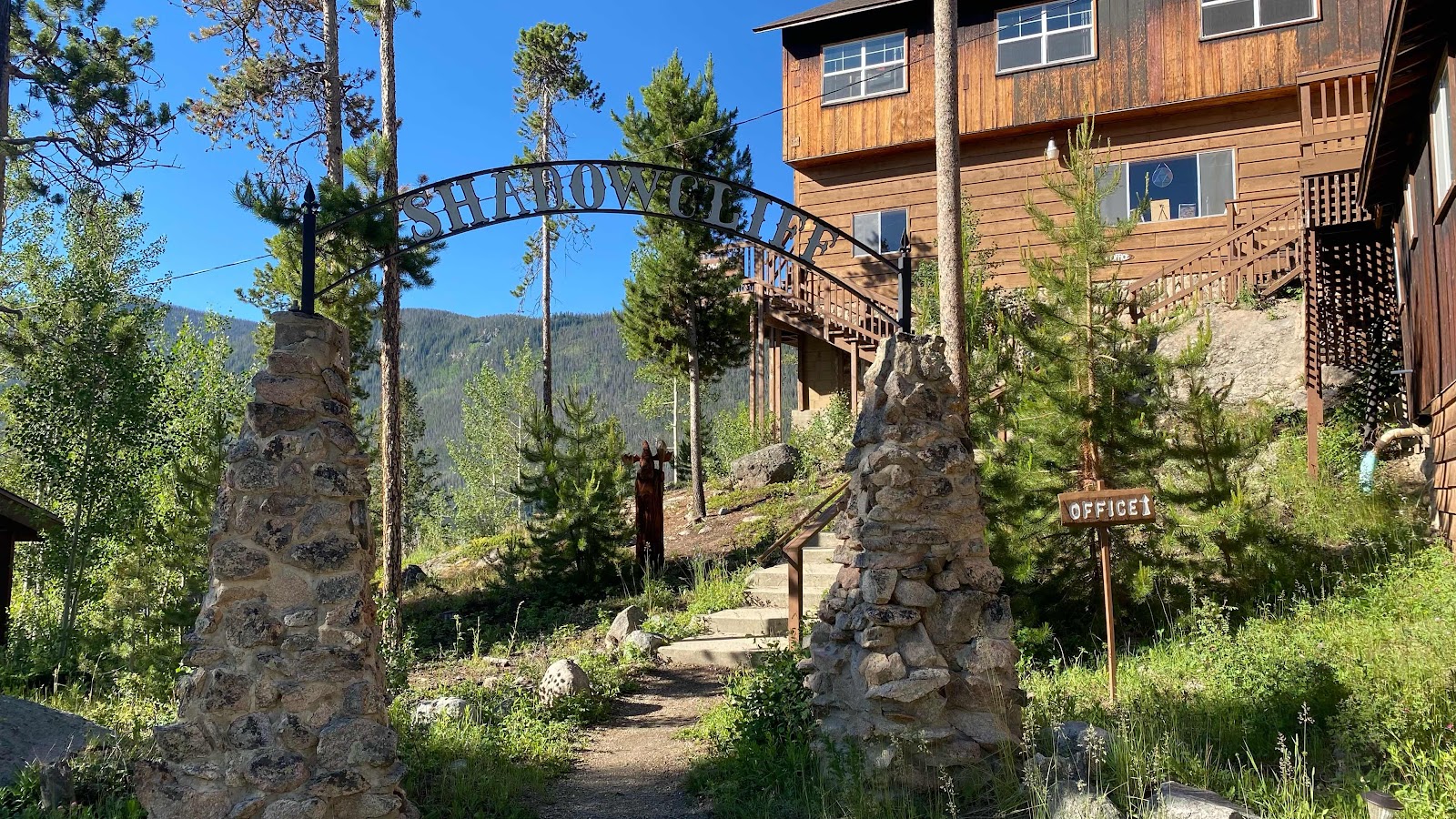
The entrance


Day 67 - Thursday, June 30, 2022 - 20.7 miles - 53,592 steps - MP 1315.1 (Cabin Creek Trail Crossing) to MP 1335.6 (On Lake Grandby) - Vert Up - 2655’ - Vert Dwn - 4163’ - Total Miles to Date - 1039.8

I was not going to push hard today. I “slept in” until 6:00am. Well, not really slept in. I was awake at 5:30am and instead of getting moving I wrote in my blog for about 40 minutes, then ate, packed and was taking down my tent when I heard voices coming down the trail. They sounded familiar and soon Raider and Pitch came into view among the blowdowns. I hailed them from my position 20 feet off the trail wedged between blowdowns and the beaver pond. They stopped to chat for a minute, then they were gone. 


I finished with my tent and headed down the trail. It took a little more than a mile for my foot to either stretch out or numb up, not sure which. This is the lowest elevation hiking I have been in a month, about 9700’ and decreasing. It felt nice to have air of some density on the uphill portions. Of course, at this lower elevation I was in forest for the whole day, wandering in and out of meadows, always on the lookout for moose. I want to see a moose!


Uncharacteristically, it started raining about 8:30am and continued unabated until nearly 11:00am. I hiked with my Frog Togg raingear on and it kept me dry. The new pack cover I bought in Silverthorne did a good job on my pack. 


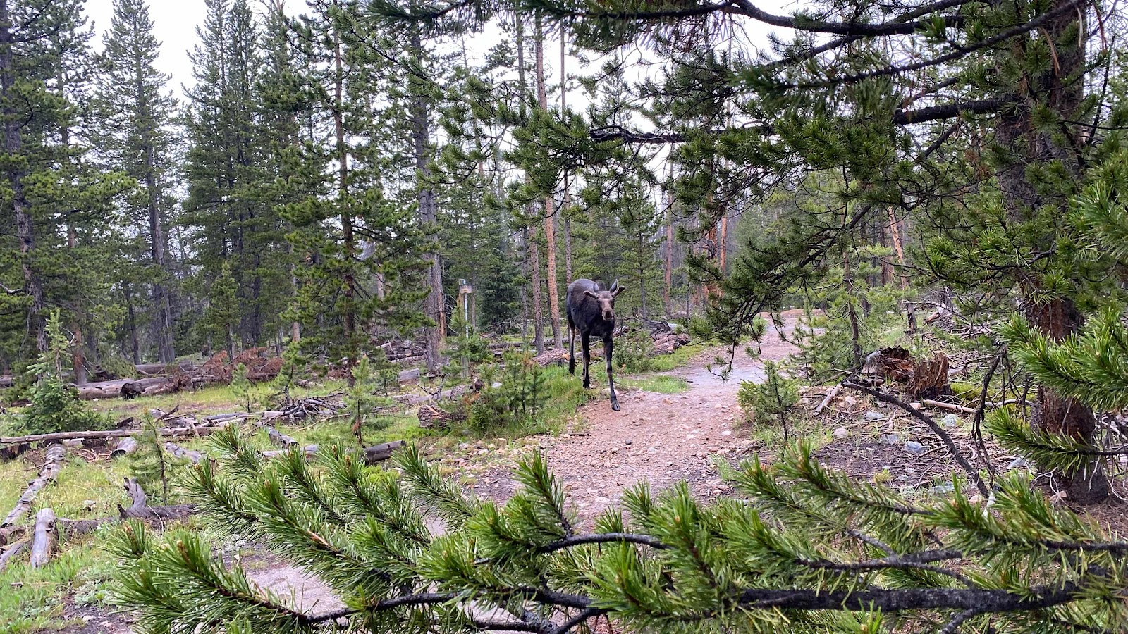
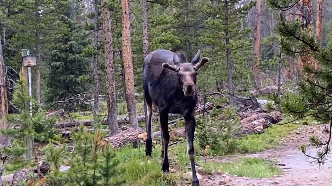
At one point the trail intersected a dirt road at right angles. I dug under my rain pants into my pants pocket to pull out my phone to see what direction I was to go, left or right. I suspected right and started drifting up the road in that direction while I brought up FarOut. I realized I needed to go left instead of right and turned around. There he was. Following me up the trail? A bull moose. Not 30’ away. I have no experience with moose, but I hear they can be mean so I edged close to some trees I could use as protection if he charged or something. He just slowly wandered toward me turning his head back and forth as if sizing me up. If moose have facial expressions, his was not a happy countenance. I already had my phone out so I snapped four photos while we eyed each other. He was right in the road right where I needed to go. How do you make a moose move out of your way without pissing him off? After a minute or two he slowly moved to the shoulder and started grazing some grass. I began to approach him, wondering what his reaction would be, fight or flight. I banged my trekking poles together and he skittered a few steps into the underbrush away from me. Flight. I banged a few more times and he wandered quickly off. Yeah!! A moose encounter of the first kind!


I followed the road to a parking lot and then started from there on another trail that reentered the woods in the general direction I had come from. Sure enough, within 100 yards there was my moose again. This time he was done with me and scampered? Galloped? Loped? Ran? into the woods. That was cool. 


Soon the rain quit, the sun peeked out a bit and I took off my rain gear. Now the trail dropped another 1500’ over the next few miles to 8300’ at Monarch Lake. This is a popular destination for day hikers and I saw maybe 20 people walking around the lake. The rain had made for a very muddy trail. Many had nice sneakers on that were now caked and splattered with mud. 


At the end of the lake is the access road and parking lot. Just before reaching the road I saw a man and a woman sitting at a picnic table eating and drying their gear. I stopped and introduced myself. This was Petr and Kafka from the Czech Republic. We got to talking. Soon the rain started falling again and they were quick to gather their drying things. 


We walked together to the end of the road and found an outhouse (!) and garbage cans (!). We stopped to empty the trash from our packs and use the facilities. Then the rain started in earnest. We hung on the porch for a few minutes watching it fall, them stepped out into it and kept going. We still had about 7.5 miles to go to a reportedly good camping spot on Lake Granby. 


Turns out Petr (Daydreamer) is a solid liberal

In the Czeck Republic so we had lots discuss. The 7 miles went quickly even though the trail climbed 600 vertical feet up over a hill next to the lake. 


We crossed a creek 0.3 miles before the camping site. We stopped to fill our bottles for the night (2 liters each). I saw an opportunity to ice my foot. I slipped of my left shoe and spent 15 minutes soaking it while Petr and Kafka continued to the campsite. 


The site was right on the shore of the lake. Kafka and Petr went skinny dipping while I set up my tent, then it was my turn. The water was surprisingly not freezing, though still very chilly. 


I retired to my tent to cook, eat cleanup and go to bed. They did the same. We agreed

To start hiking at 6/00am. This allows us to get to town early, turning a nero into an almost zero. 


This moose is standing on the trail I just left. Was he following me?


He just kept staring at me. An old man in a blue Frog Tog rain suit must be interesting. 


See how unhappy he looks. I was hiding behind a tree hoping I could use it as protection if he got angry. 


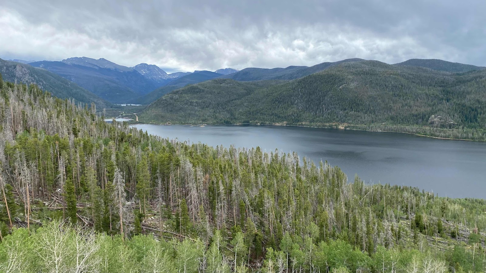
You can see the progression of lakes we hiked past by looking up the valley. 


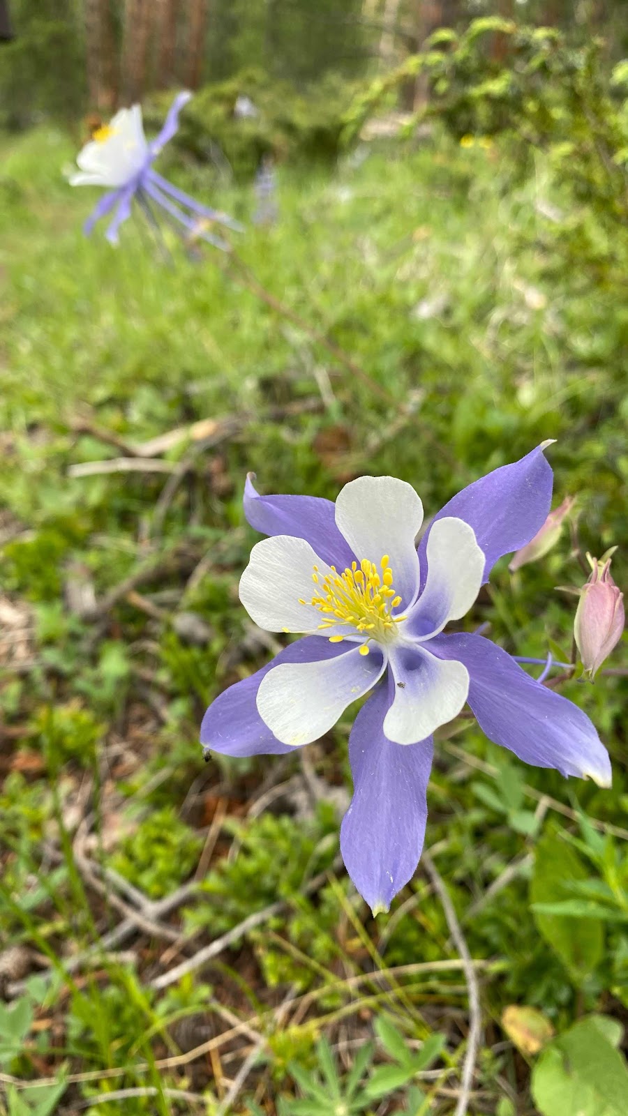
This is the Colorado Blue Columbine. Stunningly gorgeous!

Friday, July 1, 2022

Day 66 - Wednesday, June 29, 2022 - 24.9 miles - 58,377 steps - MP 1290.1(2 switchbacks above Berthold Pass) to MP 1315.1 (Cabin Creek Trail Crossing)- Vert Up - 6417’ - Vert Dwn - 8172’ - Total Miles to Date - 1019.1

A day to celebrate for many reasons!  First, look at that total mileage number. Finally broke 1000 miles walked. Woohoo!  Look at the daily distance. 24.9!  That’s a big day (but it is also a somewhat false number. More on that later.) The last big mountain of the Rockies has been climbed and descended, Mt. James. 


The weather forecast for today was for deteriorating conditions. It thundered and rained for about two hours last night, starting about 7:00pm, so I was wondering what today would bring. My attention to the weather was more acute than normal because I was hoping to take the Mt James alternate, a high altitude ridge run about 4.5 miles long skirting or climbing five peaks that would save me following the CDT down and around this collection of peaks, a loop 10 miles long with a boatload of elevation loss and gain. This is why my distance figure is a little misleading. I cut 5.5 miles off by doing the traverse. I didn’t want to get caught on this exposed ridge in a thunderstorm. 


I’ve become pretty accustomed to Rockies weather. Usually nice in the mornings, starts forming clouds starting between 10 and noon, those clouds start accumulating mid to late afternoon and before dark “Kaboom”, thunder and lightning. The fact that forecast showed worse weather than yesterday made me think the thunderstorms would come earlier today. I got up an hour earlier than usual hoping to get across the traverse before the weather went sour. 


First, I had to ascend 1200 feet over 2.7 miles on the CDT to reach the top of Mt. Flora. There was a brisk wind blowing all the way up. I arrived at the top about 7:00 am. I had promised myself I would not make the decision about doing the traverse or following the trail until I reached the top of Flora, but I really had already decided. 10 miles compared to 4.5? 2500’ compared to 2100’?  Unless the clouds were obscuring the route or there was thunder at 7:00 in the morning, I was doing the traverse. 


There were high clouds across the entire sky. They weren’t thick, but who knows what they would do as the morning progressed?  I’d keep an eye on those sneaky buggers. 


The traverse starts out easy. Just level to slightly downhill walking on a very broad ridge top. Then suddenly, the ground drops out from under your feet and you descend 400’ down very steep meadow. While descending I’m looking across to an equally tall and steep slope up the hill on the opposite side of the valley. Once on top of that it’s a half a mile of ridge walking and then a traverse of 13,129 Mt. Eva, staying 280’ below its summit and traversing into a pass between it and Parry Peak. Up to the top of Mt. Parry at 13,320’. Now some ridge running and incredibly steep

heather to the top of an unnamed 13,200’ peak. More steep heather drops me into rocky pass between this peak and Mt. James. Now it got fun!  A little rock scrambling, a few moves, slipping thru a pass and into a protected notch for a bite to eat and a rest, then up a near vertical boulder field for 300 vertical feet to the nearly level ground at the base of James’ summit block where I connected with the CDT and hiked the last 300-400 feet to the summit. The weather held. A fun route. 


There was still a ton of ridge running to do as the CDT stayed high for the next 10 miles or so. There was an old mining road that paralleled the CDT but dropped off the ridge, then climbed back on top to meet it again at Rollins Pass, a distance of 6 or 7 miles. I chose the road because it dropped to tree level, affording weather protection and I figured I could walk more easily on road than a narrow trail. 


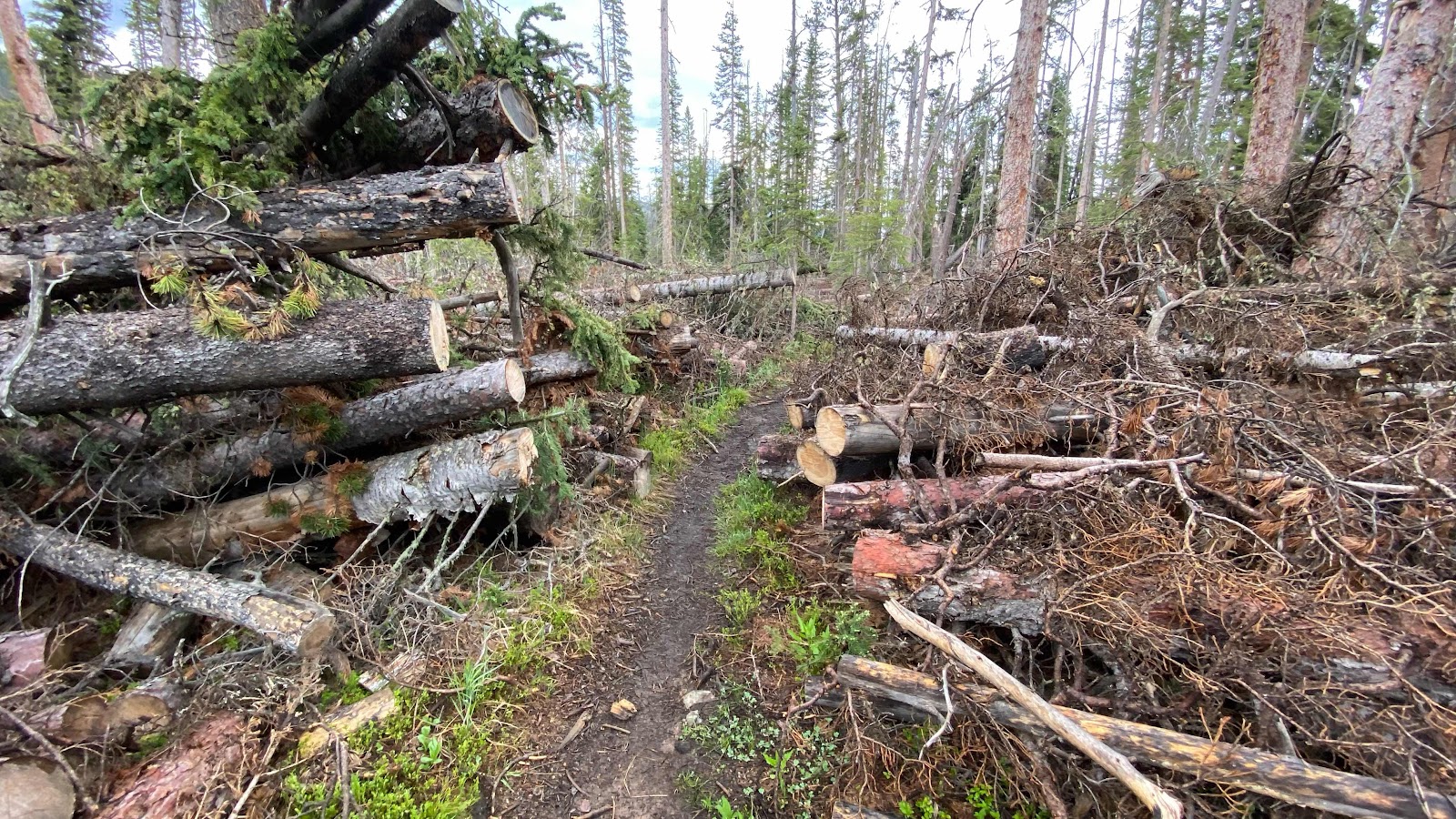
Once at Rollins Pass I followed the CDT up in the meadows for another 3 or 4 miles until it dropped down Cabin Creek. Some horrific wind event occurred in 2019-2020 winter that literally blew down all the trees. All of them. Think of the game pickup sticks on a grand scale. It was impassable for 2020 CDT hikers. Luckily for us, a crew came through and cut a swathe through the three miles of downed timber so it is now passable for hikers. 


I found a spot for my tent right where the trail crosses Cabin Creek, nestled between a root ball of a blown down tree and another blown down tree and a beaver pond. The mosquitoes were atrocious but once inside my tent they don’t bother me. About 8 o’clock the wind picked up and it rained hard. I don’t mind a good storm once I am inside the tent, cozy and warm. So far it has only rained with any ferocity in the evenings. Let’s hope it stays that way. 


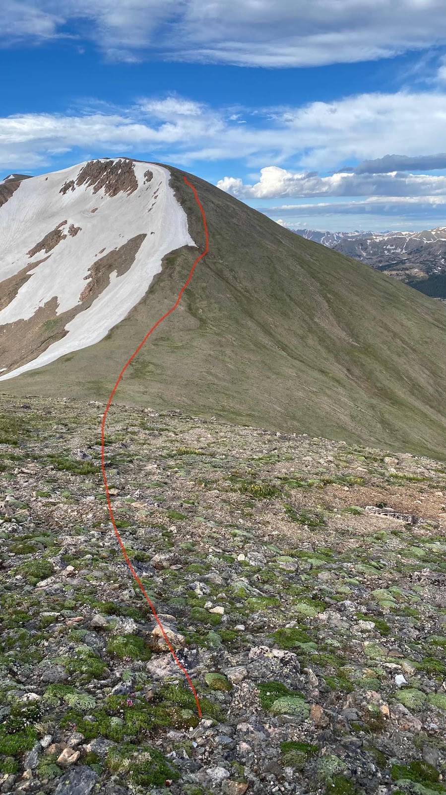
My route coming down off Mt. Flora on very steep meadow. 


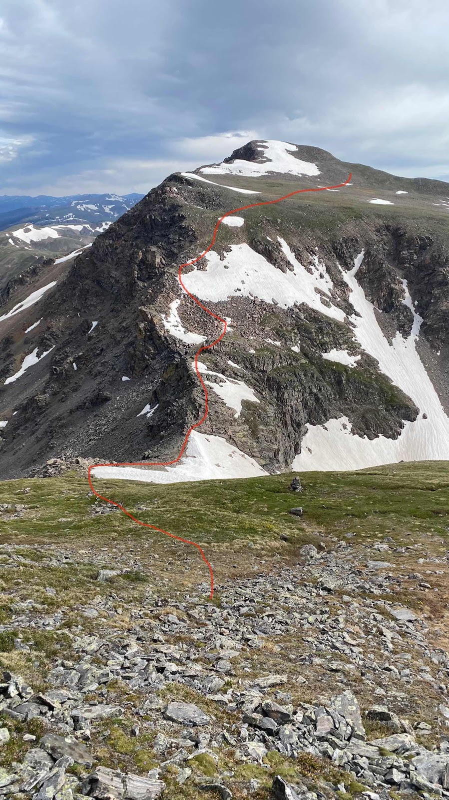
Mt. James is on the far left. The red line shows the route. The low pass between the two peaks offered some rock scrambling to get through. 


The rock scrambling route through the pass to get to Mt. James. Where the red line ends is where my route hit the CDT. 


Me on top of Mt. James


Those areas of dead trees are due to a massive wind storm that literally blew down all the trees. 


Sky Pilot flowers


In California these are called Sierra Wall Flowers. Maybe here they are Rocky Wall Flowers?


Magnificent miles of meadow ridge running


When a whole forest blows down 


Trail crews have cut a path through the blowdowns. 


Day 65 - Tuesday, June 28, 2022 - 16.9 miles - 48,913 steps - MP 40 of Silverthorne Alt (Bobtail Creek) to MP 1290.1(2 switchbacks above Berthold Pass) - Vert Up - 4675’ - Vert Dwn - 4148’ - Total Miles to Date - 994.2

Well, the foot?  Took about a mile and a half this morning for it to loosen up and become nearly pain free. Still better than it was, but not what I hope it will become. 


It was cold last night. I was up and moving by 6:00am and the meadows all had frost, the snow patches were frozen solid and there was occasionally ice on some of the small trickles of water running through the meadows. Saw lots of moose poop, but alas, no moose. I followed Bobtail creek for two miles downstream. At about halfway down the trail crossed the creek. There was no bridge and no stones to hop on. Maybe the cold water would do my foot good?  I wadded across. Cold!!  But within 30 seconds my foot felt great!  No pain, just freezing cold. 


At the bottom end of the valley stood a big, very new looking barn or workshop. I had read in FarOut’s comments there was a two log footbridge across the now rather large creek. Digging through the chest high willows I found it and crossed without rewetting my very cold feet. 


Here the trail became a road that switchbacked up the west facing ridge for about three miles and 2000’ of elevation gain. About 2/3rds of the way up, on one of the switchbacks, I saw some hikers taking down camp. It was now about 8:00am. I didn’t recognize the man at first. I knew I had met him, but I couldn’t place him. OMG, it’s THE family. I hadn’t expected to see them, so they were completely off my radar. Mom and the three girls had already headed up the road. Dad and the two older boys were taking down camp. I stood and talked for about 5-10 minutes, then headed up the road. I passed mom, Deadweight, Beast and Angel Wings, stopping to talk for a couple minutes. 


At the top of the ridge the alternate route I’ve been on for days intersects the real CDT. I turned left at the top of ridge and I’m back on the CDT.  Just before I reached the top of the ridge I saw two people hike past, heading north. I wondered if it is anyone I knew. A couple miles up the trail (beautiful miles of ridge running at about 12,000+ feet) the couple stopped to heat up some water for cocoa. I stopped to say hi and introduce myself. They were Mountain and  Lion, a couple in their 60s from Zurich, Switzerland. We chatted for a few minutes, then I headed down the trail as they enjoyed their hot chocolate. Of course, we leap frogged each other for the rest of the afternoon. 


The trail stayed high. In fact, it did this circling maneuver. When I first popped over the ridge and rejoined the CDT I saw some kind of industrial facility in the valley below. As the day wore on, I circled the facility, which turned out to be a mine. The trail made a big horseshoe U around it, up on the ridges while it sat down in the valley below. Whatever machinery they had running, a constant humming, could be heard the whole day. 


The trail dipped down the ridge on the far side of the horseshoe and then climbed very steeply up the side of the mountain to the top of mount Stewart and then headed northeast toward Berthoud Pass. 


I have been so used to snow melt streams along the trail that are not on FarOut that I have not even considered looking for water, I just fill my bottle when it gets low from one of the seasonal snow melt streams. Things changed. I filled one bottle 15 miles before Berthoud Pass and there was none all the way to the pass. I arrived with about a cup of water. FarOut showed the next water about 18 miles up the trail. Uh oh. There were many cars at the parking lot. Better Yogi some water. There was a forest service firefighters truck parked with the rest. Five guys in firefighter t-shirts were milling about. I asked if they had some water, about 2 liters, to spare. The obvious leader climbed up on the truck and handed down 4 16oz Costco bottles of water. I poured them into my bottles and returned the empties to them, thanked them profusely and chatted for a few minutes. They were on loan from Spokane, down for a few weeks. 


As I headed for the trail and out of the parking lot a guy leaned out of his Suburban and asked if I was hiking the CDT. I replied yes and he offered me a Gatorade. I accepted. Ooops. This guy was crazy. He was living in his Suburban and in the 10 minutes it took for me to be break off from him he told me he had lived in Florida for 38 years but was now homeless by choice in Colorado, was going to build a stealth shelter in the mountains and spend the winter having watch thousands of hours of YouTube video on how to do it and on and on and on. I did get a sealed Gatorade which I drank on the spot and gave him the empty. I finally had to walk away as the weather was getting nasty looking. 


I walked up the road a couple switchbacks and found a small level place by a tree big enough for me to lay down with enough area to pitch my tent. The rain started to fall as I got my tent up, then I climbed inside and did my evening routine while thunder boomed outside for an hour. 


Tomorrow, early morning weather willing, I am going to take the James Peak alternate, a cross country route over five 13,000 foot peaks that runs a ridge line and reconnects with the CDT. It will saves me dropping into a valley and climbing back out, shortening the distance by about five miles and saving me 1400’ of climbing. If the weather will allow the ridge run. 


The road walk climb out of Bobtail Creek


Dad and boys taking down camp on the switchback in the road


Looking back at Bobtail Creek from the CDT on the ridge


The CDT running the ridge


The CDT and the seemingly endless Colorado Rockies 


Flowers are starting to bloom


The mine from the top of Mt. Stewart 


Tailing ponds. Notice the red mountain with a road cut across its face.