Sunday, May 6, 2018

Wednesday, May 2, 2018 - Getting Started

It is harder to get out on a hike than it is to do the hike, or at least that is how it seems this morning. I am sitting in Sally’s government provided single wide at the Big Oak Flat entrance to Yosemite, eating breakfast and loading the car for the six hour drive to Lancaster where I will Lyft to the trailhead and hopefully get about 9 miles under my feet today. Considering I left Toledo nearly a week ago and was packing and planning in the weeks prior to that,  I think my statement at the top of this paragraph is true. 

Sally and I have enjoyed the last three days together, her days off. We visited the Valley twice to ride bikes and enjoy the booming waterfalls. Also, we made a trip to Sonora, about 75 minutes away, to do some shopping. Interspersed between those events we did repairs to her house, met her coworkers, hot tubbed at the Rush Creek resort 2 miles down the road and enjoyed a community campfire. 

Mice have been a problem since Sally moved in. I brought with me a can of expanding foam insulation with which I plugged gaping holes in the floor left under her kitchen sink by the plumber. The same in her bathroom. I also used the foam to plug big holes in her roof that poured water into her home when it rained. We have been mouseless for three nights. Must have plugged the right holes. 

Sally and I enjoyed a breakfast of Special K, then I said goodbye and headed out her door while she continued to get ready for work. I started the Honda and began my 5 hour 45 minute drive to Lancaster and the start of my 5 day, 85 hike northward on the PCT.  With a quick fill up in Oakhurst, it was non stop to Lancaster. As I drove through Mojave, I noticed the Eastern Sierra bus pulling out in front of me. Checking the clock, nearly noon, I realized that this was the same bus I would be riding Monday morning to get back to my car. GPS was guiding me to the address of the bus stop in Lancaster, but I decided to follow the bus. Although the GPS and the bus driver did not agree on the route, both ended up at the same spot, the Metrolink terminal. I had picked this spot so on my return I could just step off the bus and be at my car, allowing me to quickly get traveling back to Sally in Yosemite. 
I was not sure how long it would take to get a Lyft driver, so I immediately ordered one, then grabbed my pack and put on my hiking shoes. Before I got the laces tightened, Juan arrived-less than a minute. Luckily, I had everything ready to go before I left. I threw my pack in his trunk, double checked the Honda to be sure I had left nothing, and we were off. 

I must admit I was a bit unsettled. From the moment I turned off my car until I was flying down the highway to the PCT in Juan’s car was no more than 5 minutes. No time for introspection and review of my gear. I reminded myself that I had purposely sealed up my pack days earlier for just this scenario and in this I found solace. 

It was about a half hour drive to the trailhead. Coming over the rise, I immediately recognized the terrain from four years earlier. Juan braked to a stop right at the trailhead. I pulled my pack from the trunk, shouldered it, said thanks to Juan and  just like that I was on the PCT. 

The weather in Lancaster had been nearly total blue skies with a puffy cloud here and there. Here in the mountains between the LA Basin and the desert clouds obscured the sun and touched the ridges I was climbing toward. These clouds made for comfortable hiking temperatures, although a steady wind made it somewhat cool. 

I did not know how far I would or could go. I hoped to hike about ten miles. I walked away from the Juan’s car at 1:38 pm, so I had ample time to cover some distance. As it turned out, I was able to get 12 miles under my belt, passing through about 8 miles of area burned 5 years ago and 4 miles showing me the beauty that had been destroyed by the fire. For the last four miles I was in oak trees, lush grass, verdant manzanita and a litany of desert shrubs. I settled for the night in lush grass between towering oaks on a ridge top. Hopefully, you picture a magnificent setting. However, a 20-30 mph wind was blowing thick clouds through those towering oaks who were doing their best to extract the water from the clouds and deposit it on the ground. I had to pitch my tarp to keep dry. Within an hour or so everything I had was gooey with wet. It was a cool, wet and uncomfortable night. I kept reminding myself the forecast for the days ahead was a warming trend and full sun. I also kept repeating “this is supposed to be a desert hike!”


Saturday, May 5, 2018 - Community

I just downed two ice cold 20 oz Pepsi Zeros. Man, was I thirsty. How, you might ask, can I be drinking ice cold pops while hiking in the desert?  Answer:  I’m not in the desert anymore. I’m riding the Kern County bus from Tehachapi to Lancaster. Let me explain . . .

Yesterday, after all the other hikers left me alone under the bridge at Cottonwood Creek, I was relaxing, hoping the jelly my thigh muscles had turned into would coalesce into actual muscle fiber again by morning. Suddenly, a big blob of bird shit hit me. I looked up at the bridge I was laying under and saw streaks of bird shit on the supporting columns and quickly realized I was preparing to sleep under some large, nocturnal bird of prey’s nest. Luckily, all my gear was on a single sheet of Tyvek which I quickly drug out from under the “drop zone”. I cleaned up with a baby wipe and went back to my vegetative/healing state. 
The night was uneventful and I slept like a log, lulled by the background hum of gigantic windmills rotating and generating through the night. 
I did not set an alarm, but woke up at 5:00 am. Instead of using my pot to eat my granola with milk, I made the milk in the sandwich bag the powder was in, then poured the milk into the sandwich bag the granola was in and ate out of the bag. Quick and no clean up. 
I was packed up and on my way by 5:38 am. I had three liters of water on board, knowing there was water 6 miles up the trail. 
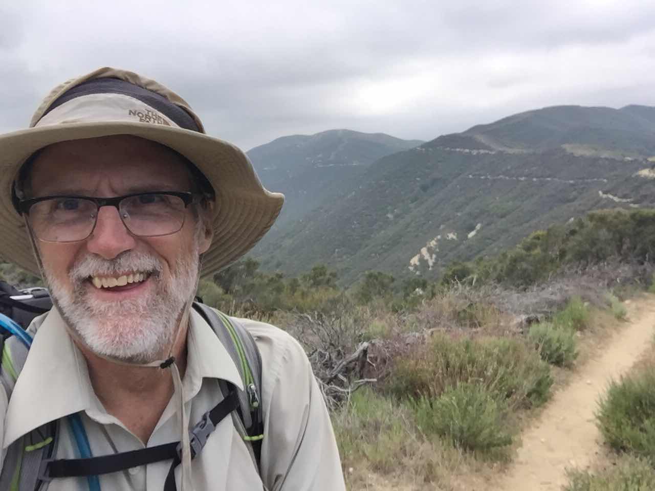
For the first four miles the trail wound through the forest of gigantic windmills, heading northwest toward the Tehachapi mountains. I caught up with Cheeto and his wife Ruby in about an hour. They had only hiked two miles last night after leaving the bridge before camping for the night. I had only briefly talked with him at Hiker Town and again briefly under the bridge. Now we got to talk as we worked our way uphill through the windmills. Cheeto is a 65 year old guy who worked a variety of jobs, none of which you would classify as a “career” (his words).  He and his wife Ruby live in Maine. In retirement he does paid Nordic ski patrol in the winter and works part time at a bike repair shop as a mechanic. Super kind and soft spoken, I really enjoyed his company. Leaving the windmill farm and starting some switchbacks up onto the side of the mountains, we passed more of the “under the bridge” gang. 
At 6 miles from the bridge is the last water for the next 17 miles. It is a very small “creek”, the water was cool and clear. I filled up with five liters of water, about 11 extra pounds. I was still planning to hike 14 miles for the day, spend a night, then hike the 10 miles out to Tehachapi, spend a night at the Motel Six in Mojave, catch the Monday morning bus to Lancaster and then drive back to Yosemite to spend Tuesday with Sally, her last day off for the week. Sniper, a late 20’s red headed girl, Skywalker a late 20’s guy, Newt (same), Garbage Disposal (GD, same) and a couple others whom I can’t remember their names were also filling up on water. 
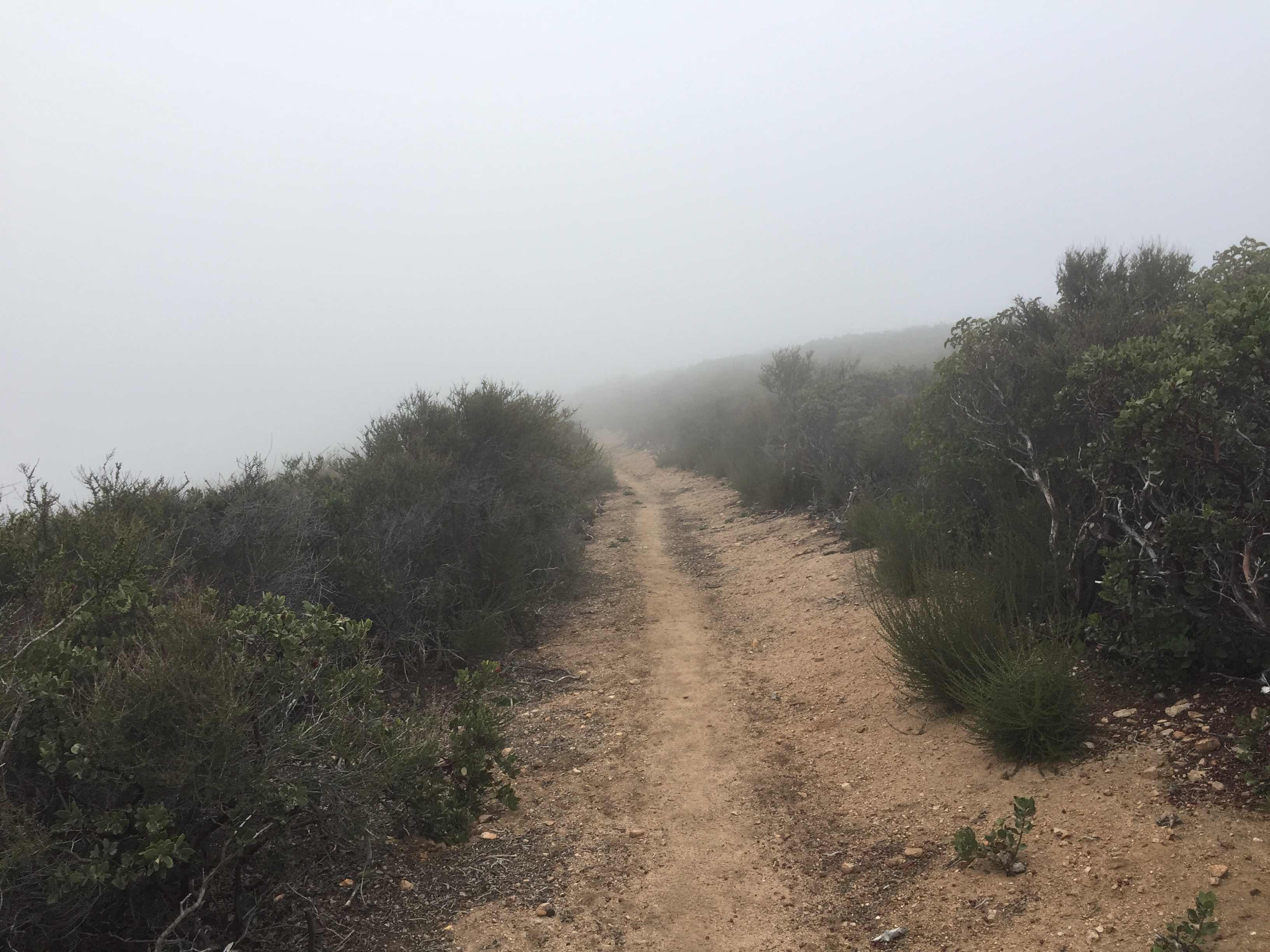
People trickled out of the ravine as they completed collecting their water.  I was in the middle of the pack. The trail was totally exposed to the sun. I was thankful it was still fairly early (9 ish)  because the southern exposure would have been a scorcher later in the day. The trail contoured around the end of rounded ridges, gently rising and falling as it entered and left each ravine. Suddenly, it dropped 500’ into a deep ravine. Here I stopped with Sniper and GD to rest because our next 3 miles was a 1600’ switchbacking climb up to the ridge top. I found out Sniper’s mom was parking at the Tehachapi trailhead and hiking in 6 miles to meet her daughter while we talked and bantered, weighing resting longer against the rising temperatures as the morning progressed. 
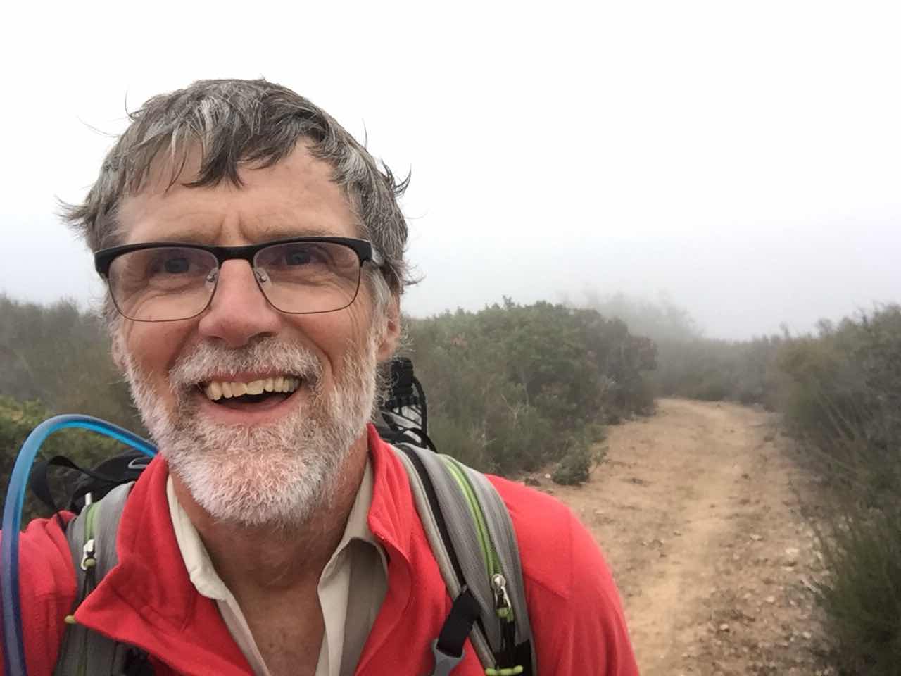
Ten minutes of rest and my pack was back on and I was sweating up the climb. The place I was planning to camp was at the top. An hour and a half later, as I approached the top and the camp area I noticed all the kids that had been in front of me were all congregated in one area. Oak, Hippy Gipsy, GD, Sniper, Skywalker, Newt and Sunshine we’re enjoying some totally unexpected trail magic. Chairs, water, bags of cookies and apples were left by trail angels, right on top of the mountain. I had an apple and a bag of cookies and enjoyed getting to know everyone a little more. Newt mentioned a place in Tehachapi called “Wits End”, a PCT haven where packages could be mailed and where they coordinated trail angels to pick up hikers and bring them to town. I looked them up on the web, found their number and sent a text asking if an angel would accept a full tank of gas and dinner if they would drive me to Lancaster. They texted back that there was bus service and sent the link. I had decided to hike the ten miles out and let serendipity get me to Lancaster so I was walking down the trail as I received and sent texts. I double checked the schedule for the Kern County Transit bus as I walked, the disjointed bobbing motion of the phone and my head making it difficult to read the rows and columns of times and destinations. I found that the last bus of the day from Tehachapi to Lancaster left the Kmart in Tehachapi at 4:35 pm. I was nine point five miles from the trail head. It was 1:00 pm. I had three hours and thirty five minutes to walk 9.5 miles, hitch a ride to Kmart, find the bus stop and board. I picked up my pace as I calculated I needed to exceed three miles per hour to make it to the trailhead in under theee hours, leaving me a little more than thirty minutes to hitch a ride to Kmart. Talk at the trail angel cache on the mountain top and with Big Red from two days earlier lead me to believe Tehachapi had amazing trail angel coordination. I hoped this would work as I pounded down the hill. 
I passed GD, Newt and Skywalker during the decent. I came upon Sniper, standing with a woman I did not recognize and said hi as I passed by. About a minute down the trail I realized it was her mother and stopped to let them catch up so I could meet her. I apologized for being an idiot, introduced myself, chatted for a minute, then continued my “sprint” for the bus. 
The White Pass Ski Patrol banquet and awards ceremony was happening while I was hoofing it. I called Max, hoping he was attending. He was. I caught him in the bathroom taking a break from the meeting. We FaceTimed as I hiked so I could show him the forest of windmills I was again hiking through. Now I was down to less than two miles and I could see cars parked at the trailhead in the distance. I was hoping that these were trail angels waiting to give hikers a ride to town. Sure enough, 35 minutes later as I walked into the parking lot two men stood outside their cars and asked me if I needed a ride to town. I sheepishly asked if they could get me to Kmart by 4:35 pm, feeling like I had been given a gift and was asking for something more. One of them said sure, no problem and had me put my pack in his Subaru wagon. It was only 3:45 pm, so we waited another 10 minutes to see if any others emerged from the trail. None showed, so we loaded up and headed to town. As we were leaving the parking lot another car was entering. Another trail angel coming to see if any hikers needed rides.  Wow!! What kind and thoughtful people!! I introduced myself as “Coach” to my driver. His name was JT. We chatted during the 15 minute drive to town. He said the angels are all coordinated at “Wits End” by a guy who thought he could be more useful coordinating all the angels rather than making endless trips to check for hikers. JT estimated there to be about 200 trail angels in town helping to transport hikers. He said today had been their busiest day of the season so far with upwards of 35 hikers shuttled to town. He confirmed my findings about the nature of PCT hikers. All were confident, well spoken, extremely thankful and appreciative for the rides, conversational and very interesting people. He said he often hung out at Wits End just to talk with the hikers because he enjoyed getting to know them. 
We got to Kmart at 4:15 pm. I asked a very large lady sitting outside where the bus stopped. She pointed me across the parking lot and suddenly I remembered the location from when Sally and I had been here four years earlier. I ducked into the store and purchased two Diet Pepsi’s, then walked across the parking lot to the bus stop. I downed both sodas in the 10 minutes waiting for the bus, kind of wishing I had bought a third. The bus was on time. $3.00 for an hour and a half ride to Lancaster!!  I told the driver it was way too cheap as I fed my three dollars into his collection machine. He laughed, asking if I really thought it was too cheap. The bus was spotless and comfortable. It looked brand new. There were only three of us. We stopped at a pizza place so the rider that had been on the bus since Bakersfield could use the bathroom. Then we were off, with two stops in Mojave, three in Rosamond and four in Lancaster before we stopped at the Metrolink parking lot where I had left my car four days earlier. I thanked the driver and started walking to my car. It had been longer than the 72 hour limit. Would it still be there, and if so, not vandalized?  
There it was. I tossed in my pack, changed into my running shoes and cranked her up. She started immediately and purred like new. It was now 6:16 pm. The 5 hour and 45 minute drive put me at Sally’s at midnight. I gassed up and headed out of town. I called Ed and talked with him until nearly Bakersfield. I called Andy and talked to him as the sun set getting me 30 miles north of Bakersfield. I called Ken. We talked until almost Coarsegold. Now it was 10:30 pm and the road was nearly empty. I sped thru the winding turns from Oakhurst to Big Oak Flat enjoying flying around the tight 25 mph curves somewhere between 40 and 50 mph. I was super alert, scanning for bears and other wildlife on the margins of the road. None presented themselves. I coasted down from Crane Flat to Sally’s trailer, sneaking in with my lights and engine off, hoping not to wake anyone. I climbed into my bed where the passengers seat is supposed to be and was soon asleep. What a great day!!  23 miles of hiking. Great people on and off the trail!! Super good luck making transportation connections. Wow!  Life is good!!


Thursday, May 3, 2018 - Tough Decision

Miles - 27.4  Ascent - 4,249’ - Descent - 5,677’

I thought this was Southern California!  All night the rain fell on my tarp, or until about 3 am when the sky cleared and the moon’s brilliance shone like a spotlight. It never really rained. If you payed attention, you would notice the rain only pounded the tarp when a strong gust of wind dislodged the fog collecting into droplets on the leaves of the oaks. With the fog ending, so did the conveyor belt of water from fog to leaves to my tarp. The wind persisted. 

I woke at 5:00 am, had my premeasured 3/4 cup of granola with powdered milk, packed all my damp gear and was on the trail by 5:38. 

In studying the PCT Water Report last night I found I was facing a decision. 27 miles ahead on the trail lay Hiker Town, a funky (weird) collection of small buildings reminiscent of doll houses with facades themed from the old west. Sheriffs office, doctor, livery, etc. about 10 or so. Some were only big enough for a metal framed army type cot and a night stand, others could sleep up to six on the floor. This place is significant because it is the last water before a 17.5 mile stretch of the PCT across the Mojave Desert, a course that follows an aqueduct that feeds LA. 27 miles was more than I wanted to walk on only my second day out, yet if I stopped anywhere short of Hiker Town it would cost me a day because I did not want to begin the 17.5 mile stretch of waterless desert in the middle of the day. If I split the 27 miles into two days it would mean ending my hike a day later than planned, making me miss Sally’s days off completely. So, what to do? Chance injury with a 27 mile day, or miss seeing Sally in Yosemite before driving back to Washington?  I decided to delay the decision until later in the day, paying close attention to my knees, ankles, thighs and calf’s as the day progressed. 
There is a mantra thru hikers observe as a good sign, 10 by 10. Finish 10 miles of trail by 10 in the morning. Setting off at 5:38 am, I had a good chance of completing this goal. The trail was perfect for cruising. Mostly flat with slight ups and downs, it contoured around the rounded mountains passing through gorgeous stands of oak carpeted with lush grasses and flowers. It was spectacular. 
By 9:15 am I had completed 10 miles. I celebrated with a long rest stop, snacking on food I had brought, drying my socks and setting up my solar panel to charge my small battery I would use tonight to charge my phone. 
The trail gained 1000’ in the next 2 miles. The sky was sunny, but the air very cool with a little breeze. I still had water from yesterday, but I was getting low and needed to be mindful of places to refill. I checked the PCT Water Report I had downloaded the day before (I had a printed one about 5 days old as a backup).  There is no running water in these mountains, only cisterns dug into the ground with metal roofs above that collect the water and channel it into the tank. The water is good if you filter it, removing the algae, bugs and detritus that end up in the tank. The roof over the tank helps to keep the water cool. One such cistern, The Red Rock water cache was two miles up the trail. I found it off to the right side of the trail, about 40’ away in the brush and dipped some water from it into my filter, then into my water bottle. 
Up to this point, about 24 hours, I had not seen another person on the trail. While filling my bottle, I heard voices down on the trail, but by the time I finished and descending to the trail, they had gone. Determined to meet my first people on the trail, I headed north, picking up my pace a bit. 
Another cistern, affectionately called “guzzlers”, lie another two miles up the trail at mile 506.4. At this point the trail crosses a road, and here I found Oak and Hippy Gypsy setting up for lunch in the shade. Oak and I walked the 100 yards down to the guzzler and filled our bottles, then returned to eat a quick lunch. They both hailed from San Diego.  They had done the AT in 2013, not knowing the PCT existed. 
We chatted for fifteen minutes while eating, then I got up to leave.  I had done 14 miles to this point. Another guzzler lie 4 miles ahead, at a remote campground. It was at this point that I would make my decision, either stay the night and go to Hiker Town the next day, or do the additional 9 miles down to the desert floor. 
From here the trail wound through more huge oaks and verdant grasses and flowers. Someone had been pruning the oaks, I suspect to help them survive if a fire came through. 
The trail then dropped very steeply right down the fall line, losing 1400 feet quickly. Soon I was at mile 18.  Decision time. I wasn’t particularly tired, but past experience told me those additional 9 miles can be debilitating. Miss a day with Sally or hike on. 
I unpacked all the damp gear from my pack and layed it out on the ground to dry, stalling for time. I stretched and tested the strength and soreness in my legs. 

What the hell. Let’s go for it. Oak and Hippy Gypsy passed as I was packing up my now dry gear. Soon I was following them down the trail. The first 2 miles were switchbacks down off the mountains. Easy. 

The next seven were tough. Up 200’. Down 200’. Over and over and over. Oak and Hippy Gypsy stopped for a break. I decided to keep going. About 3.5 miles out I stopped for a snack. I was bonking big time. A snickers and a package of Despicable Me 3 fruit snacks bumped my blood sugar back up and I spent the next hour and a half walking in to Hiker Town. 

Kids from the PCT in 2014 said it was a really weird place with a creepy owner. I did find it weird, but thought Bob, the owner, was not too bad. I selected to stay in one of the themed buildings for two reasons (1) to get out of the wind and (2) to make a donation to this kind man who maintains water caches and allows PCT hikers to shower, cook, lounge in his garage and camp on his property for free. 

While preparing for a shower, Big Red called. We met Big Red on the PCT in 2014. Since I was not going to do the Tehachapi to South Kennedy Meadows leg of my hike, I would miss seeing him. He decided to drive to Hiker Town to visit. I got a much needed shower, cooked a dinner of curry chicken and rice, pineapple, cranberries, walnuts, and washed my socks. Big Red showed up about 8:00 pm, bringing an ice cold Diet Pepsi. We sat outside my room in camp chairs catching up until 10:00 pm. The temperature had dropped. I was freezing. I crawled into my bed, pulling my quilt over me. My legs were definitely fatigued, as were the bottoms of my feet, but all the joints felt fine. I have 17.5 miles of desert to do tomorrow. We will see . . .  With service, I sent a few texts, then fell asleep about 11:30 pm. 


Friday, May 4, 2018 - Mojave

It was a fun night. The wind battered my cozy little doll house-type room most of the night, making me feel secure and comfortable sheltered inside. The bed sank 10” when I laid down on it, yet it was comfortable. Might the 27 miles of the day before contributed to this feeling of comfort?
I woke up often during the night. Each time I would look at the time and be thankful I still had hours in which to sleep. At 4:00 am I rousted myself from bed, ate, packed up and headed out the door. The wind was still blowing, but not as strong as earlier. It was 4:35 am and still dark, although a 3/4 moon was nicely lighting the area. 
Today’s path literally follows the LA aqueduct for 17 miles. Part of the aqueduct is open to the sky, part in a 10’ diameter pipe and part in a concrete ditch that is paved over and enclosed, with a service road on top. 17.5 miles of road walking. This portion of the PCT is legendary for its mind numbing boredom. And, it traverses the Mojave Desert, so it is hot, hot, hot. No shade trees. And although we are walking on an aqueduct full of water, no access to that water. 
The first hour in the dark was fun just cause it was dark. The next three miles were fun because I literally walked on top of the 3/4 buried pipe. Another mile or so was interesting because the concrete road that the water ran under was impeccable clean. Then a PCT hiker named Picasso joined me and we talked for two hours while chewing up miles. We got so involved in our discussion of grandkids that we missed a turn and walked nearly half a mile before we caught our error and had to backtrack. 
But the last 4 miles were mind numbing. By now it was getting hot. Picasso had moved ahead. My legs that had so brilliantly carried me yesterday were fading. I dragged the last mile, found water and scurried under the Cottonwood bridge to get out of the sun, my final resting point for the day. It was noon. 
Under the bridge I found Beerhugs and Special K. They had hiked through night to get here in the morning and were just waking up from their morning nap. I joined them under the bridge, spreading out my Tyvek ground sheet in the shade. I did not move again until the moving sun forced me to find shade again. As the day moved on, more and more kids arrived. By 5:00 pm there were 18 of us lurking under the bridge. They knew each other well, yet included me in the group. It was fun. By 5:30 pm, they were all gone. With Tehachapi only 23 miles away, they wanted to get a little closer so they could make it to town by tomorrow night. Me? I was intent on resting my legs and stayed put, the only one left under the bridge. It sure felt quiet with everyone gone. 


Friday, May 4, 2018

Wednesday, May 2, 2018 - Getting Started

It is harder to get out on a hike than it is to do the hike, or at least that is how it seems this morning. I am sitting in Sally’s government provided single wide at the Big Oak Flat entrance to Yosemite, eating breakfast and loading the car for the six hour drive to Lancaster where I will Lyft to the trailhead and hopefully get about 9 miles under my feet today. Considering I left Toledo nearly a week ago and was packing and planning in the weeks prior to that,  I think my statement at the top of this paragraph is true. 

Sally and I have enjoyed the last three days together, her days off. We visited the Valley twice to ride bikes and enjoy the booming waterfalls. Also, we made a trip to Sonora, about 75 minutes away, to do some shopping. Interspersed between those events we did repairs to her house, met her coworkers, hot tubbed at the Rush Creek resort 2 miles down the road and enjoyed a community campfire. 

Mice have been a problem since Sally moved in. I brought with me a can of expanding foam insulation with which I plugged gaping holes in the floor left under her kitchen sink by the plumber. The same in her bathroom. I also used the foam to plug big holes in her roof that poured water into her home when it rained. We have been mouseless for three nights. Must have plugged the right holes. 

Sally and I enjoyed a breakfast of Special K, then I said goodbye and headed out her door while she continued to get ready for work. I started the Honda and began my 5 hour 45 minute drive to Lancaster and the start of my 5 day, 85 hike northward on the PCT.  With a quick fill up in Oakhurst, it was non stop to Lancaster. As I drove through Mojave I noticed the Eastern Sierra bus pulling out in front of me. Checking he clock, nearly noon, I realized that this was the same bus I would be riding Monday morning to get back to my car. GPS was guiding me to the address of the bus stop in Lancaster, but I decided to follow the bus. Although the GPS and the bus driver did not agree on the route, both ended up at the same spot, the Metrolink terminal. I had picked this spot so on my return I could just step off  the bus and not my car, allowing me to quickly get traveling back to Sally in Yosemite. 
I was not sure how long it would take to get a Lyft driver, so I immediately ordered one, then grabbed my pack and put on my hiking shoes. Before I got the laces tightened, Juan arrived-less than a minute. Luckily, I had everything ready to go before I left. I through my pack in his trunk, double checked the Honda to be sure I had left nothing, and we were off. 

I must admit I was a bit unsettled. From the moment I turned off my car until I was flying down the highway to the PCT in Juan’s was no more than 5 minutes. No time for introspection and review of my gear. I reminded myself that I had purposely sealed up my pack days earlier for just this scenario and in this I found solace. 

It was about a half hour drive to the trailhead. Coming over the rise, I immediately recognized the terrain from four years earlier. Juan brakes to a stop right at the trailhead. I pulled my pack from the trunk, shouldered it, said thanks to Juan just like that I was on the PCT. 

The weather in Lancaster had been nearly total blue skies with a puffy cloud here and there. Here in the mountain between the LA Basin and the desert  cloud obscured the sun and touched the ridges I was climbing toward. These clouds made for comfortable hiking temperatures, although a steady wind   Made it slow girly cool. 

I did not know how far I would or could go. I hoped to get about ten miles in. I walked away from the car at 1:38 pm, so I had ample time to cover some distance. As it turned out, I was able to get 12 miles under my belt, passing through about 8 miles of area burned 5 years ago and 4 miles showing me the beauty that had been destroyed by the fire.for the last four I was in oak trees, lush grass, verdant manzanita and a litany of desert shrubs. I settle for the night in lush grass between towering oaks on a ridge top. Hopefully you picture a magnificent setting. However, a 20-30 mph wind was blowing thick clouds through those towering oaks who were doing their beat to extract the water from the clouds and deposit on the ground. I had to pitch my tarp to keep dry. Within an hour or so everything I had was gooey with wet. It was a cool, wet and uncomfortable night. I kept reminding myself the forecast for the days ahead was a warming trend and full sun. I also kept repeating “this is supposed to be a desert hike!”