Sunday, May 29, 2022

Day 34- Saturday, May 28, 2022 - 8.9 miles - 27,374 steps - MP 810.9 to MP 819.5- Vert Up - 1754’ Vert Dwn - 1868’ - Total Miles to Date - 577.2

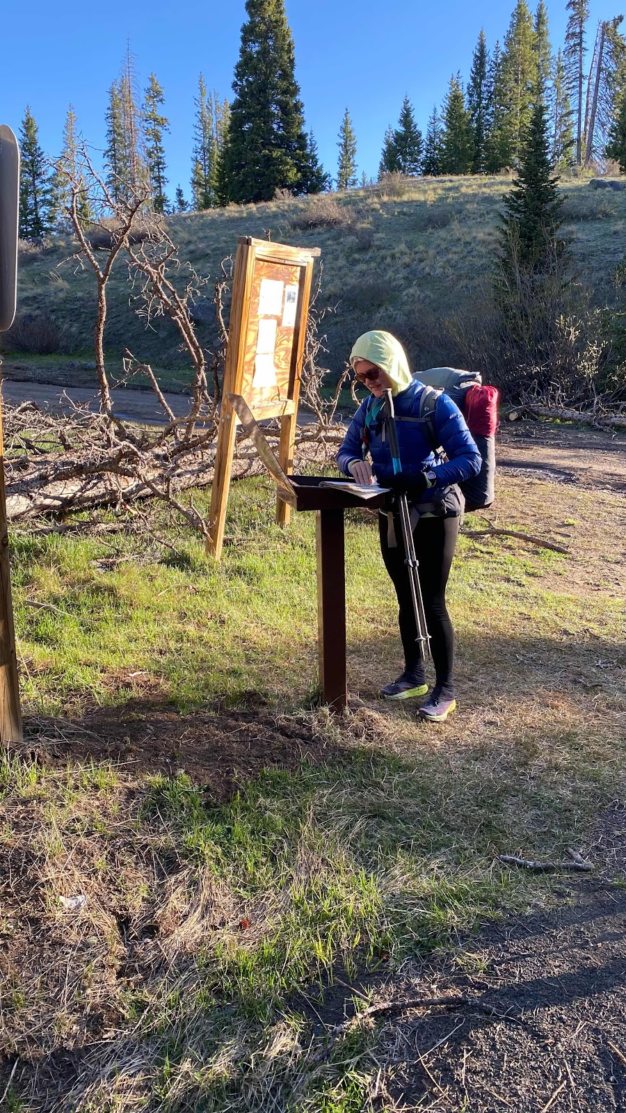
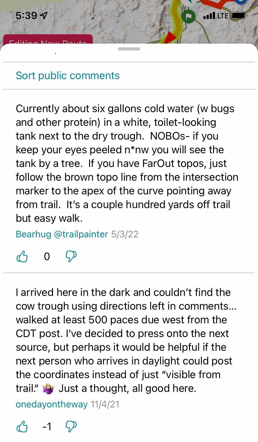
It is startling to realize how many people out here on the CDT do not know how to read a topographic map nor use their ice axe. With the advent of the app “FarOut”, map reading is a skill no longer necessary. Navigation has become a video game. Keep the dot representing you on the red line representing the trail and you cannot get lost. And it works really well. 


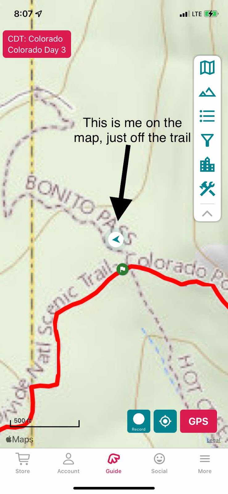
It is infinitely better than map and compass. It gives you uncanny ability to see your position in the field with regards to features on the map and the all important “red line” that represents the trail. For most hikers, their position relative to the trail is all that is necessary. The trail is covered in 5 feet of snow and is invisible?  No problem, just pull out your phone and see if the dot representing you is on the red line representing the trail. If it is, great. If not move in the direction that puts the dot on the trail and you are where you are supposed to be. This tool has opened up the trail to countless hikers that otherwise lack the skills necessary to navigate the trails. Just make sure your battery stays charged and you don’t lose your phone. 

But what about all the other information contained on that topographic map that the dot and redline occupy, especially contour lines? From these you can see ridges, valleys, north slopes and south slopes, how steep the terrain is, where rivers run and in what direction, peaks, and countless other nuances of the terrain. My experience so far when talking with other CDT hikers about the land we are walking through is they cannot see these features on their maps on their phone because they don’t know how to read a map. Follow the red line and all will be fine. We even have a name for it, “red lining”. Alternate routes on the CDT are other colors on the FarOut app. You might be “blue lining” or “green lining” if you take one of the alternate routes. 

There is still a lot of snow over the trail, but predictably heaviest on north slopes and east slopes where the sun either never shines directly or only in the morning when the air is still cool and melting is slow to occur. When I look at the topographic map on “FarOut” I see these slopes and can predict with great accuracy where we will encounter snow. I can see gulleys where the snow will collect and hide from the sun. I can see how steep the slopes are and assess how difficult the snow gully crossings will be. However, when I try to discuss these features with my fellow travelers or with hikers wondering what the route ahead will be like I see confusion and no comprehension in their eyes. To me, these are basic navigation skills that enhance your safety and bring understanding to the terrain. Yet, most of the hikers I have met do not have these skills, even those who have completed the PCT and AT and are now doing the CDT, going for their triple crown. Can’t read a map. Just keep the dot representing me on the red line representing the trail. 

The same is true for ice axe arrest techniques, truly a life saving skill. I have spent many hours the last four days teaching my fellow hikers the basics of how to hold your axe when carrying it, how to arrest your fall with it and how to glissade using it to control your speed. To come into these mountains with these snowy conditions and not have sought training and practice seems foolish. And yet, here they are in droves. And doing fine. The app is bomb proof for navigating and so far no one has taken a serious fall on the snow slopes - yet. In this first 67 mile section of the Colorado Rockies most have realized they are ill equipped and are not going to do the next 114 mile section. Rather, they will get rides up to Wyoming and hike the lower elevation snow free sections and return to Colorado later in the summer when the snows are gone. 


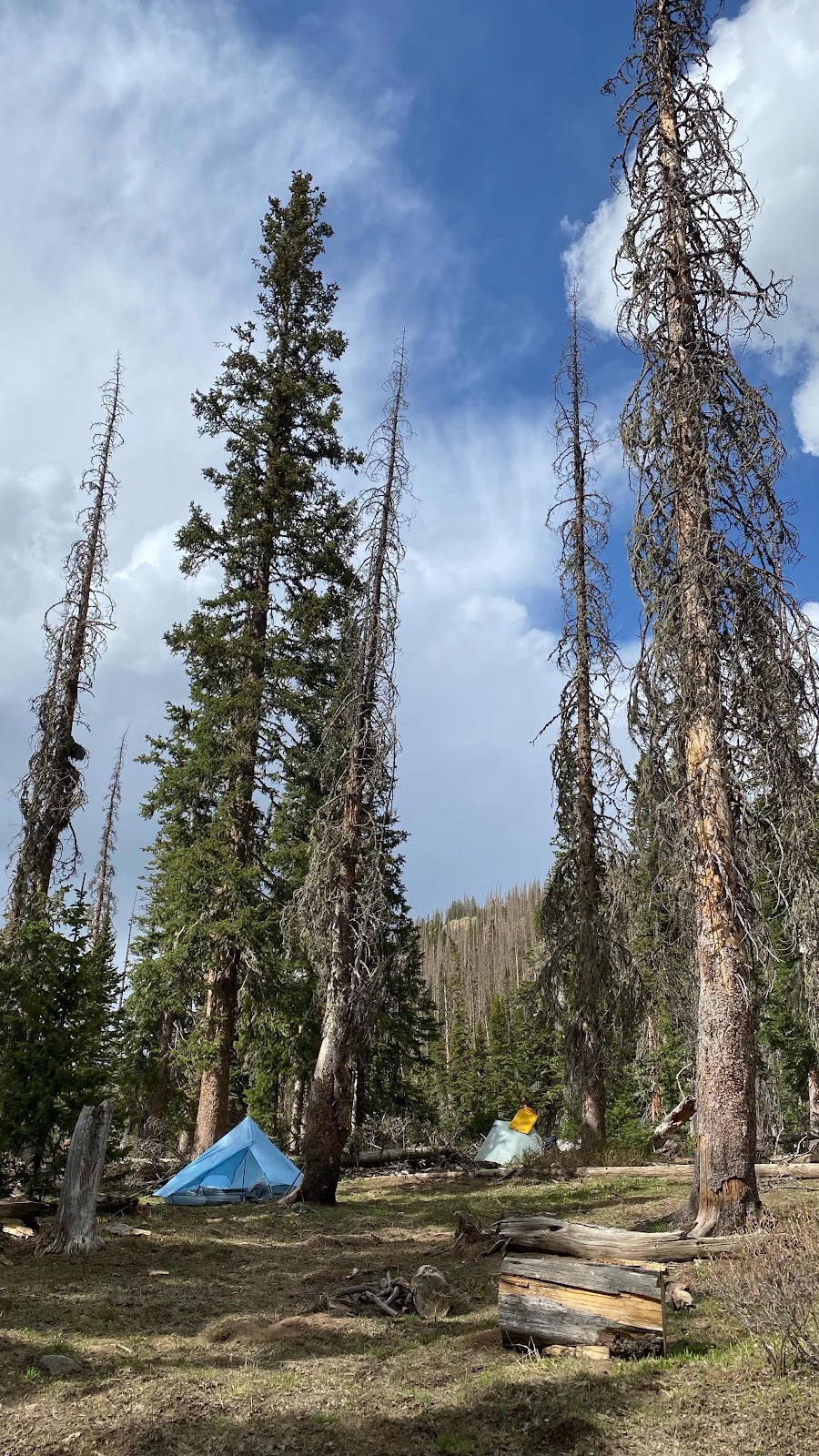
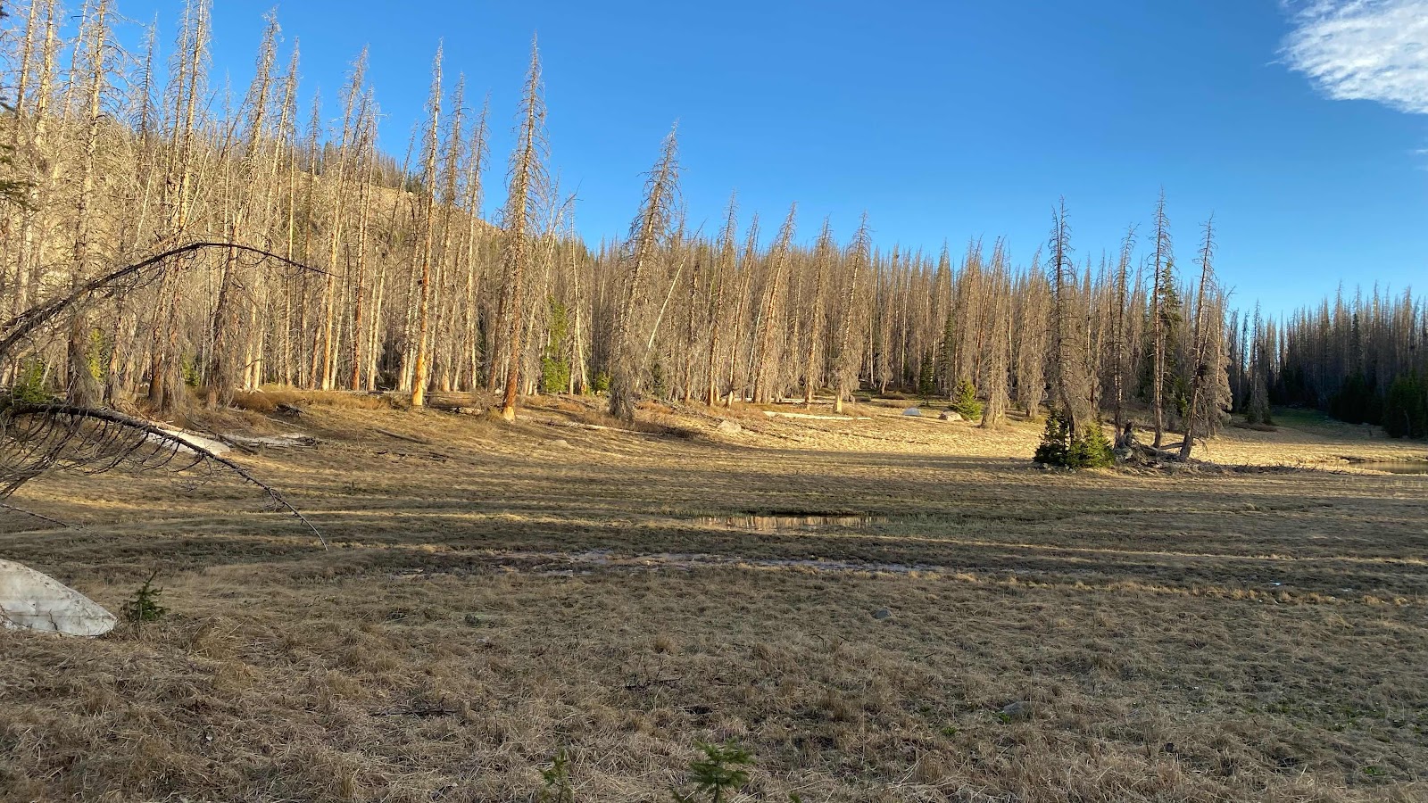
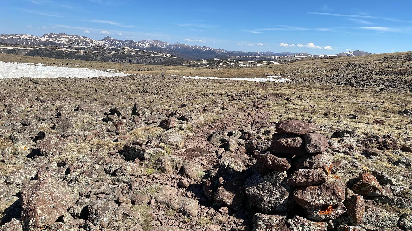
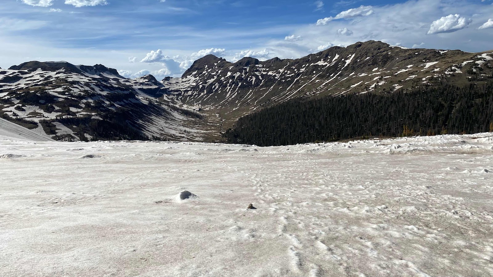
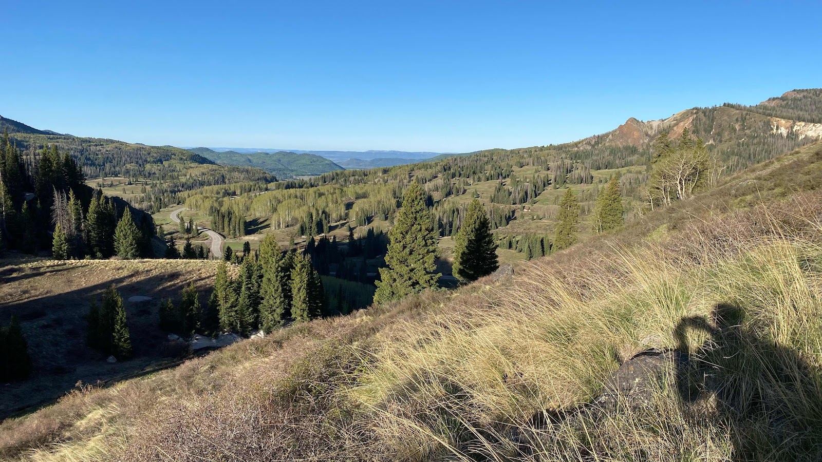
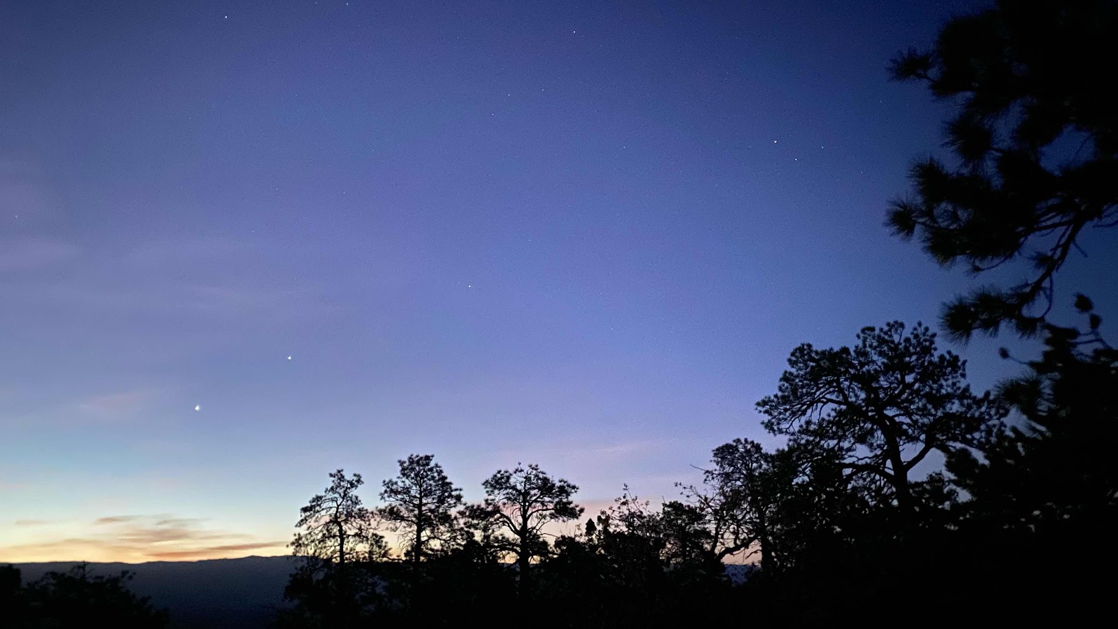
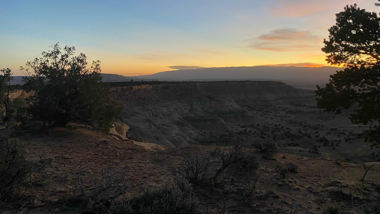
I woke to a nice sunrise this morning, the clouds adding color and texture to the morning sky, although I would prefer a cloudless sky. Neeko and I had arranged to start hiking at 6:30am, and he was ready to go right on time. The trail traversed on the steep north slope of this u-shaped valley, heading up to its upper end where it contoured around to the south facing other side of the valley and climbed up over the ridge. Rather than trying to traverse snow frozen solid during the night, we dropped into the valley, crossed the river at its bottom and climbed up until we hit the trail. This all occurred between 11,400’ and 12,200’. Tree line is about 11,600’, so we transitioned from forests (mostly dead trees) to alpine meadows. Once on top, we traversed beautiful open tundra like landscapes until we came to the next valley which the trail descended in a manner similar to our starting valley. Each time our ascent was on a snow free south facing slope. Our descents were always on north facing snow choked slopes. We repeated this three times today in the space of ten miles. The most difficult was our last. 

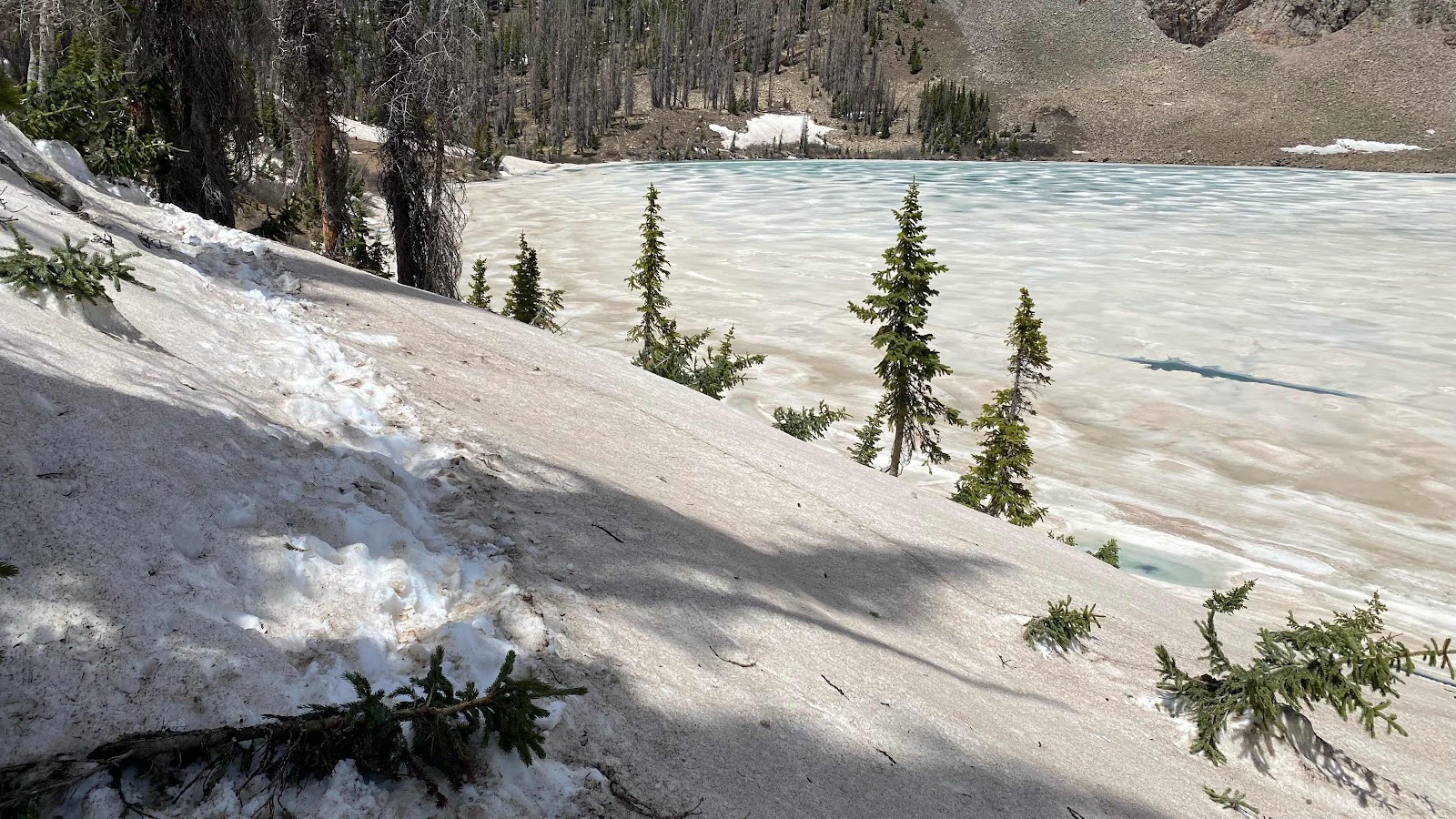
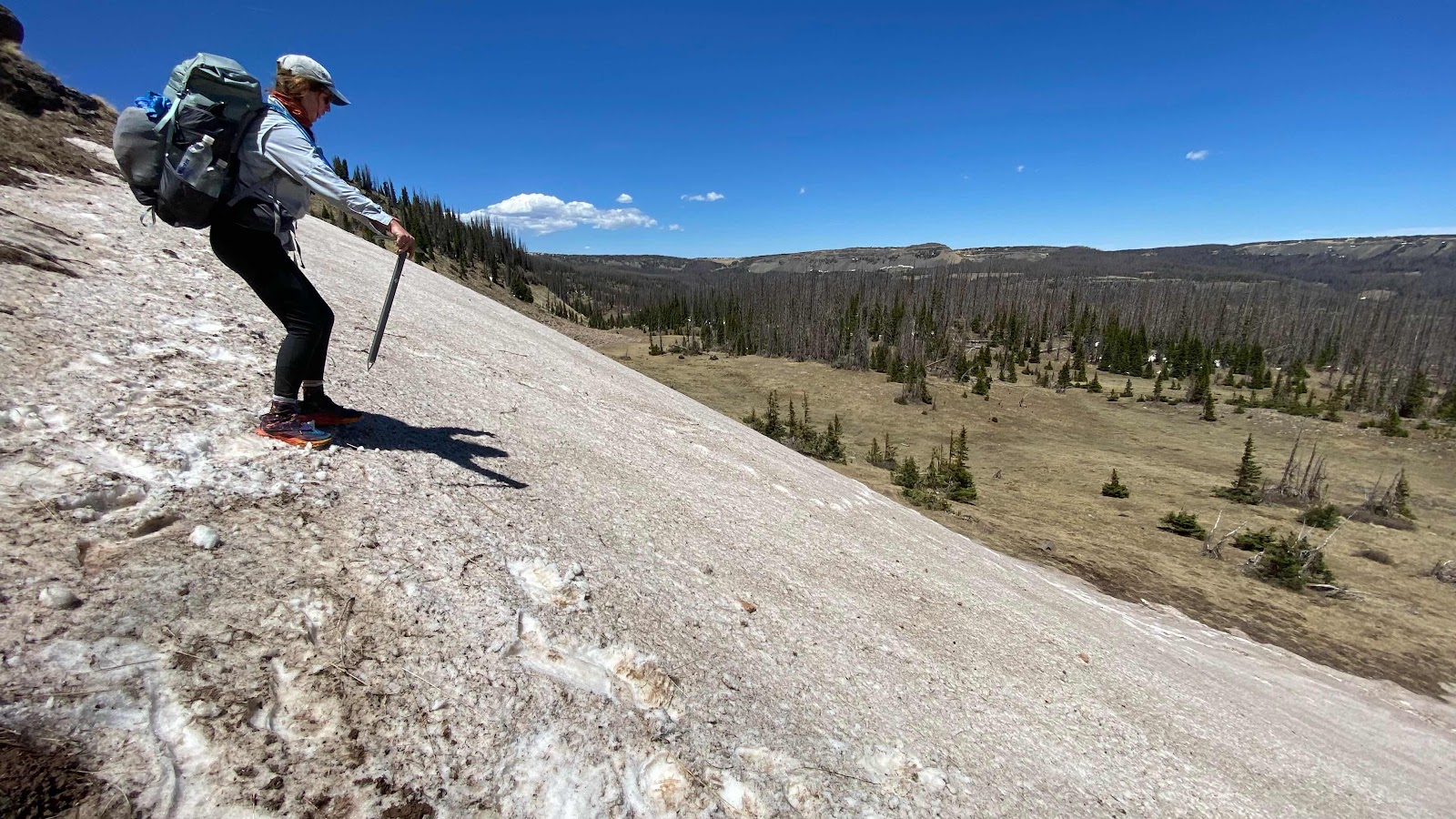
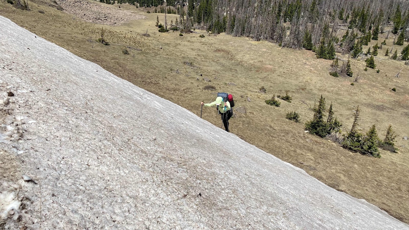
Comments on FarOut placed by hikers before us suggested that traversing the trail on the south side of the valley (thus facing north) was difficult and it was best to drop into the valley and hike up its flat bottom which was gentle sloping and snow free. Enigma, Neeko and I took this to mean don’t bother traversing at all and just descend straight off the ridge. This proved to be a bad move. The side of the valley was very steep and composed of a mixture of water soaked dirt, solid rock, scree and snow. I descended about 150 vertical feet and concluded I was nuts to be on this slope. Above me Enigma and Neeko were trying to descend in flimsy trail shoes. The wind was a steady 20 mph with gusts to 40. In between gusts I yelled up to them to return to the top of the ridge and start traversing on the trail in search of a gentler slope to the bottom. I timed my shouts by observing their clothing. If it was flapping in the wind I knew they would never hear me. When I saw their clothing relax I yelled for all I was worth. They got the message and began their tricky and delicate climb back up the 75’ they had descended. At this point I was committed. It was 800 vertical feet from ridge line to valley floor and I had descended 300 of it. I left the crumbly rock and dirt and kicked steps into the adjacent snow. It was a good 50°. I down climbed by facing into the slope, kicking secure steps while having the entire shaft of my ice axe firmly imbedded in the snow. Move axe. Kick steps. Move axe. Kick steps. In this manner I descended to the valley floor. I just hoped they had safely made it to the top of the ridge and were finding an alternate route down. 

The wind in the bottom of this treeless valley was far worse than up on the ridge. Gusts in excess of 60 mph knocked me around repeatedly as I attempted to find a vantage point to locate them on the ridge and track their descent so we could meet up again. I hunkered down behind a small clump of alpine firs and watched for their movements. After about 15 anxious minutes I saw two small figures traversing a line across the face of the valley wall that was the trail. As they moved down the trail (up the valley) I shadowed their movements below, planning to reunite with them when they found a suitable place to descend. 

More than an hour passed before they reached the valley floor. They reported an easy descent, about half a mile up the valley from my descent. We crossed the river in the valley bottom on a snow bridge, hid behind trees to eat our lunch and decided to hike up the valley in search of a sheltered place to camp. 

Even though we only had ten miles in, the trail climbed out of the valley and on to the ridges above. If the wind was this violent in the valley, who knew what it was on the ridges. It was about eight miles of hiking once on top, farther than we wanted to attempt this late in the day. We found places to camp in the valley and enjoyed an afternoon off, drying socks and shoes, charging electronics with my solar panels, eating and writing. Because of our short distance for the day, hikers a day behind us caught up. Soon there were about 15 to 20 of us camped, waiting for morning and calmer winds, or at least an early enough start on the day to not have to camp well above tree line. This was an exciting and challenging day. Much more interesting than just trail walking. 


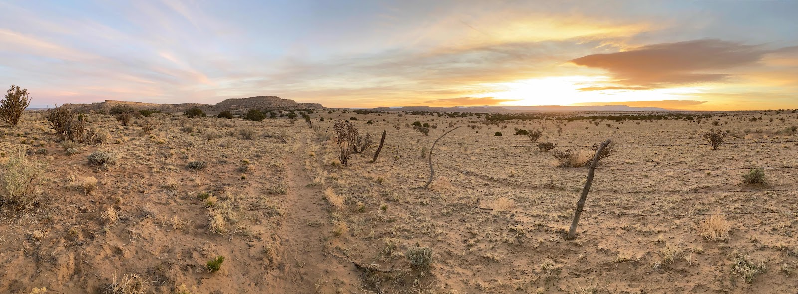
Sunrise from my tent


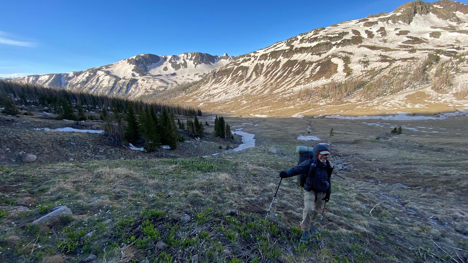
Neeko in the valley floor 


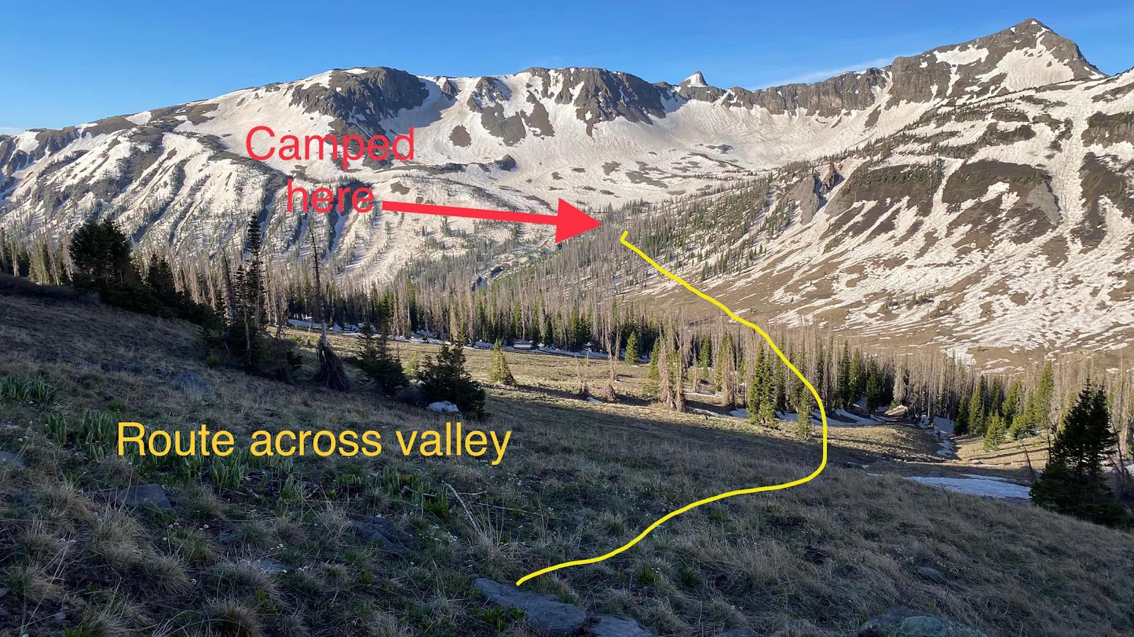
Easier to cross country across the valley than follow the snow choked trail
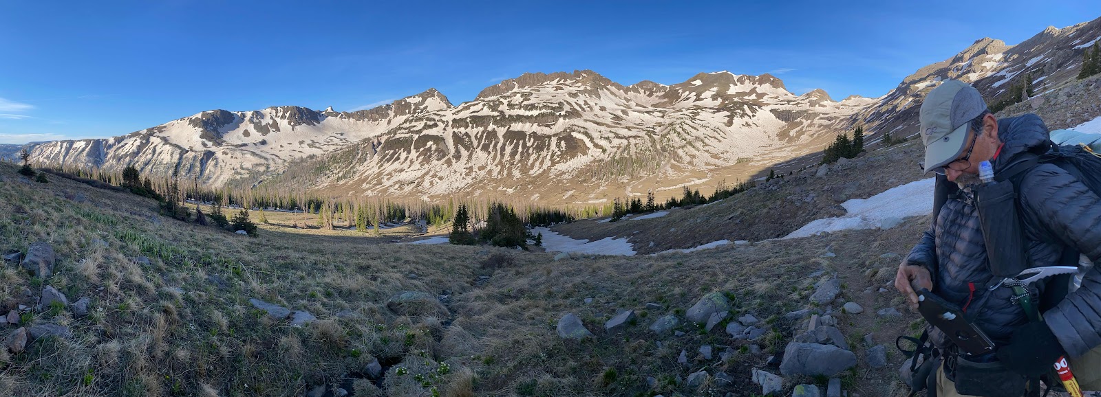

Beautiful morning


Streams frozen overnight


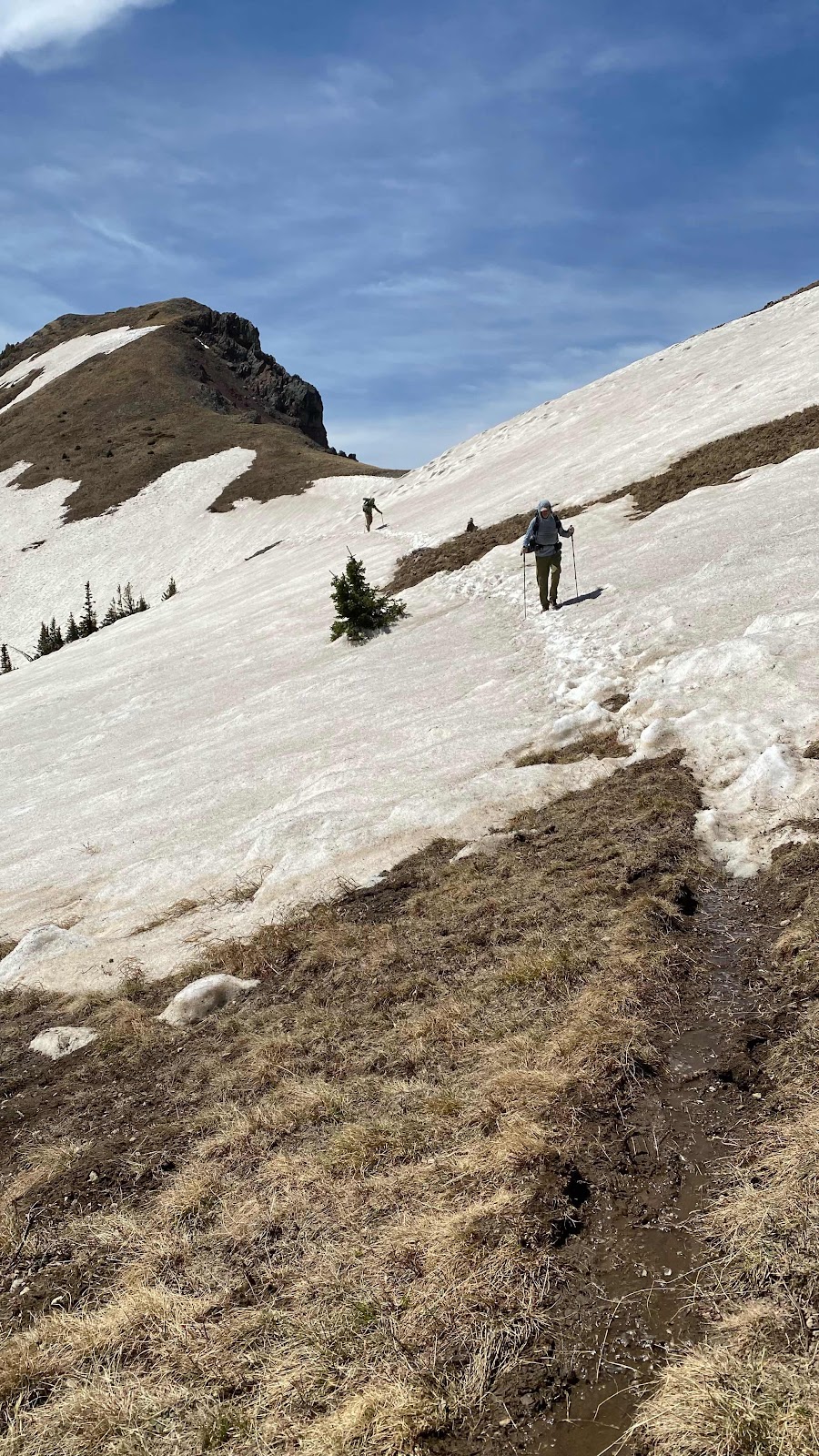
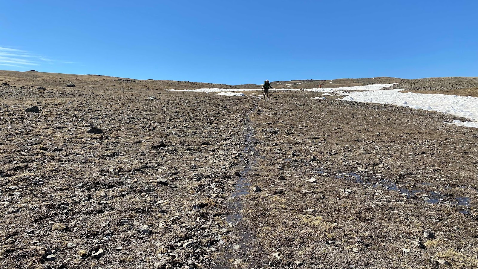
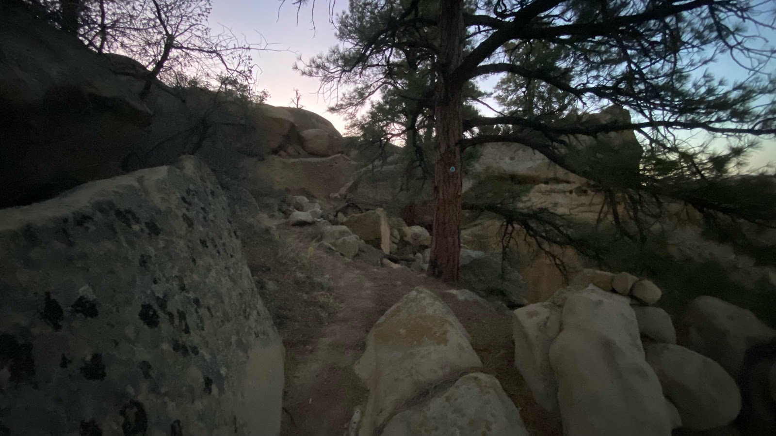
Much of the trail looked like this


My descent on the left and Neeko and Enigma up on the ridge looking for an easier descent. 


Day 33- Friday, May 27, 2022 - 16.1 miles - 43,908 steps - MP 794.8 to MP 810.9- Vert Up - 2455’ Vert Dwn - 2308’ - Total Miles to Date - 568.3

They are all dead. As far as my eye roams over this magnificent landscape of the Colorado Rockies - all the trees are dead. Forests that stretch for miles and miles up valleys and canyons, across slopes and on the flat mesas, all the trees are dead. Sure there will be a live one now and then but the forests stand dead. 


In 2016 I witnessed the death of 116 million ponderosa pines in California. As we drove first to Kings Canyon National Park and then hiked the Sierra High Route the forests turned bright orange as millions of pines died. Now I hike through the Rockies and I see an even worse blight. All the pine trees are dead. 


It is hard to find a safe place to camp because ever tree is dead and could potentially fall on us as we sleep. The number of blow downs on the trails are staggering but will pale in comparison to what is coming when all these dead standing trees start to fall. 


At first glance across this rugged, beautiful landscape your eye doesn’t notice the dead trees. You just see a forest. But, soon you notice that the forest isn’t green. It’s dusky grey brown. 


Not to preach, but we are in trouble. When tens of thousands of acres of forests up and die at locations all across the country and the world we need to evaluate the effect our activities have on this environment that sustains us. 


The wind is howling. We need shelter from it. Only the forest can provide, but the forest is mostly dead trees. That is my blue tent parked beneath that dead tree. Howling wind, dead trees. What could possibly go wrong?


Up at 5:45 am, tent down, pack packed and on the trail with Neeko by 6:30am. DG and Franzia like to sleep in. They will follow later. We may or may not see them, although DG is up when we leave. 

The trail climbs out of the lake basin and up to the ridge above from 11,248’ to 12,100’. Today we are walking on snow 50 or 60% of the time. As we approach the top of the ridge see three hikers. They introduce themselves as Ducky, Chameleon and Shoes. While chatting with them Bingo Bongo and Jif hike up. We leapfrogged Bingo Bongo and Jif all day as our pace is similar to theirs and the route finding got a bit tougher due to deep snows and blowdowns. 

Bingo Bongo is 57 and ran a Bingo wholesale supply business, hence his name. Jif is 62 and is an avid through hiker plus volunteers to do trail maintenance in Southern California. We had lunch with them on the trail and got into lengthy discussions about a wide range of topics. 

The going was quite slow. At times it was impossible to follow the trail. It was buried under 3 to 6 feet of snow and traversed steep hillsides that were difficult to cross. Many times we climbed down to the valley below and climbed up the other side to find the trail again. 

By Blue Lake the snow was deep and a small forest of fir trees had been flattened. We had to work our way through the tangle of trunks and branches and snow. 

Our last obstacle of the day was a 800’ climb to 12,200’ and then a 800’ descent. The climb was on a south slope making it relatively snow free. The descent was on snow. For me this makes the descent quick. Neeko is still very tentative on snow. His descents are slow. 

We made it to a stream crossing on the side of the mountain. It was now 5:30pm and time to quit. However, there was no level place to camp. We found a small place for Neeko, just about a body width and length in size. I found a level space just big enough to accommodate me in my sleeping bag as long as I didn’t roll too much. I pitched my tent, centering the floor over the flattish spot. I was beat. It felt good to recline and let everything relax. Dinner of spaghetti and pudding, then writing for an hour and a half. It was difficult to type on my phone because my hands kept cramping. They do this periodically. Don’t know what the cause is. As darkness settled in about 9:00pm I finished my writing and prepared to sleep. What an amazing place and an amazing adventure. It is by far the toughest part of the CDT to date. 


Nice forest, except all the trees are dead


Cairns mark the way when above tree line. This cairn is at 12,000’


Descending from the pass in the previous photo


Cold nights and frozen puddles in the mornings. The trail is often a ditch full of snow melt water. 


Our route along Blue Lake through the snow


Neeko descends the snow from 12,200’ to 11,400’


The valley we are heading for. Notice all the trees on the right side of the photo are dead. 


Day 32- Thursday, May 26, 2022 - 14.9 miles - 43,863 steps - MP 780.0 to MP 794.8- Vert Up - 2905’ Vert Dwn - 1625’ - Total Miles to Date - 552.2

John Muir used the term glorious often in his writing. Whatever he saw and experienced in the natural word moved him to write with such intense feeling and emotion that it captured the hearts of millions and was instrumental in helping to establish our National park system. 


I bring this up because the word glorious was on repeat in my head all day. And not just the scenery. The people I was with, the activities we concocted, the weather and yes, the scenery, all combined to make an absolutely glorious day. 


I was awake at 5:30am and began slowly to pack up and get ready for my first day back on the trail since hiking into Cuba on May seventh. DG and Franzia were camped a few feet away in their tents. I was cowboy camping. I heard both of them start rustling around in their tents as I gathered my pack together. At 6:05am my pack was loaded and I walked to the potty. On my return I noticed a small SUV stopped on the shoulder of the highway right in front of the RV entrance. I surmised it was Patsy, the woman I had texted last night about a ride to the pass. I walked back to our campsite, grabbed my pack and told the girls our ride was here. They still had to finish stowing their gear, so I walked up to the highway to check out the car and occupant. It was indeed Patsy. I put my pack in the back and climbed into the passenger seat. It was only 6:15am, 15 minutes ahead of schedule. Patsy and I discussed the weather and how cold it was. Then she began to tell me about the death of her husband a year ago and how her heart ached for the parents of the children that were murdered in their classroom this week. Her grief and despair were etched on her face. She described the circumstances of her husband’s death and how difficult life had been this past year since his death. 

DG (short for Dollar General, her trail name) and Franzia arrived right at 6:30am and we were off. Patsy continued her story and I soon learned all about her children and grandchildren and her life in Chama. She was a sweet lady with a broken heart. The school shooting had caused the pain of husband’s death to resurface and she just needed to talk and have someone listen. I was wondering what the girls in the back seat were thinking. We were having this intimate and personal conversation that they walked into and yet I had only just met Patsy 15 minutes earlier. Patsy and her husband have been ferrying hikers to the pass for the past twenty years. She really enjoys meeting the people. 

On the drive up we saw 6 elk and 6 or 8 deer. I was struck with how gorgeous the scenery was. A real contrast to the last 537 miles of New Mexico. 

At the pass we exited the car, tipped Patsy $5 each, took her picture and then tried to orient ourselves and find the trail. 

It is remarkable to me that these two 29 year old girls were willing to share a ride with me, be dumped together on an abandoned mountain pass and then start hiking together. Actually, it is the standard on any through hike. The people you meet are kind, generous, accepting and trusting, having no reason not to trust. Anyone going to the effort and pain to hike the CDT is not the kind of person who would think of doing someone harm. 

I really knew little of these two, so as we hiked up the trail we talked and got to know one another. The more I learned the more I realized I was hiking with two extraordinary young women.

They have been friends since age five, growing up in Key West, Florida. They will both celebrate their 30 birthdays this year. Franzia headed out on her own at 18, first to Canada, then England and has lived the last five years in Portugal where she pursues her passion of art. Her moving out did not involve animosity between her and her parents in the least. They were supportive and happy to see her begin her life on her own. Franzia speaks of her parents with great respect, admiration and love. 

DG worked in New York doing freelance media work. She produced Netflix commercials and has worked with Anthony Ramos from Hamilton and other notables. When the pandemic hit she moved back to Key West and sails on a charter sailboat. She just got her Captain rating. 

Beyond their life choices and accomplishments they are kind, thoughtful, very self aware, insightful and very interesting to talk to. 

At five miles we stopped for something to eat. As we munched and chatted a man I had not met came up the trail. He introduced himself as Neeko (pronounced Knee-co). I had promised the girls the night before I would teach them how to use the ice axes they were carrying at the first snow on the trail. Neeko also had absolutely no experience with an ax so I invited him to join us in the lesson, whenever the opportunity presented itself along the trail. 

The girls like to dawdle at breaks so I took off with Neeko promising to wait for them at the first snow. We ran into a steep, north facing slope in a few miles and I spent time with Neeko showing him how to secure his footing in the snow and to use the shaft of his axe to anchor himself. If he had slipped he would have slid into a forest of trees and likely been injured. With Neeko passed, I waited about ten minutes for DG and Franzia to show. I gave them the same lesson I had given to Neeko and we were soon across. 

A few hundred yards up the trail we found a snow field on a gentle slope where I could teach them how to arrest. We spent 20 minutes practicing arresting from the three positions, sitting, head first on your back and head first on your stomach. Both learned quickly and were a hoot to work with. 

A couple miles further up the trail we had to cross a fairly steep snow slope that had a good runout. I pointed out that this was an excellent slope to train on and both girls and Neeko jumped at the chance even though we were all getting tired and were hiking at 11,500 feet. 

DG went first, starting in the sitting position. The slope was steep enough that she built up some speed before rolling into the arrest position and stopping. Then she did the unexpected. With full pack on and no prompting, she hurled herself down the slope on her back, head downhill. Again she arrested beautifully. She must have had a good teacher. 😀

Franzia and Neeko were more reserved but both did well arresting from the sitting position. 

When climbing back up to the top Franzia picked the steepest part of the hill. She was about 2/3 of the way up when her feet slipped and she slid down. She tried to arrest, but she had her poles in her other hand. She did slow her fall, but she was on a part of the slope with no runout. She slide into the heather and grass for about 10 feet before grinding to a halt. Unhurt, she chocked it up to a learning experience and soon joined us back on top, using the footsteps DG and I had kicked in. 

People hiking the CDT wear the lightest foot ware they can get away with. They are really nothing more than a glorified tennis shoe. They are terrible on snow, offering no edging ability. Anticipating the snow, I wore a hiking boot that does well kicking steps and edging on snow. I got some comments about how heavy and stiff they are when I was meeting hikers in Chama, but they are excellent for the conditions we are facing. I will switch back to a light weight hiker once the snow has melted out in a few weeks or a month. 

The four of us continued up the trail, headed for Dipping Lake. We had a wonderful ridge top lunch session with Neeko revealing info about his family. 

He moved to the US from Mexico at the age of 25. He told us about his two sons. He has a doctorate in Electrical Engineering. He is 65 and not ashamed to admit he is petrified of the snow. He was very appreciative of the ice axe lessons. 

All exhausted, we got to Dipping lake after six and we’re all too tired to search for a camping site to set up our tents. After a ten minute rest I mustered the strength to cross the outlet of the lake and find enough room for our four tents. Before I climbed into my tent I thanked Neeko and the girls for an amazing day. It was glorious!!


Patsy, our driver, at Cumbres Pass


DG signs the trail register


Franzia signs the trail register


Did I mention how gloriously beautiful Colorado is?


DG prepares to practice her self arrest skills


Franzia climbing back up to the trail just moments before she falls


Me on top of a 12,200’ peak that the trail climbs


Franzia passes a warning sign about the dangerous trail ahead


Wednesday, May 25, 2022

Day 31- Wednesday, May 25, 2022 - 0.0 miles - 0 steps - MP 629 to MP 629- Vert Up - 0’ Vert Dwn - 0’ - Total Miles to Date - 537.3

A month an hour!  Three days an hour!  What modern miracles of movement!  I needed to hike 600 miles last month to once again appreciate the plane and the automobile. I spent 30 days hiking New Mexico, traveling just under 600 miles. Yet, I boarded an airplane in Seattle this morning and was soon traveling that same 600 mile distance every hour instead of every month. Unbelievable!! After a flight to Denver and a connector to Albuquerque I rode three buses and in a mere 20 hours I traversed a couple thousand miles to wind up in Chama, NM, just a few miles from my destination of Cumbres Pass where I will pick up the CDT again and start hiking north at 20 miles a day (give or take a few), a far cry from a car or jet’s performance. But what I lose in speed I make up for in a connection to the land I am traversing. The smells, the wind, the sun, the rain, the undulations of the land, the babbling creeks, the towering peaks dwarfing my existence and putting me in my place. It is a good place to be, seeing the world go by at 2.5 miles per hour. 

The flight I had booked three weeks ago got me home and was supposed to get me back to Albuquerque but yesterday at 1:00 in the afternoon while weeding the garden at home I got a text from Delta saying my flight had been delayed three hours. With that delay I arrived in Salt Lake City too late to make my connecting flight to Albuquerque. Sally helped me cancel that now useless flight and book another. Instead of flying out of Portland I flew out of Seattle and on United rather than Delta. As a bonus, the flight was about $20 bucks cheaper. That surprised me as I was booking less than 24 hours before takeoff. 

I had to have an early flight to get me to Albuquerque around noon so I could catch all the buses required to drive me the 172 miles to Chama. This meant a 5:00am flight, which translates to rising at 1:30am to make the drive to SeaTac. I entered the terminal at 3:35am only to find a massive crowd at the United counters. There were no workers there at that hour. They did not show up until 3:50am. I got my pack checked by 4:15am, scurried through TSA and got to my gate just in time to walk onto the plane. Quick and efficient with no time to waste. 

I had researched all the air and ground transportation in the weeks before today and all came off perfectly. One thing I did not arrange was accommodations in Chama for tonight. As mentioned above, I hope to exit the bus in Chama and find a ride up to Cumbres Pass, 13 miles away. If a ride proves impossible to find I will stealth camp just out of town and try for a ride again in the morning. 

Update:  9:30 pm. The shuttle dropped me off in Chama. I was the only rider for the 90 minute drive. I started walking toward Cumbres Pass and noticed a CDT hiker in front of me and 4 behind me. At the entrance to a RV park I stopped with plans to thumb a ride to the pass, although I held little hope of success as it was 8 o’clock and there was no traffic on the highway. The four people behind me on the road stopped and we did introductions. I met Kid, DG, Franzia (like the wine), Pib and two others that I can’t remember their names. DG and Franzia liked the idea of hitch hiking to the pass and stayed out on the highway with me, the others walked to the RV park and the campsites they already had. DG and Franzia are best friends having known each other for 25 yrs. They both turn 30 this summer. We had a nice conversation out on the road. Only two trucks went by and neither stopped. After half an hour we realized it was fruitless and registered for a campsite together. By sharing the site we saved money. Three in a site came to $8 apiece where a campsite alone was $20. The two girls set up their tents. I decided to cowboy camp. 

Everyone gathered at a picnic table to shoot the breeze. I used the restroom then stopped by. They were passing a joint around. I don’t drink or smoke so I took the opportunity to plug my electronics in, then returned to sit and get to know everyone. We chatted and laughed until I excused myself at 9:30 to go to bed. 

DG had the name and number of someone in town that gives rides to the pass. I texted her (Patsy) and she agreed to give us (DG, Franzia and I) a ride tomorrow morning at 6:30 am. 

It is amazing how quickly you are assimilated into a group. I hadn’t been off the bus 10 minutes when I met this group and we had a wonderful evening getting to know each other. I assured DG and Franzia I would teach them how to use their ice axes tomorrow so they are planning to hike with me until we hit snow so I can show them the techniques. They have axes, have watched YouTube videos, but have never used one before. Forgot to take photos today. I’ll try to fill in tomorrow. 

Friday, May 20, 2022

Thursday, May 19, 2022 - 0.0 miles - 0 steps - MP 629 to MP 629- Vert Up - 0’ Vert Dwn - 0’ - Total Miles to Date - 537.3

A quick update. I’ve been off trail for 11 days,  on the road with Sally and grandson Robby for 9 of those days, 6 of the 9 car camping in Yosemite Valley. We start driving toward home in Toledo tomorrow. 


While off trail, some monumental changes have occurred concerning the hike. All of northern New Mexico, from Grants to the Colorado border has been closed to all recreational use due to the extremely high fire danger. This includes my route on the CDT from Cuba to Cumbres Pass in Colorado. This means I will not be returning to Cuba as planned. I will still fly into Albuquerque, but I will now bus to Chama in northern New Mexico and start walking north again from Cumbres Pass, Colorado, being forced to skip about 140 miles of New Mexico due to the closure. A $1000 fine and jail time are threatened if you are found hiking in the closed forest. Am I disappointed at missing this portion of the trail?  A bit, but such is the nature of thru hiking during this time of global warming. Forests catch fire with extreme frequency and ridiculously early in the season (Early May?  Really?) forcing closures and walk arounds. When planning this adventure my concern was fire in Montana and Idaho in August and September, not New Mexico the first weeks of May. We will see how this plays out as the seasons advance. 

Interestingly, this nearly puts me back on my original schedule. By coming home for two weeks and then returning to hike northern New Mexico I would have delayed by two weeks my entry into the San Juan Mtns of southern Colorado. But now, by bussing around northern New Mexico my delay only amounts to a little less than a week. The snow has been melting, but I suspect I will be on continuous snow for at least the first couple of weeks of Colorado. Traveling, camping and negotiating snow covered terrain doesn’t concern me. What does is the speed with which I can move. Maintaining a 20+ mile per day pace while postholing could be tough. I’ll have crampons and an ice ax, so I may find myself traveling in the wee hours of the morning to attain solid ice to walk upon. Whatever, I’ll have to adapt my schedule to contend with whatever conditions I am presented with. 

I purchased a new pack and shoes while away, both are waiting for me at home in Toledo (I’m still in Yosemite as I write this). I bought the Gossamer Gear Mariposa pack, hoping for a more comfortable fit than my previous REI Flash 62. My shoes are a pair of Asolo Fugitives, a slightly more substantial shoe than the Salomon trail shoes. I have worn them before. They are very water proof (Goretex lined) and provide a bit more support for cramponing. I still have three pair of Salomons in reserve for the rest of the hike and any I don’t use I can return to REI. 

Where are the people I was formally hiking with?  Dallas is driving to South Pass City in Wyoming on the 20th and hiking south bound (SoBo) to Rawlings, WY and then plans to return to Chama and head north, depending on snow conditions. Jean-Bruno (I’m French) is joining her. Magic Mike is doing something similar. They too are trying to buy time while the snow melts, but doing so by hiking the snow free portions of the trail in the great divide basin in Wyoming. I don’t know where everyone else is (Kingo, Peppermint, Legs, Hornsby, Grit, etc) but I suspect I’ll learn more when I get back on trail. I’ve texted them, but I have not heard back. I suspect they might be out of service on the trail somewhere. 

In summary, all is good!! I’ve had an amazing week with Sally and Robby in Yosemite. Craig and Barb Oen have been here with us. We’ve biked, hiked and taken Robby bouldering. Friends from the park service have stopped by, so lots of visiting. I’ve eaten more than I would have thought possible and likely regained any weight I lost on the trail. Anything sore from the abuse of 20+ mile days for a month has healed.  I fly out on Wednesday the 25th and hope to be hiking that day or the 26th. I’ve only complete one month out of five and only 537 miles out of about 3000, so there is much more ahead of me than behind. Looking forward to it!   Life is amazing!!


Craig, Barb, Sally, Robby and Chuck at the Mariposa Grove 


Sally and Robby at the upper grove of sequoia. 


Magnificent trees. 


Robby plays hydronic engineer building a dam in a small creek next to the snow swollen Merced River

Robby bouldering near the Awahnee. 

Thursday, May 12, 2022

Day 30 - Sunday, May 8, 2022 - 0.0 miles - 5,299 steps - MP 629 to MP 629- Vert Up - 0’ Vert Dwn - 0’ - Total Miles to Date - 537.3

It’s a zero day. Ahhhhhhhhhh. Let the body recover after a pounding.  


It’s been thirty days since I hiked away from Crazy Cook Monument on the US/Mexico border, 537 miles ago. Let’s take a moment to reflect. 


There is an intimacy to thru hiking. Seeing the state of New Mexico at 2.5 mph without our typical shield of glass and steel around us is more sensual, more personal and . . . more intimate. The sun and wind remind you of your frailty. The need to chase water and carry sufficient food connects you to your basal needs. The utter fatigue at the end of the day enhances your connection to your own mortality. Your rebirth the following morning strengthens your confidence in your body to heal itself. A glorious sunset, sunrise, hawk hanging motionless on the breeze, the moon progressing thru it’s cycle while the planets and stars reveal themselves remind you of your place in this cycle of life and the universe. The whole thru hike experience makes you acutely aware of what it means to be alive. 


I have jokingly remarked that the day of hiking is akin to hitting yourself in the head with a hammer. It feels so good when you finally stop at night and camp. It is the contrast between these two extremes that enhances both. Just to lay down in your tent or on your ground tarp after 10 or 12 hours of hiking and elongate your spine, rest your legs and relax every muscle in your body is such a joy!


How many who started are still on trail?  I don’t know. There are a number of people I have not seen since Silver City, but whether just slower or faster or left the trail, I don’t know. Some repetitive use injuries were starting to show themselves. Ankles, shins, back were some of the complaints I have heard. Extra zero days to let parts heal is the universal therapy. 


What wildlife have I seen?  Rabbits, lizards, snakes, antelope, elk, havolinas, squirrels, any number of birds. I’ve seen enough to keep it interesting. 


What about weight loss or gain?  The assumption is hikers will have massive weight loss due to all the exercising. Every couple of days I would record everything I ate and compare the calorie input to the calorie output as recorded by my Apple Watch. Let’s take a look:


I consumed 2808 calories during the day. Through the exercise of hiking I burned 1,515 calories and my normal metabolism burned 1500 for a total calorie use of 3015, so I was short 207 calories for that day. There is a caveat. My metabolic budget of 1500 calories will have me lose 1.5 pounds each week. I would be happy with that, but that means I was really more like 700 calories short of maintaining my weight. After I lose a few pounds and slim down I will have to up my calorie count to stop excessive weight loss. 

But, calories aren’t everything. Nutrition is important. You’ll notice that on this particular day there was not a single vegetable in my diet. Nor fruits. This is unusual for me. Most dinners have dried vegetables of some kind. 

Some days when I recorded my exercise and food intake I have been nearly 1000 calories short.  Others I am over a few hundred.  I won’t know how this is playing out until I can stand on a reliable scale and see how I am doing.  I don’t notice my pants tighter or looser.  When I cook my dinner, I usually prepare a liter of whatever I am eating. That is a lot of food. And, I add a tablespoon or two of olive oil to the meal just to up the calories. So I don’t think I am losing much weight if any. Oh, and nearly every dinner features a cup of instant pudding for desert. Not a thinning item to add to a meal. But, like I said, have to wait to stand on a scale to see what is happening.

I got up about 6:30am this morning and walked across the highway for a breakfast in the cafe. A 3 egg omelet, toast and hashbrowns. yum. Back in my room I rinsed all my gear, getting the dust and dirt of 500+ miles off everything. I meticulously went through every item in my pack, trying to decide which items I could do without in an attempt to lighten my load.  I might have eliminated a pound or two.  The problem is my pack. It’s an REI Flash 62, it is uncomfortable for a couple reasons.  80% of the weight of the load should be on your hips, but when I tighten up the waist strap the padding rolls and exposes my hip to the nylon belt instead of the padding. That gets irritating and makes my hips sore and requires me to release the hip belt a bit and put the weight back on my shoulders. I came to the conclusion I need a new pack

In the afternoon I interviewed other hikers at the Cuban Lodge as to which pack they had and if they liked it or not. I had three contenders I was looking at, The Gossamer Gear Mariposa, the ULA Circuit and the Zpacks pack. All three were represented at the lodge and I borrowed each from their owner, loaded my stuff in and pranced around the parking lot and up and down the highway in the very blustery wind evaluating each. I settled on the Gossamer Gear Mariposa. I loved the way it fit, distributed the load and the number and placement of pockets. It was in the middle of the group as far are weight, measuring 32oz, between the zPacks 19oz and the ULA Circuit at nearly 38oz.  I ordered one on line, shipping it to my home in Toledo, as I am traveling there tomorrow to join Sally for a drive to and week in Yosemite Valley. I will bus and train to Albuquerque and then fly to Portland where she will pick me up. My return flight to Albuquerque is set for May 25, giving me 2 weeks off the trail. Some of my sore spots will heal up during this time and the snow in the San Juan range in Colorado will melt, allowing me easier passage into that state.

I’ll write a blog about my journey home, then suspend writing until I return to the trail on May 25th. 


An appropriate sign I found in Cuba, New Mexico

Sunday, May 8, 2022

Day 29 - Saturday, May 7, 2022 - 11.4 miles - 28,569 steps - MP 618.5 to MP 629- Vert Up - 386’ Vert Dwn - 881’ - Total Miles to Date - 537.3

I set my alarm for 5:00am.  I had awakened a couple times during the night and stared up at the stars. Why have I been sleeping in a tent?  I mean I like my tent, but it has been perfectly clear for 29 days in a row. I could have been watching the progression of the night sky. Note to self: sleep out under the stars whenever possible. 

At 5:00am my watch woke me. The sun had not began to light the eastern sky. The moon had set. Not a breath of wind. It was actually somewhat warm or at least not cold. The stars were brilliant. I knew to look east. Sure enough there they were, the four planets still forming a perfect line, although unlike three weeks ago when the order was Jupiter, Venus, Mars, then Saturn, Venus had moved closer to the sun to create the order Venus, Jupiter, Mars, Saturn. I had seen Venus and Jupiter nearly on top of each other a week or two ago. Now they had changed places and were nicely spaced out again. This is the advantage and joy of sleeping out instead of in a building (and in the desert where clouds don’t obstruct the view). 


Faint, but visible in the early morning light, from left to right,Venus, Jupiter, Mars and Saturn 

I didn’t move too fast. No need to. I ate a bag of granola and packed my pack as the sun began to faintly light the eastern horizon. Shoes on, pack packed and I was on my feet. I needed my headlamp to see where I was going as I located the trail, but only for the first five minutes. After that the light from the east illuminated the landscape sufficiently for me to switch off my headlamp. 

The trail stayed close to the edge of the mesa for quite some time affording a view out across the desert landscape. Occasionally, I could see the lights of Cuba winking in the distance between the junipers. 


The edge of the mesa with Cuba barely visible in the background 


I had 11.4 miles to cover to get to Cuba, the first 7 on trail and dirt roads, the last four on paved highway. After a mile I passed Lee and Sue standing in their campsite. They were nearly done packing and I knew they would soon be behind me. Except for a stop to remove my fleece and grab a bar to eat I moved non-stop to the highway. There I stopped and sat on the shoulder of the road to remove my shoes and socks and shake the sand and dust from my socks and wipe my feet clean. My shoes are worn out and have developed cracks and holes in the upper material that allows sand and dust in. I thought I would enjoy walking the highway more if my feet were clean, knowing they wouldn’t get dirty again on a paved road. 

As I finished cleaning my feet and lacing up my shoes Lee and Sue came into view. We ended up walking the highway together, sharing stories about our respective homes and lives. 

The first building in town was the Cuban Lodge where I had made a reservation yesterday. We rang the bell and Flora appeared in her pajamas and nightgown and assigned us rooms. Mine was 102. It was about 9:45am.    

The Cuban Lodge was built in the late 50’s or early 60’a and is little changed except for the wear and tear of 60 years. Pretty pathetic. At $70 a night it is overpriced for the condition of the building and rooms, but it was clean. 


The Cuban Lodge from across the five lane highway (turning lane in the middle)


Just a slight step up from a tent, at least it fended off the wind. 


My room with my gear laid out

I parked my pack in my room and strode the 1/4 mile down to the Post Office and retrieved my four packages. I checked out the laundromat on the opposite side of the four lane highway on the way back. 

And so began a Nero today. I did my laundry, completely emptied my pack, took a long, long shower, shopped at the Dollar General next door to the hotel and greeted old friends as they hiked into town. 

Kingo arranged for a group of us to eat out at a place at the other end of town at 7:00pm, about 1.25 miles away. I was looking forward to it as Legs, Grit, Kingo and Peppermint would be there and it would be the last time I would see them for a while, if not the whole summer as they would get hopelessly ahead of me during my two week hiatus from the trail. But, as I stepped out my door at 6:50pm to walk to dinner I ran into “I’m French”, the new trail name for Jean Bruno. He had reserved a room for tonight but Flora was not to be found. He had just gotten off the trail and was standing outside the office with no where to go. I took off down the street to dinner. About 100 yards later I realized he really needed a shower and a place to get off his feet. I called him and told him I was returning to let him in my room to shower and clean up. I got him set up with a towel and shampoo, then asked if wanted to come eat after he cleaned up. He said no, so I left again for dinner. Now I would be late, like 40 minutes late. As I walked down the highway for 15 minutes I realized it was too far and too late. After I finished dinner I would have to walk back in the dark. I sent a text that I couldn’t make it and returned to my room. I’m French had finished his shower and was still trying to get his own room. Finally, he got a room at the hotel down the street, giving up on his potential room here. 

When I got to my room this morning I was footsore, dirty and tired. The walk to the Post Office seemed like a long one as did the one to the laundry. But, by the evening I felt quite good, good enough to hit the trail in the morning. But, my plans lie elsewhere. A total zero day tomorrow and then a bus, train and plane ride home to Toledo on Monday. I’ll miss the friends I’ve made, but I am really looking forward to spending a couple weeks with Sally in Yosemite. The Rocky Mountain snows will melt while I’m away, making for quicker hiking when I return.  Life is good!

Day 28 - Friday, May 6, 2022 - 28.5 miles - 69,429 steps - MP 591.1 to MP 618.5- Vert Up - 3635’ Vert Dwn - 2778’ - Total Miles to Date - 525.9

Today is going to be a long day. And water will be sparse. And the temperatures, which have been mild for weeks are going up. Although I saw the high of the day on the forecast was to be 85° it didn’t register with me that I would need to alter may actions. And my back has been hurting, just to the right of my spine, at the bottom edge of my scapula. The confluence of these factors got me in a bit of trouble today. 


Last night, as soon as I crested the plateau I searched for a camping spot. The ground was solid rock, sandstone. I found sand drifted behind a juniper and tried to erect my tent, but the sand was only an inch or two deep. My tent stakes would not go in. So I picked up my gear in my arms and wandered a couple hundred feet to where the sand was deeper, found a flat spot nestled between prickly pear cactus and set up, the front stake of my tent imbedded in the middle of a cactus. I had enough water for dinner and the night, but only about two cups by the time morning came. There was a sketchy water source 0.3 miles up the trail which I planned to hit first thing. Here is what FarOut hikers reported:


I was up before sunrise and moving by 6:10am. I kept my eyes glued to the NNW and spotted something white. I headed off the trail towards it and soon found a faint track leading that way. I soon saw Grit’s tent and Leg’s (Aaron) sleeping bag. They had camped very near it. 

There was indeed a vertical 18” diameter white pipe sticking out of the ground with about a foot of water in it, dead bugs floating on top.


I filled my Smart Water bottle and moved on. I would purify it later. I now had a liter and a half, enough to get me at least 10 miles and to a reliable water cache that lay just nine miles ahead. 

The terrain continued where it left off last night. It was gorgeous. The trail was perched on the edge of mesas or on shelves part way up their steep rocky faces giving a commanding view of the countryside for many tens of miles. 


I saw someone in red up ahead, sitting on the edge of the cliff. When I arrived at their position I found Kingo and Peppermint (now shortened to Mint) eating breakfast. I sat with them for 10 minutes and munched a pop tart, then carried on. 

A couple hours later I crossed a highway and caught up with Lee and Sue. There was supposed to be a water cache a few hundred feet off the highway. We found it. The best water cache I’ve experienced on the CDT. 50+ gallon jugs of store bought water all chained together so they won’t blow away as they get emptied. 


Sue and Lee rest and fill up for the 15.4 mile waterless stretch

The three of us added to our water stock, knowing the next water was a cattle trough 15.3 miles away and what would be mile 23 for the day for me. I judged my needs based on the morning hike of about 9 miles, not thinking of my increased fatigue or the predicted elevated temperatures. Instead of a liter per five miles, I took only a liter and a half for the 15 miles. 

The terrain was spectacular. 


The trail clung to the edge of the mesa, but it had to drop down where it’s edge was cut, then climb back up to the top. This happened at least 7 or 8 times over the 15 miles. Not big climbs and descents, but enough to rack up 3500’ of climbing over the day. 

With 5 miles left to the water source I was down to about a cup of water. I knew I had underestimated my needs and was going to suffer some serious thirst. That combined with my aching back could have made for a miserable afternoon. But around noon it suddenly occurred to me my back was hurting because I was using trekking poles. I knew using poles aggravated my back. I quit using them in 2018 on the PCT for this very reason. How had I forgotten? I didn’t even bring poles from home on this trip for that reason and only had them shipped to me to use on the Gila for all those river crossings. Somehow I had continued to use them in these weeks after the Gila forgetting the pain they eventually cause. I collapsed them and stowed them in my pack. Of course my back was already aggravated, but ceasing their use brought a measured, immediate relief. 


Cairns mark the route across the slabs

Now it was up and down, just three or four hundred feet with each cut in the mesa. Rock cairns marked the way, often the trail was across solid rock slabs, the cairns the only way to know where the trail was.  I allowed myself a rest break every three miles. At one of those I called Sally. 

I had looked at transportation to Albuquerque from Cuba, my next town and there was public transportation. I called to tell her I was coming home to go to Yosemite with her and could be there Monday (up on the Mesa I had good service most of the day). While resting, we checked bus schedules and plane tickets. Sally booked a flight for me from Albuquerque to Portland for Monday the 9th at six in the evening, giving me all day Monday to get from Cuba to the airport. We also booked a return flight to Albuquerque for Wednesday, May 25th to get me back on the trail. The two week hiatus will give the snows in the San Juan’s time to melt out , allowing me to continue north through Colorado without having to detour around it once I return. I will lose the group I am in the midst of now, but I have a feeling I will see them along the trail, plus, I’ll get a chance to meet a whole new set of people. 

The last 3 miles was tough. I doled out a mouthful of water every half mile or so until I ran out about a half mile away. I dropped down off the mesa edge to a canyon. At the back of it was Jones Canyon Spring. 


The spring seeped out of the rocks at the base of the rock face and was collected on a metal trough for the cows (and hikers). 


There I found Lee and Sue and most importantly, lots of water. I used my Sawyer filter and immediately drank half a liter, squiring the water directly into my mouth from the filter. Then I filtered a liter into another bottle, added two packets of Propel and downed the whole liter in two chugs. I squirted another half liter into my mouth and was began to feel better, although now I was water logged. It takes time for water to absorb through the intestinal wall. 

I filled 4 1 liter bottles with water and moved into the shade of a large boulder. It was hot in the sun, the cause of my dehydration. I lay on my Tyvek for about 15-20 minutes letting the water make its way into my blood stream and relaxing my back. 

Lee and Sue came to join me and together we cooked our dinners. Hornsby had arrived and also joined in. 

My watch said I had hiked 24.5 miles, but I was 14 miles from Cuba. I needed to be closer to assure I could make it to the Post Office before they closed at 11:30am, at least 4 miles closer. Lee and Sue were of the same mind. They took off. I rested another half hour, then packed up and set off. The trail was level and down hill for two miles, then slightly up hill for about a mile, then climbed steeply to gain the top of yet another mesa. 

My goal was the top of the mesa because from there it was all downhill the 11 miles into town and I wouldn’t have to climb it first thing in the morning. 

The sun was very low in the NW sky as I walked directly into it. Thankfully, it set, the coolness of the evening beginning to set in as I approached the steep climb. 

The trail wove in between vertical sections of the layers of sedimentary rock, was a vertical scramble in places and seemed to just barely cling to the mesa face. 


The trail wove through a jumble of rocks all the way up the face of the mesa. 


The last 15 vertical feet to the top. They carved steps in the sandstone to get us over the top. Very cool!


It was all but dark when I reached the top. The glow on the western horizon was mesmerizing. I laid out my Tyvek, blew up my mattress and crawled into my bag on a slab of rock and watched the stars compete with the moon for attention. No wind. Not cold. Mesmerizing. I fought off sleep for a while just to enjoy the evening. It was worth every thirsty, achy step to get to this moment.