I started today at mile post (MP) 566.6. Cuba, NM is the location of my next resupply at MP 629. This means I am about 63 miles away. I’d like to get there by 10:30am on the morning of the third day. A Saturday. The post office is only open from the 10:00am to 11:30am. If I don’t make it I have to wait until Monday morning to get my four packages, a food resupply, my down quilt Sally mailed to me, my box of clothes and other stuff I mailed to myself so I wouldn’t have to carry it and some instep straps I ordered for my gaiters.
If I do two 25 miles days that leaves me 13 to complete Saturday morning before 11:00am. I think I can do that. So today I did 25.7. At least that is what my watch says. Trail miles I did 24.7. At least I am in the running if I can do 25 tomorrow.
Truthfully, racing to get to the next town is counter productive. I should not be in a hurry at all. As soon as I cross the state border from New Mexico to Colorado the trail enters the San Juan range of the Rockies. It is choked with snow and the trail averages 11,500’. Conventional wisdom says one should not enter Colorado until about the third week of June. At my current pace, I’ll be there a month early, May 20th. So why the rush?
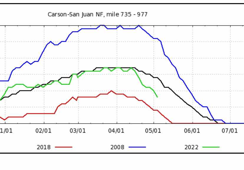
Well, there are two factors a foot here which I have not brought to light. The first is the Snow Water Equivalent report for the San Juan range. I have been watching this chart all winter, hoping for a low snow year to open the San Juans early. It has not gone well for me but has been very good for the people in this area that depend on that winter snow pack for summer water. Check out the plot below. The black line is the average, the thicker green line is this year’s snow.
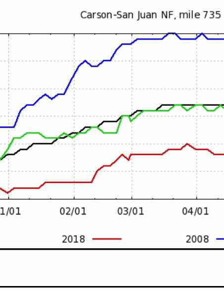
When I flew to Tucson and then bussed to Lordsburg to start this trip the green stayed right on the black. Notice that the black does bottom out until the third week of June, as conventional wisdom dictates.
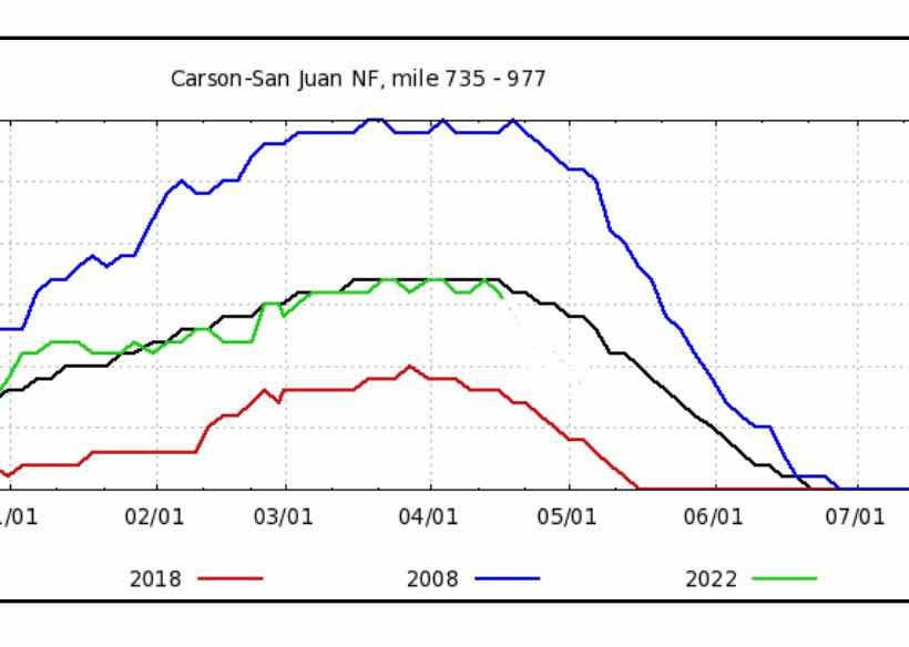
However, when I checked the chart a few days ago, while resting in Grants, a huge change jumped out at me. The melt off is way quicker than the average. In fact, if the melt rate now proceeds like an average year the San Juans will be pretty much snow free by June first.
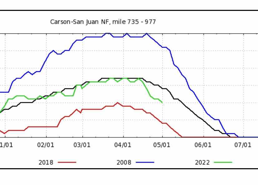
Today, I had signal when the trail edged close to the lip of the plateau. I looked again and it was even better. The melt had accelerated even more. At this rate the San Juans will become nearly snow free a month early, say May 20th or so?
Remember, I’ve never even been in the Rockies, ever in my life. So I’m reading graphs and interpreting snow coverage for a region I know nothing about. To check my reasoning, I talked to Lee, one of my fellow hikers who lives in Colorado and has extensive experience in the Colorado Rockies. He liked my reasoning, but wouldn’t commit to the idea that the San Juan’s would be passable in late May. So, while I had signal, I called the Pagosa Springs forest service office and left my inquiry on their voice mail. They called back and left me a message. They said they don’t know what the snow pack is because they rely on CDT hikers to tell them what it is like. They are waiting for me to give it a go and then let them know if I made it through or wasted a couple weeks flailing in chest deep snow.
So . . . what’s a poor boy to do?
There is another option. Wait a week or two for the snow to melt before entering the San Juans. Where should I wait? Well, Sally has reservations for camping in Yosemite Valley for May 14 to the 20th. If I bussed from Ghost Ranch to Sante Fe, flew to Sacramento and she picked me up as she drove through, I played a week in the Valley with her and our friends Craig and Barb Oen, then hopped a flight back to Sante Fe and continued on with the CDT I could accomplish two things, delay for the snow on the CDT and see Sally for a week.
However, for this to work, I need to get my packages in Cuba Saturday morning so I can start hiking to Ghost Ranch (55 miles/3 days) to catch a bus and a flight to Sacramento. Hence my 25 miles of trail today.
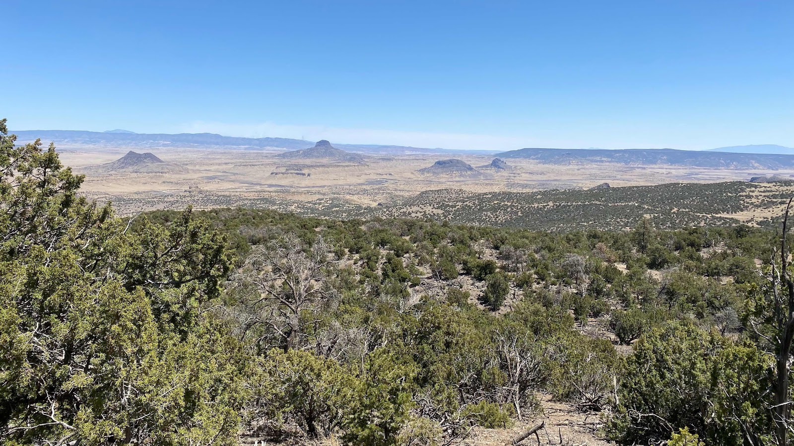
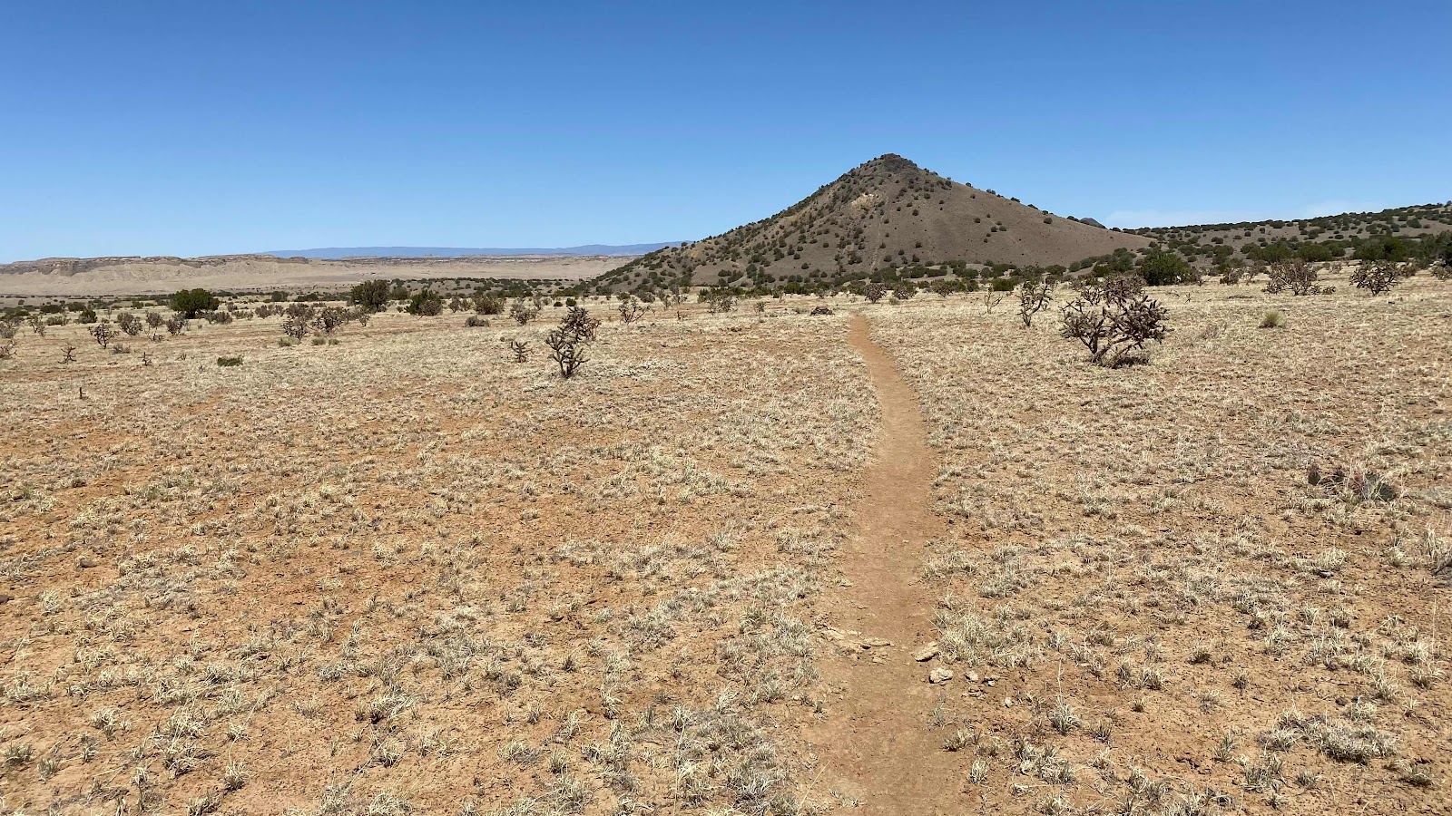
Today held some cool terrain. After hiking across the plateau for 15 miles this morning I came to its edge. The trail plummeted down the side of the plateau to the desert floor, over 2000’ below. Then, it wound through dry arroyos and between stone abutments as it climbed to regain the plateau on the other side of a huge dry river basin. It was stark and beautiful.

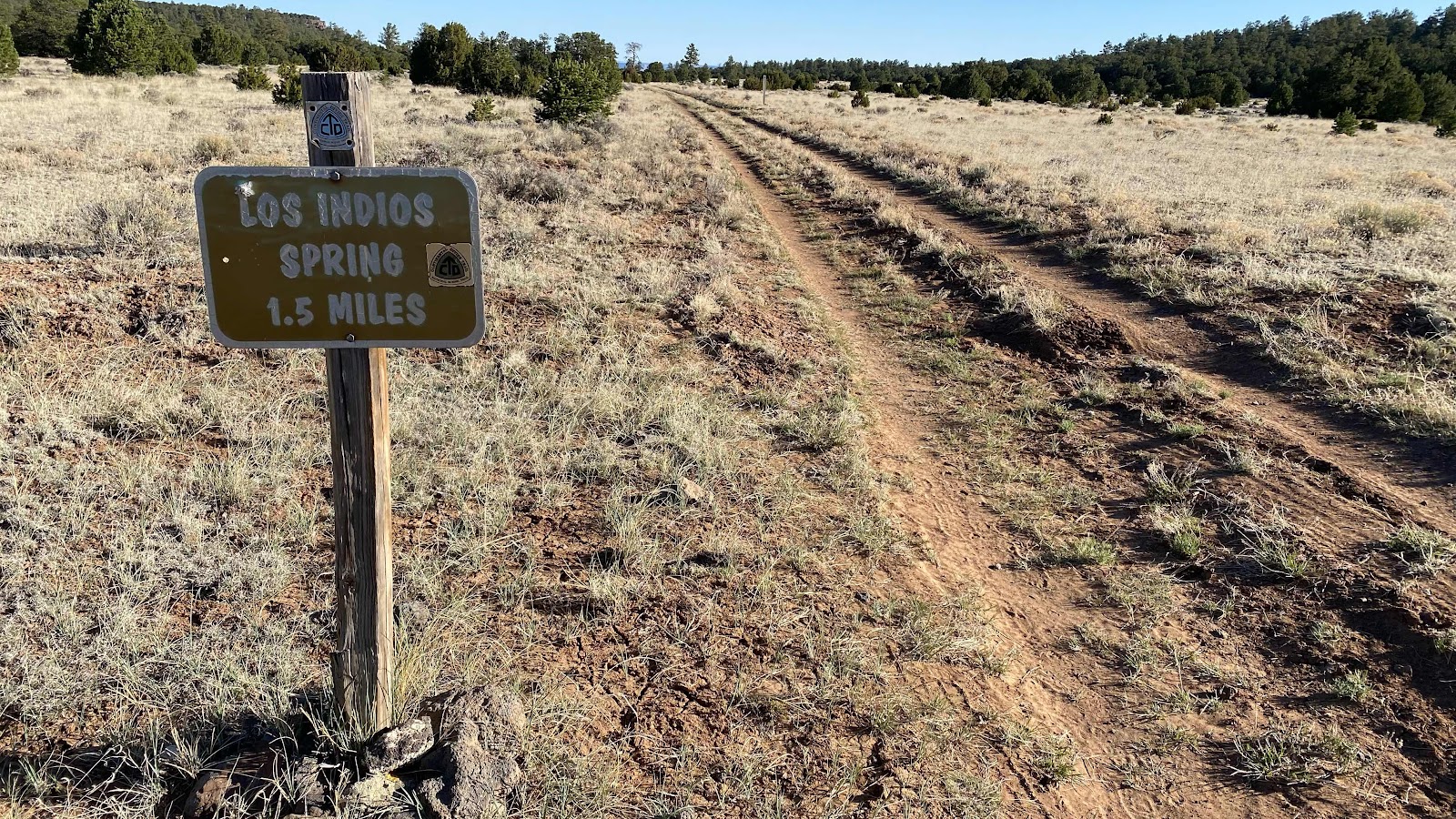
Actual trail!!
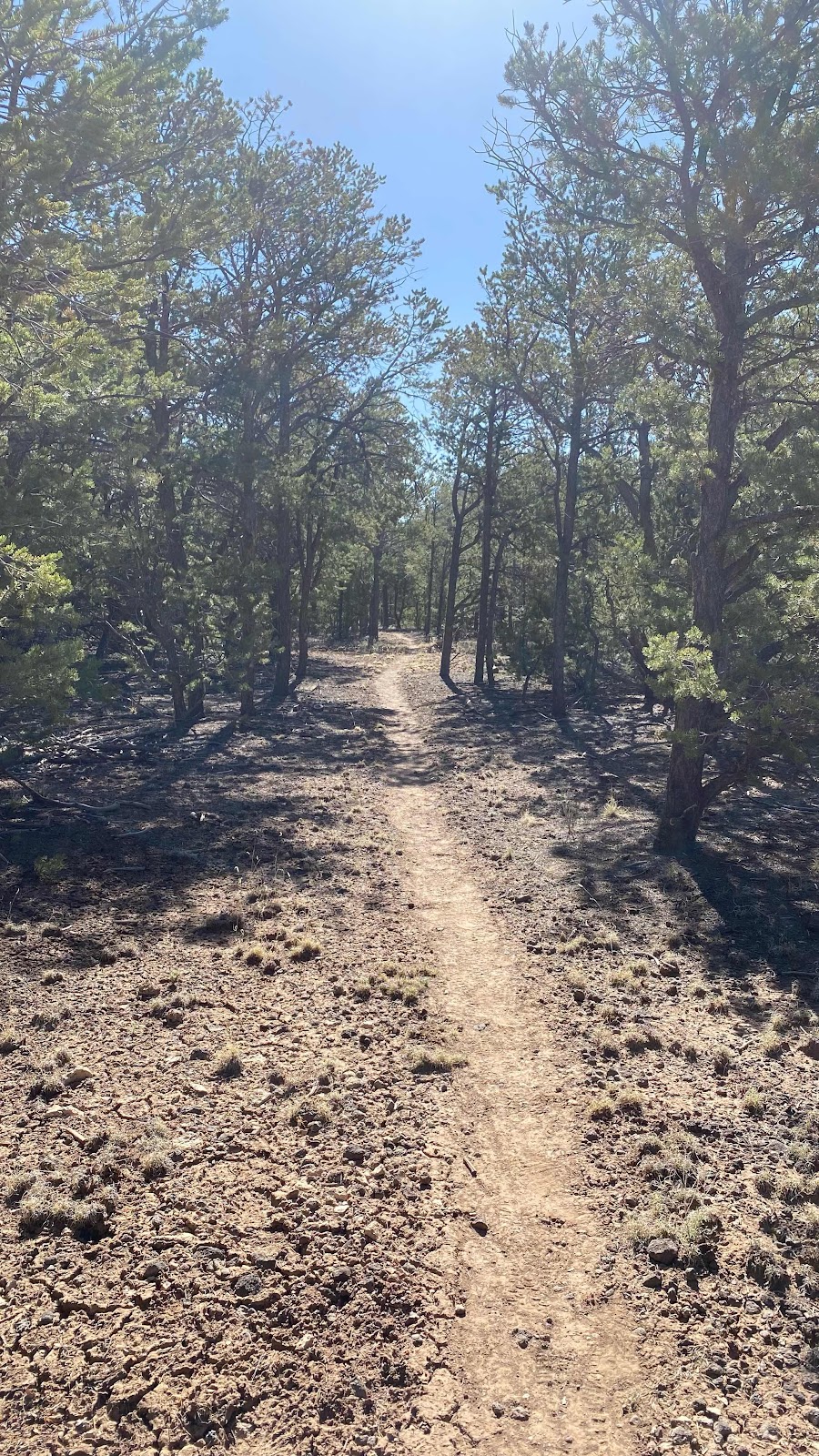
More trail
The trail drops off the plateau to the desert basin below
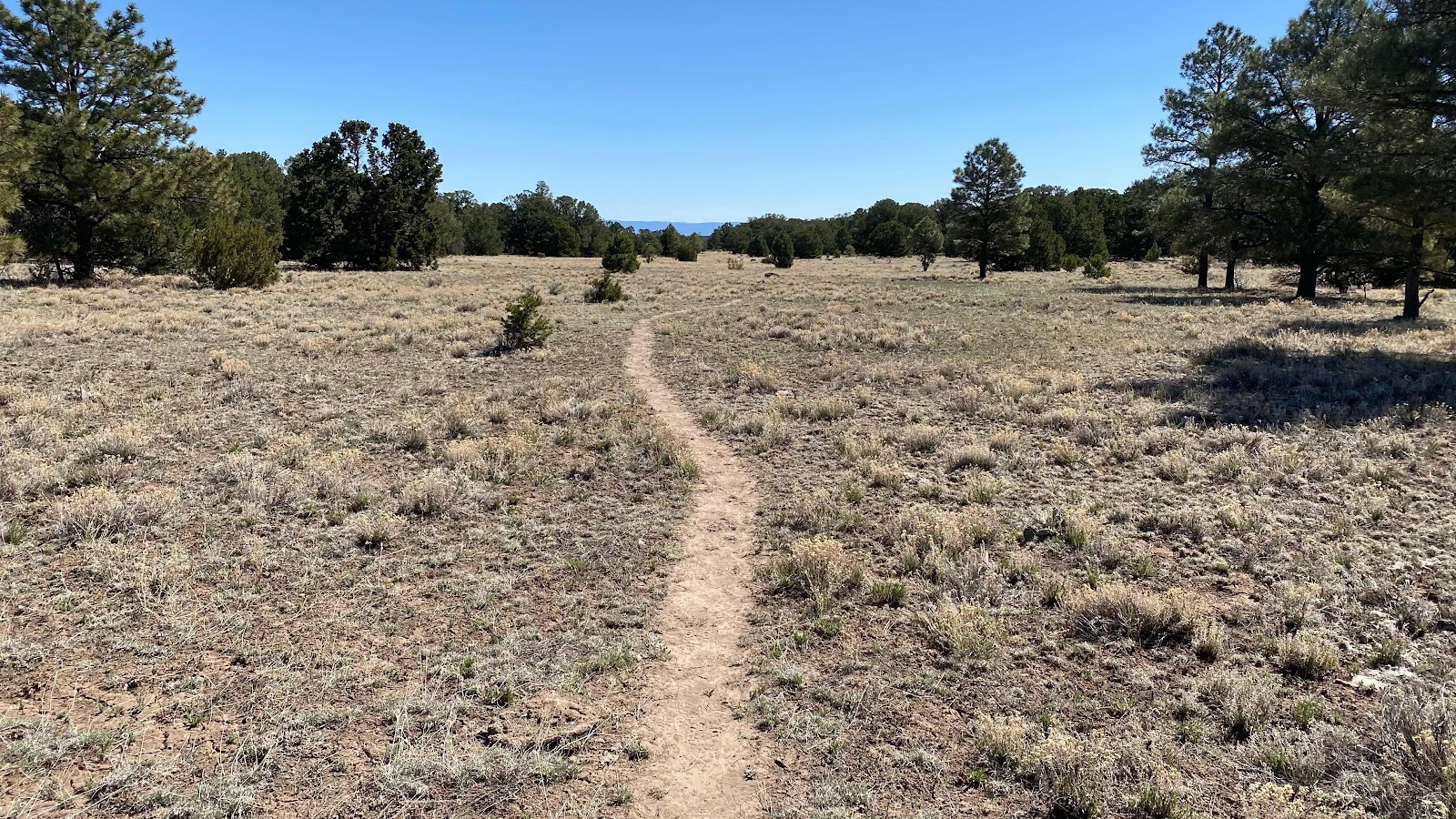
Drier and more stark once off the plateau
A cattle trough watering hole. Key water for the latter half of the day.
Hiking around the erosional work of flash floods.


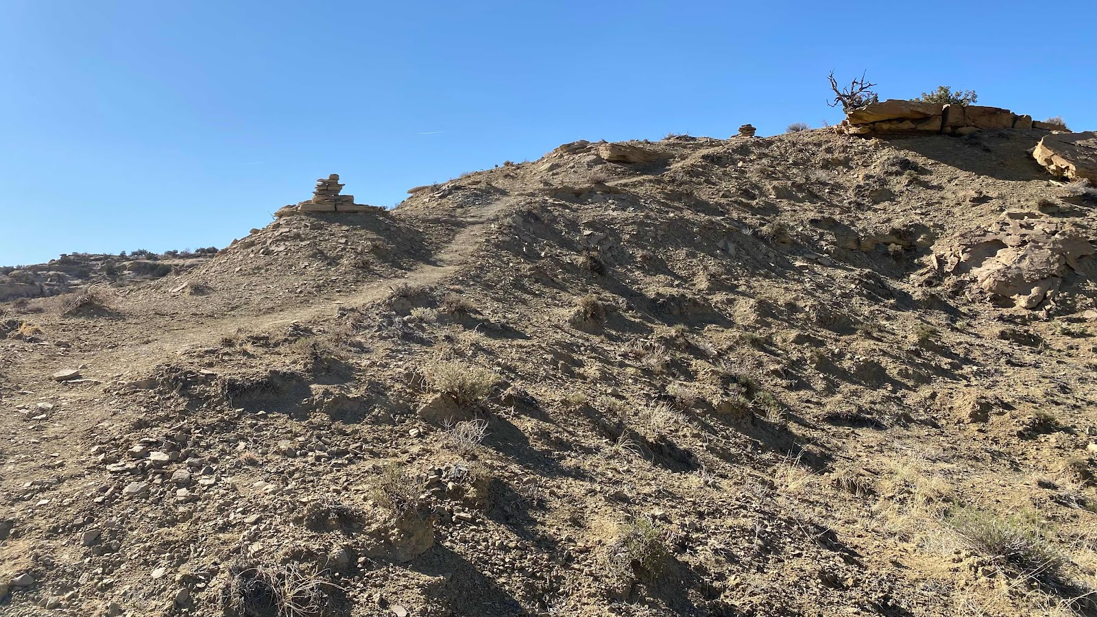
The trail regains the plateau on the other side of the arroyo.
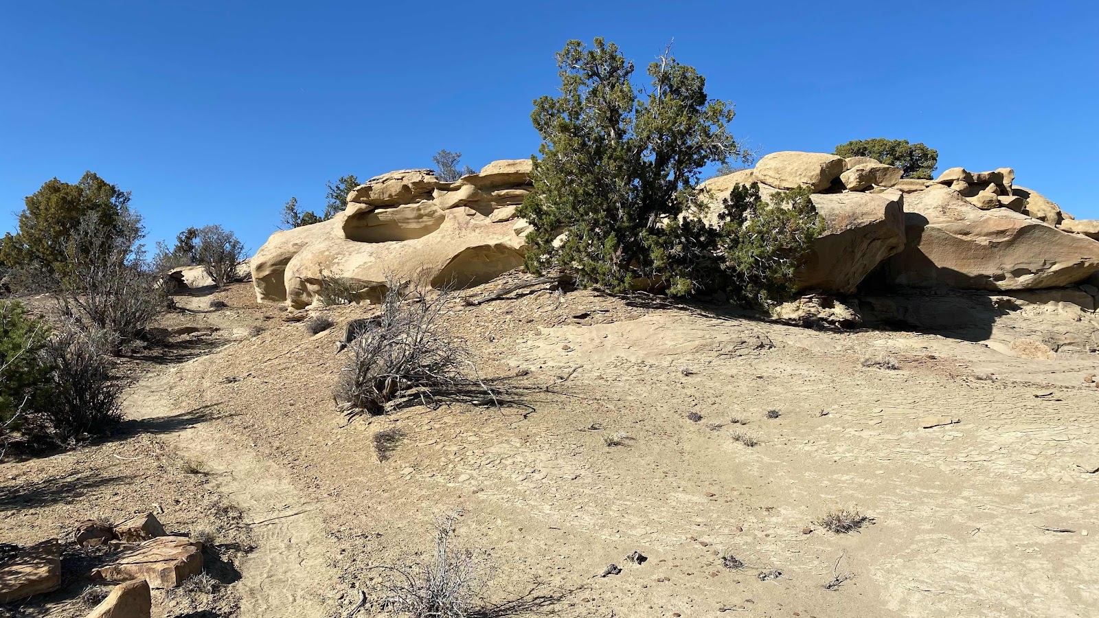
Cool sand formations on the ridge.
No comments:
Post a Comment