Thursday, June 30, 2022

Day 64 - Monday, June 27, 2022 - 16.7 miles - 53,232 steps - 23.3 miles on Silverthorne alt (City of Silverthorne) to MP 40 Of Silverthorne Alt (Bobtail Creek)- Vert Up - 5987’ - Vert Dwn - 3793’ - Total Miles to Date - 977.3

Okay!  Let’s see if three and a half days laying around improves my foot. It feel better walking around in the house, but how will that translate to actual hiking. 


I am about 3-4 miles from the trail here in Lee and Sue’s house. Best way to start this day is with a bus ride back into Silverthorne and pickup the trail where I left off, at the Econolodge. You see, the Silverthorne Alternate passes right through Silverthorne, down the highways and across major intersections. The Econolodge is right on the route. 


Unfortunately, the bus doesn’t go to the Econolodge. It drops me at the REI stop. From there it is about a mile of walking to the Econolodge because you have to get on the other side of I-70. This is done via in underpass. It isn’t until a little after 9:00am that I walk the road past the Econolodge and am in new territory. 


This is not the CDT, but the Silverthorne Alternate. No CDT signs to guide you. Trust to FarOut to guide you. The trail climbs steadily out of town gaining over 2000’. Up in the meadows the trail takes a hard right, although there is no trail there. Just cairns to follow. I don’t know why there isn’t a trail. Maybe this section isn’t traveled much and the trail never gets a chance to get beaten in?


I’m hiking alone today. Monk is visiting a friend for the next four days the scenery is spectacular. Meadows everywhere. The trail, if it exists, is a thin ribbon running across the open fields. At one point it drops 1500’ into a river valley and then climbs out on the other side. At the bottom of the valley I meet Big Gulp and Pretty Bird, a couple hiking the CDT I have not met. The 3.5 days of not hiking have thrown me in with a different group of hikers


As the afternoon advances, so do the clouds. I pick up my pace a bit, a foot race with the clouds. I am trying to take it easy on my foot, but getting struck by lightning on a ridge seems worse than a sore foot. 


Much of today is running the ridge line of Anne of Green Gables house. High and exposed. As the clouds thicken and begin to rumble I drop 1500’ into Bobcat Creek, following the faint and sketchy trail and find a campsite among the live trees. No beetle kill here. A few sprinkles fall on my tent, but that is all. 


The foot? Well, I was aware of it all day. At times it hurt, at times it was pain free. It os not where I want it to be, but it is better than when I hobbled into Silverthorne 4 days ago. I have my fingers crossed that it will improve each day rather than worsen. I have slowed my pace and pay attention to my foot placements. A few more days and I will see which way the pain trends. 


The town of Silverthorne receding into the distance as I climb the trail out of town. 


The view from Ptarmigan Pass back at Frisco and Silverthorne 


Ptarmigan Pass and the route ahead


Ridges to traverse and threatening weather. 

Monday, June 27, 2022

Day 63 - Sunday, June 26, 2022 - 0 miles - 3550 steps - zero in Silverthorne - Vert Up - 0’ - Vert Dwn - 0’ - Total Miles to Date - 960.6

Oooo. What a nasty day!  Started thundering and raining at about 11:00am and continued most of the day. I am glad I stayed put inside Lee and Sue’s house to let my foot recover more. It was a wet one. 


Jean Bruno left at 7:45am to catch the 7:58 bus to Silverthorne. The trail passes right through town. He bussed to the route and started hiking from there. I will follow in his footsteps tomorrow, with a much better weather forecast. 


What did I do all day?  Nothing. Exactly what I am supposed to be doing. Not totally true. I vacuumed, scrubbed the bathtub I have been using, cleaned the kitchen, swept the kitchen floor, took the garbage out - generally tried to erase any evidence Jean Bruno and I were here. 


Had a nice long FaceTime call with Sally. Watched a Netflix documentary on Michael Jordan. 


That’s it. 


Foot is better, by far, but still talks to me with each step. I will baby it up the trail tomorrow and in the days ahead, hoping it will heal further in spite of 10s of thousands of steps each day. We will see. 


Only about 200 miles of Colorado left, then it is the flat expanse of Wyoming’s great divide basin for 100+ miles before entering the Wind River Range. Yellowstone is a question mark due to the flooding, but it is well over a month away. Lots can change during that time. 


Onward. 

Saturday, June 25, 2022

Day 62 - Saturday, June 25, 2022 - 0 miles - 3065 steps - zero in Silverthorne - Vert Up - 0’ - Vert Dwn - 0’ - Total Miles to Date - 960.6

Noticeable improvement on the foot!! Still not good, but better is better than worse. I can walk without a noticeable limp. I still feel pain with each step, but it is a level 2 instead of level 6 pain. Time to try out this foot and see what it can tolerate. 


After breakfast Jean Bruno and I decided to go to REI and the grocery store. The bus stop is about 100 yards away down the highway. Hop on the bus and 7 minutes later I am at REI again. I needed Croakies to hold my glasses on my face. Jean Bruno needed some items at the grocery. In and out and back to the bus stop. Round trip including shopping and ride-a little more than an hour. 


Back in the house I packed my resupply food into its dry bag and then spread all the gear I’m carrying into an organized layout for a photo, all the while eyeing what I could dump to lighten my load. 


Sally called and we got her VISA account repaired so she can verify purchases she makes without the verification request coming to me. 


I’ve decided to stay one more day at the house. Instead of hiking tomorrow (Sunday) I will wait until Monday, giving my foot one more day of R&R. Hopefully, the extra day will pay dividends in the days ahead on the trail.  


Day is not over, and I am caught up with my blogging!  May add more to this one later. 


Not much to add. Talked to my brother Ken about his flying to Canada for Kenmore Air and to Andy. Mostly laying around icing my foot and watching YouTube videos, eating dinner and resting. One more day tomorrow of rest, then back on the trail and we’ll see how the foot does. 


While I had everything out of my pack I put together a photo of everything I am carrying. Here it is:


Also, here are my feet as of yesterday morning. Can you tell which one is swollen (they both look bad). 

Day 61 - Friday, June 24, 2022 - 0 miles - 1786 steps - zero in Silverthorne - Vert Up - 0’ - Vert Dwn - 0’ - Total Miles to Date - 960.6

I didn’t wake up until 9:45am!  Wow!!  Hopefully my body was working overtime to repair my foot and didn’t have enough energy to wake me. But, standing up o n it as I got out of bed told me it was not much different than the day before. 


Jean Bruno had been up for quite a while and greeted me as I came out of my bedroom. I cooked scrambled eggs with spinach and cheese and had a toasted Kaiser roll for breakfast. Then, the rest of the day was pretty repetitive. Ice foot for 20 minutes. Take ice off for 20 minutes. Ice foot for 20 minutes. Take ice off for 20 minutes. While this is going on I wrote in my blog, read the news, researched the route ahead, made phone calls, talked with Jean Bruno, etc. Very inactive. I whittled away at the $76 worth of groceries I had purchased and took a hot bath. Never left the house. But, this is what I am supposed to be doing. Focus all my energy into healing. 


I caught up on Stephen Colbert monologues in the evening and was asleep by 10:00pm. Hopefully my foot shows improvement by tomorrow morning. Stay tuned. 


No photos.

Day 60 - Thursday, June 23, 2022 - 10.3 miles - 31,206 steps - (small lake at 12.9 miles on Silverthorne Alternate) to 23.3 miles on Silverthorne alt (City of Silverthorne)- Vert Up - 909’ - Vert Dwn - 3442’ - Total Miles to Date - 960.6

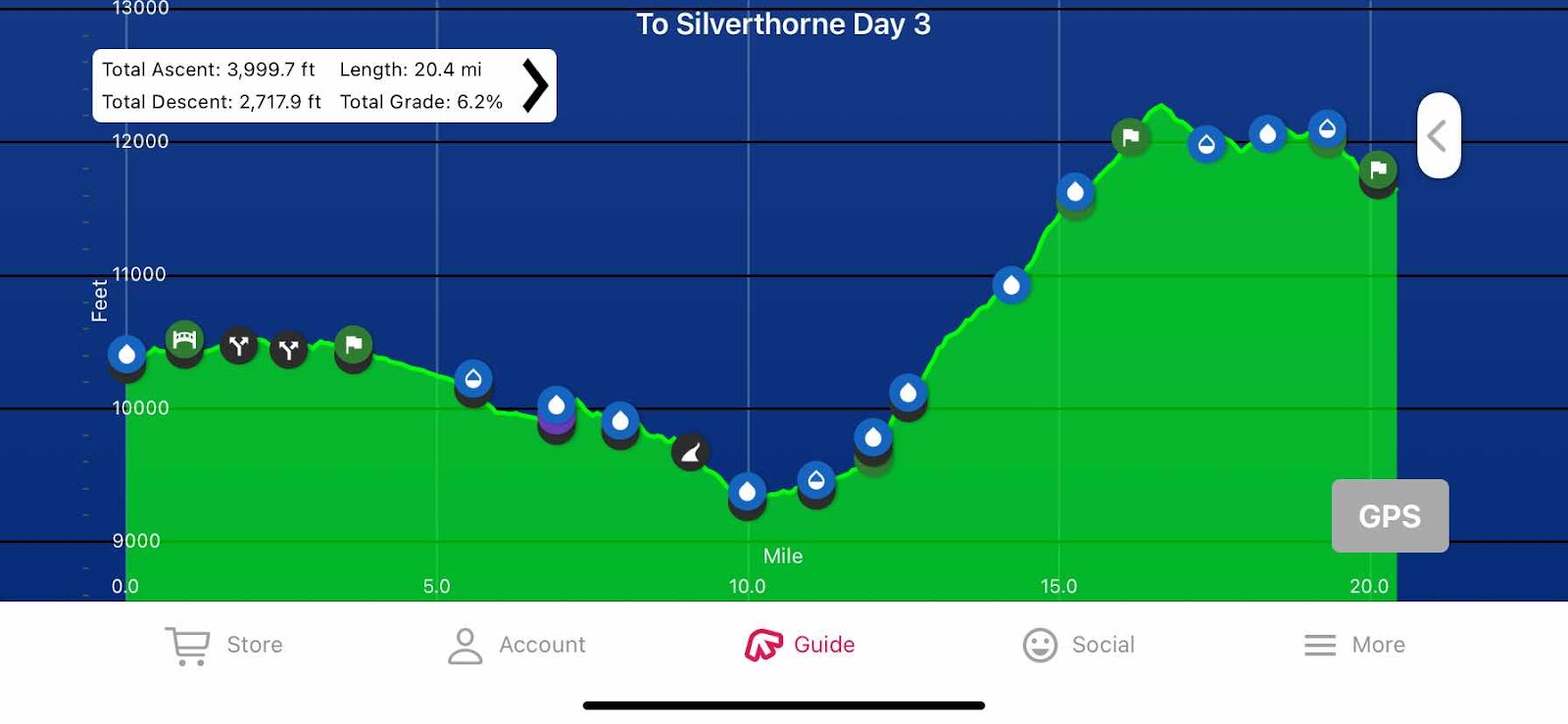
Just 10.3 miles to Silverthorne. If I average 2 miles per hour, just 5 hours to get there. If I get up and out by 6:00am I’ll be in town at 11:00am. This will give me a nero today, coupled with two zeros. That is some serious rest, and surely needed. 


I set an alarm on my watch for 5:15am just to make sure I got up and moving. This is day 60 so the routine is pretty well established. Sit up in bed, put on fleece and puffy, start stove. While water for oatmeal is boiling, deflate pillow and stuff it. While oatmeal is rehydrating (or whatever it does) deflate air mattress and roll and stuff. Eat breakfast. Rinse bowl. Stuff Zpad into pack. Brave the cold by getting out of my quilt and stuff it, then stuff everything in pack and move it out of tent. Shoes on. Disassemble tent, stuff in outside pocket of pack. Look around to be sure I didn’t leave anything. Start walking. 


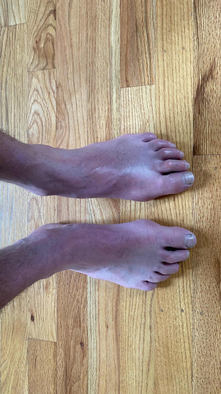
This is where things got different. I could barely walk. My left foot was very sore and hurt with each step. I limped up the trail like Walter Brennan. I thought, at this rate I will never make it to town. I’m too slow. 


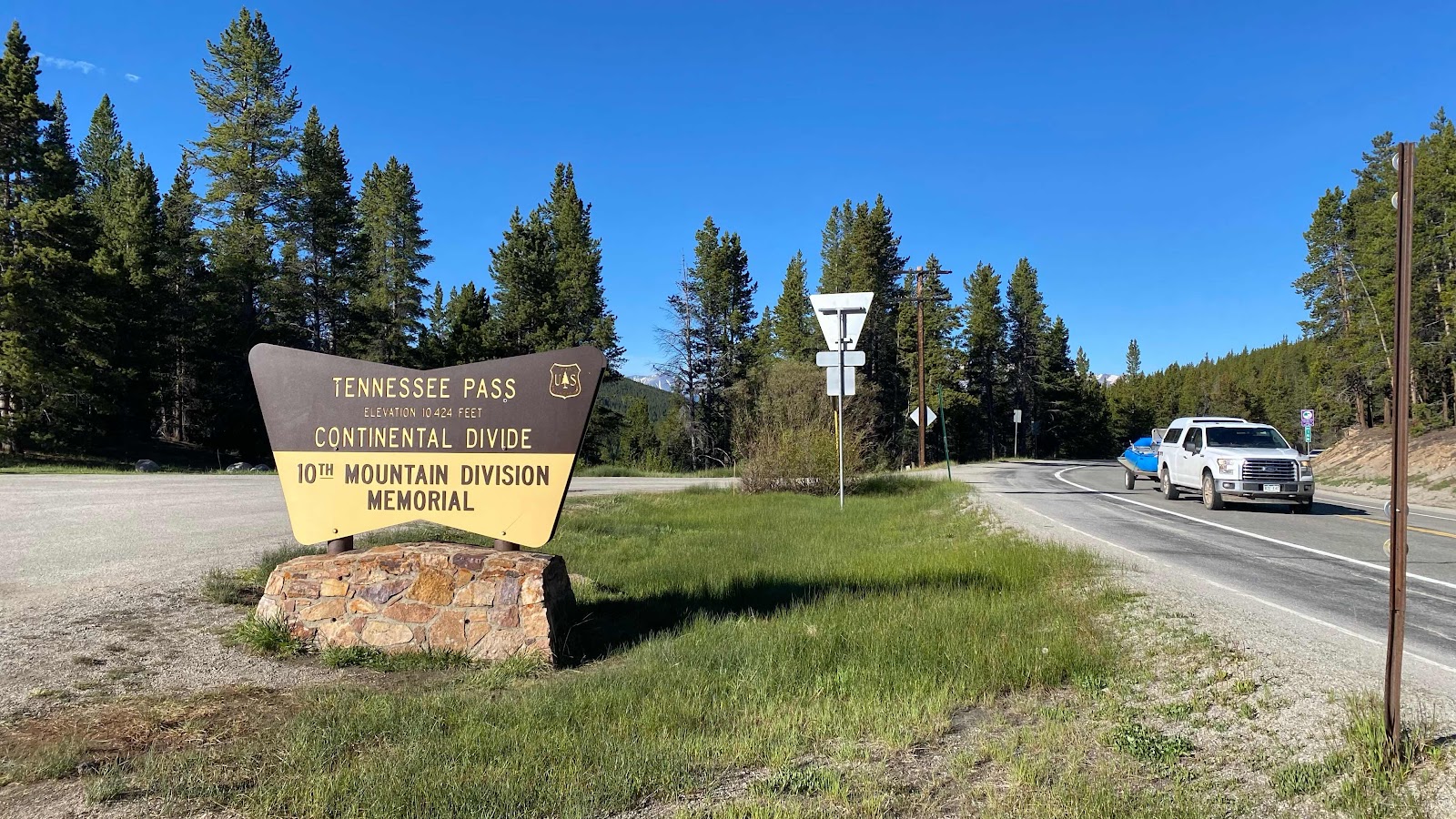
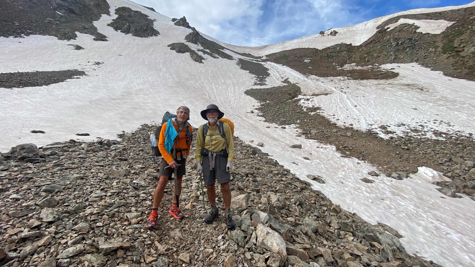
I worked my way up the trail, hobbling along, hoping my foot would eventually warm up. I made it up to the pass, my pace quickening a little. To my surprise, my watch said I was doing just under 2 miles an hour. I didn’t think I was moving that fast. 


Somehow, downhill is easier on my foot. Something about bending the foot when going up hill or on the level creates the pain. Downhill doesn’t require the ankle to bend forward. Luckily for me, it was steadily downhill all the way to town, except for two small rises. By mile three my foot was warmed up or numb to the pain and I was able to walk normally, although the foot was talking to me with each step, not yelling, just talking. 


FarOut’s accuracy was as bad today as yesterday. The actual trail was a dotted line on the map on FarOut, not the line they gave us as a guide. I followed the trail and it took me where I wanted to go-Silverthorne. 


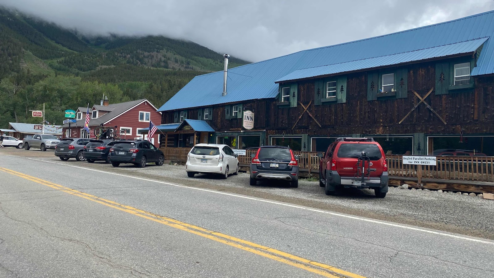
I contacted Dallas about five miles from town when I was on a bluff overlooking the valley with the town in the distance. I got signal. Somehow Magic Mike had scored a car for a few hours and could drive us around to do errands. Is that why he is called Magic Mike?  I reached the trailhead two miles from town a few hours later and started walking the roads and highways to the Econolodge where Dallas has been zeroing the past two days. Again, I must be a sight walking the streets of this bustling little town in filthy clothes, pack with ice axe attached and brimmed hat while everyone else cruises in their cars, showered and clean. I stopped at a 7-11 for a soda, then continued up the hill to the Econolodge, texting Dallas I was here. She greeted me in the lobby and we walked back to her room. We caught up a bit (haven’t seen her since May 12) and I took a quick shower in her room to try to lessen my smell in the enclosed space of a Magic Mike’s borrowed car. He was on time at 11:50am and we met him outside the lobby. 


What a luxury, and a necessity with my foot. We drove to the post office where I picked up my resupply mailed by Andy. Dallas and Mike mailed some packages home. Then to REI and the grocery store right next door. Rain cover for my pack ( mine is so old all it does is let the rain in and then doesn’t let it out) and a handkerchief to replace the one I’d lost, then to the grocery store for food for my zeros. Three grocery bags full!  Glad I am not trying to carry all this stuff on a bus! Finally, to lunch at an outdoor restaurant, burger and fries, then Mike drove me to Lee and Sue’s house. I found the hidden key, but just then Jean Bruno (Blue Rabbit) opened the door. He had lost his phone for a second time on this adventure. He slipped off a log while crossing a stream and his phone fell out of his pocket into the current and was swept away. He searched downstream for an hour and couldn’t find it. It wasn’t waterproof to boot. 

He had to hike back 10 miles. Lucky for him to have it happen here where he can stay at Lee and Sue’s house. He ordered a new phone on Amazon, but it took 4 days to get here. He has been just hanging out at their house waiting. This messes up his plans. He is a high school teacher back in France and must return to work September first. There is now no way for him to complete the trail. He is hoping to get through Yellowstone before he has to go home. 

Jean Bruno showed me around the house and I selected a bedroom (there are 5) just off the living room up half a flight of stairs. I stripped and put on my rain gear, then put all my clothes in the washing machine in the basement. Next, a hot bath and then ice for the foot, 20 minutes on, 20 minutes off for the rest of the day. Outside it was storming. Lightning and thunder and intermittent heavy rain. It felt nice to be in a very comfortable, dry house looking out at the tempest. 


I had a bagged salad for dinner and Jean Bruno shared half his vegetarian pizza with me. His English is very broken, although compared to day one when we rode together to the border In the same truck, he is now fluent. He is tracking his shipped phone online and it should be here tomorrow. He is a good housemate, cleans up after himself and really takes good care of the house. 


I inflated my air mattress and slept on the floor, not wanting to soil sheets and have to launder them and pillow cases. My mattress is super comfy, so no sacrifice there. 


Maybe I was keyed up, or was it the electric lights?  I didn’t fall asleep until 2:00am!  I am usually asleep by 8:45pm, 9:30pm at the latest. Monk had been extolling the wonders of the film Jeremiah Johnson so I rented and watched it on my iPhone. Meh. It was okay, not bad, but too Hollywood for me, to cliché. 


Can my foot heal in time for me to start hiking again on Sunday?  I don’t know. Hopefully, time will slow and the healing process accelerate so I can get back on the trail. Until now, I am right on the schedule I planned back in January and February, finishing in Glacier National Park at the Canadian border September 15. Come on Foot, heal!!


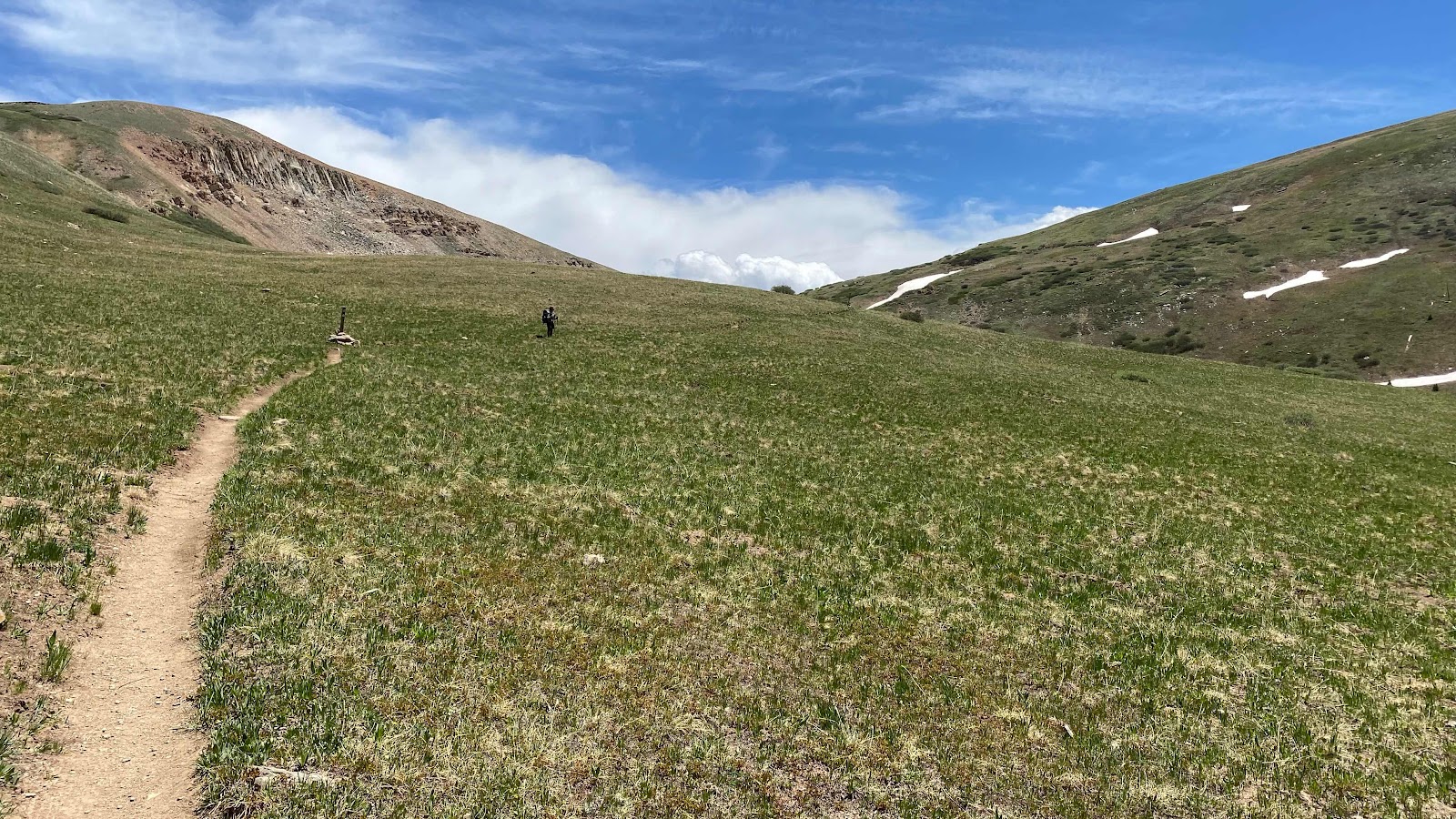
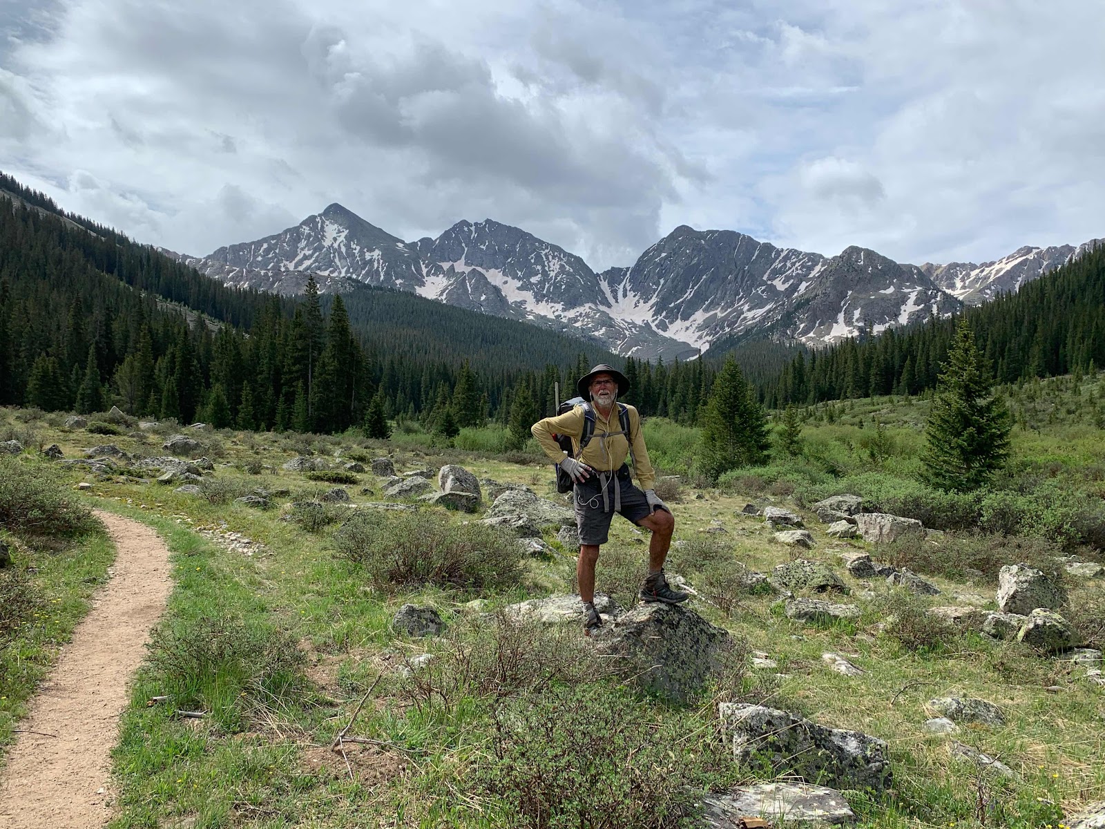
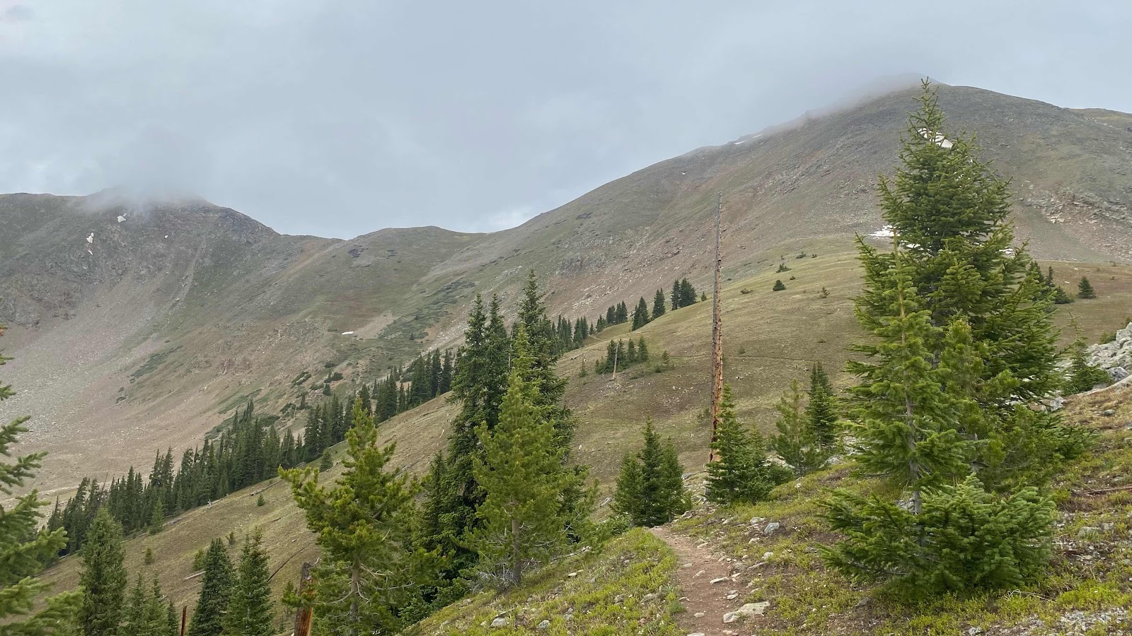
Again, beautiful meadows, this time at sunrise as I hobble up the trail. This is looking back south at where I have been. 


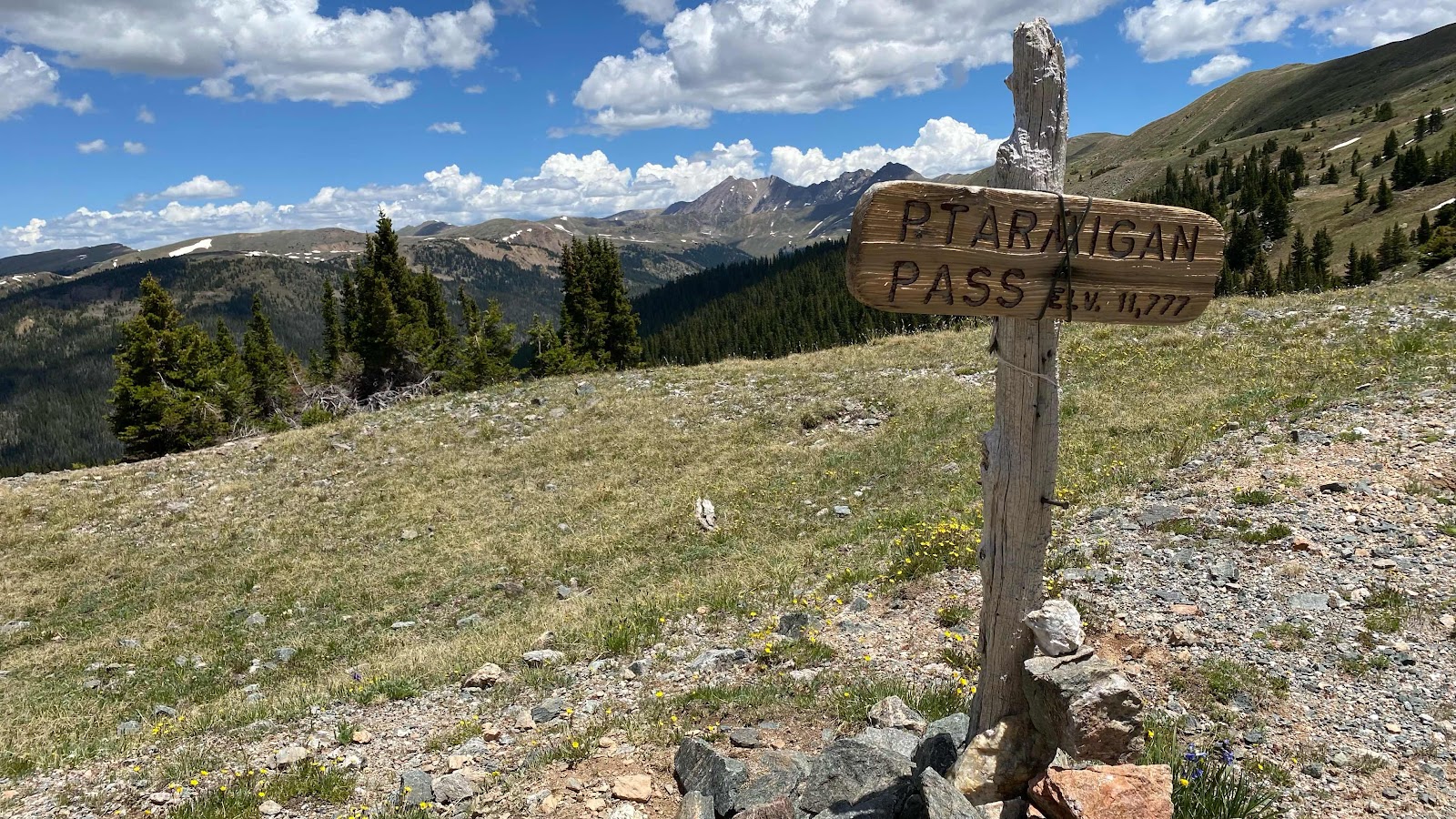
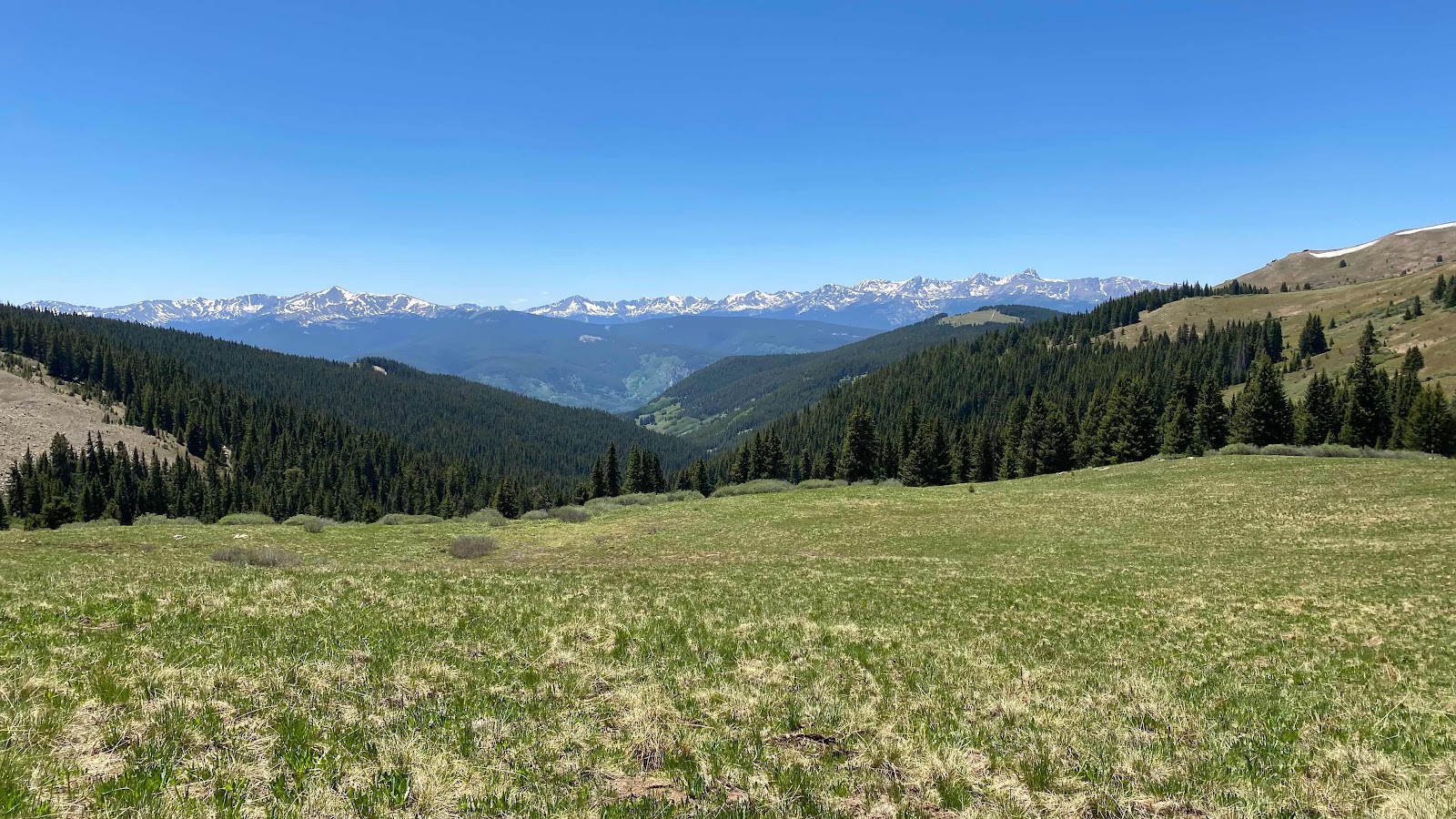
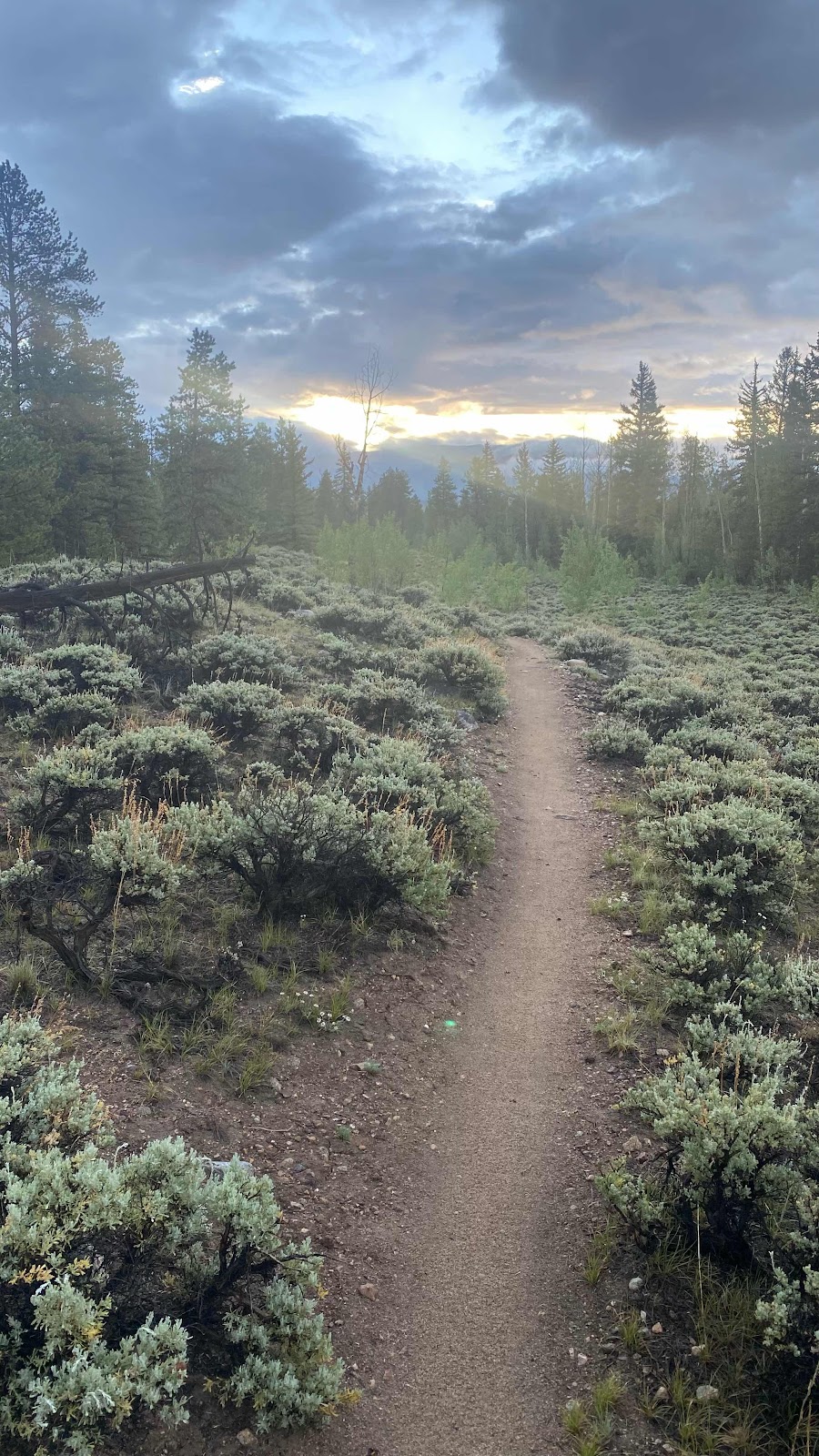
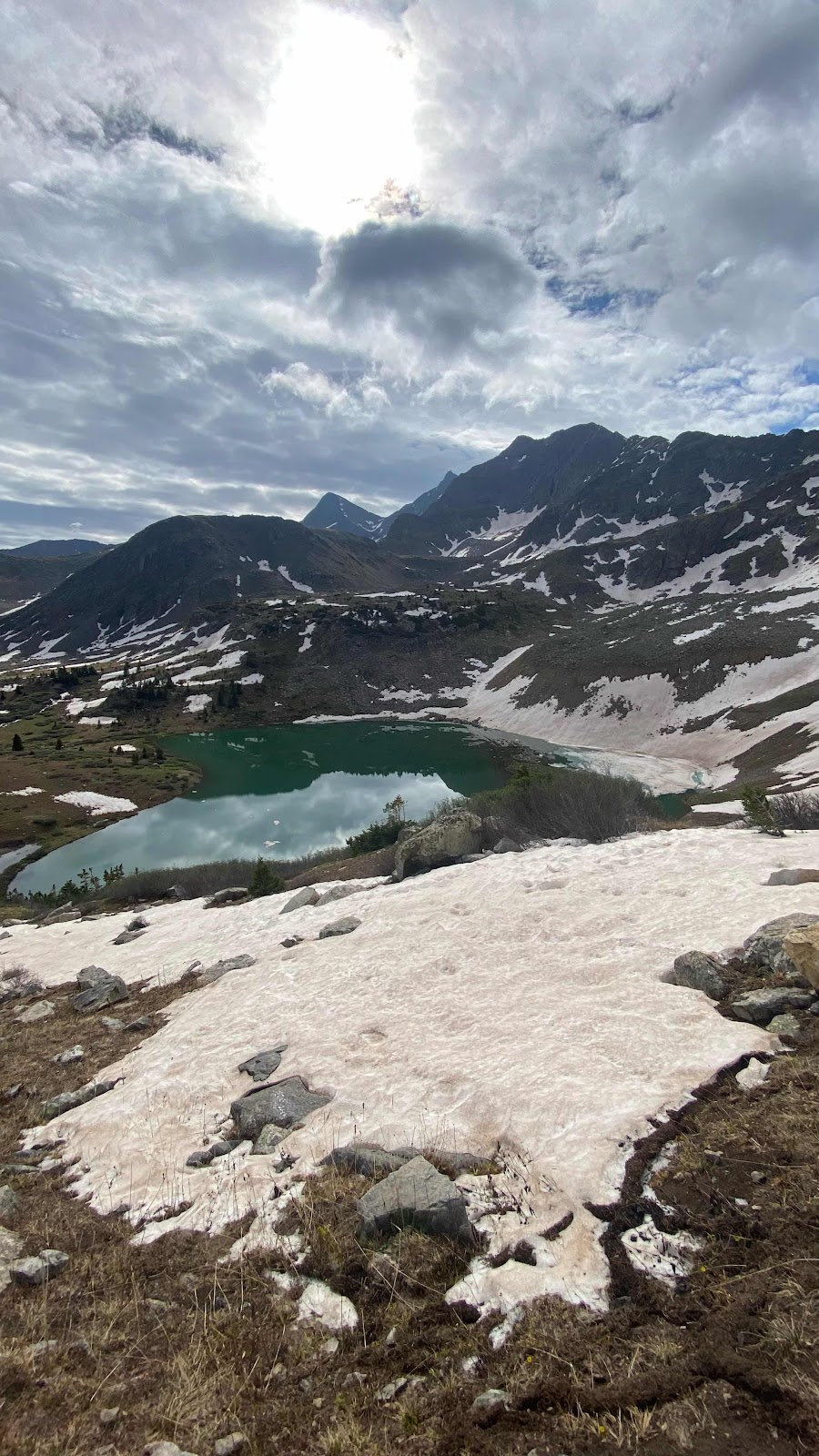
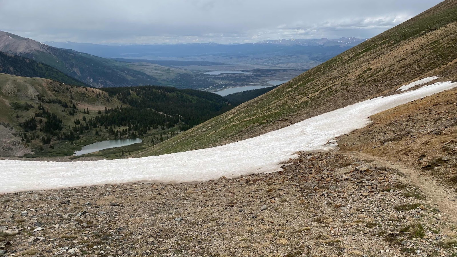
Looking north from the same pass, my route leads across this meadow and then drops down the valley to the right to Silverthorne, out of the photo. 


The Glacier Lillies are out in force. They are first to bloom, sometimes pushing up through the snow. 


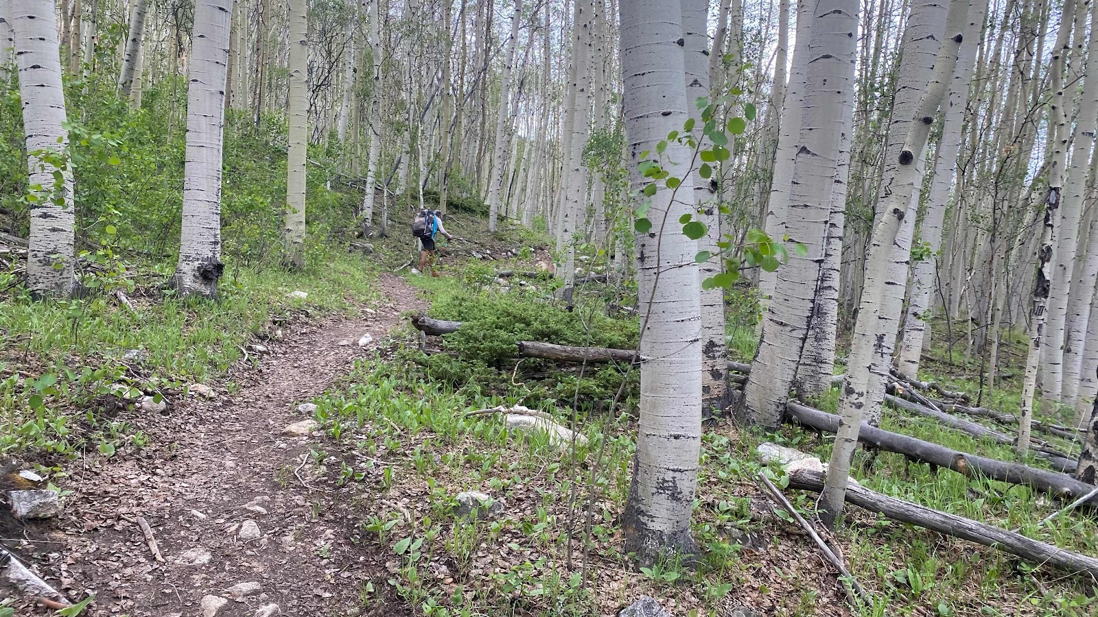
So many downed trees. Sometimes it is walking through a horizontal forest. 


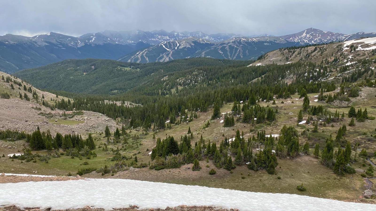
Lush vegetation and flowers along the trail with Silverthorne in the background. I’m about three walking miles from “downtown” in this photo. 


My road walk in the outskirts of Silverthorne. It is set so beautifully in the mountains, ringed by peaks that still have snow on them. They will be snow

free in a few weeks. 


Living space of Lee and Sue’s house. It is such a beautiful place. Jean Bruno and I are racking our brains about how to thank them sufficiently. 


Kitchen, dining and great room area. What a comfortable and elegant house. 


Their home from the street. 


Friday, June 24, 2022

Day 59 - Wednesday, June 22, 2022 - 19.0 miles - 50,785 steps - MP 1195 (meadows below Sugarloaf Peak) to (small lake at 12.9 miles on Silverthorne Alternate) - Vert Up - 3961’ - Vert Dwn - 4322’ - Total Miles to Date - 950.3

In an attempt to stop the increasing pain on the top of my left foot I am now hiking with that shoe totally unlaced. To be truthful, it takes about half a mile for me to start walking with a steady gait. Before that I must look like a marionette manipulated by a shivering puppeteer. I awkwardly stagger down the trail trying to get all my parts synchronized into what approximates a “normal” walk. I think I need a zero day, or two. And, as luck would have it, wonderful Sue and Lee have offered to let me use their house in Dillon (Silverthorne) to take a couple days off. Just 30 trail miles to go. 


I got out ahead of Monk, but he quickly caught this disjointed walker. Copper Mountain Ski Resort was just 6 miles down the trail. I scurried along in Monk’s wake, keeping up for the most part, but he had to stop periodically for me. We dreamed of a big waffle or pancake breakfast at the resort. We started crossing ski runs about two miles out from the base area, hiked under a roller coaster type luge track, by the remnants of last winter’s half pipe and finally dropped down to the village at the base of the lifts. We asked some employees about breakfast-nothing open was their reply-except for Starbucks. 

We found Raider, Pitch, Rooster and ET on the

couches at Starbucks, chatted for a few minutes and then had a breakfast burrito and tea. Outside both Monk and I called home and friends. Then it was time to part. Monk was hiking on the redline over to Breckenridge, then up and over Grays Peak and down to Hwy 90 where he is meeting a childhood friend he has not seen in 42 years. He will stay with her and her husband for 4 days. I am taking the Silverthorne alternate north to that town so that I can stay at Lee and Sue’s house for three nights, a double zero. The pain in my left foot makes this all that much more important as I need to get it healed up to carry on. 


Again, when close to mechanized civilization, I begin to feel the absurdity of our ability to move around on this planet and how much we take it for granted. I am sitting outside Starbucks at Copper Mountain resort enjoying my tea. To get to Silverthorne it is 12 miles via Interstate 70, about a 12 minute drive.  It is where I am hiking to. Via trail it is 24 miles. It will take me 24 hours, 14 miles this afternoon, camp for the night, then 10 miles in the morning. I could be in Silverthorne by car faster than I can walk out of the Copper Mountain resort complex. What a weird juxtaposition of space and time. 


While walking out of the complex I FaceTimed Andy. Good timing. He was planning his logistics of getting to the trail to hike with me in Wyoming. All the calling was killing my battery. I was down to less than 20% and it wasn’t noon yet. Glad I have the solar panel draped over my pack charging my external battery. 


On my way out I passed a convenience store and stopped in for a soda and some chips to eat with or for lunch. Walking around all these tourists, locals and cars with my hat and pack on and 8 days of stink and dirt make me feel very out of place, like Jed Clampet in Beverly Hills or Crocodile Dundee in New York. Just need a 14” knife hanging from my belt. 


Soda and chips eaten at an outside table, I headed for the overpass across I-70 and then onto a trail paralleling the freeway on the opposite side from the resort. Soon it began to climb and carried me away from the noise and bustle. I climbed 2200’ in 6 miles to a beautiful pass in the meadows, then descended through the forests before beginning the next ascent to the next pass. 


FarOut, the mapping and navigation program on my phone is usually spot on, so much so you can zoom in and find which side of the trail you are on when it is covered with snow, then use it to guide you back to standing right on the trail under the snow with uncanny accuracy. However, today it is not accurate at all. It may be that being on an alternate route they just didn’t put the time and effort into getting it right. In the graphic below, my route is supposed to be the lime green line. 


As you can see, I am not on it even though I am walking on the only trail in the area.  If the trail is snow free this discrepancy is not important, but if the trail is snow covered then it is not possible to know which way to go to get on the trail again. As I hiked I watched my phone and saw that the actual trail is not FarOut’s line, but the dashed line, which as I walked the trail I followed perfectly. Once I understood this error on FarOut’s part I was comfortable following the trail, knowing I would be on the dashed line rather than FarOut’s lime green route. The dashed line always made it back to and crossed FarOut’s line. 


I climbed up to a meadow with a lake indicated on the map and set up camp.  I had gone 19 miles for the day, about 6.4 before Copper Mountain and about 13 after. Other than a couple day hikers I had not seen another person on this trail. I snuggled into my tent, cooked dinner and finished one of my many delinquent blog entries, then nestled into my quilt and blissfully went to sleep. So warm and comfortable. 


An update on the saga of my inflatable sleeping pad. Last night in the meadow with Monk it went flat on me again. Luckily, I still had my Zpad under me, so I was not sleeping on the cold ground. Upon inspection in the morning, I saw that my patch had come off. Same hole as before is leaking air. I put a new patch on and covered it with a bigger piece of overlying vinyl. Hopefully, this one will hold. I was toying with the idea of sending my Zpad home and just using the inflatable, but when it goes flat, I reevaluate my sleeping pad position. For now I will pay the weight penalty (14 oz) and carry both pads. The inflatable for its unmatched comfort and the Zpad for its insulation properties and inability to go flat. 


The beavers throughout the Rockies have created linked pools down most river valleys where once a river ran quickly. This picture shows three such pools. They create habitat for moose and fish and hold water longer into summer. Amazing creatures. 


Passing under a chair lift at Copper Mountain with I-70 in the background. 


A portion of Copper Mountain village. 


The front half of Copper Mountain as seen from the trail on the opposite side of I-70. 


Both front and back sides of Copper Mountain are visible from the top of the first pass. Spectacular meadows but less spectacular weather. 


Day 58 - Tuesday, June 21, 2022 - 20.4 miles - 52,033 steps - MP 1174 (North Fork West Tennessee Creek) to MP 1195 (meadows below Sugarloaf Peak) - Vert Up - 4000’ - Vert Dwn - 2684’ - Total Miles to Date - 931.3

June 21st is remarkable for many reasons. Viewed from earth, it is the day the sun reaches its’ highest point in the northern sky. It is deemed the first day of summer. It is called the summer solstice. It is the longest day of the year in the northern hemisphere, the shortest in the southern hemisphere. It is Jeff and Jackie’s anniversary, also Joel and Hailey’s. But most importantly, it is National Hike Nude Day for thru hikers. I am not sure Congress condoned this National holiday and I have seen few participants. But today, 70 Pound Hammer hung on there and proudly carried on the tradition. With nothing more than his socks, shoes, his pack and a fanny pack he braved severe chafing, frostbite and sunburn in areas where the sun don’t shine to carry on this noble tradition. 


Looking at the profile of today’s hike, you can see the first ten miles are, for the most part, gentle downhill. All of it is below 10,500’. This means it is in the trees, following the south fork of the Eagle River. Much of it parallels the Tennessee Pass Highway. It is the last part of the day, miles 10 to 16.5 that the work occurs, with a 3000’ climb. After that, the trail stays high and undulates up and down across alpine meadows with spectacular views. 


The first excitement of the day was at Tennessee Pass, about three miles from where we camped - Porta Potties! I had left camp about ten minutes before Monk, yet when he caught up with me I was still in the Porta Potty, or as he referred to it, “my office”. Sometimes it’s nice to sit and do business instead of squatting in the woods. 


The trail didn’t cross the highway at the pass. It just poked out of the woods to say hi, honor the Army 10th Mtn Division, then ducked back in and ran parallel to it on the south side for three more miles before crossing it. 


Tennessee Pass was home to the 10th Mtn Division during WWII.


Once across, it continued to parallel it. Unusual for Monk and I, we were walking together. We were chatting about anything and everything, politics, car repair, building, relationships, kids, etc. A pleasant way to spend a morning. 


At one point the trail, now quite high above the highway, maybe 150’, came out on a rock promontory overlooking the road. There was a wooden bench that was begging to be sat on. We obliged. While snacking, 70 Pound Hammer  walked up and greeted us. We turned around to say hi and saw that he was honoring hike nude day. We were in the shade, it was 10 am and we were at about 10,000’. My first thought was, “He must be freezing!”  He chatted for a few minutes, then admitted to getting cold and headed down the trail. After our leisurely break at the bench, we followed. 


70 Pound Hammer honors National Hike Nude Day - June 21 - The longest day of the year. 


The trail rounded the end of a ridge and entered the East Fork of the Eagle River, heading up stream as compared to downstream on the South Fork. At the confluence sits the ruins of Camp Hale, the training center for the US Army 10th Mountain Division. The camp facilities were established in 1942 and decommissioned in November, 1945. We hiked past what looked like concrete bunkers for storing ammunition. Here we found Hammer again, smoking some weed and warming himself in the sun. Monk remarked that he looked like the last surviving holocaust victim that didn’t know the war had ended and snapped the amazing photo you see below. 


70 Pound Hammer wondering when the war ended


Now the trail started to climb gently up the East Fork river bottom before abruptly angling up the side of the ridge toward Kokomo Pass.  We passed a YCC trail crew grooming the trail. We broke out of the trees at 11,600’ and climbed through gorgeous alpine meadows to reach Kokomo Pass. 


Monk, as usual, up ahead of me as we approach Kokomo Pass


Every point of the compass shows snow capped mountains. These are viewed from the meadows below Kokomo Pass. 


The first thing one sees upon reaching the pass is a view southeastward to a mountain that is half missing, roads bisecting it’s surface and tailings and holding ponds below. A copper mine. It is quite a jolt to see at (a) this altitude, (b) surrounded by such beauty and © so unexpectedly. But, I am sure this phone I am typing on has copper in it as do all my charging cords and every electronic device I own, not to mention my house, cars, power lines, etc. so I can’t be too judgemental. But does it have to be here? And can’t we recycle more and buy less?


Kokomo Pass with Copper Mine in the background. 


Monk found a nice spot to sit in the lee of the ridge where we enjoyed the view and saw a few elk scampering through the willows half a mile away. Hammer, now wearing shorts due to chaffing, and Kyle, soon joined us. 


The trail undulated along the ridge top toward Searle Pass (think the ridge line of Anne of Green Gables in the previous post) for a few miles before beginning it’s descent into Guller Creek which leads to the Copper Mountain Ski Resort, but I get ahead of myself as we won’t get there until tomorrow. 


The trail heading toward Searle Pass about two miles distant, undulating through gorgeous alpine meadows, occasionally crossing snow fields and muddy spots due to snow melt. 


Before we began our plunge into Guller Creek we stopped on the ridge in the meadows and found a flat spot near a creek to camp. It was earlier than usual to stop, but 20.4 miles was a good distance, the views and scenery were magnificent and my left foot was bothering me more than normal. I think in an effort to keep up with Monk I have been walking faster than my normal pace and straining my running gear, in this case the top of my left foot. I iced both feet in the nearby snow melt creek (cold!) to calm them down.


Our cowboy camp in the meadows. Life is good. 


It was a beautiful sunset with clear skies, although clouds loomed to the east, a harbinger of a weather change on its way? Another glorious day on the trail. 

Thursday, June 23, 2022

Day 57 - Monday, June 20, 2022 - 22.8 miles - 61,062 steps - MP 1151.2 (Elbert Creek) to MP 1174 (North Fork West Tennessee Creek) - Vert Up - 4950’ - Vert Dwn - 4708’ - Total Miles to Date - 910.9

Imagine Anne of Green Gables house. Standing in front of the house the ridge line at the peak of the roof runs left to right. Then there are the gables poking out at regular intervals directly toward you, for today’s hike let’s imagine three of them. The ridge line represents the Continental Divide. It would be easy to walk the divide if the ridge line of the Rockies was as straight and level as Anne’s house. But it is not. The ridge line is jagged rock climbing to highs and plummeting to lows, unsuitable to try to construct a trail on. So, instead the trail is moved down from the ridge line to either the west side or the east side depending on which terrain is most suitable for a trail. But then there are those darn gables. The trail climbs up the side of one gable, down the other side, up over the next and then down its other side and so on. How many ups and downs? Depends on how many gables (ridges) protrude from the roof (main Rocky ridge line) and how far you hike during a day. Those gables (ridges) are the left overs after glaciers and rivers ravage the areas between them. Some valleys are steep and deep, some gentle and shallow. But to hike the CDT in Colorado you climb out of and drop into each one. And at times you climb over the divide itself and clamber up and down the gables on the other side. Such is the CDT in Colorado. And that is why the vert up and down is always in the 4 to 6 thousand foot range. Today, we climbed and descended three gables, er, I mean ridges and traversed the valleys between them. 


I left camp before Monk and walked by the tents of the family. Not a peep. All asleep?


We passed through two wilderness areas today, the Mount Massive and the Holy Cross. Today was a blur of stream crossings and traversing on the Atlantic side of the divide. Except for three high ridges that afforded territorial views, we were in trees most of the day. On one of those ridges we met Raider, a 55 yr old ex-marine survival school instructor and his tramily of Pitch, Rooster and ET. Monk and I had been enjoying the view, which included Leadville, and talking for 15 minutes when they arrived. We chatted a few minutes with them, gave them a minute or two head start and then headed down ourselves. 


Both of us wanted to up our mileage game a bit, so we set our sights on the West Fork of North Tennessee Creek, 22.8 miles for the day. We searched for good camping in this wide river bottom and found a spacious area that would have accommodated 20 tents. The mosquitoes were thick, but Monk braved the onslaught to sit outside my tent and show me photos of his work outfitting the inside of his sister-in-laws pizza restaurant and bar in Atlanta. His work is incredible. The interior is warm, inviting and very eye catching. The centerpiece is a 26’ bar he constructed. 

Because we were in the bottom of a valley and cold settles, it got cold quick and stayed cold all night. A little ice in my water bottle in the morning. But a good night’s sleep and a great day. 


Every river valley is terraced into standing lakes by the beavers. The dams are old enough to have full size trees growing out of them. This beautiful dam and beaver lodge caught our eye. 


Sometimes you have to turn around, no matter how many miles you are trying to make. This mountain scene would have gone unnoticed had not Monk glanced back over his shoulder. 


The Rocky Mountain on the far left background is Mt. Elbert, over 14,000’ tall. We hiked under its flank this morning where the family was camped. Lots of gables between us and there. 


Monk waits for me to catch up. Nice place with a beautiful view. 


FarOut shows me on top of one the gables. 


Our campsite. Monk’s tent still pitched as I leave early. One difference between here and 40 miles back, all the standing trees here are alive. Back there they were all dead and dangerous to sleep under. 

Day 56 - Sunday, June 19, 2022 - 16.1 miles - 46,647 steps - MP 1135.3 (South side of Twin Lakes to MP 1151.2 (Elbert Creek) - Vert Up - 2332’ - Vert Dwn - 1485’ - Total Miles to Date - 890.5

Well, it rained most of last night. At least off and on. Damp everything this morning. I love the feel of damp nylon (Not!). Quick breakfast of two packages of instant hot oatmeal, then pack up and finish what I started yesterday, the ten mile hike around the lake. I was quite certain I would run into Monk this morning as he was ahead of me on this trek around the lake. But I didn’t. Somehow I missed his tent pitched near the trail. 


The trail passes through an old resort from around 1885, Interlaken. Many of the old buildings have been restored. All had to be moved up the slope when they raised the level of the lake with a dam. Even though it was raining, I spent a few minutes walking around the buildings and went inside the owner’s old house. There are a few photos below. 


It was Sunday morning and as I approached the end of the lake I found many people car camping. I had started hiking just before 6 and it was now maybe 7:30ish. I walked across the dam at the end of the lake and started up the other side. My destination was the small town of Twin Lakes.  My resupply box had been sent to the grocery story in town by Andy. However, I was a little anxious it would not be there. In FarOut, the owners of the store had posted a note saying it was taking 2 to 3 weeks for packages to get there because the post office in Buena Vista was understaffed and couldn’t get the mail shipped out. I had mailed a package to myself from Salida five days ago and Andy had mailed my food supply about the same time. It took me four hours to walk the 10 miles around the lake. Four hours to contemplate my missing food and air mattress. 


At about 10:00am I walked into town. Puddles greeted me with a big hello. We chatted for a few minutes, then I went in to see if by some lucky stroke my boxes had a made it. The owner said things had improved since that post he made in FarOut and walked into the back room to see if any of my stuff was there. He returned with two boxes, one spray painted yellow for easier identification and the little box holding my inflatable pad. What luck!!


I bought a Coke and a ice cream sandwich and took my boxes out to my pack, then sat with Puddles and a couple other hikers and drank my pop and ate half my ice cream sandwich when I realized Monk said he was going to get breakfast at the Inn. I walked to the inn and sat down with Monk at his table. He had a burger and fries, I had eggs, bacon and hash browns. We delayed our departure as long as possible. We had our phones plugged in and wanted to get as much charge as possible. When we had stretched our welcome to the breaking point,we left. It was now raining outside and our packs were sitting out in the rain. My entire pack is lined with a trash bag so everything inside was dry, but the pack itself was very wet. I put my pack cover on my pack and went back in the store to buy a few items for the next 5 days. When I came out the rain had let up, but all the thru hikers were under a wrap around porch roof on an old building across the street. 


Monk excitedly told me, “The family is here. The family is here!”  What family?  Oh, THE family. There is a family hiking the trail, mom, dad and five kids ages 11, 9, 8, 6 and 11 months, boy, boy, girl, girl, girl respectively. It was incredibly cute. Each kid has a silver hiking umbrella and as dad readied them to cross the highway 6 silver domed umbrellas at differing heights followed him across the highway in a line like ducks following their mother. 


Under the porch roof I called Sally. While we talked the rain stopped and the sun came out. I organized my food and repacked my pack while talking. In the middle of my conversation the three young girls of the family 8, 6, and 11 months (carried by the 6 year old) came up to me and started showing me how they peeled the poppy buds to find the entire flower inside ready to unfold. They told me their trail names, Angel Wings (the 8 year old), Beast (6 year old) and Dead Weight (the 11 month old, mom carries her). They were so full of life; happy, curious and unafraid to talk to me, it was delightful. I had to hang up on Sally for a few minutes to give them my attention, then I called Sally back. 

Many of the hikers I have come to know were on the other side of the building drying out their stuff in the sun. Monk and I wanted to get some more miles in so we agreed on a 2:00pm departure time. I FaceTimed Andy and Jeff and talked for a few minutes and learned of my Farhers Day present, a garden wagon. 


Monk and I started hitch hiking out of town back to the trail, about a mile and a half up the highway. We started walking it because we were not getting any rides. Finally, a couple in a Toyota SUV came back and got us. She was going to hike the Camino in the fall and she thought picking us up would give her good karma. We told her about the FarOut and Buen Camino apps. 


We hiked 7.4 miles for the afternoon. Heavy rain and thunder had us scurry the last half mile of trail, quickly pitch our tents and climb in. About 45 minutes later we heard children’s happy voices coming down the trail and realized the family had caught up with us. They had hiked through the rain storm, each dry under their umbrellas. My tent opened to the trail as did Monk’s. Even though it was 8:20pm they stopped and talked to us for 10-15 minutes about life on the trail with 5 kids. They were upset about an article in a hiking magazine about the ethics of hiking with kids. From what I saw these kids were loving it. Giggling, happy, playing with each other while mom and dad talked to us, Dead Weight on his mom’s back in a pack in a one piece fluffy bear suit. I asked about diapers. They said they didn’t need any because she was potty trained and had been since age six months! They live and work in Africa when not thru hiking (they did the AT in 2020). They say everyone potty trains by six months in Africa because they can’t afford diapers. 


They headed down the trail to find a place to set up tents for the night. Monk and I called it a night. When Monk hiked past their tents in the morning he could here them all laughing and giggling in their tents. The ethics of kids on a thru hike. Nothing unethical here. 


The trail around the lake in the rain. 


The main hotel at Inter-Laken


The owner’s main residence at Inter-Laken


The entire town of Twin Lakes. Reminded me of Elbe. 


“The Family”


Beast and Dead Weight


A cool beaver dam and beaver lodge on the trail


Angel Wings with the Aspen head band she made. I added the poppy flower


Wednesday, June 22, 2022

Day 55 - Saturday, June 18, 2022 - 18.2 miles - 52,464 steps - MP 1117 (trail junction to Lake Anne Pass) to MP 1135.3 (South side of Twin Lakes - Vert Up - 4359’ - Vert Dwn - 6255’ - Total Miles to Date - 874.4

Lake Anne Pass is supposed to be steep, corniced with snow and the crux of this part of the Collegiate Range. The question is, do you hit it early in the morning when the snow is still firm or even hard and icy or later in the day when it is soft, maybe even to the point of postholing?  It rained last night, off and on and did not get very cold. Between the rain and the warmer temperatures I was betting it never froze. I delayed my usual hiking time by better than half an hour, to a little past 6:30am. 


It had been raining off and on all night.  Just before dark it rained quite hard and then rained off and on all night. Because the ground was sloped a bit toward my feet I slid a little during the night and my sleeping pad and quilt pushed the bathtub floor out beyond the margin of the tent. Rain came into the tent. Not to worry though, the tent floor did not get wet. My sleeping bag soaked up all the water. 😀


I stuffed everything in my pack. I love the feel of damp nylon (not!) and was on my way. Monk was still in his tent preparing for the day and would follow by half an hour. He is a much faster hiker than I. I figured he would catch me by the time I got to the pass. 


The weather was threatening, or it looked that way to me. I know nothing about Rocky Mountain weather except that afternoon thunderstorms are common. Getting over this pass in the morning seemed like a good idea. 


I topped out at the pass about an hour later. The trail wound through the sun alpine firs and then switchbacked up through open meadows. It was beautiful. The clouds would lower down and obscure the pass, then raise again. They were up a couple hundred feet when I got there. 


First thing I did was look over the edge to see what the deal with pass was. The whole pass was still corniced except for the extreme right side. My first impression was disappointment. The snow was steep, about 45°, but it only went down about 40-50 vertical feet and then turned into steep talus. No glissading to be had. The trail was exposed below the snow so we would be hiking down, not sliding. 


I dropped my pack to remove my ice ax, stowed my trekking pole and started over the edge. The snow was soft, not frozen. I front pointed down the slope, driving the shaft of my ax in and kicking steps into the slope. I was down before Monk, Hammer or Kyle showed. Soon I saw Hammer’s head peek over the top. He started down using the same technique as me. I videoed his descent. His feet slipped out and he slid to the rocks, slowly and stopped. Kyle and Monk descended at an angle and made it down to the trail. 


We continued down the trail until we hit a big snow field. Now we got to glissade. Standing and sitting, it made the descent quick. 


We still had one more pass to climb up and over, Hope Pass. But first we had to descend 2000 feet to the South Fork of Clear Creek, follow it for six miles and then ascend 1900’ to Hope Pass. This time there was no snow to contend with on the north side of the pass. From the top you could see Twin Lakes 2000’ below. 


We stopped for a few FaceTime calls then descended to the Lakes. The trail goes completely around the lakes, a distance of about ten miles, yet you can look across the lake and see the town about a mile away. There is a river feeding the lake between us and the town. comments on FarOut indicated it (a) is only ankle deep and can be easily crossed to (b) it is chest deep and if you weigh less than 140 don’t attempt it. Even though it was getting late, the idea of only traveling 2 miles instead of 10 coaxed me to walk the mile to the river to check it out. Monk wasn’t interested started around the lake, hoping to get a few miles in before dark. Also the sky was again threatening rain. 


My mile walk to the river took 20 minutes. It is still spring runoff and it was a raging river 70 feet across and easily chest deep in places. I hoofed it back to the intersection where I had left Monk and started around the lake. There was water in 0.6 miles. I found a place to camp near the water and set up my tent in the now falling rain. Monk was somewhere ahead of me.  Even though damp from last night my quilt fluffed nicely. Dinner and sleep. 


Due to the past three cloudy days all my electronics are low on battery. The best I could do was charge my phone to 58%, my watch to 30%. My PLB was at about 15%. I had drained my battery pack to get everything to this sorry state. With care, I could make it to town on these small charges. 


The low spot in the ridge is Lake Anne Pass. This south facing side is snow free. The trial

Switchbacks up the meadow to the pass. 


This photo looks the other way, down from the switchbacks to the valley below. 


Lake Anne Pass


Looking down the north side of the pass. Steep snow, no runout. You can see Lake Anne below. 


70 Pound Hammer starts down the snow at the top of the pass. 


Kyle and 70 Pound Hammer pose in front of the cornice at the pass after successfully descending it. 


Monk and I after our descent of the pass


Lake Anne


Climbing through a Aspen forest toward Hope Pass


Twin Lakes in the distance partially obscured from Hope Pass


The orange line shows the shortcut to town. The redline is the CDT route around the lake the river the orange line crosses is too big to wade.