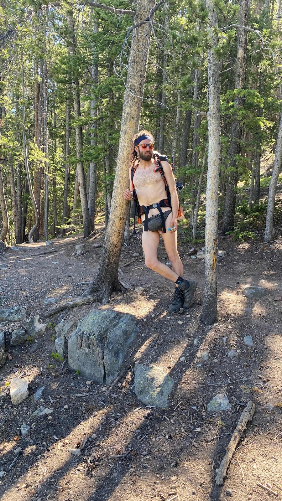
June 21st is remarkable for many reasons. Viewed from earth, it is the day the sun reaches its’ highest point in the northern sky. It is deemed the first day of summer. It is called the summer solstice. It is the longest day of the year in the northern hemisphere, the shortest in the southern hemisphere. It is Jeff and Jackie’s anniversary, also Joel and Hailey’s. But most importantly, it is National Hike Nude Day for thru hikers. I am not sure Congress condoned this National holiday and I have seen few participants. But today, 70 Pound Hammer hung on there and proudly carried on the tradition. With nothing more than his socks, shoes, his pack and a fanny pack he braved severe chafing, frostbite and sunburn in areas where the sun don’t shine to carry on this noble tradition.
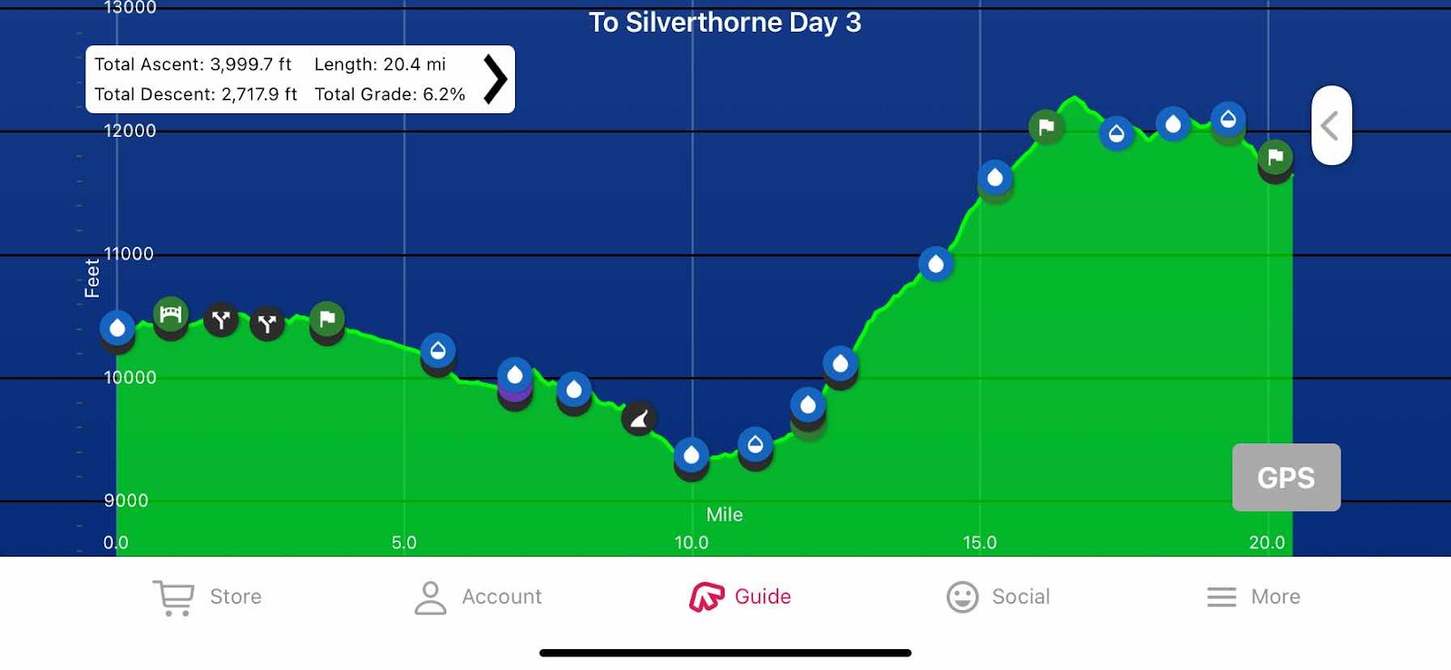
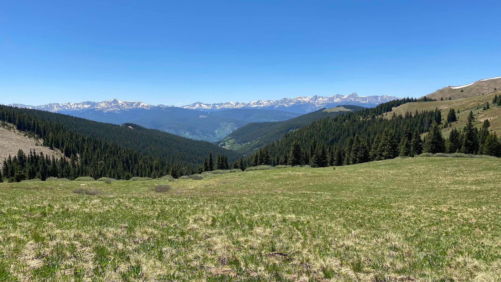
Looking at the profile of today’s hike, you can see the first ten miles are, for the most part, gentle downhill. All of it is below 10,500’. This means it is in the trees, following the south fork of the Eagle River. Much of it parallels the Tennessee Pass Highway. It is the last part of the day, miles 10 to 16.5 that the work occurs, with a 3000’ climb. After that, the trail stays high and undulates up and down across alpine meadows with spectacular views.
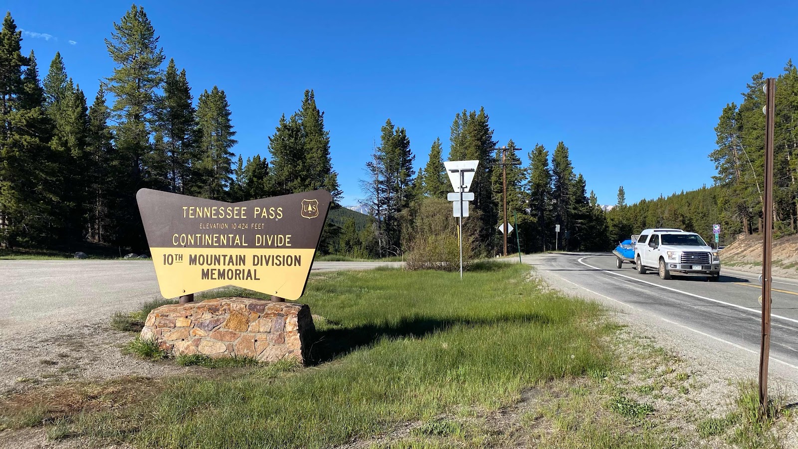
The first excitement of the day was at Tennessee Pass, about three miles from where we camped - Porta Potties! I had left camp about ten minutes before Monk, yet when he caught up with me I was still in the Porta Potty, or as he referred to it, “my office”. Sometimes it’s nice to sit and do business instead of squatting in the woods.
The trail didn’t cross the highway at the pass. It just poked out of the woods to say hi, honor the Army 10th Mtn Division, then ducked back in and ran parallel to it on the south side for three more miles before crossing it.
Once across, it continued to parallel it. Unusual for Monk and I, we were walking together. We were chatting about anything and everything, politics, car repair, building, relationships, kids, etc. A pleasant way to spend a morning.
At one point the trail, now quite high above the highway, maybe 150’, came out on a rock promontory overlooking the road. There was a wooden bench that was begging to be sat on. We obliged. While snacking, 70 Pound Hammer walked up and greeted us. We turned around to say hi and saw that he was honoring hike nude day. We were in the shade, it was 10 am and we were at about 10,000’. My first thought was, “He must be freezing!” He chatted for a few minutes, then admitted to getting cold and headed down the trail. After our leisurely break at the bench, we followed.
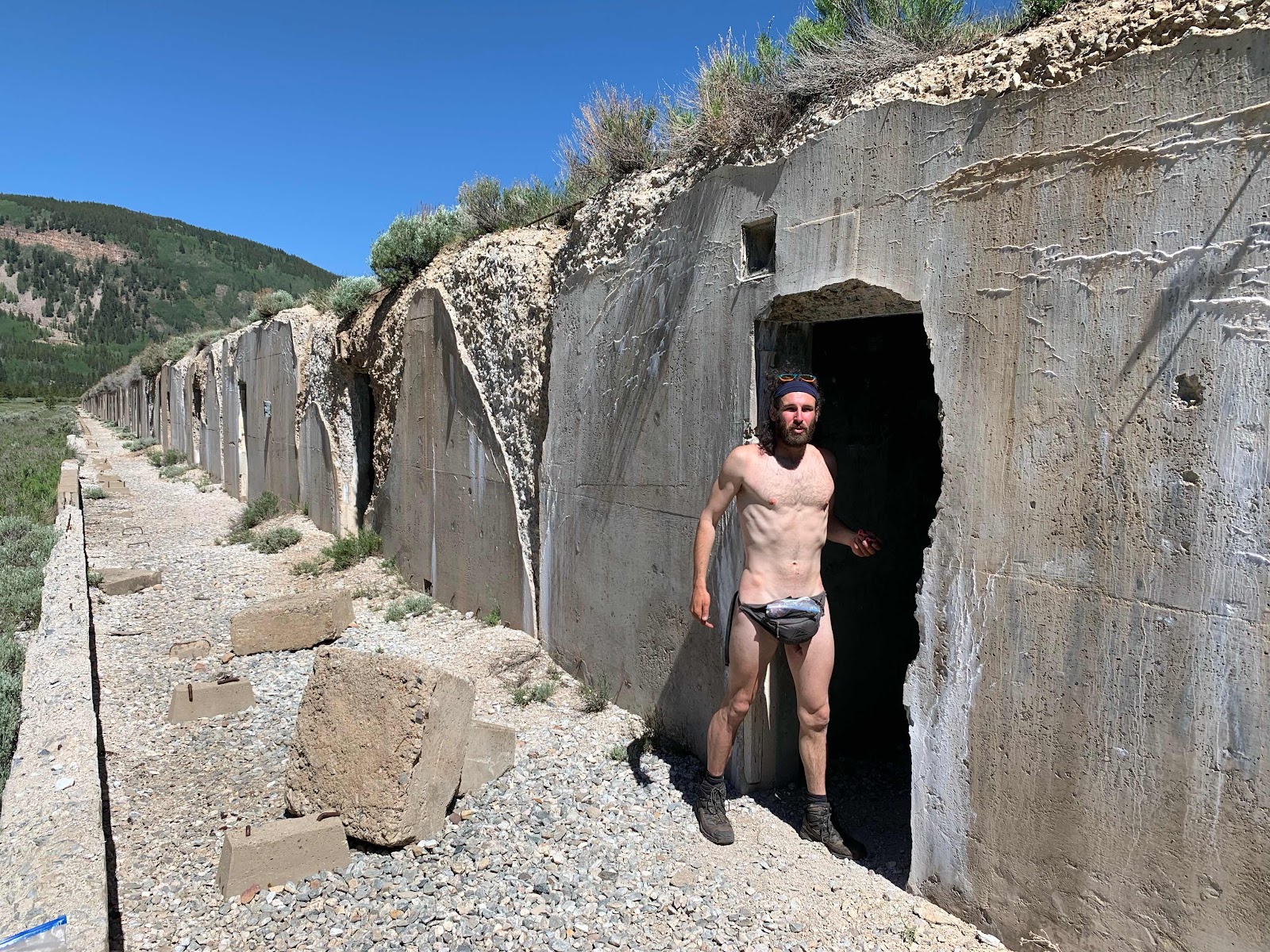
The trail rounded the end of a ridge and entered the East Fork of the Eagle River, heading up stream as compared to downstream on the South Fork. At the confluence sits the ruins of Camp Hale, the training center for the US Army 10th Mountain Division. The camp facilities were established in 1942 and decommissioned in November, 1945. We hiked past what looked like concrete bunkers for storing ammunition. Here we found Hammer again, smoking some weed and warming himself in the sun. Monk remarked that he looked like the last surviving holocaust victim that didn’t know the war had ended and snapped the amazing photo you see below.
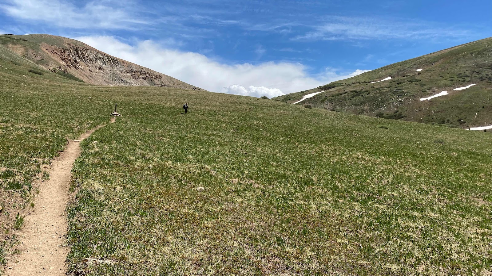
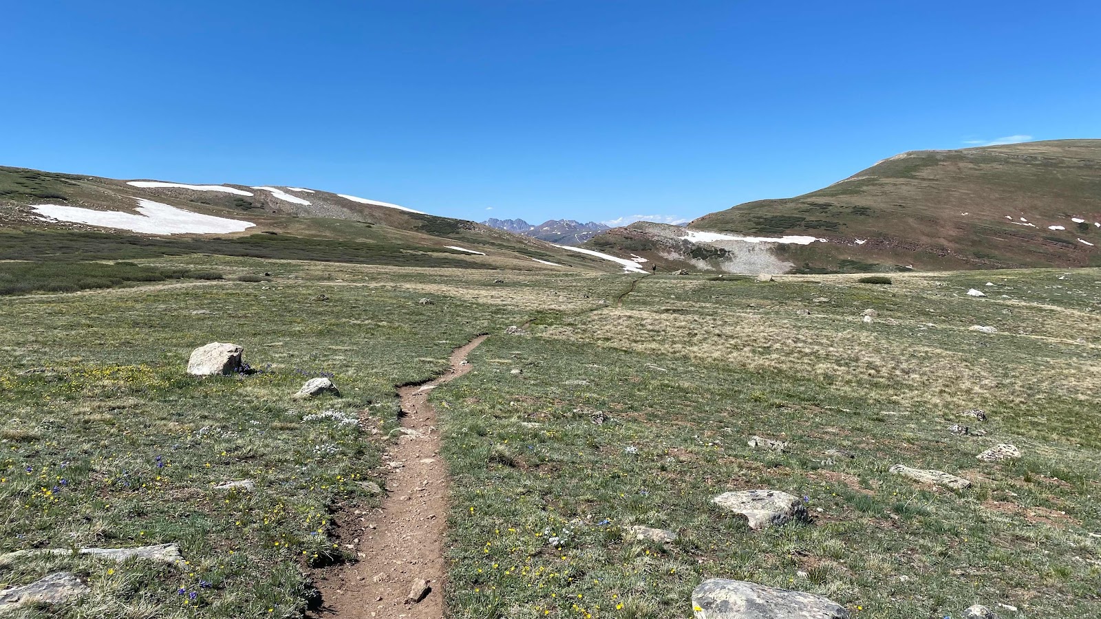
Now the trail started to climb gently up the East Fork river bottom before abruptly angling up the side of the ridge toward Kokomo Pass. We passed a YCC trail crew grooming the trail. We broke out of the trees at 11,600’ and climbed through gorgeous alpine meadows to reach Kokomo Pass.
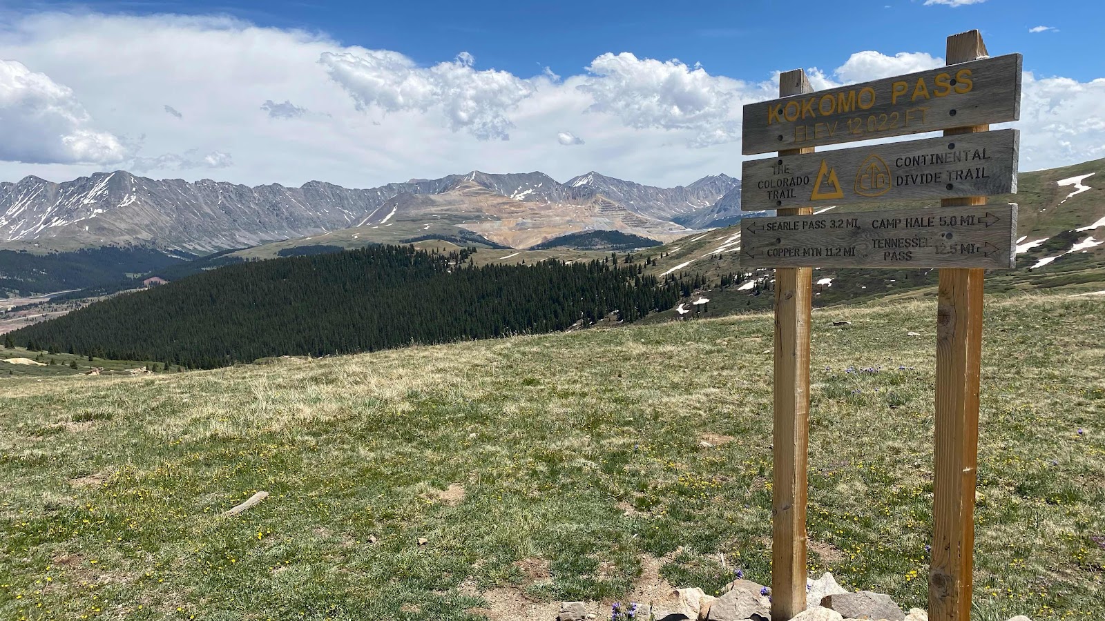
The first thing one sees upon reaching the pass is a view southeastward to a mountain that is half missing, roads bisecting it’s surface and tailings and holding ponds below. A copper mine. It is quite a jolt to see at (a) this altitude, (b) surrounded by such beauty and © so unexpectedly. But, I am sure this phone I am typing on has copper in it as do all my charging cords and every electronic device I own, not to mention my house, cars, power lines, etc. so I can’t be too judgemental. But does it have to be here? And can’t we recycle more and buy less?
Monk found a nice spot to sit in the lee of the ridge where we enjoyed the view and saw a few elk scampering through the willows half a mile away. Hammer, now wearing shorts due to chaffing, and Kyle, soon joined us.
The trail undulated along the ridge top toward Searle Pass (think the ridge line of Anne of Green Gables in the previous post) for a few miles before beginning it’s descent into Guller Creek which leads to the Copper Mountain Ski Resort, but I get ahead of myself as we won’t get there until tomorrow.
Before we began our plunge into Guller Creek we stopped on the ridge in the meadows and found a flat spot near a creek to camp. It was earlier than usual to stop, but 20.4 miles was a good distance, the views and scenery were magnificent and my left foot was bothering me more than normal. I think in an effort to keep up with Monk I have been walking faster than my normal pace and straining my running gear, in this case the top of my left foot. I iced both feet in the nearby snow melt creek (cold!) to calm them down.

It was a beautiful sunset with clear skies, although clouds loomed to the east, a harbinger of a weather change on its way? Another glorious day on the trail.
No comments:
Post a Comment