In an attempt to stop the increasing pain on the top of my left foot I am now hiking with that shoe totally unlaced. To be truthful, it takes about half a mile for me to start walking with a steady gait. Before that I must look like a marionette manipulated by a shivering puppeteer. I awkwardly stagger down the trail trying to get all my parts synchronized into what approximates a “normal” walk. I think I need a zero day, or two. And, as luck would have it, wonderful Sue and Lee have offered to let me use their house in Dillon (Silverthorne) to take a couple days off. Just 30 trail miles to go.
I got out ahead of Monk, but he quickly caught this disjointed walker. Copper Mountain Ski Resort was just 6 miles down the trail. I scurried along in Monk’s wake, keeping up for the most part, but he had to stop periodically for me. We dreamed of a big waffle or pancake breakfast at the resort. We started crossing ski runs about two miles out from the base area, hiked under a roller coaster type luge track, by the remnants of last winter’s half pipe and finally dropped down to the village at the base of the lifts. We asked some employees about breakfast-nothing open was their reply-except for Starbucks.
We found Raider, Pitch, Rooster and ET on the
couches at Starbucks, chatted for a few minutes and then had a breakfast burrito and tea. Outside both Monk and I called home and friends. Then it was time to part. Monk was hiking on the redline over to Breckenridge, then up and over Grays Peak and down to Hwy 90 where he is meeting a childhood friend he has not seen in 42 years. He will stay with her and her husband for 4 days. I am taking the Silverthorne alternate north to that town so that I can stay at Lee and Sue’s house for three nights, a double zero. The pain in my left foot makes this all that much more important as I need to get it healed up to carry on.
Again, when close to mechanized civilization, I begin to feel the absurdity of our ability to move around on this planet and how much we take it for granted. I am sitting outside Starbucks at Copper Mountain resort enjoying my tea. To get to Silverthorne it is 12 miles via Interstate 70, about a 12 minute drive. It is where I am hiking to. Via trail it is 24 miles. It will take me 24 hours, 14 miles this afternoon, camp for the night, then 10 miles in the morning. I could be in Silverthorne by car faster than I can walk out of the Copper Mountain resort complex. What a weird juxtaposition of space and time.
While walking out of the complex I FaceTimed Andy. Good timing. He was planning his logistics of getting to the trail to hike with me in Wyoming. All the calling was killing my battery. I was down to less than 20% and it wasn’t noon yet. Glad I have the solar panel draped over my pack charging my external battery.
On my way out I passed a convenience store and stopped in for a soda and some chips to eat with or for lunch. Walking around all these tourists, locals and cars with my hat and pack on and 8 days of stink and dirt make me feel very out of place, like Jed Clampet in Beverly Hills or Crocodile Dundee in New York. Just need a 14” knife hanging from my belt.
Soda and chips eaten at an outside table, I headed for the overpass across I-70 and then onto a trail paralleling the freeway on the opposite side from the resort. Soon it began to climb and carried me away from the noise and bustle. I climbed 2200’ in 6 miles to a beautiful pass in the meadows, then descended through the forests before beginning the next ascent to the next pass.
FarOut, the mapping and navigation program on my phone is usually spot on, so much so you can zoom in and find which side of the trail you are on when it is covered with snow, then use it to guide you back to standing right on the trail under the snow with uncanny accuracy. However, today it is not accurate at all. It may be that being on an alternate route they just didn’t put the time and effort into getting it right. In the graphic below, my route is supposed to be the lime green line.

As you can see, I am not on it even though I am walking on the only trail in the area. If the trail is snow free this discrepancy is not important, but if the trail is snow covered then it is not possible to know which way to go to get on the trail again. As I hiked I watched my phone and saw that the actual trail is not FarOut’s line, but the dashed line, which as I walked the trail I followed perfectly. Once I understood this error on FarOut’s part I was comfortable following the trail, knowing I would be on the dashed line rather than FarOut’s lime green route. The dashed line always made it back to and crossed FarOut’s line.
I climbed up to a meadow with a lake indicated on the map and set up camp. I had gone 19 miles for the day, about 6.4 before Copper Mountain and about 13 after. Other than a couple day hikers I had not seen another person on this trail. I snuggled into my tent, cooked dinner and finished one of my many delinquent blog entries, then nestled into my quilt and blissfully went to sleep. So warm and comfortable.
An update on the saga of my inflatable sleeping pad. Last night in the meadow with Monk it went flat on me again. Luckily, I still had my Zpad under me, so I was not sleeping on the cold ground. Upon inspection in the morning, I saw that my patch had come off. Same hole as before is leaking air. I put a new patch on and covered it with a bigger piece of overlying vinyl. Hopefully, this one will hold. I was toying with the idea of sending my Zpad home and just using the inflatable, but when it goes flat, I reevaluate my sleeping pad position. For now I will pay the weight penalty (14 oz) and carry both pads. The inflatable for its unmatched comfort and the Zpad for its insulation properties and inability to go flat.
The beavers throughout the Rockies have created linked pools down most river valleys where once a river ran quickly. This picture shows three such pools. They create habitat for moose and fish and hold water longer into summer. Amazing creatures.

Passing under a chair lift at Copper Mountain with I-70 in the background.

A portion of Copper Mountain village.

The front half of Copper Mountain as seen from the trail on the opposite side of I-70.

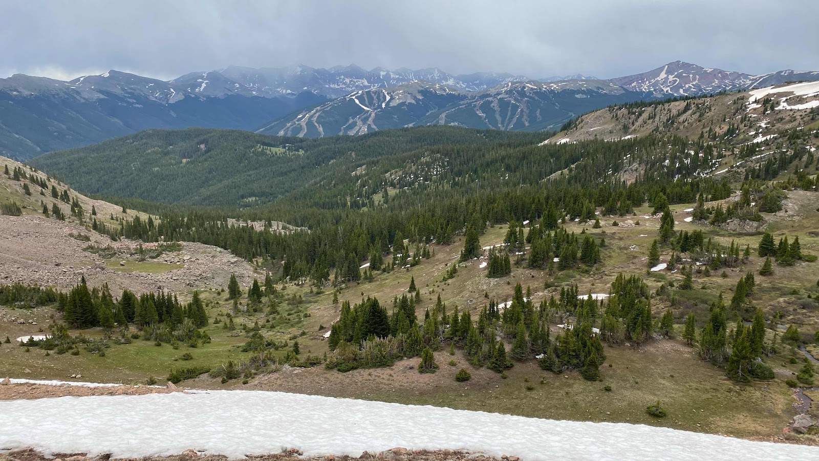
Both front and back sides of Copper Mountain are visible from the top of the first pass. Spectacular meadows but less spectacular weather.
No comments:
Post a Comment