Lake Anne Pass is supposed to be steep, corniced with snow and the crux of this part of the Collegiate Range. The question is, do you hit it early in the morning when the snow is still firm or even hard and icy or later in the day when it is soft, maybe even to the point of postholing? It rained last night, off and on and did not get very cold. Between the rain and the warmer temperatures I was betting it never froze. I delayed my usual hiking time by better than half an hour, to a little past 6:30am.
It had been raining off and on all night. Just before dark it rained quite hard and then rained off and on all night. Because the ground was sloped a bit toward my feet I slid a little during the night and my sleeping pad and quilt pushed the bathtub floor out beyond the margin of the tent. Rain came into the tent. Not to worry though, the tent floor did not get wet. My sleeping bag soaked up all the water. 😀
I stuffed everything in my pack. I love the feel of damp nylon (not!) and was on my way. Monk was still in his tent preparing for the day and would follow by half an hour. He is a much faster hiker than I. I figured he would catch me by the time I got to the pass.
The weather was threatening, or it looked that way to me. I know nothing about Rocky Mountain weather except that afternoon thunderstorms are common. Getting over this pass in the morning seemed like a good idea.
I topped out at the pass about an hour later. The trail wound through the sun alpine firs and then switchbacked up through open meadows. It was beautiful. The clouds would lower down and obscure the pass, then raise again. They were up a couple hundred feet when I got there.
First thing I did was look over the edge to see what the deal with pass was. The whole pass was still corniced except for the extreme right side. My first impression was disappointment. The snow was steep, about 45°, but it only went down about 40-50 vertical feet and then turned into steep talus. No glissading to be had. The trail was exposed below the snow so we would be hiking down, not sliding.
I dropped my pack to remove my ice ax, stowed my trekking pole and started over the edge. The snow was soft, not frozen. I front pointed down the slope, driving the shaft of my ax in and kicking steps into the slope. I was down before Monk, Hammer or Kyle showed. Soon I saw Hammer’s head peek over the top. He started down using the same technique as me. I videoed his descent. His feet slipped out and he slid to the rocks, slowly and stopped. Kyle and Monk descended at an angle and made it down to the trail.
We continued down the trail until we hit a big snow field. Now we got to glissade. Standing and sitting, it made the descent quick.
We still had one more pass to climb up and over, Hope Pass. But first we had to descend 2000 feet to the South Fork of Clear Creek, follow it for six miles and then ascend 1900’ to Hope Pass. This time there was no snow to contend with on the north side of the pass. From the top you could see Twin Lakes 2000’ below.
We stopped for a few FaceTime calls then descended to the Lakes. The trail goes completely around the lakes, a distance of about ten miles, yet you can look across the lake and see the town about a mile away. There is a river feeding the lake between us and the town. comments on FarOut indicated it (a) is only ankle deep and can be easily crossed to (b) it is chest deep and if you weigh less than 140 don’t attempt it. Even though it was getting late, the idea of only traveling 2 miles instead of 10 coaxed me to walk the mile to the river to check it out. Monk wasn’t interested started around the lake, hoping to get a few miles in before dark. Also the sky was again threatening rain.
My mile walk to the river took 20 minutes. It is still spring runoff and it was a raging river 70 feet across and easily chest deep in places. I hoofed it back to the intersection where I had left Monk and started around the lake. There was water in 0.6 miles. I found a place to camp near the water and set up my tent in the now falling rain. Monk was somewhere ahead of me. Even though damp from last night my quilt fluffed nicely. Dinner and sleep.
Due to the past three cloudy days all my electronics are low on battery. The best I could do was charge my phone to 58%, my watch to 30%. My PLB was at about 15%. I had drained my battery pack to get everything to this sorry state. With care, I could make it to town on these small charges.
The low spot in the ridge is Lake Anne Pass. This south facing side is snow free. The trial
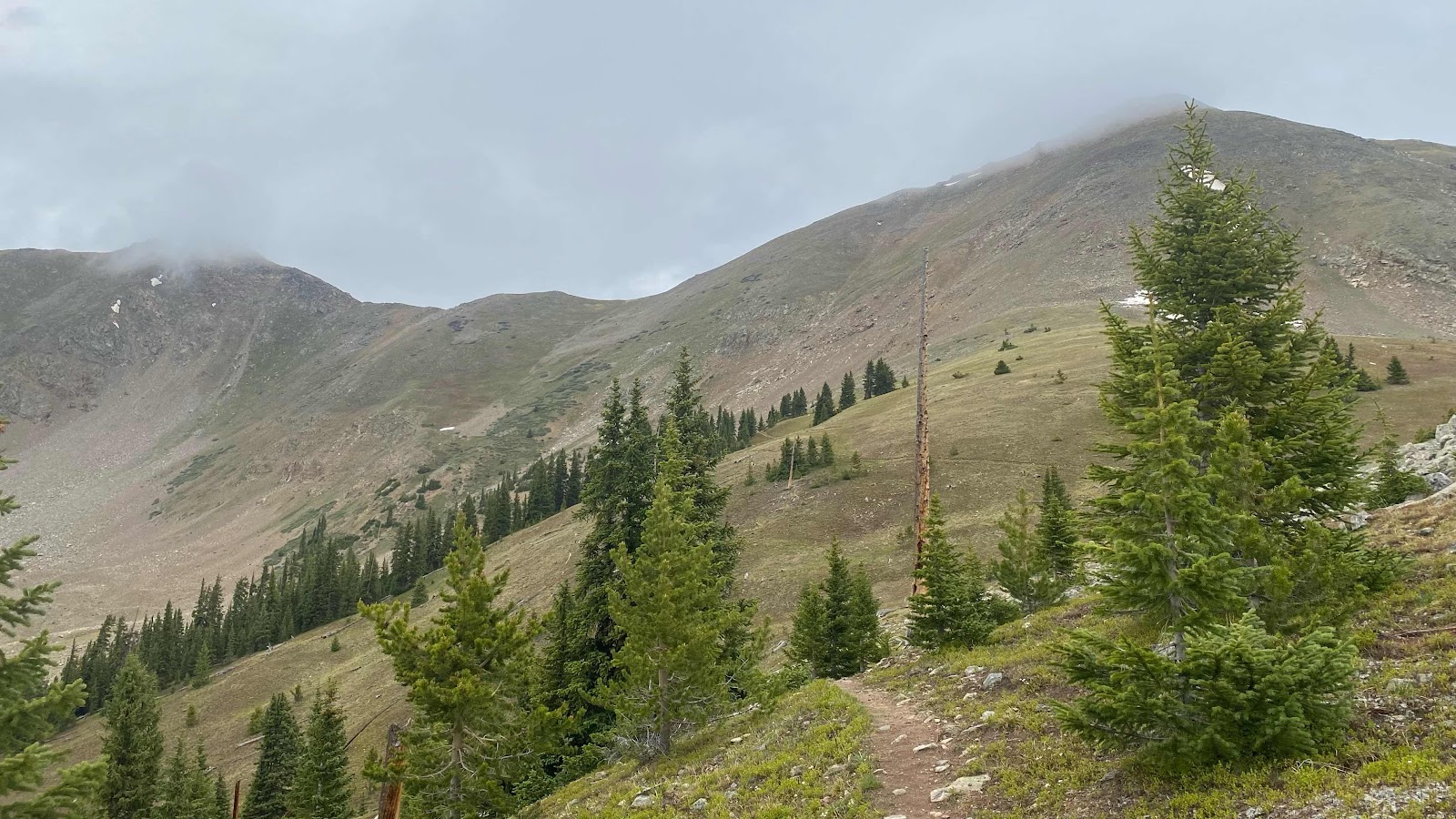
Switchbacks up the meadow to the pass.
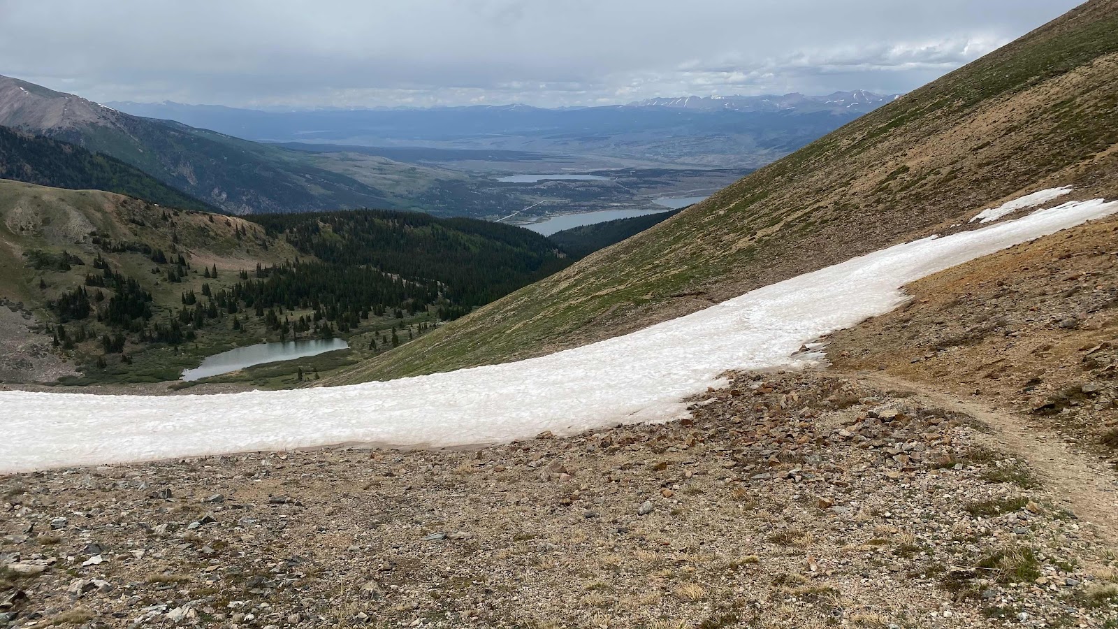
This photo looks the other way, down from the switchbacks to the valley below.

Lake Anne Pass
Looking down the north side of the pass. Steep snow, no runout. You can see Lake Anne below.

70 Pound Hammer starts down the snow at the top of the pass.

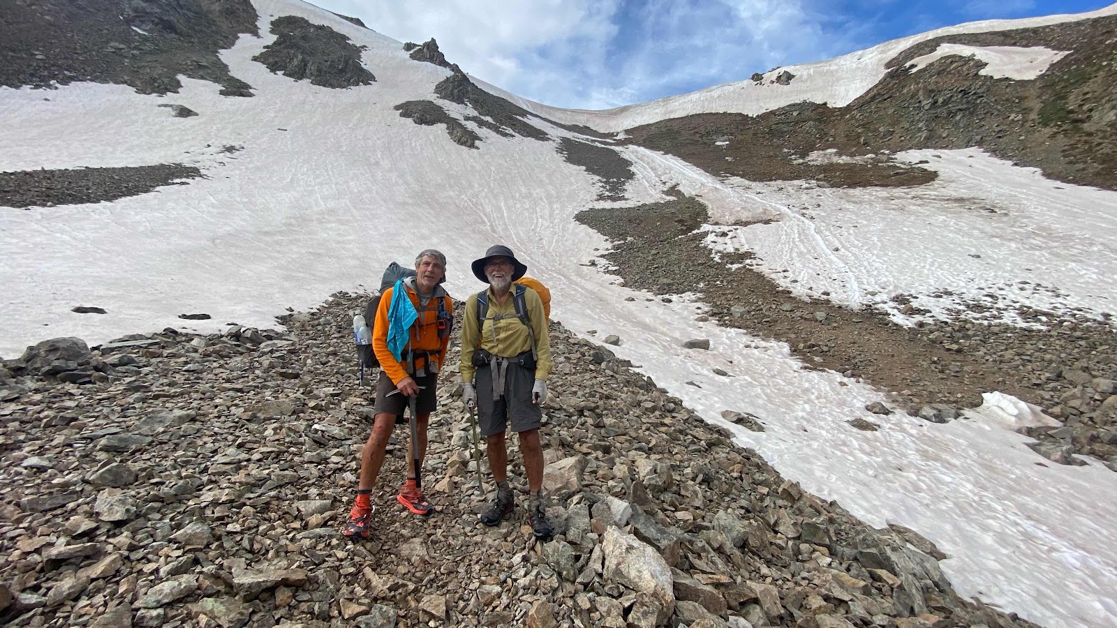
Kyle and 70 Pound Hammer pose in front of the cornice at the pass after successfully descending it.

Monk and I after our descent of the pass
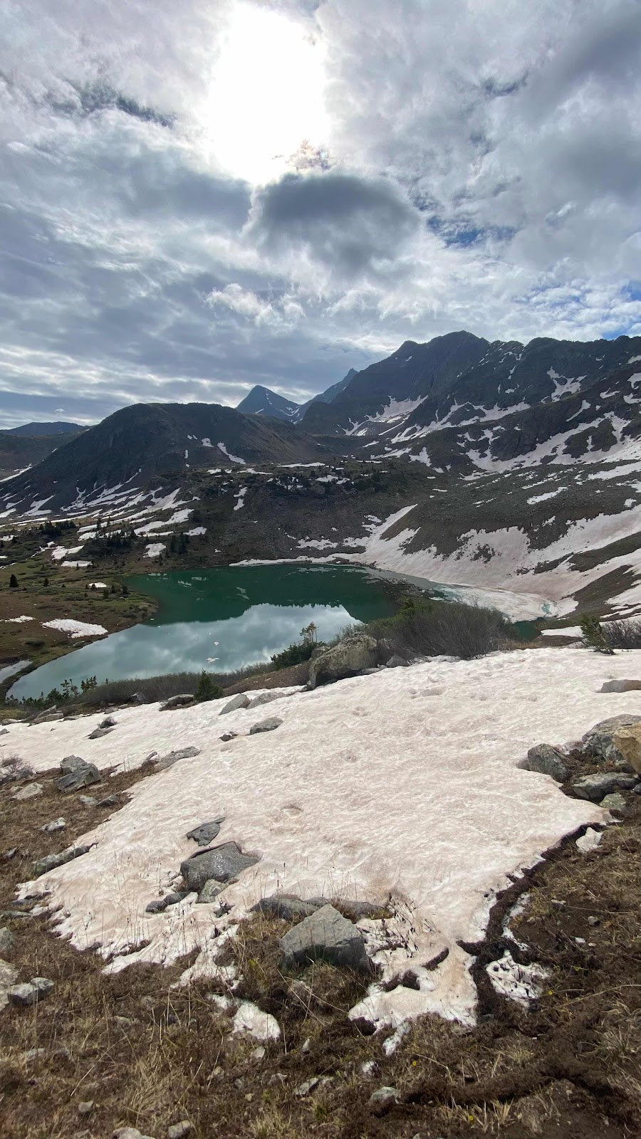
Lake Anne
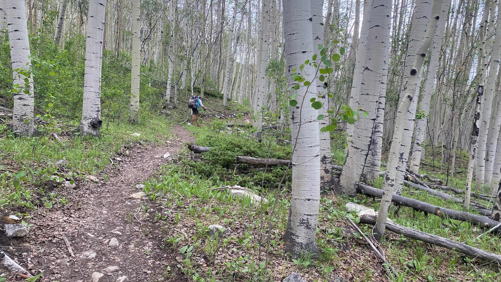
Climbing through a Aspen forest toward Hope Pass
Twin Lakes in the distance partially obscured from Hope Pass
The orange line shows the shortcut to town. The redline is the CDT route around the lake the river the orange line crosses is too big to wade.

No comments:
Post a Comment