Okay! Let’s see if three and a half days laying around improves my foot. It feel better walking around in the house, but how will that translate to actual hiking.
I am about 3-4 miles from the trail here in Lee and Sue’s house. Best way to start this day is with a bus ride back into Silverthorne and pickup the trail where I left off, at the Econolodge. You see, the Silverthorne Alternate passes right through Silverthorne, down the highways and across major intersections. The Econolodge is right on the route.
Unfortunately, the bus doesn’t go to the Econolodge. It drops me at the REI stop. From there it is about a mile of walking to the Econolodge because you have to get on the other side of I-70. This is done via in underpass. It isn’t until a little after 9:00am that I walk the road past the Econolodge and am in new territory.
This is not the CDT, but the Silverthorne Alternate. No CDT signs to guide you. Trust to FarOut to guide you. The trail climbs steadily out of town gaining over 2000’. Up in the meadows the trail takes a hard right, although there is no trail there. Just cairns to follow. I don’t know why there isn’t a trail. Maybe this section isn’t traveled much and the trail never gets a chance to get beaten in?
I’m hiking alone today. Monk is visiting a friend for the next four days the scenery is spectacular. Meadows everywhere. The trail, if it exists, is a thin ribbon running across the open fields. At one point it drops 1500’ into a river valley and then climbs out on the other side. At the bottom of the valley I meet Big Gulp and Pretty Bird, a couple hiking the CDT I have not met. The 3.5 days of not hiking have thrown me in with a different group of hikers
As the afternoon advances, so do the clouds. I pick up my pace a bit, a foot race with the clouds. I am trying to take it easy on my foot, but getting struck by lightning on a ridge seems worse than a sore foot.
Much of today is running the ridge line of Anne of Green Gables house. High and exposed. As the clouds thicken and begin to rumble I drop 1500’ into Bobcat Creek, following the faint and sketchy trail and find a campsite among the live trees. No beetle kill here. A few sprinkles fall on my tent, but that is all.
The foot? Well, I was aware of it all day. At times it hurt, at times it was pain free. It os not where I want it to be, but it is better than when I hobbled into Silverthorne 4 days ago. I have my fingers crossed that it will improve each day rather than worsen. I have slowed my pace and pay attention to my foot placements. A few more days and I will see which way the pain trends.
The town of Silverthorne receding into the distance as I climb the trail out of town.

The view from Ptarmigan Pass back at Frisco and Silverthorne

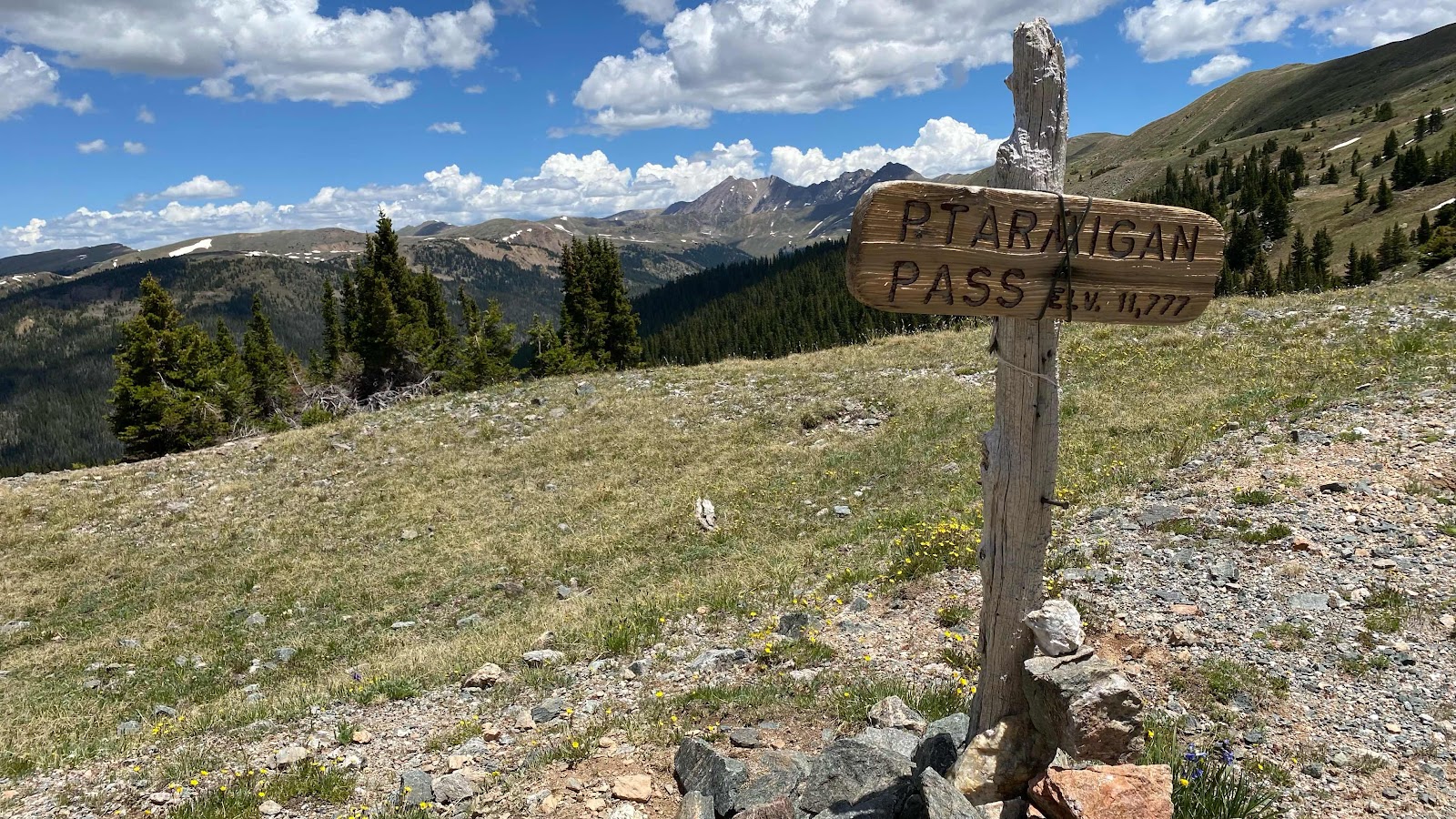
Ptarmigan Pass and the route ahead
Ridges to traverse and threatening weather.

No comments:
Post a Comment