Well, the foot? Took about a mile and a half this morning for it to loosen up and become nearly pain free. Still better than it was, but not what I hope it will become.
It was cold last night. I was up and moving by 6:00am and the meadows all had frost, the snow patches were frozen solid and there was occasionally ice on some of the small trickles of water running through the meadows. Saw lots of moose poop, but alas, no moose. I followed Bobtail creek for two miles downstream. At about halfway down the trail crossed the creek. There was no bridge and no stones to hop on. Maybe the cold water would do my foot good? I wadded across. Cold!! But within 30 seconds my foot felt great! No pain, just freezing cold.
At the bottom end of the valley stood a big, very new looking barn or workshop. I had read in FarOut’s comments there was a two log footbridge across the now rather large creek. Digging through the chest high willows I found it and crossed without rewetting my very cold feet.
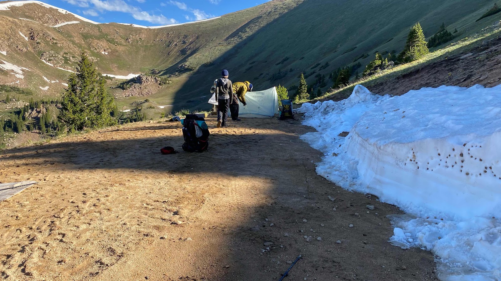
Here the trail became a road that switchbacked up the west facing ridge for about three miles and 2000’ of elevation gain. About 2/3rds of the way up, on one of the switchbacks, I saw some hikers taking down camp. It was now about 8:00am. I didn’t recognize the man at first. I knew I had met him, but I couldn’t place him. OMG, it’s THE family. I hadn’t expected to see them, so they were completely off my radar. Mom and the three girls had already headed up the road. Dad and the two older boys were taking down camp. I stood and talked for about 5-10 minutes, then headed up the road. I passed mom, Deadweight, Beast and Angel Wings, stopping to talk for a couple minutes.
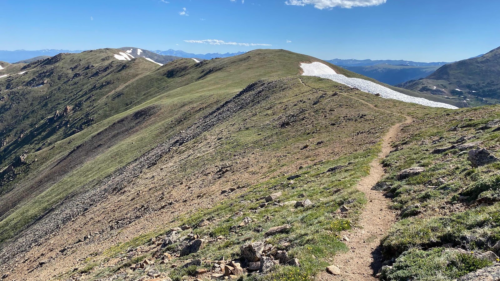
At the top of the ridge the alternate route I’ve been on for days intersects the real CDT. I turned left at the top of ridge and I’m back on the CDT. Just before I reached the top of the ridge I saw two people hike past, heading north. I wondered if it is anyone I knew. A couple miles up the trail (beautiful miles of ridge running at about 12,000+ feet) the couple stopped to heat up some water for cocoa. I stopped to say hi and introduce myself. They were Mountain and Lion, a couple in their 60s from Zurich, Switzerland. We chatted for a few minutes, then I headed down the trail as they enjoyed their hot chocolate. Of course, we leap frogged each other for the rest of the afternoon.
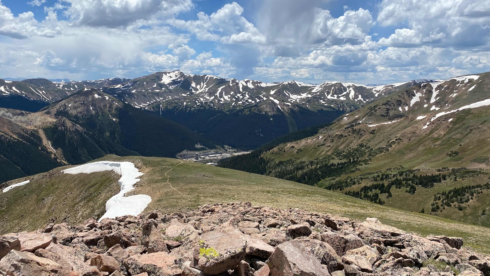
The trail stayed high. In fact, it did this circling maneuver. When I first popped over the ridge and rejoined the CDT I saw some kind of industrial facility in the valley below. As the day wore on, I circled the facility, which turned out to be a mine. The trail made a big horseshoe U around it, up on the ridges while it sat down in the valley below. Whatever machinery they had running, a constant humming, could be heard the whole day.
The trail dipped down the ridge on the far side of the horseshoe and then climbed very steeply up the side of the mountain to the top of mount Stewart and then headed northeast toward Berthoud Pass.
I have been so used to snow melt streams along the trail that are not on FarOut that I have not even considered looking for water, I just fill my bottle when it gets low from one of the seasonal snow melt streams. Things changed. I filled one bottle 15 miles before Berthoud Pass and there was none all the way to the pass. I arrived with about a cup of water. FarOut showed the next water about 18 miles up the trail. Uh oh. There were many cars at the parking lot. Better Yogi some water. There was a forest service firefighters truck parked with the rest. Five guys in firefighter t-shirts were milling about. I asked if they had some water, about 2 liters, to spare. The obvious leader climbed up on the truck and handed down 4 16oz Costco bottles of water. I poured them into my bottles and returned the empties to them, thanked them profusely and chatted for a few minutes. They were on loan from Spokane, down for a few weeks.
As I headed for the trail and out of the parking lot a guy leaned out of his Suburban and asked if I was hiking the CDT. I replied yes and he offered me a Gatorade. I accepted. Ooops. This guy was crazy. He was living in his Suburban and in the 10 minutes it took for me to be break off from him he told me he had lived in Florida for 38 years but was now homeless by choice in Colorado, was going to build a stealth shelter in the mountains and spend the winter having watch thousands of hours of YouTube video on how to do it and on and on and on. I did get a sealed Gatorade which I drank on the spot and gave him the empty. I finally had to walk away as the weather was getting nasty looking.
I walked up the road a couple switchbacks and found a small level place by a tree big enough for me to lay down with enough area to pitch my tent. The rain started to fall as I got my tent up, then I climbed inside and did my evening routine while thunder boomed outside for an hour.
Tomorrow, early morning weather willing, I am going to take the James Peak alternate, a cross country route over five 13,000 foot peaks that runs a ridge line and reconnects with the CDT. It will saves me dropping into a valley and climbing back out, shortening the distance by about five miles and saving me 1400’ of climbing. If the weather will allow the ridge run.
The road walk climb out of Bobtail Creek

Dad and boys taking down camp on the switchback in the road
Looking back at Bobtail Creek from the CDT on the ridge

The CDT running the ridge
The CDT and the seemingly endless Colorado Rockies

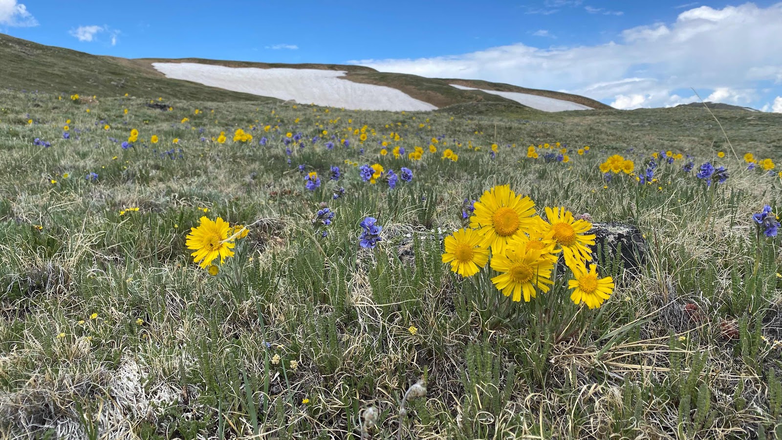
Flowers are starting to bloom
The mine from the top of Mt. Stewart
Tailing ponds. Notice the red mountain with a road cut across its face.
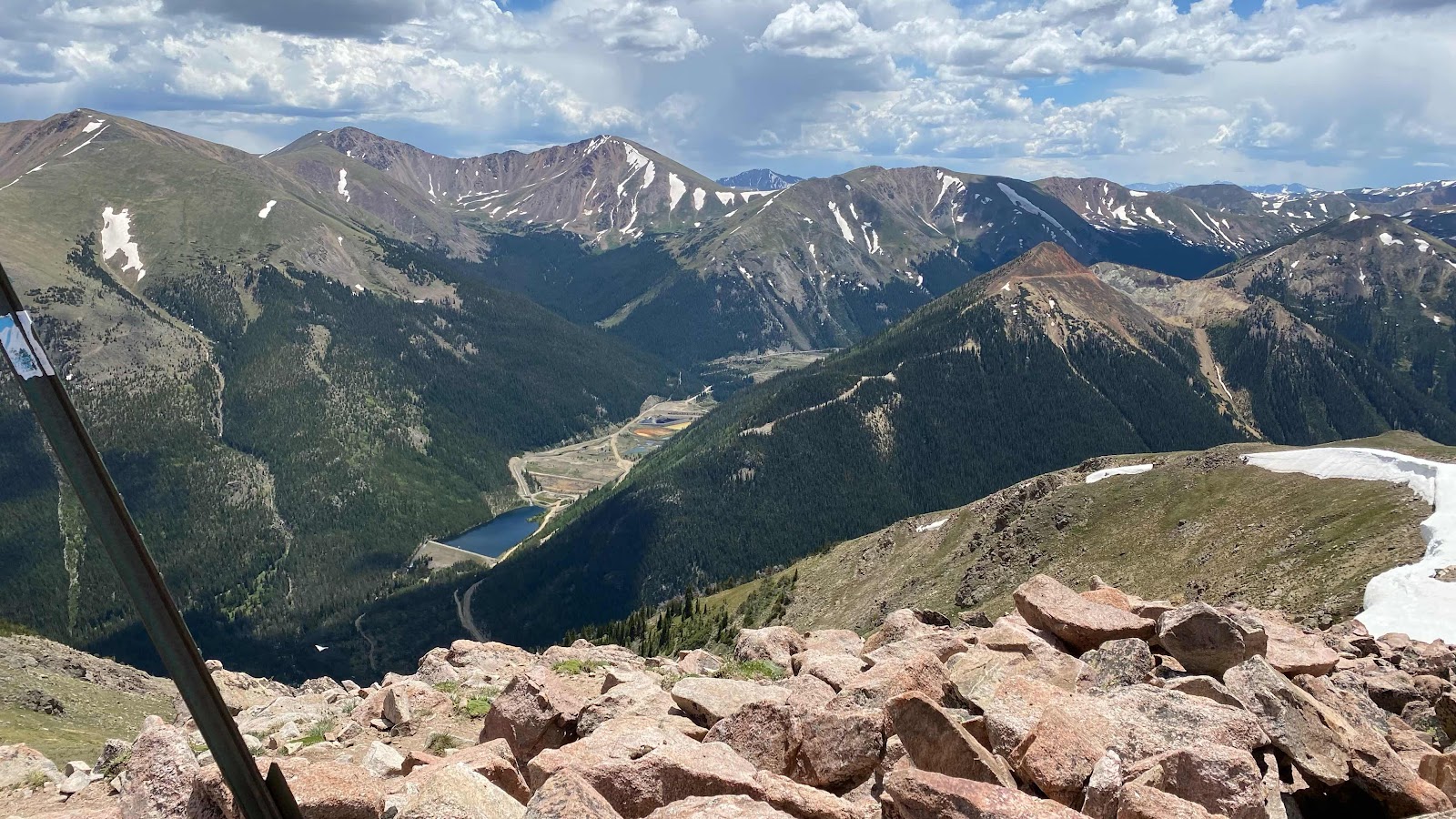
That mine in the Henderson Mine, North America's largest producer of molybdenum:
ReplyDeletehttps://en.wikipedia.org/wiki/Henderson_molybdenum_mine