A day to celebrate for many reasons! First, look at that total mileage number. Finally broke 1000 miles walked. Woohoo! Look at the daily distance. 24.9! That’s a big day (but it is also a somewhat false number. More on that later.) The last big mountain of the Rockies has been climbed and descended, Mt. James.
The weather forecast for today was for deteriorating conditions. It thundered and rained for about two hours last night, starting about 7:00pm, so I was wondering what today would bring. My attention to the weather was more acute than normal because I was hoping to take the Mt James alternate, a high altitude ridge run about 4.5 miles long skirting or climbing five peaks that would save me following the CDT down and around this collection of peaks, a loop 10 miles long with a boatload of elevation loss and gain. This is why my distance figure is a little misleading. I cut 5.5 miles off by doing the traverse. I didn’t want to get caught on this exposed ridge in a thunderstorm.
I’ve become pretty accustomed to Rockies weather. Usually nice in the mornings, starts forming clouds starting between 10 and noon, those clouds start accumulating mid to late afternoon and before dark “Kaboom”, thunder and lightning. The fact that forecast showed worse weather than yesterday made me think the thunderstorms would come earlier today. I got up an hour earlier than usual hoping to get across the traverse before the weather went sour.
First, I had to ascend 1200 feet over 2.7 miles on the CDT to reach the top of Mt. Flora. There was a brisk wind blowing all the way up. I arrived at the top about 7:00 am. I had promised myself I would not make the decision about doing the traverse or following the trail until I reached the top of Flora, but I really had already decided. 10 miles compared to 4.5? 2500’ compared to 2100’? Unless the clouds were obscuring the route or there was thunder at 7:00 in the morning, I was doing the traverse.
There were high clouds across the entire sky. They weren’t thick, but who knows what they would do as the morning progressed? I’d keep an eye on those sneaky buggers.
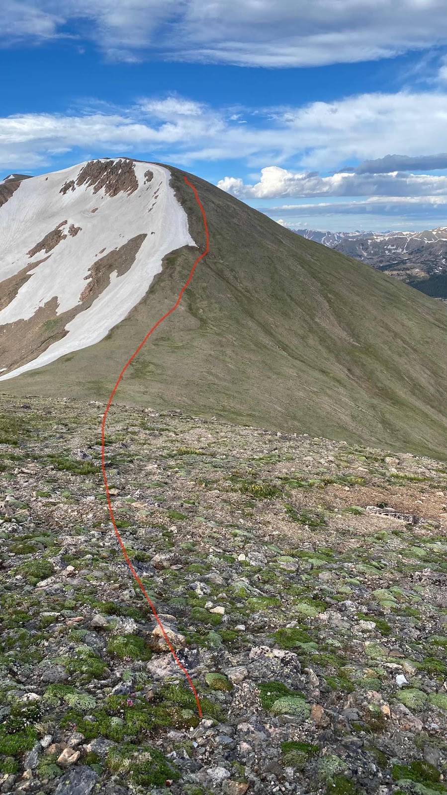
The traverse starts out easy. Just level to slightly downhill walking on a very broad ridge top. Then suddenly, the ground drops out from under your feet and you descend 400’ down very steep meadow. While descending I’m looking across to an equally tall and steep slope up the hill on the opposite side of the valley. Once on top of that it’s a half a mile of ridge walking and then a traverse of 13,129 Mt. Eva, staying 280’ below its summit and traversing into a pass between it and Parry Peak. Up to the top of Mt. Parry at 13,320’. Now some ridge running and incredibly steep
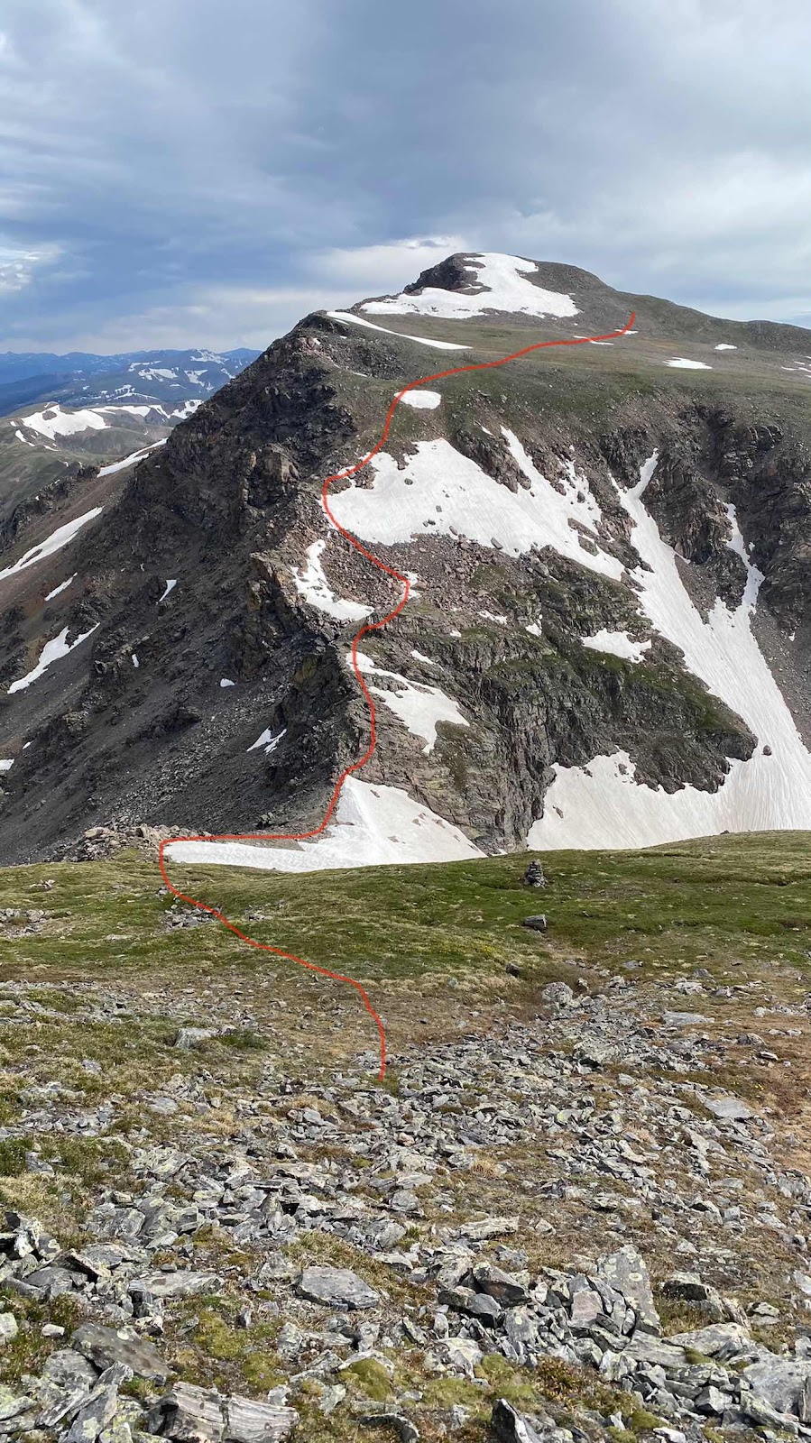
heather to the top of an unnamed 13,200’ peak. More steep heather drops me into rocky pass between this peak and Mt. James. Now it got fun! A little rock scrambling, a few moves, slipping thru a pass and into a protected notch for a bite to eat and a rest, then up a near vertical boulder field for 300 vertical feet to the nearly level ground at the base of James’ summit block where I connected with the CDT and hiked the last 300-400 feet to the summit. The weather held. A fun route.
There was still a ton of ridge running to do as the CDT stayed high for the next 10 miles or so. There was an old mining road that paralleled the CDT but dropped off the ridge, then climbed back on top to meet it again at Rollins Pass, a distance of 6 or 7 miles. I chose the road because it dropped to tree level, affording weather protection and I figured I could walk more easily on road than a narrow trail.
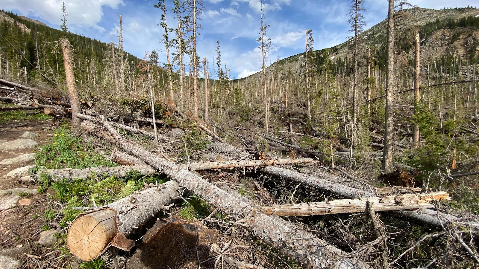
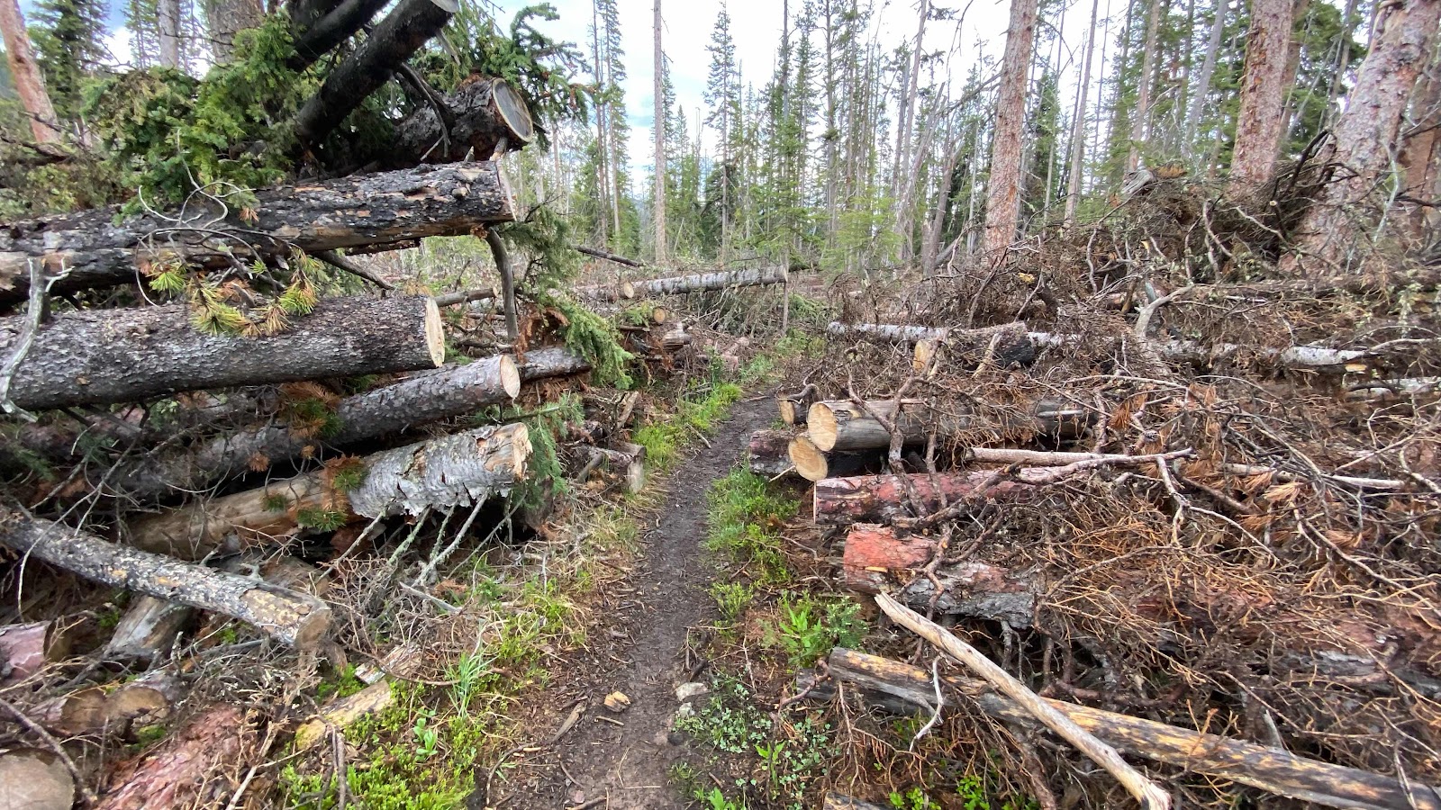
Once at Rollins Pass I followed the CDT up in the meadows for another 3 or 4 miles until it dropped down Cabin Creek. Some horrific wind event occurred in 2019-2020 winter that literally blew down all the trees. All of them. Think of the game pickup sticks on a grand scale. It was impassable for 2020 CDT hikers. Luckily for us, a crew came through and cut a swathe through the three miles of downed timber so it is now passable for hikers.
I found a spot for my tent right where the trail crosses Cabin Creek, nestled between a root ball of a blown down tree and another blown down tree and a beaver pond. The mosquitoes were atrocious but once inside my tent they don’t bother me. About 8 o’clock the wind picked up and it rained hard. I don’t mind a good storm once I am inside the tent, cozy and warm. So far it has only rained with any ferocity in the evenings. Let’s hope it stays that way.
My route coming down off Mt. Flora on very steep meadow.
Mt. James is on the far left. The red line shows the route. The low pass between the two peaks offered some rock scrambling to get through.

The rock scrambling route through the pass to get to Mt. James. Where the red line ends is where my route hit the CDT.
Me on top of Mt. James

Those areas of dead trees are due to a massive wind storm that literally blew down all the trees.

Sky Pilot flowers

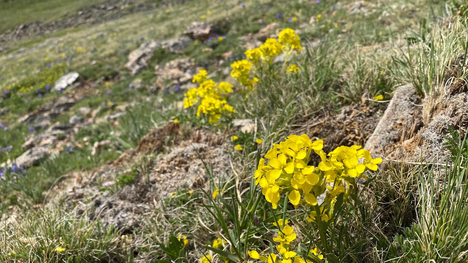
In California these are called Sierra Wall Flowers. Maybe here they are Rocky Wall Flowers?
Magnificent miles of meadow ridge running

When a whole forest blows down

Trail crews have cut a path through the blowdowns.
I found the Mount Flora alternate very hard... 6 hours from Mount Flora to James Peak for me. But so beautiful !!!
ReplyDeleteIt's Blue Rabbit
Delete