What a great start to an epic adventure! I couldn’t sleep last night. Turned on NPR on my phone at 11:00pm. The only way I could tell I had slept was by the missing gaps in the radio broadcast I missed when I dozed off. I’m not sure if I was apprehensive, excited or just not tired because all I did was ride in cars and busses all day and eat. Whatever the reason, the lack of sleep did not hamper my performance today.
The drive to the start of the CDT is 85 miles from Lordsburg. The first 50 miles are covered in 50 minutes. It takes over 2 hours to go the last 35 miles. The road is gully washed, rutted and extremely rough. But what a hoot!
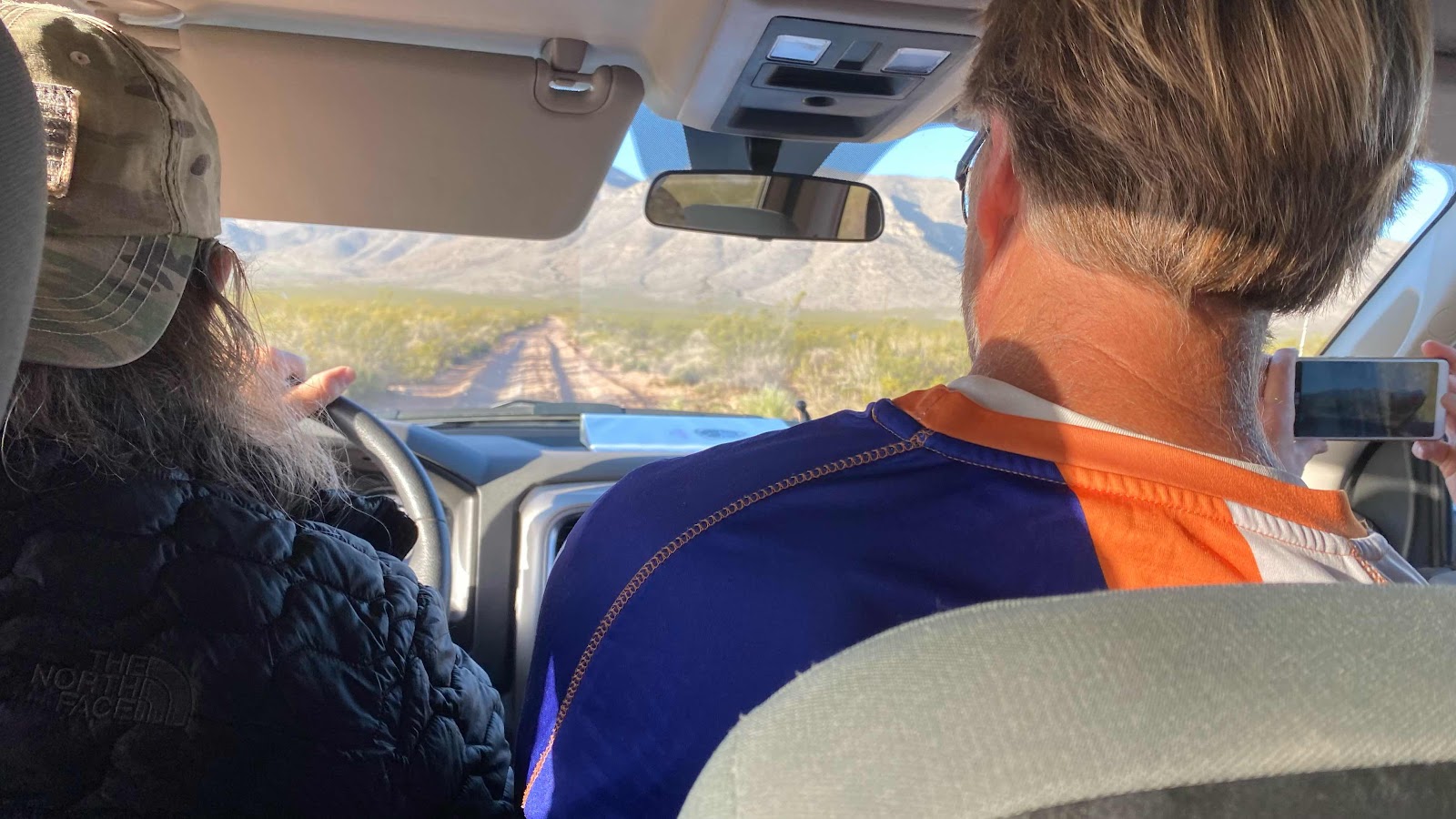
There are six of us in a rented 4WD dodge pickup. Our driver, Tim from El Paso, looks like a band member from ZZ Top. We are zooming at 80mph down the freeway (I-10) then 50 to 60 mph on two lane paved roads, then creeping at 5-15 mph as we bounce down washed out roads. All the while country music pouring from the radio. Tim did a great job of pointing out where the water caches were, pitfalls and promises of the route and cautionary tales, talking loud enough to be heard over the radio.
We met in Lordsburg at 6:15am at 207 Shakespeare Ave. Tim loaded our packs into large plastic storage containers to keep them dust free while on the drive. We left for the border at 6:30am. There were five of us in the truck. Lee and Sue, a retired couple from Colorado in the back seat with me, Jean Bruno from France and Trudge from Huntington Beach, CA. We had a lively conversation the entire ride. Lee and Sue worked in the space program, Lee designing spaceship software and Sue doing data analysis on rocket engines for the Titan rockets.
We arrived at the border at 9:35am. D’Anne and Lighthouse were still there, having rode an earlier shuttle. We snapped some photos at the monument and they took off. My fellow shuttle passengers posed for photos, then I left about 15 minutes behind Lighthouse and D’Anne.
Our destination was 14 miles away, the first water cache. We had driven by it on the way in, even stopping to inspect its contents. The trail rose steadily for the first ten miles, yet only gained 1000’ in that distance. My worrisome Plantars Fasciitis was talking to me for the first three or four miles giving me a little concern, but it calmed down as the day wore on and was soon no louder than all the other background pains that come from hiking 18 miles on the first day.
The vegetation was low scrub brush for as far as we could see. The temperature was pleasant most of the day, reaching a high of 85, but with a strong wind blowing it did not feel that warm.
As you would expect, water management is everything. We had 14 miles to get to the water cache. If one figures a liter per 5 miles, that would mean a three liter carry, 6.6 pounds of water. All of us started with 4 liters for a margin of safety. Nearly all of us had an unused liter by the time we reached the water cache.
I caught up with D’Anne and Lighthouse at about mile 8.5 and I walked with them the rest of the way to the water cache. Lee, Sue, Jean Bruno and I leapfrogged each other all day.
This portion of the trail is open range cattle ground. The trail is hard to follow because there are so many animal trails. Luckily, the CDTC has posted their emblem signs on tall fence posts all along the route to guide us.
The original plan was to camp at the water cache. After much discussion, we decided to go another three miles to a camping spot I had seen while driving in and had bookmarked on my phone in Guthook. As it turned out the 3 miles was as the crow flies. As the hiker walks it was 3.5. Everyone in the party noted the discrepancy to me as we were all tired and footsore.
You might be wondering how I had seen a campsite from the truck on the drive in. Turns out, this portion of the trail is routed up on the slope above the road and parallels it, but our driver told us the trail was so overgrown that we really didn’t want to walk it. Every plant in the desert is spiny and prickly. Someone had tried to walk it a few days ago and had lacerated first their bare legs and then their pants. For that reason we are walking 11 miles of the road we drove in on rather than hiking the trail. While on the subject of road walking, of the 18 miles we walked today, all but about 2.8 was on gravel roads or down washes that looked like gravel roads without the ruts.
Once we found the clear spot to camp along side the road we each pitched our tents, cooked our dinners, tended our feet and bodies and went to bed. Of the nine that rode to the terminus this morning, seven are camped here tonight, 5 men and 2 women. Not a single one of us is under 50, and only 2 are under 60. Where are all the kids?

Loading up the truck in Lordsburg getting ready for the drive to the border.

45 minutes into the drive we stop at Hachita for last minute needs. I got a small fuel canister. I think the store and the CDT have an agreement to bring customers to the store.
You can see the dirt road through the wind shield. Rough and slow going.

Tim, our shuttle driver at the Southern monument.

The border fence between Mexico and the US at the southern terminus of the trail.

D’Anne and I at the southern terminus.
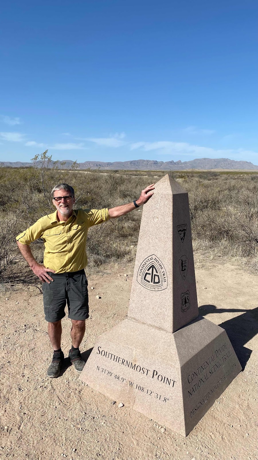
Me at the southern terminus.
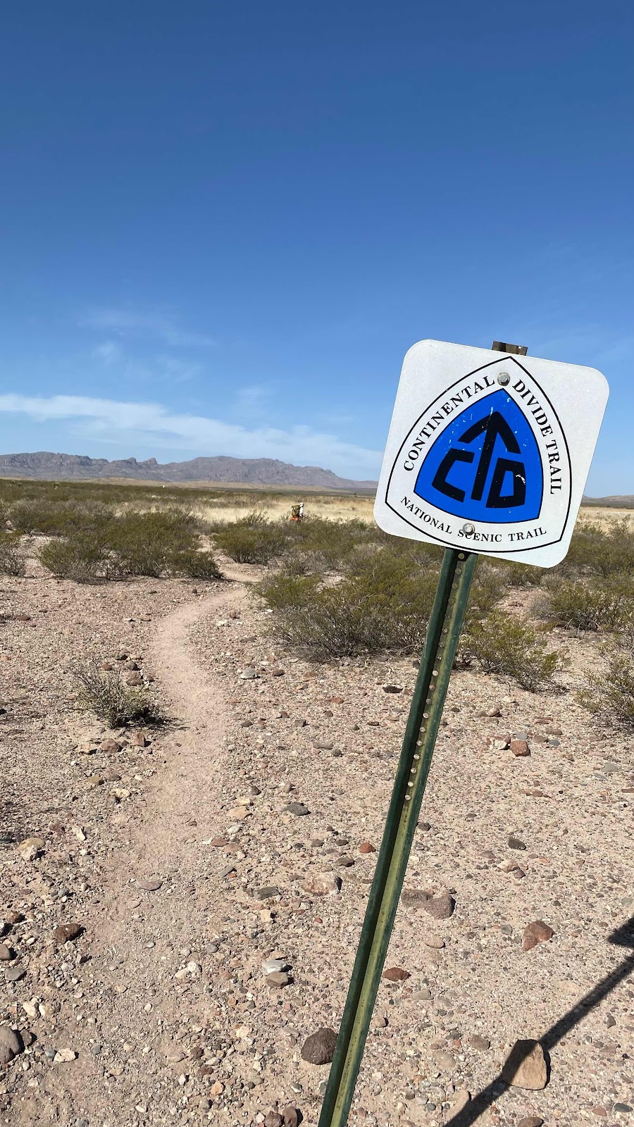
The trail, the trail signage and the Hachet Mountains in the background.

16 of the 18 miles we walked the first daywere on double track roads.
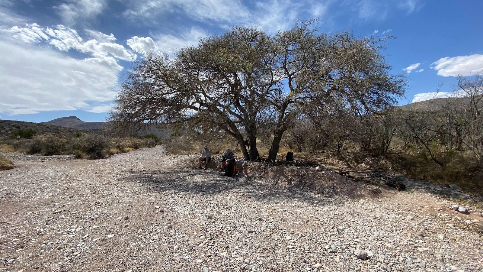
The only shade tree of the day-about mile 12.5

Lighthouse, myself and D’Anne enjoying the shade
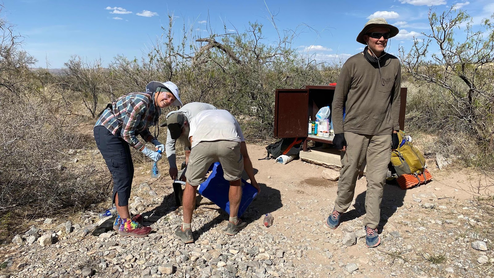
Filling water bottles at the first water cache (mile 14)
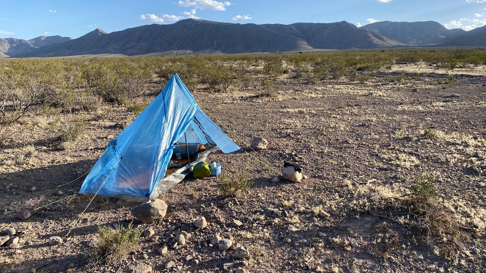
First night’s camp

Blue tent is mine, D’Anne’s is brown, Lighthouse’s is the green one.
No comments:
Post a Comment