I hurt so good. Oh, man, do I hurt. I am laying on my sleeping pad on my back, head propped up by my stuffed sleeping bag acting as a pillow. Every part of me is twitching with fatigue. I am counting on the power of sleep and food to set me right by 5:00am tomorrow for the 14 mile walk to Silver City.
It was a busy day with no water. 22 miles from Burro Mountain RV Park (MP 121.3) where we stayed last night to a mile past a cow watering tank at mile post 142.8. My watch says I hiked 24.62 miles. Of course, with no water along the way we had to pack enough for 24 miles. The heaviest single item in my pack is water. My pack weighs about 27 pounds. Of that 9 lbs is water. One third of the weight. As the day goes on and I drink my water supply my pack lightens appreciable. That’s good. I figure I need one liter of water for every 5 miles, less in the cool morning, more in the hot afternoon.
The route today stayed up on the ridges for the most part, with nice views to the east and west as we traveled north. Magic Mike, Dallas (D’Anne) and I stayed together most of the day, stopping to rest together and eat together. About midday Magic got his mojo going and we didn’t see him the rest of the day.
There was a report that there was water about halfway (11.2 miles) but the description left doubt as to whether it would be viable. “Several scoopable pools on 4/12. Clear and tasty.” Scoopable is troublesome as it means the water is shallow and might evaporate before we get there. Rather than rely on this source, we bet on the one 21 miles ahead:

You’ll see pictures below of both sources. The one at 11.2 miles was still there when we arrived and was viable, but I was carrying enough for the whole distance so there was no need to replenish. The one at 21 miles was as described, wonderful.
We had a little mixup right after the 11.2 water source. Mike jumped out ahead, I followed shortly after and Dallas a few minutes after me. The trail was hard to follow as it cut up a dry wash and then emerged into the forest a few hundred yards upslope. I had signal and was talking to Sally on the phone, using the FarOut app to make sure I was on route in the maze of old roads. But, in the process I missed the post marking where a new section of trail had been built that was not on FarOut. After a few minutes my route petered out. I had to hang up on Sally to concentrate on route finding. Just then I saw Carl (a hiker we had met only an hour ago) 75 feet upslope. He said he was standing on the trail. I walked up and sure enough, he was. This was not on FarOut, an unusual occurrence as it is usually pretty accurate. I assumed Dallas was in front of me and Carl confirmed this. We walked and talked for the next 20 minutes, recalling previous situations where we assumed we were behind when really we were ahead. I thought I had better confirm that Dallas was ahead of me. With my inReach PLB (personal locator beacon) I can text out via satellite even if I don’t have cell coverage. I sent her a note “I’m at at mile 135 at 12:14”. We have learned to attach a time to satellite texts because sometimes they are really slow. She responded surprisingly quickly with “135 12:21 R U stopping for lunch?!?” So I was in front of her! Instead of hurrying to catch up I slowed and then stopped, texting “At 135.3 waiting for you 12:23”. I sat down, took off my shoes to air my feet, tore open a packet of gooey almond butter and honey and began smearing it on tortillas. A few minutes later I got this message “I’m at 135.7 12:27 I’ll stop here and wait”. I did one of those Scooby-Doo “huh?”s. I crammed the rest of my tortilla in my mouth, laced up my shoes and headed up the trail. Mine and Carl’s first impulse was right. She was ahead of us. I caught up, finished my lunch while Dallas took off, finished another call with Sally and started walking again.
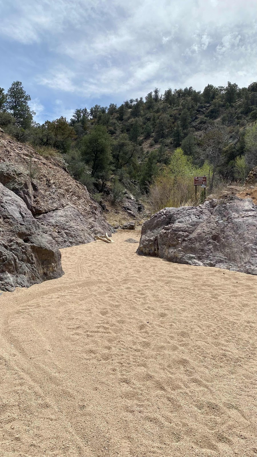
The trail continued on the ridge top, slowly undulating up and down as it passed into and out of ravines. The alligator junipers were the tallest plants at about 8 feet so there was very little shade. At Mile 138.7 the trail intersected a road at right angles and the route followed the road. It plunged down into an arroyo where it made a sharp left into a slot canyon, the floor of which was loose, unconsolidated sand. Soft on the soles of my tired feet, but really tiresome to trudge through.
But the canyon had attributes that made the trudging enchanting. The bedrock was purple! Imagine a narrow canyon, sandy floor, purple walls and narrowing as you reach its mouth. In just a few minutes it spilled out at right angles to another, wider canyon whose flat base was still loose sand, but served as a road with tire tracks running its length. This we followed for the next three miles as it slowly widened until we saw our cattle trough off to the right. By this time I had caught up with Carl, we had walked the last half mile together. We walked around the cattle pen and up to the water tank, an iron circular ring about 18” high and 30’ in diameter. The water looked so inviting I wanted to jump in and cool off. I filled four - liter sized bottles with the water by dipping my cooking pot In, swirling to push the aquatic submarine life away and pouring the contents into my bottles. I was quite pleased at my results as no visible creatures made it into my bottles. I would add bleach later. We are asked not to camp near these cattle water sources so we packed up and headed down the road, my pack noticeably 9 pounds heavier. About a mile down the road I found Dallas up a slight rise to the right in the shade of a juniper tree. Other than copious amounts of cow pies everywhere, it looked like a great place to camp. Truthfully, as tired as I was anyplace would have looked like a great place to camp. 10 minutes later I was in my erected tent, about 4:40pm, and remained horizontal until 4:30am the next morning, counting on the amazing restorative power of sleep to make tomorrow’s walk of 15 miles into Silver City possible. Did I mention it is 13 miles on Hwy 180? More on that tomorrow.

A stunning sunrise. Do the fires to the east add to the color?
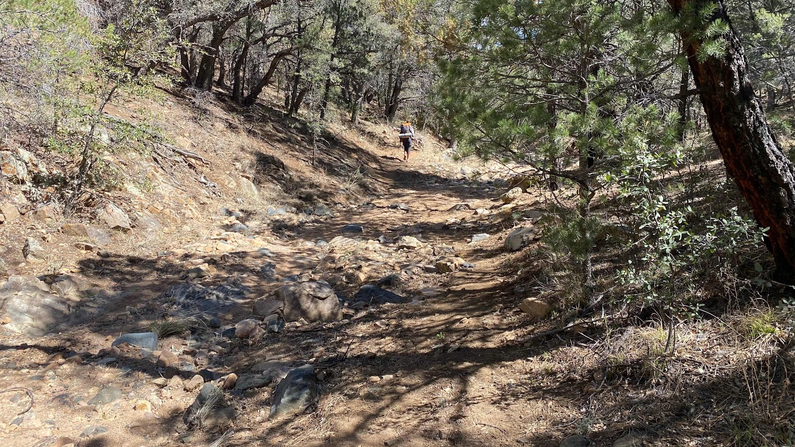
The trail left the ridge and followed a draw for a while. This is where the intermittent water is.

Carl sits near the scoopable water source. It is not flowing. It appears to be ground water that makes it to the surface. Already carrying enough water for the day so I didn’t collect more.
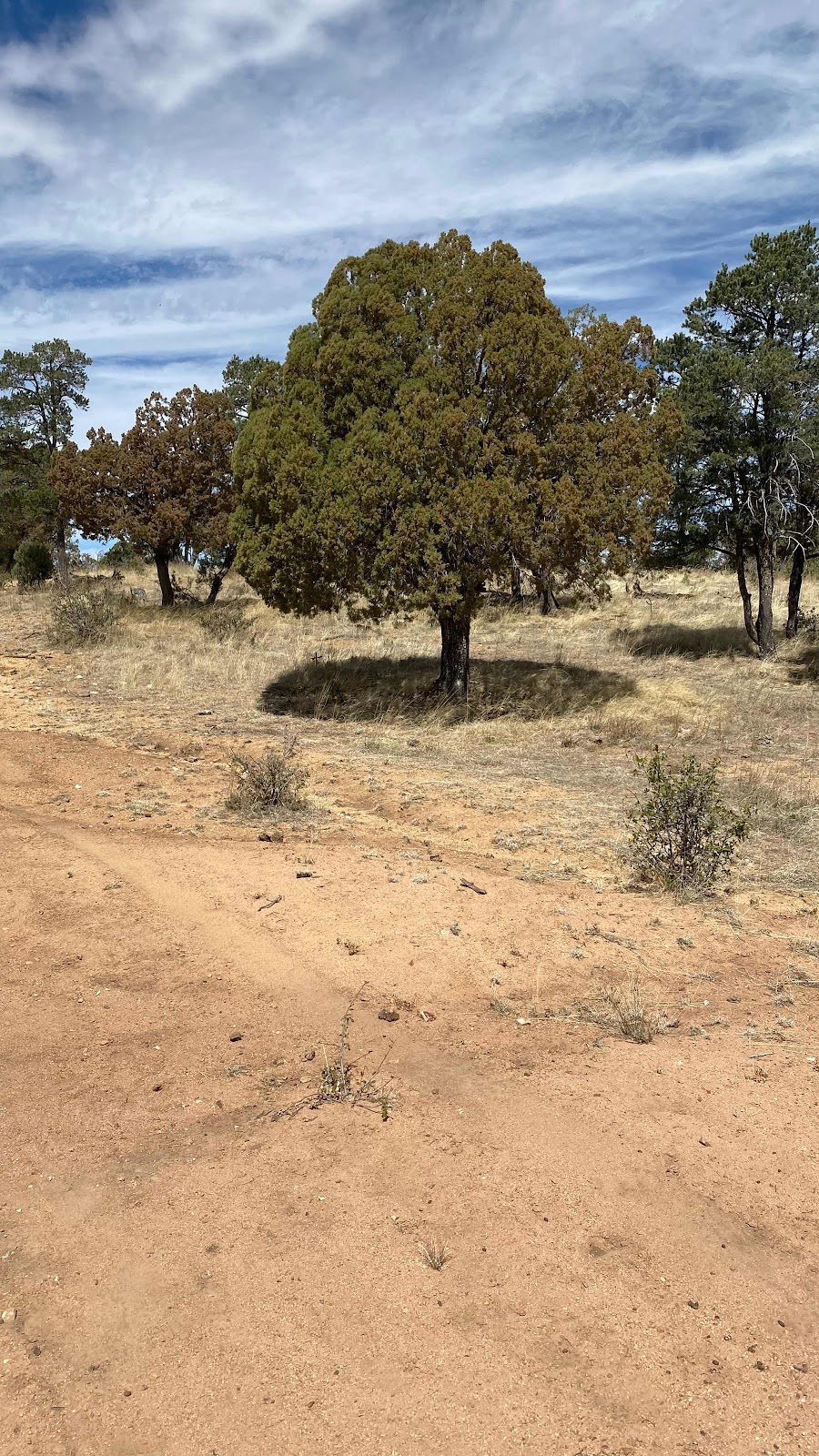
Back on the ridge, I loved the near perfectly round shadow of this juniper.

Beach sand trudge, but beautiful!!
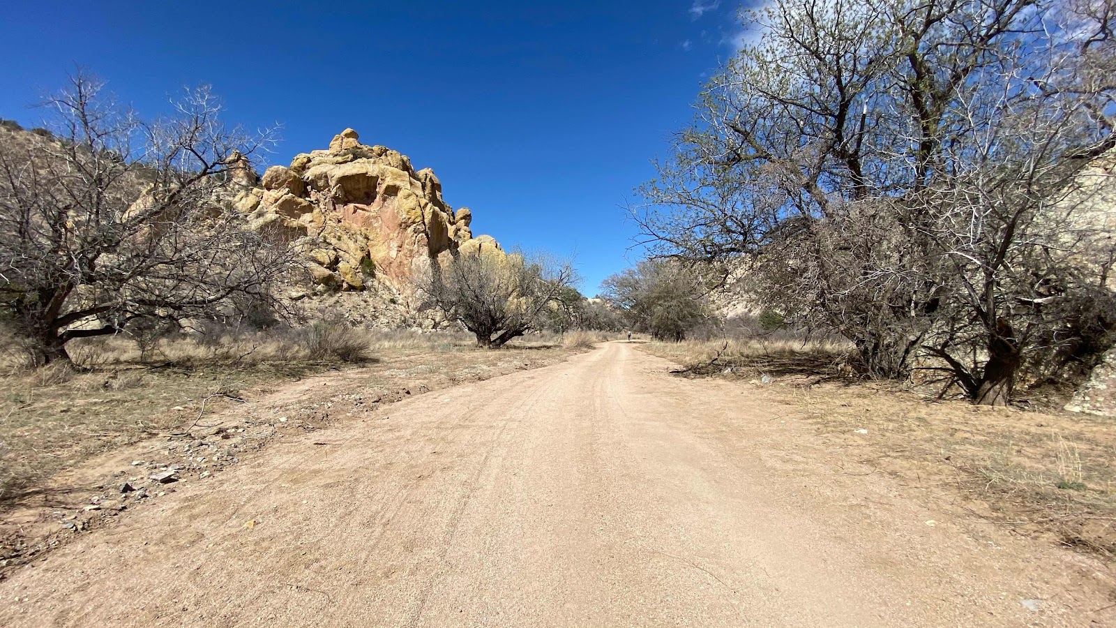
The canyon widens. Trees just starting to bud.
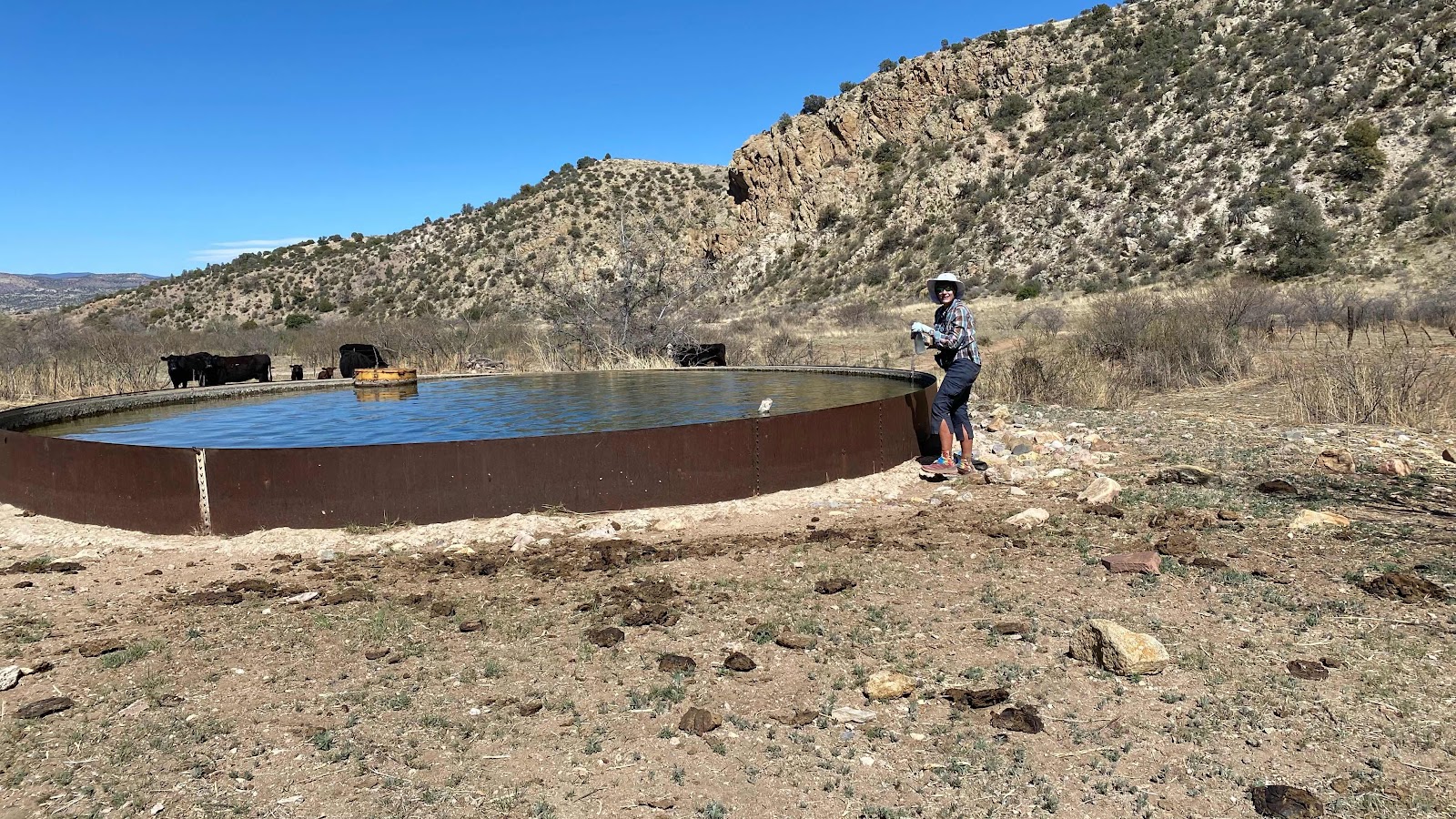
Our oasis water source.
No comments:
Post a Comment