Today is the day we finish the Gila River Canyon portion of the CDT. I must admit after four days of wet shoes and 50 miles I’ll be ready to be done with it when the day is over. But for now, I am still relishing every moment. It is such a treat to hike such a uniquely beautiful area. Soaring canyon walls reaching 500’ right out of the river that twists and turns like a giant luge track. Serene forests. Beaver dams blocking the river and flooding our route. The river running over slabs of solid bedrock. The constant murmur of the river as it flows downhill. The wind howling in the treetops. Beautiful!!
Hit the trail at 6:30am. Within 200’ the river had to be wadded, soaking my feet and providing a cooling not needed at 6:30am (it was 37°). The river twisted and turned up the cliff lined valley as it had the days before.
At about 8:30am the river had to be crossed, but instead of a rocky or sandy bottom, it was solid bedrock. All the rocks underwater have been slippery, but when it is individual rocks or pebbles your foot sinks in and wedges between the loose rocks and provides stable footing. On these slabs there was nothing to wedge your foot against. It could just slip out at anytime. As I crossed, one of my feet slipped out from under me and I came crashing down frontward into the river. It was only knee deep at that place which means I soaked the front of me, face to shins. But, it was shallow enough that I caught myself with my outstretched arms on the bottom bedrock. Plus, I still had to continue across the river. Later in the day I noticed my left shoulder becoming painful. I must have strained something pretty good, because as the day wore on it got worse. By nightfall, sitting in my tent I couldn’t move my arm to reach for things without stabs of pain. I suspect it will be a week of moaning until it heals itself. Bummer.
Yesterday, I met a guy on the trail going downstream. He wanted to know how bad the beaver dams were downstream because the lakes they form can go from side to side of the canyon, flooding the river bed to a depth of 6’. I had not encountered such a thing and let him know. He told us there was a big one further up the river. Reading comments in FarOut I learned about class 5 scrambling to get around one such pool formed by a beaver dam. We found it today and had to negotiate it. From the descriptions I assumed the water was 6’ deep and looked for a way to climb around it. The river made a hairpin turn here so I climbed the rock rib inside the hairpin. I got up it okay, but when I climbed to the top of it, about 100’ high, it was unscalable cliffs to descend on the other side. I down climbed back to my starting point and began to survey the other side for a route. Just then two things happened. Aaron, another thru hiker showed up and from my vantage point on the left side of the river I was able to guide him on the right side around some vertical rock faces. Also, Dallas decided to test the 6’ deep reports and found the pools to be only crotch deep. We all waded the pool the two times required to get around the hairpin and were wet, as usual, but on our way again.
There were stretches of trail for up to a mile that were well established and quick and easy to follow. But there were times it was nearly impossible to follow and flailing in the brush and weeds were required to find the path again. All in all, an awesome adventure.
We emerged from the river drainage at Snow Lake, a reservoir at the head of the valley and moved to the camping area to use the toilets and fill our water bottles at the faucet indicated by FarOut. The faucet was not operating. hmmmm . . . I had a liter. The lake water was way down, a long walk away and very brown. FarOut comments reported water a couple miles up the route, now a gravel road, so we decided to move on. We had to descend a steep embankment to a parking lot and there sat a pickup with its owner standing next to his open driver's door. I Yogied (PCT verb for asking for something, like Yogi Bear and the pic-i-nic baskets) him for water and he was excited to be able to help us and gave us 7 - 16 oz bottles of water which we poured into our water bottles. That was enough for tonight’s dinner, the night and tomorrow's hike to the first available water. We walked to mile 80.3, found a flat spot to camp and set up our tents.
The continuous stream of available water in the Gila River is behind us and we are back to finding water in cow troughs and tanks and long water carries.
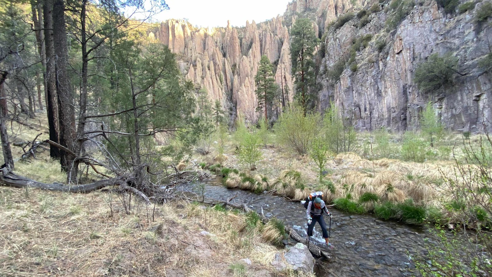
Crossing the Gila again . . .
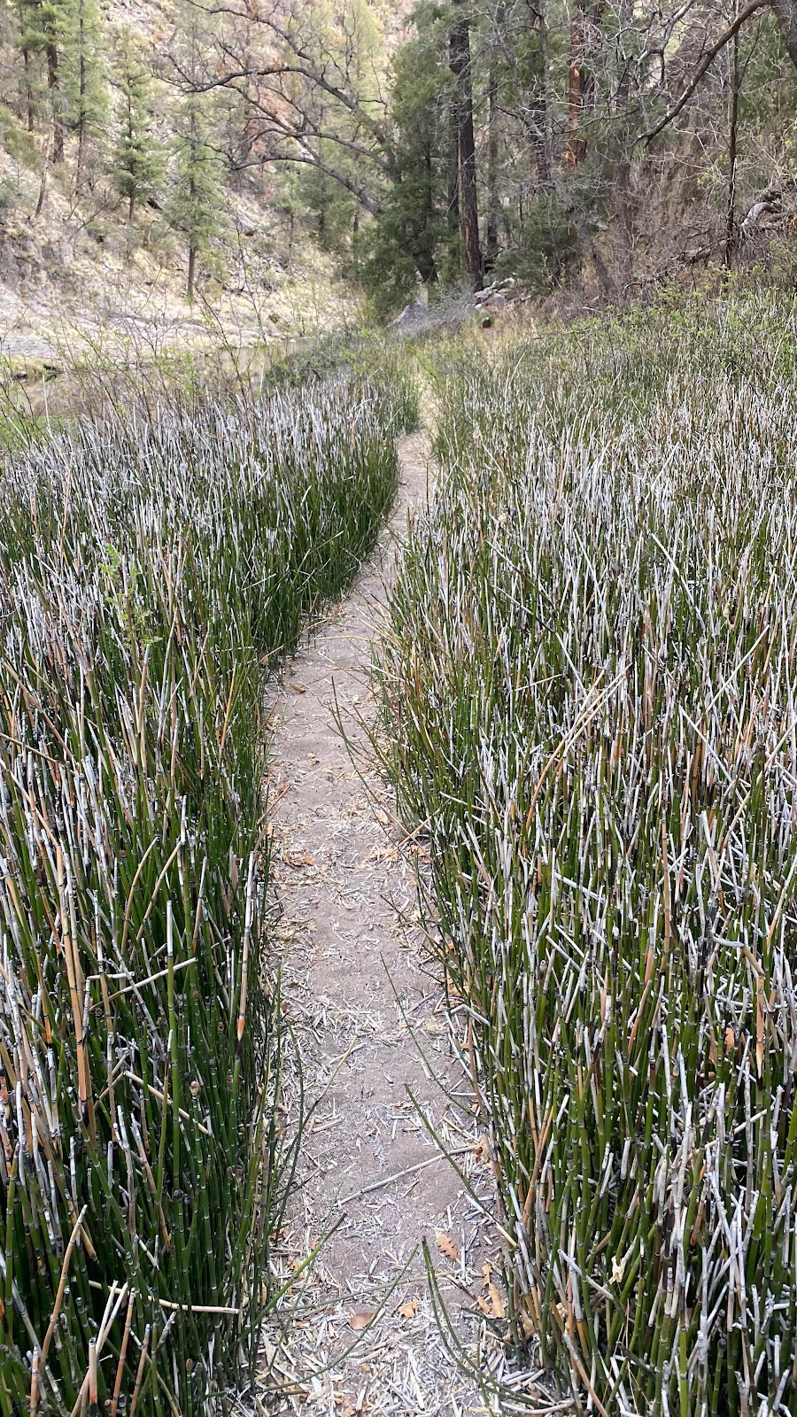
This portion was well defined trail. Much better than trying to wade through these reeds.

The valley widened as the upper end got closer.
No comments:
Post a Comment